Category:Markt 35, 's-Hertogenbosch
Jump to navigation
Jump to search
| Object location | | View all coordinates using: OpenStreetMap |
|---|
 | |||||
| Upload media | |||||
| Instance of |
| ||||
|---|---|---|---|---|---|
| Location | 's-Hertogenbosch, North Brabant, Netherlands | ||||
| Street address |
| ||||
| Heritage designation |
| ||||
 | |||||
|
This is a category about rijksmonument number 21726
|
| Address |
|
Media in category "Markt 35, 's-Hertogenbosch"
The following 26 files are in this category, out of 26 total.
-
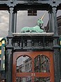 's-Hertogenbosch Rijksmonument 21726 Markt 35, eenhoorn.JPG 2,736 × 3,648; 3.15 MB
-
 's-Hertogenbosch Rijksmonument 21726 Markt 35.JPG 2,736 × 3,648; 3.19 MB
-
 Benedendeel voorgevel - 's-Hertogenbosch - 20110373 - RCE.jpg 820 × 1,200; 222 KB
-
 Centrum, 5211 's-Hertogenbosch, Netherlands - panoramio (4).jpg 1,375 × 2,048; 552 KB
-
 Hinthammerstraat, overzicht - 's-Hertogenbosch - 20110377 - RCE.jpg 788 × 1,200; 248 KB
-

-

-
 Interieur eerste verdieping, sleutelstuk - 's-Hertogenbosch - 20333365 - RCE.jpg 1,200 × 956; 180 KB
-
 Interieur eerste verdieping, sleutelstuk - 's-Hertogenbosch - 20333366 - RCE.jpg 956 × 1,200; 189 KB
-
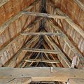 Interieur kapconstructie - 's-Hertogenbosch - 20333380 - RCE.jpg 1,200 × 1,200; 305 KB
-

-

-

-

-
 Interieur, kapconstructie, detail telmerk III - 's-Hertogenbosch - 20333371 - RCE.jpg 1,200 × 1,200; 305 KB
-
 Interieur, kapconstructie, detail telmerk IIII - 's-Hertogenbosch - 20333370 - RCE.jpg 1,200 × 1,200; 425 KB
-
 Interieur, overzicht kapconstructie - 's-Hertogenbosch - 20333388 - RCE.jpg 956 × 1,200; 222 KB
-
 Interieur, overzicht kelder aan achterzijde - 's-Hertogenbosch - 20333379 - RCE.jpg 1,200 × 1,200; 226 KB
-

-
 Interieur, overzicht kelder in middenstuk - 's-Hertogenbosch - 20333375 - RCE.jpg 1,200 × 1,200; 299 KB
-
 Overzicht - 's-Hertogenbosch - 20109981 - RCE.jpg 1,189 × 1,200; 333 KB
-
 Overzicht van de voorgevels - 's-Hertogenbosch - 20381382 - RCE.jpg 1,196 × 1,200; 272 KB
-
 Overzicht voorgevels - 's-Hertogenbosch - 20333389 - RCE.jpg 956 × 1,200; 230 KB
-
 Voorgevels - 's-Hertogenbosch - 20110374 - RCE.jpg 817 × 1,200; 219 KB
-
 Wit geaderd marmer - 's-Hertogenbosch - 20333363 - RCE.jpg 956 × 1,200; 155 KB
-
 Zicht in de Hinthamerstraat vanuit de Markt - 's-Hertogenbosch - 20381340 - RCE.jpg 1,198 × 1,200; 290 KB


.jpg)


