Category:Martinikerk, Itens
Jump to navigation
Jump to search
| Object location | | View all coordinates using: OpenStreetMap |
|---|
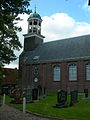
church building in Littenseradiel, Netherlands  | |||||
| Upload media | |||||
| Instance of | |||||
|---|---|---|---|---|---|
| Location | Itens, Súdwest-Fryslân, Friesland, Netherlands | ||||
| Street address |
| ||||
| Located on street |
| ||||
| Heritage designation |
| ||||
| Inception |
| ||||
 | |||||
|
This is a category about rijksmonument number 21538
|
| Address |
|
Media in category "Martinikerk, Itens"
The following 13 files are in this category, out of 13 total.
-
 Exterieur naar het noord-westen - Itens - 20120344 - RCE.jpg 1,200 × 962; 303 KB
-
 Hervormde kerk Itens.jpg 2,048 × 1,536; 445 KB
-
 Intenieur, aanzicht orgel, orgelnummer 747 - Itens - 20417606 - RCE.jpg 818 × 1,200; 157 KB
-
 Interieur - Itens - 20120345 - RCE.jpg 956 × 1,200; 184 KB
-
 Interieur naar het oosten - Itens - 20120346 - RCE.jpg 1,200 × 952; 173 KB
-
 Itens Het Kerkje.JPG 1,536 × 2,048; 495 KB
-
 ITENS MARTINIKERK 1.jpg 6,000 × 4,000; 13.65 MB
-
 ITENS MARTINIKERK 2.jpg 6,000 × 4,000; 14 MB
-
 ITENS MARTINIKERK 3.jpg 4,000 × 6,000; 12.09 MB
-
 ITENS MARTINIKERK DETAIL TOREN.jpg 4,000 × 6,000; 10.45 MB
-
 ITENS MARTINIKERK GEDENKSTEEN.jpg 3,697 × 5,546; 15.15 MB
-
 ITENS MARTINIKERK.jpg 4,608 × 3,456; 2.73 MB
-
 Itens, Martinytsjerke.jpg 1,600 × 1,067; 1.08 MB


