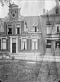
Category:Martinikerkhof 25 (Groningen)
Jump to navigation
Jump to search
| Object location | | View all coordinates using: OpenStreetMap |
|---|
building in Groningen, Netherlands  | |||||
| Upload media | |||||
| Instance of | |||||
|---|---|---|---|---|---|
| Location | Groningen, Netherlands | ||||
| Street address |
| ||||
| Heritage designation |
| ||||
 | |||||
|
This is a category about rijksmonument number 18564
|
| Address |
|
Media in category "Martinikerkhof 25 (Groningen)"
The following 9 files are in this category, out of 9 total.
-
 Groningen (2769881847).jpg 3,888 × 2,592; 4.9 MB
-
 LG-Groningen- Martinikerkhof 27.JPG 2,816 × 2,112; 2.05 MB
-
 Martinikerkhof25 Groningen.jpg 3,648 × 2,736; 1.08 MB
-
 Overzicht met voorgevel - Groningen - 20365386 - RCE.jpg 1,200 × 947; 284 KB
-
 Overzicht voorgevel en linker zijgevel - Groningen - 20365385 - RCE.jpg 947 × 1,200; 322 KB
-
 Overzicht voorgevel met Vlaamse geveltop - Groningen - 20094037 - RCE.jpg 1,200 × 894; 296 KB
-
 Twee huizen op hoek - Groningen - 20325885 - RCE.jpg 1,200 × 823; 172 KB
-
 Voorgevel - Groningen - 20094036 - RCE.jpg 878 × 1,200; 319 KB
-
 Voorgevels - Groningen - 20094034 - RCE.jpg 1,200 × 812; 250 KB
.jpg)


