Category:Martinikerkhof 30 (Groningen)
Jump to navigation
Jump to search
| Object location | | View all coordinates using: OpenStreetMap |
|---|
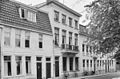
building in Groningen, Netherlands  | |||||
| Upload media | |||||
| Instance of | |||||
|---|---|---|---|---|---|
| Location | Groningen, Netherlands | ||||
| Street address |
| ||||
| Heritage designation |
| ||||
 | |||||
|
This is a category about rijksmonument number 18567
|
| Address |
|
Media in category "Martinikerkhof 30 (Groningen)"
The following 2 files are in this category, out of 2 total.
-
 Martinikerkhof30 Groningen.jpg 2,736 × 3,648; 1,003 KB
-
 Voorgevels - Groningen - 20094039 - RCE.jpg 1,200 × 794; 267 KB
