Category:Maxey, Cambridgeshire
Jump to navigation
Jump to search
English: Maxey is a village in the City of Peterborough in England located between Peterborough & Stamford and southwest of The Deepings - it is home to nearly 700 residents.
village and civil parish in Cambridgeshire, UK  | |||||
| Upload media | |||||
| Instance of | |||||
|---|---|---|---|---|---|
| Location | City of Peterborough, Cambridgeshire, East of England, England | ||||
 | |||||
Subcategories
This category has the following 3 subcategories, out of 3 total.
Media in category "Maxey, Cambridgeshire"
The following 163 files are in this category, out of 163 total.
-
 1914 Studebaker at the Maxey Classic Car Show, August 2018 - geograph.org.uk - 5876876.jpg 3,456 × 4,608; 3.42 MB
-
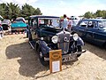
 1929 Austin 7 at the Maxey Classic Car Show, August 2018 - geograph.org.uk - 5877319.jpg 3,456 × 4,608; 3.35 MB
-
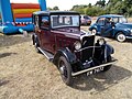
 1929 Ford Model A at the Maxey Classic Car Show, August 2018 - geograph.org.uk - 5876775.jpg 4,608 × 3,456; 3.41 MB
-

-
 1933 Singer Nine at the Maxey Classic Car Show, August 2018 - geograph.org.uk - 5876882.jpg 4,608 × 3,456; 3.66 MB
-

-
-

-
 1952 Austin A30 at the Maxey Classic Car Show, August 2018 - geograph.org.uk - 5875140.jpg 4,608 × 3,456; 3.38 MB
-

-

-
 1958 Ford Prefect at the Maxey Classic Car Show, August 2018 - geograph.org.uk - 5874442.jpg 4,608 × 3,456; 3.48 MB
-
 1959 Scootacar at the Maxey Classic Car Show, August 2018 (geograph 5874357).jpg 3,456 × 4,608; 3.49 MB
-
 1961 Ford Consul at the Maxey Classic Car Show, August 2018 - geograph.org.uk - 5876740.jpg 4,608 × 3,456; 3.54 MB
-

-
-

-

-
-
 1964 Ford Corsair at the Maxey Classic Car Show, August 2018 - geograph.org.uk - 5876782.jpg 4,608 × 3,456; 3.64 MB
-
 1964 MG Midget at the Maxey Classic Car Show, August 2018 - geograph.org.uk - 5875104.jpg 4,608 × 3,456; 3.49 MB
-
 1965 Morris Minor at the Maxey Classic Car Show, August 2018 - geograph.org.uk - 5874411.jpg 3,456 × 4,608; 3.64 MB
-
 1965 Morris Minor at the Maxey Classic Car Show, August 2018 - geograph.org.uk - 5874416.jpg 4,608 × 3,456; 3.75 MB
-

-
 1966 MG MGB at the Maxey Classic Car Show, August 2018 - geograph.org.uk - 5877315.jpg 4,608 × 3,456; 3.47 MB
-
 1966 MG MGB at the Maxey Classic Car Show, August 2018 - geograph.org.uk - 5877316.jpg 4,608 × 3,456; 3.35 MB
-

-

-

-

-

-

-

-
 1969 Morris Minor at the Maxey Classic Car Show, August 2018 - geograph.org.uk - 5876797.jpg 4,608 × 3,456; 3.66 MB
-

-

-
-
 1972 Jaguar XJ6 at the Maxey Classic Car Show, August 2018 - geograph.org.uk - 5875176.jpg 4,608 × 3,456; 3.45 MB
-
 1972 Triumph Stag at the Maxey Classic Car Show, August 2018 - geograph.org.uk - 5877317.jpg 4,608 × 3,456; 3.48 MB
-

-
 1974 Rover 2200 at the Maxey Classic Car Show, August 2018 - geograph.org.uk - 5874953.jpg 4,608 × 3,456; 3.55 MB
-
 1974 Triumph Stag at the Maxey Classic Car Show, August 2018 - geograph.org.uk - 5874482.jpg 4,608 × 3,456; 3.53 MB
-

-

-

-

-
 A very large flat field - geograph.org.uk - 4336262.jpg 640 × 430; 27 KB
-
 A15 towards Market Deeping - geograph.org.uk - 5207709.jpg 4,185 × 2,437; 1.34 MB
-
 Along Maxey Cut - geograph.org.uk - 5023155.jpg 640 × 480; 62 KB
-
 Along the River Welland - geograph.org.uk - 4829613.jpg 480 × 640; 104 KB
-
 Along the River Welland - geograph.org.uk - 4829617.jpg 640 × 480; 79 KB
-
 Barn, Nunton Lodge Farm - geograph.org.uk - 967653.jpg 640 × 480; 84 KB
-

-
 Bridleway near Maxey - geograph.org.uk - 885327.jpg 640 × 480; 68 KB
-
 By the River Welland - geograph.org.uk - 4829616.jpg 480 × 640; 96 KB
-
 Cherry Tree Cottage, Maxey, Peterborough - geograph.org.uk - 243928.jpg 640 × 480; 298 KB
-
 Cottages, Lolham Hall - geograph.org.uk - 3177575.jpg 640 × 480; 70 KB
-
 Daimler SP250 at the Maxey Classic Car Show, August 2018 - geograph.org.uk - 5880318.jpg 4,608 × 3,456; 3.47 MB
-
 Daimler SP250 at the Maxey Classic Car Show, August 2018 - geograph.org.uk - 5880328.jpg 4,608 × 3,456; 3.66 MB
-
 EIIR lamp box, Maxey - geograph.org.uk - 4072222.jpg 2,700 × 3,751; 2.01 MB
-

-
 Etton-Maxey Pits nature reserve - geograph.org.uk - 3792022.jpg 4,320 × 3,240; 5.7 MB
-
 Farmland near Maxey - geograph.org.uk - 3177577.jpg 640 × 480; 78 KB
-
 Farmland towards Lake - geograph.org.uk - 3020372.jpg 640 × 491; 63 KB
-
 Footpath around a field - geograph.org.uk - 5579177.jpg 640 × 480; 114 KB
-
 Footpath around a field - geograph.org.uk - 5579183.jpg 640 × 480; 96 KB
-
 Ford on the Lincolnshire Border at Market Deeping - geograph.org.uk - 2126669.jpg 3,872 × 2,592; 2.97 MB
-
 Gilbern Invader at the Maxey Classic Car Show, August 2018 - geograph.org.uk - 5874369.jpg 4,608 × 3,456; 3.82 MB
-
 Grass field - geograph.org.uk - 5579192.jpg 640 × 480; 92 KB
-
 High Street - geograph.org.uk - 967656.jpg 480 × 640; 97 KB
-
 High Street, Maxey - geograph.org.uk - 3177591.jpg 640 × 480; 94 KB
-
 Houses on High Street, Maxey - geograph.org.uk - 3177587.jpg 640 × 435; 61 KB
-
 Ice cream van, Maxey - geograph.org.uk - 5876707.jpg 4,608 × 3,456; 3.44 MB
-
 Ice cream van, Maxey - geograph.org.uk - 5876714.jpg 4,608 × 3,456; 3.66 MB
-
 In between two fields - geograph.org.uk - 997292.jpg 640 × 480; 57 KB
-
 Just off Mill Road - geograph.org.uk - 4829621.jpg 480 × 640; 140 KB
-
 King Street (Roman Road) - geograph.org.uk - 3177576.jpg 640 × 480; 120 KB
-
 King Street passing over the River Welland - geograph.org.uk - 3447928.jpg 4,000 × 3,000; 4.05 MB
-
 Lane heading south towards Etton - geograph.org.uk - 3177602.jpg 640 × 480; 63 KB
-
 Lane to Etton - geograph.org.uk - 3835445.jpg 4,320 × 3,240; 5.96 MB
-
 Lolham Fisheries - geograph.org.uk - 1000449.jpg 480 × 640; 59 KB
-
 Lolham Mill near Bourne, Lincolnshire - geograph.org.uk - 4440521.jpg 1,774 × 1,187; 1.07 MB
-
 Looking down Maxey Road - geograph.org.uk - 2446866.jpg 4,000 × 3,000; 3.97 MB
-
 Maxey Crossing.jpg 4,000 × 3,000; 4.08 MB
-
 Maxey Cut and flooded pit - geograph.org.uk - 3792025.jpg 4,320 × 3,240; 5.9 MB
-
 Maxey Cut near Etton - geograph.org.uk - 3718042.jpg 4,000 × 3,000; 2.62 MB
-
 Maxey Cut near Etton - geograph.org.uk - 3718074.jpg 4,000 × 3,000; 2.73 MB
-
 Maxey footpath - geograph.org.uk - 5023169.jpg 480 × 640; 73 KB
-
 Maxey Independent Chapel - geograph.org.uk - 5023168.jpg 640 × 480; 85 KB
-
 Maxey Lakes - geograph.org.uk - 4829622.jpg 640 × 480; 145 KB
-
 Maxey Lakes - geograph.org.uk - 4829625.jpg 640 × 480; 77 KB
-
 Maxey Lakes - geograph.org.uk - 4829630.jpg 640 × 480; 83 KB
-
 Maxey Lakes - geograph.org.uk - 949024.jpg 480 × 640; 78 KB
-
 Maxey Mill - geograph.org.uk - 4829329.jpg 480 × 640; 120 KB
-
 Maxey Mill - geograph.org.uk - 5579169.jpg 640 × 480; 96 KB
-
 Maxey Mill - geograph.org.uk - 967647.jpg 640 × 480; 79 KB
-
 Maxey Mill and pond - geograph.org.uk - 4829330.jpg 480 × 640; 77 KB
-
 Maxey Mill Sluice - geograph.org.uk - 5579157.jpg 640 × 480; 96 KB
-
 Maxey Mill sluice and the River Welland - geograph.org.uk - 4829333.jpg 480 × 640; 109 KB
-
 Maxey Mill, 1779 - geograph.org.uk - 3929271.jpg 4,320 × 3,240; 5.63 MB
-
 Maxey parish church - geograph.org.uk - 5023164.jpg 640 × 480; 70 KB
-
 Maxey Quarry - geograph.org.uk - 959233.jpg 640 × 480; 89 KB
-
 Maxey Road - geograph.org.uk - 1514849.jpg 640 × 426; 71 KB
-
 Maxey Road - geograph.org.uk - 5982307.jpg 640 × 480; 61 KB
-
-
 Maxey Sand and Gravel Pit - geograph.org.uk - 885333.jpg 640 × 480; 66 KB
-
 Maxey Sand and Gravel Pit - geograph.org.uk - 959396.jpg 640 × 480; 65 KB
-
 Maxey village sign - geograph.org.uk - 2632549.jpg 3,000 × 4,000; 4.13 MB
-
 MGB sports cars at the Maxey Classic Car Show, August 2018 - geograph.org.uk - 5874452.jpg 4,608 × 3,456; 3.66 MB
-
 Mill Road, Maxey - geograph.org.uk - 3654626.jpg 4,000 × 3,000; 2.62 MB
-
 Mill Road, Maxey - geograph.org.uk - 3869184.jpg 4,000 × 3,000; 2.56 MB
-
 Nature reserve in Maxey Pits - geograph.org.uk - 3791942.jpg 4,320 × 3,240; 5.77 MB
-
 Near Lake Lodge - geograph.org.uk - 4829632.jpg 480 × 640; 128 KB
-
 Nunton Lodge Farm - geograph.org.uk - 2446849.jpg 4,000 × 3,000; 4.03 MB
-
 Nunton Lodge Farm - geograph.org.uk - 2446855.jpg 4,000 × 3,000; 3.97 MB
-
 Off Mill Road, Maxey - geograph.org.uk - 4829615.jpg 480 × 640; 94 KB
-
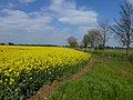 Oilseed rape between Maxey and Market Deeping - geograph.org.uk - 3929214.jpg 4,320 × 3,240; 5.79 MB
-
 Orchard Grove, Maxey - geograph.org.uk - 3929241.jpg 4,320 × 3,240; 5.8 MB
-

-
 Pylon behind the bushes - geograph.org.uk - 2367626.jpg 640 × 370; 29 KB
-
 Quarry Lane, Maxey - geograph.org.uk - 3177594.jpg 640 × 480; 64 KB
-
 Quarry Lane, Maxey - geograph.org.uk - 3177595.jpg 640 × 480; 66 KB
-
 Red Clouds - geograph.org.uk - 653683.jpg 640 × 480; 48 KB
-
 River Welland - geograph.org.uk - 5579202.jpg 640 × 480; 92 KB
-
 River Welland at West Deeping - geograph.org.uk - 3447922.jpg 4,000 × 3,000; 4.15 MB
-
 River Welland at West Deeping - geograph.org.uk - 3447926.jpg 4,000 × 3,000; 4.07 MB
-
 River Welland near Maxey Mill - geograph.org.uk - 4829337.jpg 480 × 640; 159 KB
-
 Riverside path - geograph.org.uk - 5578322.jpg 640 × 480; 125 KB
-
 Road heading east out of Maxey - geograph.org.uk - 3177600.jpg 640 × 480; 86 KB
-
 Road junction - geograph.org.uk - 5982309.jpg 640 × 480; 64 KB
-
 Road junction and finger post - geograph.org.uk - 5982312.jpg 640 × 480; 58 KB
-
 Roundabout on the A15, Northborough - geograph.org.uk - 5653266.jpg 2,304 × 1,728; 853 KB
-
 Rover P4 at the Maxey Classic Car Show, August 2018 - geograph.org.uk - 5874492.jpg 4,608 × 3,456; 3.55 MB
-
 School Lane and the village sign, Maxey - geograph.org.uk - 2632581.jpg 4,000 × 3,000; 4.28 MB
-
 School Lane, Maxey, Peterborough - geograph.org.uk - 217370.jpg 640 × 480; 220 KB
-
 St Peter's Church, Maxey - geograph.org.uk - 2442871.jpg 4,000 × 3,000; 4.08 MB
-
 St Peter's Church, Maxey across the fields - geograph.org.uk - 2442853.jpg 4,000 × 3,000; 4.28 MB
-
 St. Peter's churchyard and Maxey Hall (geograph 6899275).jpg 1,024 × 768; 196 KB
-
 Stone barn on Maxey Road - geograph.org.uk - 3929147.jpg 4,320 × 3,240; 5.54 MB
-

-
 Telecommunication mast - geograph.org.uk - 5579216.jpg 480 × 640; 91 KB
-
 Thatched cottage on High Street, Maxey - geograph.org.uk - 2957401.jpg 4,000 × 3,000; 4.14 MB
-
 Thatched cottage on High Street, Maxey - geograph.org.uk - 3869214.jpg 4,000 × 3,000; 2.95 MB
-
 Thatched cottage on High Street, Maxey - geograph.org.uk - 3869222.jpg 4,000 × 3,000; 2.85 MB
-
 Thatched cottage, Maxey - geograph.org.uk - 3177598.jpg 640 × 445; 110 KB
-
 Thatched dog and cat at Maxey - geograph.org.uk - 2957404.jpg 4,000 × 3,000; 4.41 MB
-
 The A15, Northborough - geograph.org.uk - 6193429.jpg 1,848 × 1,162; 896 KB
-
 The Blue Bell, Maxey (geograph 7396572).jpg 3,776 × 2,520; 4.29 MB
-
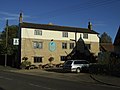 The Blue Bell, Maxey - geograph.org.uk - 3177596.jpg 640 × 480; 62 KB
-
 The Blue Bell, Maxey - geograph.org.uk - 3869203.jpg 4,000 × 3,000; 2.23 MB
-
 The church of St Peter, Maxey - geograph.org.uk - 3929159.jpg 4,320 × 3,240; 5.53 MB
-
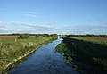 The Maxey Cut - geograph.org.uk - 3177606.jpg 640 × 442; 51 KB
-
 The Maxey Cut - geograph.org.uk - 6302480.jpg 1,024 × 685; 237 KB
-
 The Mill at Maxey - geograph.org.uk - 864873.jpg 640 × 480; 90 KB
-
 Top end of Maxey Road - geograph.org.uk - 5012312.jpg 640 × 480; 72 KB
-
 Towards Lake Lodge - geograph.org.uk - 4829628.jpg 480 × 640; 137 KB
-
 Towards the A15 - geograph.org.uk - 4829620.jpg 480 × 640; 53 KB
-
 Triumph 1300 at the Maxey Classic Car Show, August 2018 - geograph.org.uk - 5959980.jpg 4,608 × 3,456; 3.74 MB
-
 War Memorial, Maxey - geograph.org.uk - 3177585.jpg 480 × 640; 105 KB
-
 Maxey car show - geograph.org.uk - 641729.jpg 640 × 480; 77 KB
-
 Maxey Lakes Access Land - geograph.org.uk - 653820.jpg 640 × 480; 124 KB
-
 Part of Maxey village - geograph.org.uk - 639571.jpg 640 × 421; 87 KB
-
 Village sign, Maxey, Peterborough - geograph.org.uk - 217371.jpg 468 × 640; 263 KB


.jpg)


_-_geograph.org.uk_-_3177576.jpg)


_-_geograph.org.uk_-_3177601.jpg)


.jpg)


.jpg)


