Category:Melbourne, East Riding of Yorkshire
Jump to navigation
Jump to search
English: Melbourne is a village and civil parish in the East Riding of Yorkshire, England. It is situated approximately 8 miles (13 km) west of the market town of Market Weighton and 4.5 miles (7.2 km) south west of the market town of Pocklington. It lies just to the south of the Pocklington Canal.
village and civil parish in East Riding of Yorkshire, United Kingdom  | |||||
| Upload media | |||||
| Instance of | |||||
|---|---|---|---|---|---|
| Location | East Riding of Yorkshire, Yorkshire and the Humber, England | ||||
| Said to be the same as | Melbourne (Wikimedia duplicated page, civil parish) | ||||
 | |||||
Subcategories
This category has the following 4 subcategories, out of 4 total.
Media in category "Melbourne, East Riding of Yorkshire"
The following 200 files are in this category, out of 298 total.
(previous page) (next page)-
-
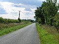
 A dike off Main Road, towards Laytham - geograph.org.uk - 2289749.jpg 800 × 600; 324 KB
-
 A footpath to the Pocklington canal - geograph.org.uk - 2517764.jpg 800 × 600; 328 KB
-
 A minor road towards the B1228 - geograph.org.uk - 2289651.jpg 800 × 600; 209 KB
-
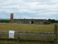
 Acre Farm - geograph.org.uk - 178708.jpg 640 × 480; 98 KB
-
 Along Church Road - geograph.org.uk - 2202238.jpg 640 × 480; 235 KB
-
 Along Kidd Lane - geograph.org.uk - 5363893.jpg 640 × 427; 248 KB
-
 Approaching a bend in the Pocklington Canal - geograph.org.uk - 5286535.jpg 1,024 × 768; 229 KB
-

-
 Approaching South Acre Farm - geograph.org.uk - 5364654.jpg 640 × 427; 222 KB
-
 Approaching the B1228, General Lane - geograph.org.uk - 2289668.jpg 800 × 600; 282 KB
-
 Ash Lane - geograph.org.uk - 3080891.jpg 640 × 480; 147 KB
-
 Ash Lane - geograph.org.uk - 5363900.jpg 640 × 427; 210 KB
-
 Ash Lane Crossroads - geograph.org.uk - 1299381.jpg 640 × 480; 78 KB
-
 Ash Lane to East Cottingwith - geograph.org.uk - 180087.jpg 640 × 480; 125 KB
-
 B1228 heading north - geograph.org.uk - 2035769.jpg 640 × 480; 120 KB
-

-

-
 Bend in farm track, Clays Plantation - geograph.org.uk - 5286209.jpg 1,024 × 768; 324 KB
-
 Bend in the road - geograph.org.uk - 5364651.jpg 640 × 427; 245 KB
-
 Bend on the Pocklington Canal - geograph.org.uk - 5286590.jpg 1,024 × 768; 286 KB
-
 Bibbill Lane - geograph.org.uk - 1299108.jpg 640 × 480; 115 KB
-
 Black Drain - geograph.org.uk - 295059.jpg 640 × 480; 131 KB
-
 Blossom along the road - geograph.org.uk - 5365574.jpg 640 × 427; 277 KB
-
 Blossom in Melbourne - geograph.org.uk - 2364157.jpg 640 × 480; 106 KB
-
 Bridge 3, Church Bridge, Pocklington Canal - geograph.org.uk - 2387589.jpg 1,600 × 1,200; 492 KB
-
 Bridge Farm, Melbourne - geograph.org.uk - 4460416.jpg 2,448 × 1,624; 957 KB
-
 Bridge No 5, Pocklington Canal - geograph.org.uk - 3935307.jpg 1,600 × 1,200; 709 KB
-
 Bridge over the Sop Dike - geograph.org.uk - 5286696.jpg 1,024 × 768; 324 KB
-
 Bridleway off Kidd Lane - geograph.org.uk - 5286716.jpg 1,024 × 768; 321 KB
-
 Bridleway off Kidd Lane - geograph.org.uk - 5363680.jpg 640 × 427; 261 KB
-
 Brooklands Farm - geograph.org.uk - 180427.jpg 640 × 480; 35 KB
-
 Building at Scamland near Melbourne - geograph.org.uk - 2289554.jpg 800 × 600; 288 KB
-
 Buildings at East Farm, East Common - geograph.org.uk - 4460308.jpg 2,448 × 1,624; 1.34 MB
-
 Buildings at East Farm, East Common - geograph.org.uk - 4460326.jpg 2,448 × 1,624; 1.04 MB
-
-
 Campey Lane heading south - geograph.org.uk - 2035811.jpg 640 × 480; 108 KB
-
 Campey Lane, Melbourne - geograph.org.uk - 1396049.jpg 640 × 480; 82 KB
-
 Canal Boats moored in Melbourne Arm - geograph.org.uk - 2668621.jpg 4,000 × 3,000; 3.99 MB
-
 Canal from Church Road - geograph.org.uk - 2364217.jpg 640 × 480; 108 KB
-
 Canal from Church Road - geograph.org.uk - 5365577.jpg 640 × 427; 242 KB
-
 Church Bridge - geograph.org.uk - 5365578.jpg 640 × 427; 218 KB
-

-
 Church Bridge on Church Road - geograph.org.uk - 4462093.jpg 2,448 × 1,624; 1.55 MB
-

-
 Church Bridge over the Pocklington canal - geograph.org.uk - 2517733.jpg 800 × 600; 312 KB
-
 Church Bridge, Pocklington Canal - geograph.org.uk - 3935322.jpg 1,600 × 1,200; 482 KB
-
 Church Bridge, Pocklington Canal - geograph.org.uk - 5636849.jpg 1,024 × 768; 182 KB
-
 Church Bridge, Pocklington Canal - geograph.org.uk - 5867318.jpg 1,024 × 768; 188 KB
-
 Church bridge. - geograph.org.uk - 6046963.jpg 1,024 × 768; 123 KB
-
 Church Road - geograph.org.uk - 2202221.jpg 640 × 480; 239 KB
-
 Church Road - geograph.org.uk - 2364207.jpg 640 × 480; 117 KB
-
 Church Road - geograph.org.uk - 3676392.jpg 640 × 427; 93 KB
-
 Church Road towards Thornton - geograph.org.uk - 4462087.jpg 2,448 × 1,624; 1.58 MB
-
 Church Road towards Thornton - geograph.org.uk - 4462123.jpg 2,448 × 1,624; 1.04 MB
-
 Clubhouse at Melbourne CC ^ FC ground, Melbourne - geograph.org.uk - 4460456.jpg 2,448 × 1,624; 1.58 MB
-
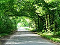
 Country Road from the Great West Wood - geograph.org.uk - 178709.jpg 640 × 480; 72 KB
-
 Country Road to Melbourne - geograph.org.uk - 178702.jpg 640 × 480; 87 KB
-
 Cows - geograph.org.uk - 180438.jpg 640 × 480; 80 KB
-
 Drain and farm track towards Rose Thorpe Park - geograph.org.uk - 5936866.jpg 1,600 × 1,200; 585 KB
-
 Drain and Melbourne Ings - geograph.org.uk - 5286664.jpg 1,024 × 768; 261 KB
-
 Drain on Thornton Ings - geograph.org.uk - 1396043.jpg 640 × 480; 90 KB
-
 East from Church Lane bridge - geograph.org.uk - 2202241.jpg 640 × 480; 266 KB
-
 Edge of Melbourne - geograph.org.uk - 2364127.jpg 640 × 480; 112 KB
-
 Eight wet hooves - geograph.org.uk - 5286706.jpg 1,024 × 768; 200 KB
-
 Electricity line and saturated field - geograph.org.uk - 3280054.jpg 1,024 × 768; 101 KB
-
 Entering Melbourne, East Yorkshire - geograph.org.uk - 2289585.jpg 800 × 600; 266 KB
-
 Entrance to Melrose Farm - geograph.org.uk - 5365571.jpg 640 × 427; 276 KB
-
 Entrance to Rose Thorpe Park - geograph.org.uk - 1395985.jpg 640 × 480; 73 KB
-
 Entrance to Scott Pallets - geograph.org.uk - 5363682.jpg 640 × 427; 221 KB
-
 Entrance to Scott Pallets - geograph.org.uk - 5937092.jpg 1,600 × 1,200; 517 KB
-
 Entrance to South Farm, East Common - geograph.org.uk - 4460268.jpg 2,448 × 1,624; 1.58 MB
-
 Entrance to South Farm, East Common - geograph.org.uk - 4460297.jpg 2,448 × 1,624; 1.55 MB
-

-
 Farm building near East Common Farm - geograph.org.uk - 2035851.jpg 640 × 480; 47 KB
-
 Farm track (footpath) near Park Farm - geograph.org.uk - 2035821.jpg 640 × 480; 73 KB
-
 Farm Track - geograph.org.uk - 308558.jpg 640 × 480; 111 KB
-
 Farmland and pylons near Scamland - geograph.org.uk - 2035859.jpg 640 × 480; 69 KB
-
 Farmland beside Rossmoor Drain - geograph.org.uk - 5362428.jpg 640 × 427; 219 KB
-
 Farmland looking towards Park Wood - geograph.org.uk - 2035789.jpg 640 × 480; 77 KB
-
 Farmland near Brickyard Farm - geograph.org.uk - 2035818.jpg 640 × 480; 83 KB
-
 Farmland near Great West Wood - geograph.org.uk - 5363879.jpg 640 × 427; 221 KB
-
 Farmland near Melbourne - geograph.org.uk - 2035798.jpg 640 × 480; 85 KB
-
 Farmland near Ryedale Farm - geograph.org.uk - 2035834.jpg 640 × 480; 70 KB
-
 Field Edge - geograph.org.uk - 308566.jpg 640 × 480; 108 KB
-
 Fields off the Laytham road - geograph.org.uk - 5364567.jpg 640 × 427; 234 KB
-
 Flooded field - geograph.org.uk - 5286150.jpg 1,024 × 768; 179 KB
-
 Flooded Ings - geograph.org.uk - 5286692.jpg 1,024 × 768; 173 KB
-
 Flooded path - geograph.org.uk - 5286153.jpg 1,024 × 768; 169 KB
-
 Footbridge into South Wood - geograph.org.uk - 2035775.jpg 640 × 480; 164 KB
-
 Footbridge over Rossmoor Drain - geograph.org.uk - 5285795.jpg 1,024 × 768; 315 KB
-
 Footbridge over Rossmoor Drain - geograph.org.uk - 5286225.jpg 1,024 × 768; 321 KB
-
 Footpath alongside Rossmoor Drain - geograph.org.uk - 5286220.jpg 1,024 × 768; 164 KB
-

-
 Footpath from Kidds Lane to Intakes Lane - geograph.org.uk - 180425.jpg 640 × 480; 102 KB
-
 Footpath going nowhere - geograph.org.uk - 5882048.jpg 1,024 × 576; 144 KB
-
 Footpath to Baldwin's Bridge and The Beck - geograph.org.uk - 5286699.jpg 1,024 × 768; 175 KB
-
 Footpath to The Beck - geograph.org.uk - 5286684.jpg 1,024 × 768; 170 KB
-
 Gap in a field of barley - geograph.org.uk - 3564969.jpg 640 × 427; 91 KB
-
 Gate and rather wet field - geograph.org.uk - 5285690.jpg 1,024 × 768; 213 KB
-
 Gate near Boundary Farm - geograph.org.uk - 5363904.jpg 640 × 427; 303 KB
-
 Gate near the corner of a field - geograph.org.uk - 5287674.jpg 1,024 × 768; 195 KB
-
 Gated track off the B1228 - geograph.org.uk - 2035786.jpg 640 × 480; 120 KB
-
 Goslings for sale - geograph.org.uk - 5363671.jpg 640 × 427; 243 KB
-
 Grass hiding water - geograph.org.uk - 5286206.jpg 1,024 × 768; 221 KB
-
 Head of canal, Melbourne - geograph.org.uk - 3935318.jpg 1,600 × 1,200; 607 KB
-
 Highland Cow at Melrose Farm - geograph.org.uk - 180447.jpg 640 × 480; 87 KB
-
 Hoppelcarr Drain, East Common - geograph.org.uk - 4460340.jpg 2,448 × 1,624; 1.47 MB
-
 Horse Pastures - geograph.org.uk - 5286144.jpg 1,024 × 768; 203 KB
-
 House at Bridge Farm, Melbourne - geograph.org.uk - 4460462.jpg 2,448 × 1,624; 1.4 MB
-
 Hump back bridge over canal - geograph.org.uk - 2202230.jpg 640 × 480; 255 KB
-
 Ings near Melbourne - geograph.org.uk - 5286688.jpg 1,024 × 768; 216 KB
-
 Intakes Lane (track) - geograph.org.uk - 1299119.jpg 640 × 480; 101 KB
-
 Intakes Lane - geograph.org.uk - 5737913.jpg 1,024 × 768; 308 KB
-

-
 Jump into the field beside Charity Drain - geograph.org.uk - 5937044.jpg 1,600 × 1,200; 747 KB
-
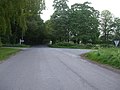
 Junction of General Lane - geograph.org.uk - 2202210.jpg 640 × 480; 248 KB
-
 Kidd Lane - geograph.org.uk - 180422.jpg 640 × 480; 87 KB
-
 Kidd Lane - geograph.org.uk - 180433.jpg 640 × 480; 118 KB
-
 Kidd Lane - geograph.org.uk - 180434.jpg 640 × 480; 114 KB
-
 Kidd Lane at Great West Wood - geograph.org.uk - 2289638.jpg 800 × 600; 331 KB
-
 Kidd Lane heading south west - geograph.org.uk - 2035800.jpg 640 × 480; 101 KB
-
 Kidd Lane junction - geograph.org.uk - 1299117.jpg 640 × 480; 65 KB
-
 Kidd Lane junction - geograph.org.uk - 1299205.jpg 640 × 480; 82 KB
-
 Kidd Lane meets Ash Lane - geograph.org.uk - 5363898.jpg 640 × 427; 227 KB
-
 Laburnum Cottage - geograph.org.uk - 5363667.jpg 640 × 427; 208 KB
-
 Leaving Clays Plantation - geograph.org.uk - 5287685.jpg 1,024 × 768; 276 KB
-
 Letterbox west of Melbourne - geograph.org.uk - 5362429.jpg 640 × 427; 296 KB
-
 Looking east, near Scamland - geograph.org.uk - 2517648.jpg 800 × 600; 212 KB
-
 Lookout Stages crash - geograph.org.uk - 5333559.jpg 2,048 × 1,536; 947 KB
-
 Lookout Stages Rally - geograph.org.uk - 5333553.jpg 2,048 × 1,536; 653 KB
-
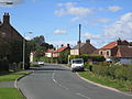
 Main Street, Melbourne, East Riding of Yorkshire.jpg 640 × 438; 60 KB
-
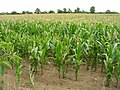 Maize field, Scamland - geograph.org.uk - 2035838.jpg 640 × 480; 123 KB
-
 Melbourne (East Riding of Yorkshire).JPG 4,320 × 3,240; 3.18 MB
-
 Melbourne 1906 (archive ref PO-1-90-1) (30383272421).jpg 760 × 476; 97 KB
-
 Melbourne Arms - geograph.org.uk - 180130.jpg 640 × 480; 61 KB
-
 Melbourne CC ^ FC ground, Melbourne - geograph.org.uk - 4460450.jpg 2,448 × 1,624; 1.26 MB
-
 Melbourne Grange - geograph.org.uk - 5286727.jpg 1,024 × 768; 137 KB
-
 Melbourne Grange - geograph.org.uk - 5287614.jpg 1,024 × 768; 134 KB
-
 Melbourne Grange - geograph.org.uk - 5363676.jpg 640 × 427; 229 KB
-
 Melbourne Hall - geograph.org.uk - 180107.jpg 640 × 480; 124 KB
-
 Melbourne Hall entrance - geograph.org.uk - 308548.jpg 640 × 480; 145 KB
-
 Melbourne Hall from The Park - geograph.org.uk - 2668601.jpg 2,897 × 2,014; 2.09 MB
-
 Melbourne Ings - geograph.org.uk - 5286538.jpg 1,024 × 768; 197 KB
-
 Melbourne Junction, Pocklington Canal - geograph.org.uk - 871955.jpg 640 × 480; 323 KB
-
 Melbourne main road - geograph.org.uk - 295063.jpg 640 × 342; 39 KB
-
 Melbourne Methodist Church - geograph.org.uk - 224389.jpg 431 × 284; 16 KB
-
 Melbourne Village Hall - geograph.org.uk - 180128.jpg 640 × 480; 95 KB
-
 Melbourne Wesleyan Chapel - geograph.org.uk - 3280036.jpg 1,024 × 768; 131 KB
-
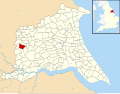 Melbourne, East Riding of Yorkshire UK parish locator map.svg 1,425 × 1,107; 1.68 MB
-
 Melbourne, former Church of St Monica - geograph.org.uk - 224388.jpg 431 × 284; 18 KB
-
 Melbridge House on Church Lane, Melbourne - geograph.org.uk - 4460488.jpg 2,448 × 1,624; 1.08 MB
-
 Memorial Tree to Sgt J R Colebrook, Air Gunner - geograph.org.uk - 4452899.jpg 1,624 × 2,448; 1.76 MB
-
 Minor road scene - geograph.org.uk - 308380.jpg 640 × 402; 103 KB
-
 Minor road towards Ellerton - geograph.org.uk - 2035825.jpg 640 × 480; 73 KB
-
 Minor road towards Everingham - geograph.org.uk - 2035853.jpg 640 × 480; 67 KB
-
 Minor road towards Melbourne - geograph.org.uk - 2035794.jpg 640 × 480; 67 KB
-
 Minor road towards Pocklington - geograph.org.uk - 2035843.jpg 640 × 480; 78 KB
-
 Minor road towards Pocklington - geograph.org.uk - 2035864.jpg 640 × 480; 61 KB
-
 Minor road towards Ross Moor - geograph.org.uk - 2035751.jpg 640 × 480; 81 KB
-
 Minor road towards Seaton Ross - geograph.org.uk - 2035836.jpg 640 × 480; 98 KB
-
 Minor road towards White Farm - geograph.org.uk - 2035813.jpg 640 × 480; 95 KB
-
 Moored canal boats at Melbourne, East Yorkshire - geograph.org.uk - 2387576.jpg 1,600 × 1,200; 522 KB
-
 Moored in Melbourne Arm - geograph.org.uk - 2668629.jpg 4,000 × 3,000; 3.45 MB
-
 Moorings at Melbourne, East Yorkshire - geograph.org.uk - 2387570.jpg 1,600 × 1,200; 514 KB
-
 New Covert and Park Wood on General Lane - geograph.org.uk - 2517831.jpg 800 × 600; 348 KB
-
 New Moor Fields - geograph.org.uk - 1299395.jpg 640 × 480; 46 KB
-
 New Moor Lane - geograph.org.uk - 1299115.jpg 640 × 480; 44 KB
-
 Outbuilding near East Common Farm - geograph.org.uk - 3564963.jpg 640 × 427; 86 KB
-
 Pallets - geograph.org.uk - 180419.jpg 640 × 476; 75 KB
-
 Park Entrance - geograph.org.uk - 308564.jpg 640 × 332; 46 KB
-
 Park Farm - geograph.org.uk - 180441.jpg 640 × 480; 66 KB
-
 Park Farm from Ash Lane - geograph.org.uk - 2668613.jpg 3,648 × 2,736; 4.28 MB
-
 Park Farm, Melbourne - geograph.org.uk - 1396055.jpg 640 × 480; 57 KB
-
 Park track - geograph.org.uk - 308563.jpg 640 × 403; 64 KB
-
 Path across Town's Ings near Melbourne, E Yorks - geograph.org.uk - 5609137.jpg 5,184 × 2,920; 5.8 MB
-
 Path alongside a fence - geograph.org.uk - 5286714.jpg 1,024 × 768; 265 KB
-
 Path leading to Scamland Bridge - geograph.org.uk - 4460316.jpg 2,448 × 1,624; 1.08 MB
-
 Path leading to Scamland Bridge - geograph.org.uk - 4460370.jpg 2,448 × 1,624; 1.56 MB
-
 Pocklington Canal (disused) Bridge - geograph.org.uk - 573860.jpg 640 × 480; 103 KB
-
 Pocklington Canal - geograph.org.uk - 3676396.jpg 640 × 427; 88 KB
-
 Pocklington canal - geograph.org.uk - 540842.jpg 640 × 480; 104 KB
-
 Pocklington Canal - geograph.org.uk - 540846.jpg 480 × 640; 66 KB
-
 Pocklington Canal - geograph.org.uk - 5867320.jpg 1,024 × 768; 161 KB
-
 Pocklington Canal and mooring platform - geograph.org.uk - 5286138.jpg 1,024 × 768; 166 KB
-
 Pocklington Canal at Melbourne Ings - geograph.org.uk - 5609139.jpg 5,184 × 2,920; 5.73 MB
-
 Pocklington Canal at Swingbridge No 4 - geograph.org.uk - 3935302.jpg 1,600 × 1,200; 754 KB
-
 Pocklington Canal from Church Bridge - geograph.org.uk - 4452867.jpg 2,448 × 1,624; 1.26 MB
-
 Pocklington Canal from the bridge - geograph.org.uk - 2202235.jpg 640 × 480; 252 KB
-
 Pocklington Canal near Melbourne - geograph.org.uk - 3935311.jpg 1,600 × 1,200; 980 KB
-
 Pocklington Canal near Melbourne - geograph.org.uk - 5412788.jpg 543 × 640; 430 KB
-
 Pocklington Canal towpath - geograph.org.uk - 2202240.jpg 640 × 480; 275 KB
-
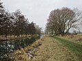
 Pocklington Canal Towpath - geograph.org.uk - 573855.jpg 640 × 480; 128 KB
-
 Pocklington Canal. - geograph.org.uk - 1855.jpg 640 × 480; 70 KB
-
 Potholed track - geograph.org.uk - 5286701.jpg 1,024 × 768; 159 KB
-
 Public Footpath to the Pocklington Canal - geograph.org.uk - 294909.jpg 640 × 480; 132 KB
-
 Pylons near Scamland - geograph.org.uk - 3564961.jpg 427 × 640; 85 KB
-
 RAF Memorial - geograph.org.uk - 3080857.jpg 640 × 480; 152 KB
-
 Road leading to South Farm, East Common - geograph.org.uk - 4460282.jpg 2,448 × 1,624; 1.14 MB
-
 Road near Charity Drain - geograph.org.uk - 5364566.jpg 640 × 427; 222 KB


,_Pocklington_Canal_-_geograph.org.uk_-_5286667.jpg)


,_Pocklington_Canal_-_geograph.org.uk_-_5286674.jpg)
,_Pocklington_Canal_-_geograph.org.uk_-_5286676.jpg)


_near_Park_Farm_-_geograph.org.uk_-_2035821.jpg)


_-_geograph.org.uk_-_1299119.jpg)


.JPG)
_(30383272421).jpg)


_Bridge_-_geograph.org.uk_-_573860.jpg)


