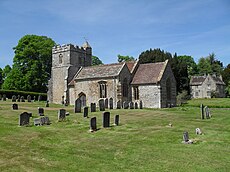
Category:Melcombe Horsey
Jump to navigation
Jump to search
English: Melcombe Horsey is a village in west Dorset, England. The village has a population of 141 .
civil parish in Dorset, United Kingdom | |||||
| Upload media | |||||
| Instance of | |||||
|---|---|---|---|---|---|
| Location | Dorset, South West England, England | ||||
| Population |
| ||||
 | |||||
Subcategories
This category has the following 3 subcategories, out of 3 total.
Media in category "Melcombe Horsey"
The following 62 files are in this category, out of 62 total.
-
Benchmark on Pump House, Cross Lanes - geograph.org.uk - 4807918.jpg 640 × 427; 84 KB
-
Bingham's Melcombe - geograph.org.uk - 4030256.jpg 640 × 480; 83 KB
-
Bingham's Melcombe House - geograph.org.uk - 2314715.jpg 640 × 427; 401 KB
-
Bingham's Melcombe, Catley Gates - geograph.org.uk - 3348052.jpg 1,024 × 768; 295 KB
-
Bingham's Melcombe, Eagle Gates - geograph.org.uk - 3348037.jpg 1,024 × 765; 171 KB
-
Bingham's Melcombe, sheep grazing - geograph.org.uk - 3348042.jpg 1,024 × 768; 260 KB
-
Bridle Path Nettlecombe Tout - geograph.org.uk - 2650850.jpg 640 × 480; 138 KB
-
Bridleway crossing at Dorsetshire Gap - geograph.org.uk - 6060486.jpg 3,776 × 2,520; 3.1 MB
-
Cattle at Melcombe Park Farm - geograph.org.uk - 6057871.jpg 5,184 × 3,456; 4.65 MB
-
Concrete structure on the ridge of Nettlecombe Tout - geograph.org.uk - 6060470.jpg 3,776 × 2,520; 3.3 MB
-
Cross dyke near Higher Melcombe - geograph.org.uk - 4834360.jpg 640 × 427; 56 KB
-
Cross Lanes - geograph.org.uk - 1319020.jpg 640 × 427; 71 KB
-
Cross Lanes - geograph.org.uk - 4027666.jpg 640 × 480; 61 KB
-
Cross Roads at Cross Lanes - geograph.org.uk - 4990486.jpg 1,600 × 1,034; 574 KB
-
Dorsetshire Gap on a Foggy Afternoon - geograph.org.uk - 6057863.jpg 5,184 × 3,456; 5.63 MB
-
Drive to Bingham's Melcombe - geograph.org.uk - 4030248.jpg 640 × 480; 77 KB
-
Eagle Gates, Bingham's Melcombe - geograph.org.uk - 4030245.jpg 640 × 480; 74 KB
-
Eastern flanks of Nettlecombe Tout - geograph.org.uk - 4848901.jpg 640 × 427; 35 KB
-
Entrance gates to Bingham's Melcombe - geograph.org.uk - 2163193.jpg 640 × 480; 103 KB
-
Field by Higher Melcombe Manor - geograph.org.uk - 2162754.jpg 640 × 480; 84 KB
-
Field by the road to Higher Melcombe - geograph.org.uk - 2162739.jpg 640 × 480; 82 KB
-
Fields, Bingham Melcombe - geograph.org.uk - 4030241.jpg 640 × 480; 70 KB
-
Giant's Grave Henning Hill - geograph.org.uk - 1319017.jpg 640 × 440; 72 KB
-
Hedge on Hog Hill - geograph.org.uk - 4836623.jpg 640 × 427; 65 KB
-
Higher Melcombe Farm - geograph.org.uk - 4963245.jpg 640 × 480; 69 KB
-
House at Badger Lane, Cross Lanes - geograph.org.uk - 4990483.jpg 1,600 × 1,065; 500 KB
-
In the Woods above Dorsetshire Gap - geograph.org.uk - 6057820.jpg 5,184 × 3,456; 6.9 MB
-
Lamb near Cheselbourne - geograph.org.uk - 1319016.jpg 640 × 520; 135 KB
-
Looking down on Melcombe Park Farm - geograph.org.uk - 6062111.jpg 3,776 × 2,520; 4.04 MB
-
Lyscombe Bottom - geograph.org.uk - 4849659.jpg 640 × 427; 44 KB
-
Lyscombe Hill - geograph.org.uk - 4412807.jpg 3,072 × 2,304; 3.15 MB
-
Melcombe Bingham, finger-post detail - geograph.org.uk - 1752226.jpg 640 × 480; 63 KB
-
Melcombe Bingham, fingerpost - geograph.org.uk - 3348064.jpg 768 × 1,024; 116 KB
-
Melcombe Park Farm Dorset - geograph.org.uk - 1460007.jpg 640 × 426; 79 KB
-
Nettlecombe Tout - geograph.org.uk - 2652591.jpg 640 × 480; 80 KB
-
Nettlecombe Tout Ditch and Dyke - geograph.org.uk - 2650835.jpg 640 × 453; 102 KB
-
New use for phone box - geograph.org.uk - 4027659.jpg 640 × 480; 68 KB
-
Pump House, Cross Lanes - geograph.org.uk - 4807920.jpg 640 × 427; 73 KB
-
Sheep near Cheselbourne - geograph.org.uk - 1319018.jpg 640 × 430; 102 KB
-
Sign detail, Melcombe Bingham - geograph.org.uk - 1986213.jpg 640 × 480; 143 KB
-
Signpost at Dorsetshire Gap - geograph.org.uk - 4848911.jpg 640 × 427; 117 KB
-
Site of Melcombe Horsey - geograph.org.uk - 2650813.jpg 640 × 480; 71 KB
-
Spring House - geograph.org.uk - 4990496.jpg 1,600 × 1,065; 635 KB
-
The approach to Higher Melcombe - geograph.org.uk - 2162747.jpg 640 × 480; 104 KB
-
The road to Higher Melcombe - geograph.org.uk - 2162735.jpg 640 × 480; 106 KB
-
The tree-edged road to Higher Melcombe - geograph.org.uk - 2162742.jpg 640 × 480; 129 KB
-
Topiary at Higher Melcombe Manor - geograph.org.uk - 2162752.jpg 640 × 480; 87 KB
-
Trig point on Henning Hill - geograph.org.uk - 4807913.jpg 640 × 427; 59 KB
-
Turn right for Bulbarrow Hill - geograph.org.uk - 6062119.jpg 3,776 × 2,520; 3.3 MB
-
View WNW towards Melbury Bingham - geograph.org.uk - 1603154.jpg 640 × 426; 90 KB
-
Village scene, Melcombe Bingham - geograph.org.uk - 1986184.jpg 640 × 480; 119 KB
-
Wessex Ridgeway at Melcombe Park Farm - geograph.org.uk - 6057877.jpg 5,184 × 3,456; 5.58 MB
-
Wessex Ridgeway in Breach Wood - geograph.org.uk - 6058309.jpg 5,184 × 3,456; 7.37 MB


