Category:Mendip District
Vai alla navigazione
Vai alla ricerca
English: Mendip is a local government district of the county of Somerset in England.
district in Somerset, England  | |||||
| Carica un file multimediale | |||||
| Istanza di |
| ||||
|---|---|---|---|---|---|
| Luogo | Somerset, Sud Ovest dell'Inghilterra, Inghilterra | ||||
| Capitale | |||||
| Organo legislativo |
| ||||
| Data di fondazione o creazione |
| ||||
| Popolazione |
| ||||
| Superficie |
| ||||
| sito web ufficiale | |||||
 | |||||
Sottocategorie
Questa categoria contiene le 63 sottocategorie indicate di seguito, su un totale di 63.
File nella categoria "Mendip District"
Questa categoria contiene 51 file, indicati di seguito, su un totale di 51.
-
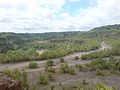
 Above Ebbor Gorge. - panoramio.jpg 3 648 × 2 736; 4,29 MB
-
 Asham Quarry - panoramio.jpg 2 048 × 1 536; 860 KB
-
 Asham woods in mid-summer - panoramio.jpg 2 048 × 1 536; 865 KB
-
 Birds in Asham Quarry - panoramio.jpg 2 048 × 1 536; 828 KB
-
 Bluebells on Burrington Common. - panoramio.jpg 2 816 × 2 112; 2,76 MB
-
 Cage in Asham Wood - panoramio.jpg 2 048 × 1 536; 835 KB
-
 Cliff face at north end of quarry - panoramio.jpg 1 536 × 2 048; 866 KB
-
 Cliff face at the south side of the quarry - panoramio.jpg 1 536 × 2 048; 870 KB
-
 Cliffs at quarry - panoramio.jpg 2 048 × 1 536; 735 KB
-
 Fairy Cave Quarry and cave entrance (geograph 5027685).jpg 1 920 × 1 440; 989 KB
-
 Harridge Wood, Nettlebridge. - panoramio (1).jpg 3 648 × 2 736; 4,36 MB
-
 Harridge Wood, Nettlebridge. - panoramio (2).jpg 2 736 × 3 648; 4,07 MB
-
 Harridge Wood, Nettlebridge. - panoramio.jpg 2 736 × 3 648; 4,36 MB
-
 Horka Rockit - panoramio.jpg 2 816 × 2 112; 2,73 MB
-

-

-

-
 Mendip Stone Stile. (One of the locations in "Hot Fuzz") - panoramio.jpg 1 952 × 2 592; 1,52 MB
-
 Mendip wall (geograph 1884820).jpg 640 × 428; 87 KB
-
 Moss on Drystone Wall. - panoramio.jpg 1 714 × 1 895; 1,75 MB
-
 Nunney Brook. - panoramio.jpg 3 648 × 2 736; 4,21 MB
-
 Penn Hill TV Transmitter. - panoramio.jpg 2 055 × 2 615; 755 KB
-
 Pine trees - panoramio.jpg 2 272 × 3 408; 6,97 MB
-
 Priddy - panoramio.jpg 2 048 × 1 536; 331 KB
-
 Priddy circles.jpg 3 000 × 2 157; 2,18 MB
-
 Priddy Mineries - panoramio - christopher summerha….jpg 2 816 × 2 112; 1,99 MB
-
 Priddy Mineries - panoramio.jpg 2 816 × 2 112; 2,8 MB
-
 Quarry cliffs at Asham Wood - panoramio.jpg 2 048 × 1 536; 849 KB
-
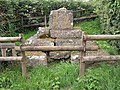 Remains of cross, Castle (geograph 2589704).jpg 640 × 480; 156 KB
-
 Road - panoramio (101).jpg 4 288 × 2 848; 5,52 MB
-
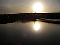
 Road Bridge of former Radstock to Frome Railway. - panoramio.jpg 5 312 × 2 988; 5,69 MB
-
 Romulus and Remus suckling The She Wolf, Penn Hill, Wells. - panoramio.jpg 2 527 × 2 230; 3,73 MB
-
 Romulus and Remus, (Detail). - panoramio.jpg 1 328 × 1 029; 1,06 MB
-
 Ruins, Fussells Iron Works, Mells. - panoramio.jpg 2 988 × 5 312; 5,4 MB
-
 Sharp meander in the Wellow Brook - panoramio.jpg 2 048 × 1 536; 859 KB
-
 Sheep with apple tree (36108516541).jpg 3 648 × 5 472; 10,23 MB
-
 Shepton Mallet Rural District Council Boundary Stone, Harridge Wood. - panoramio.jpg 2 736 × 3 648; 6,64 MB
-
 St. Dunstan's Cave. - panoramio.jpg 2 736 × 3 648; 7 MB
-
 St. Dunstan's Well. - panoramio.jpg 2 736 × 3 648; 6,18 MB
-
 Structure at dis-used quarry - panoramio.jpg 2 048 × 1 536; 805 KB
-
 Tank Traps - panoramio.jpg 2 048 × 1 536; 873 KB
-
 Tank Traps on the Wellow Brook - panoramio.jpg 2 048 × 1 536; 876 KB
-
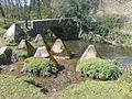
 Thatched Sheep Hurdles, Priddy. - panoramio.jpg 2 816 × 2 112; 3,74 MB
-
 This way- (Unsplash).jpg 3 782 × 2 532; 2,89 MB
-
 View across the quarry - panoramio.jpg 2 048 × 1 536; 659 KB
-
 View of Glastonbury's Tor - panoramio.jpg 2 272 × 1 704; 1,85 MB
-
 Westwards along the Wellow Valley - panoramio.jpg 2 048 × 1 536; 798 KB
-
 Wind Power comes to Binegar. - panoramio.jpg 2 112 × 2 816; 767 KB
-
 Wookey Stone - panoramio.jpg 2 272 × 1 704; 1,82 MB
-
 WW2 Control Bunker entrance for Burrington Bomb Decoy. - panoramio.jpg 2 816 × 2 112; 3,45 MB
-
 WW2 Control Bunker for Burrington Bomb Decoy. - panoramio.jpg 2 816 × 2 112; 3,27 MB


.jpg)
.jpg)
.jpg)


_-_panoramio.jpg)
.jpg)


.jpg)
.jpg)


._-_panoramio.jpg)


.jpg)


.jpg)


