Category:Glastonbury
Jump to navigation
Jump to search
town in Somerset, England, United Kingdom _from_the_tor_arp.jpg) | |||||
| Upload media | |||||
| Instance of | |||||
|---|---|---|---|---|---|
| Location | Mendip, Somerset, South West England, England | ||||
| Population |
| ||||
| Said to be the same as | Glastonbury (Wikimedia duplicated page, civil parish) | ||||
| official website | |||||
 | |||||
Subcategories
This category has the following 18 subcategories, out of 18 total.
- Streets in Glastonbury (35 F)
A
B
- Banksy in Glastonbury (2 F)
C
- Chalice Well (30 F)
G
- Glastonbury Canal (16 F)
- Glastonbury Cricket Club (3 F)
- Glastonbury Market Cross (20 F)
- Glastonbury War Memorial (7 F)
H
S
T
Media in category "Glastonbury"
The following 200 files are in this category, out of 990 total.
(previous page) (next page)-
 "Sigeric" by Heather Burnley - geograph.org.uk - 5846379.jpg 640 × 480; 344 KB
-
 'School' road sign, Benedict Street, Glastonbury - geograph.org.uk - 5058600.jpg 2,000 × 2,667; 2.43 MB
-
 'The Who'd A Thought it' pub garden, Glastonbury - geograph.org.uk - 5834132.jpg 1,563 × 1,288; 892 KB
-
 'Who'd a thought it^' - geograph.org.uk - 3253845.jpg 1,704 × 2,304; 1.62 MB
-

-
 2011 , Glastonbury Tor from afar - geograph.org.uk - 2475186.jpg 1,215 × 901; 459 KB
-
 25 High Street, Glastonbury - geograph.org.uk - 5067732.jpg 3,008 × 2,000; 2.43 MB
-
 27 and 29 High Street Glastonbury - geograph.org.uk - 3897511.jpg 2,048 × 1,360; 627 KB
-
 A black mark on the High Street - geograph.org.uk - 3139852.jpg 2,304 × 1,704; 1.06 MB
-
 A convenient plaque - geograph.org.uk - 3732441.jpg 2,448 × 3,264; 4.81 MB
-
 A couple of crosses - geograph.org.uk - 3723286.jpg 600 × 800; 112 KB
-
 A fork in the road - geograph.org.uk - 2309607.jpg 600 × 800; 173 KB
-
 A former garage - geograph.org.uk - 2911603.jpg 1,024 × 768; 121 KB
-
 A Glastonbury Dutchman - geograph.org.uk - 3728497.jpg 1,024 × 768; 288 KB
-
 A Glastonbury Thorn, St John the Baptist, Glastonbury, Somerset.jpg 2,562 × 2,118; 1.55 MB
-
 A mixture of styles and patterns - geograph.org.uk - 3262979.jpg 2,304 × 1,704; 1.67 MB
-
 A provident man - geograph.org.uk - 3256099.jpg 1,704 × 2,304; 1.6 MB
-

-
 A rhyne at Pomparles Bridge, Glastonbury - geograph.org.uk - 1322255.jpg 640 × 480; 186 KB
-
 A second fork - geograph.org.uk - 2310628.jpg 600 × 800; 145 KB
-
 A second gate - geograph.org.uk - 2308228.jpg 1,024 × 768; 347 KB
-
 A slice taken out - geograph.org.uk - 3262972.jpg 1,704 × 2,304; 1.56 MB
-
 A tree with a hole, Street Road, Glastonbury - geograph.org.uk - 5603779.jpg 1,200 × 1,600; 801 KB
-
 A well-served house - geograph.org.uk - 3256150.jpg 2,304 × 1,704; 1.82 MB
-

-

-
 A39 heading to Glastonbury - geograph.org.uk - 2065542.jpg 640 × 480; 146 KB
-
 A39, Glastonbury Bypass - geograph.org.uk - 3802201.jpg 640 × 480; 326 KB
-
 A39, Hartlake Bridge - geograph.org.uk - 3802223.jpg 640 × 480; 278 KB
-
 A39, Street Road, Glastonbury - geograph.org.uk - 3802195.jpg 640 × 480; 244 KB
-
 A39, Wells Road - geograph.org.uk - 3802209.jpg 640 × 480; 277 KB
-
 A39, Wells Road - geograph.org.uk - 3802215.jpg 640 × 480; 289 KB
-
 Abbey entrance and shop - geograph.org.uk - 2816872.jpg 1,024 × 768; 203 KB
-
 Abbey Gardens - geograph.org.uk - 5243369.jpg 6,000 × 4,000; 7.11 MB
-
 Abbey ground on the north side - geograph.org.uk - 5834152.jpg 1,600 × 1,069; 719 KB
-
 Abbey House Retreat, Chilkwell Street, Glastonbury - geograph.org.uk - 2834369.jpg 2,000 × 1,500; 882 KB
-
 Abbey Moor Stadium - geograph.org.uk - 2618470.jpg 640 × 480; 47 KB
-
 Abbey remains, Glastonbury - geograph.org.uk - 5146519.jpg 1,600 × 1,200; 312 KB
-
 Abbey View - geograph.org.uk - 2919322.jpg 800 × 600; 128 KB
-
 Abbot's accommodation outline in the grass - geograph.org.uk - 5834275.jpg 2,048 × 1,368; 1.06 MB
-
 Abbot's Kitchen, Glastonbury Abbey - geograph.org.uk - 5406562.jpg 1,500 × 1,000; 1.31 MB
-
 Abbot's Kitchen, Glastonbury Abbey - geograph.org.uk - 5846358.jpg 480 × 640; 221 KB
-
 Across Kennard Moor - geograph.org.uk - 2586899.jpg 1,496 × 1,122; 758 KB
-
 Across the Cemetery - geograph.org.uk - 3722914.jpg 1,024 × 768; 304 KB
-
 Across the Roundabout - geograph.org.uk - 2911610.jpg 1,024 × 768; 141 KB
-
 Afternoon nap - geograph.org.uk - 196691.jpg 640 × 480; 103 KB
-
 Almshouses, Heritage Court, Glastonbury - geograph.org.uk - 5603808.jpg 1,600 × 1,200; 777 KB
-
 Along Coursing Batch - geograph.org.uk - 2308249.jpg 600 × 800; 103 KB
-
 Ammonite - geograph.org.uk - 167895.jpg 640 × 426; 168 KB
-
 An age-old scene - geograph.org.uk - 3256014.jpg 2,304 × 1,704; 1.63 MB
-
 Angel on the Cross - geograph.org.uk - 3724364.jpg 600 × 800; 97 KB
-
 Anything take your fancy^ - geograph.org.uk - 3256023.jpg 2,304 × 1,704; 1.71 MB
-
 Apple Orchard - geograph.org.uk - 2816795.jpg 1,024 × 768; 303 KB
-
 Apple trees in Avalon Orchard on Glastonbury Tor - geograph.org.uk - 5606793.jpg 1,200 × 1,600; 777 KB
-

-
 Arch in the tower - geograph.org.uk - 3578839.jpg 600 × 800; 118 KB
-
 Archway - geograph.org.uk - 2816863.jpg 1,024 × 768; 226 KB
-
 Archway with a view - geograph.org.uk - 3256073.jpg 2,304 × 1,704; 1.59 MB
-
 Archway, St Michael's, Glastonbury Tor - geograph.org.uk - 4587499.jpg 1,920 × 2,560; 1.23 MB
-
 Art or Graffiti^ - geograph.org.uk - 2911627.jpg 1,024 × 768; 224 KB
-
 Ashwell Lane - geograph.org.uk - 2307854.jpg 1,024 × 768; 183 KB
-
 Ashwell Lane - geograph.org.uk - 2309596.jpg 600 × 800; 95 KB
-
 Ashwell Lane - geograph.org.uk - 2811442.jpg 1,024 × 768; 138 KB
-
 Ashwell Lane - geograph.org.uk - 2846170.jpg 1,024 × 763; 188 KB
-
 Ashwell Lane Junction - geograph.org.uk - 2308231.jpg 1,024 × 768; 177 KB
-
 Assembly Rooms - geograph.org.uk - 3262943.jpg 1,704 × 2,304; 1.62 MB
-
 ATC building in Glastonbury - geograph.org.uk - 2909457.jpg 1,024 × 768; 194 KB
-
 Avalon Conservative Club, Glastonbury - geograph.org.uk - 1997207.jpg 640 × 606; 108 KB
-
 Avalon Orchard on Glastonbury Tor - geograph.org.uk - 5606792.jpg 1,600 × 1,200; 804 KB
-
 Avalon Orchard, Glastonbury Tor - geograph.org.uk - 4588015.jpg 1,920 × 2,541; 1.11 MB
-
 Award on the wall - geograph.org.uk - 2310823.jpg 1,024 × 768; 196 KB
-
 Back of his head - geograph.org.uk - 3577595.jpg 1,024 × 768; 149 KB
-
 Back to Old Oaks - geograph.org.uk - 2908174.jpg 600 × 800; 100 KB
-
 Back to the A361 - geograph.org.uk - 2310620.jpg 600 × 800; 168 KB
-
 Back to the copse - geograph.org.uk - 2312558.jpg 1,024 × 768; 379 KB
-
 Back to the lodge - geograph.org.uk - 2308856.jpg 600 × 800; 108 KB
-
 Barclays, Glastonbury - geograph.org.uk - 1997746.jpg 479 × 640; 74 KB
-
 Barn across the road - geograph.org.uk - 2309000.jpg 1,024 × 768; 160 KB
-
 Barrel Head - geograph.org.uk - 3731728.jpg 600 × 800; 134 KB
-
 Bartletts Farm Industrial Yard - geograph.org.uk - 5568259.jpg 1,024 × 768; 139 KB
-
 Basketfield Lane - geograph.org.uk - 2811731.jpg 1,024 × 768; 291 KB
-
 Basketfield Lane - geograph.org.uk - 2811756.jpg 1,024 × 768; 266 KB
-
 Baskets on the bollards - geograph.org.uk - 3560041.jpg 1,024 × 768; 170 KB
-
 Beckery Map Picture.jpg 1,142 × 578; 85 KB
-
 Bed in the Almshouse - geograph.org.uk - 3728772.jpg 1,024 × 768; 87 KB
-
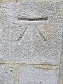
 Bench Mark, Glastonbury Tor - geograph.org.uk - 3602833.jpg 640 × 640; 268 KB
-
 Bench overlooking the herb garden - geograph.org.uk - 5834291.jpg 1,600 × 1,069; 628 KB
-
 Benchmark at the Farm - geograph.org.uk - 2303076.jpg 600 × 800; 191 KB
-
 Benchmark at the top - geograph.org.uk - 3139834.jpg 1,704 × 2,304; 1.83 MB
-
 Benchmark by the pots - geograph.org.uk - 2429922.jpg 600 × 800; 154 KB
-
 Benchmark on Chilkwell Street, Glastonbury - geograph.org.uk - 5146518.jpg 1,200 × 1,600; 589 KB
-
 Benchmark on Glastonbury Tor - geograph.org.uk - 3577340.jpg 600 × 800; 155 KB
-

-
 Benchmark on St John's Church, Glastonbury - geograph.org.uk - 5140074.jpg 1,200 × 1,600; 806 KB
-
 Benchmark on St Michael's Tower, Glastonbury - geograph.org.uk - 5146516.jpg 1,200 × 1,600; 776 KB
-
 Benchmark on Stile near Chalice Orchard, Glastonbury - geograph.org.uk - 5151443.jpg 1,200 × 1,600; 680 KB
-
 Benchmark on the ATC Barracks - geograph.org.uk - 2909452.jpg 600 × 800; 127 KB
-

-
 Benchmark on the Toilet - geograph.org.uk - 3559194.jpg 600 × 800; 147 KB
-
 Benchmark on town hall, Glastonbury - geograph.org.uk - 5135779.jpg 1,200 × 1,600; 689 KB
-

-
 Bend on Brindham Lane - geograph.org.uk - 2908198.jpg 1,024 × 768; 149 KB
-
 Benedict and Magdalene - geograph.org.uk - 4442949.jpg 800 × 533; 172 KB
-
 Benedict Street - geograph.org.uk - 2838202.jpg 1,024 × 768; 131 KB
-
 Benedict Street - Market Place - geograph.org.uk - 4991446.jpg 640 × 480; 78 KB
-
 Benedict Street, Glastonbury - geograph.org.uk - 5603828.jpg 1,600 × 1,200; 764 KB
-
 Benedict Street, Glastonbury - geograph.org.uk - 6241050.jpg 1,280 × 720; 733 KB
-
 Bere Lane - geograph.org.uk - 5243376.jpg 6,000 × 4,000; 7.66 MB
-
 Bere Lane and the Tor, Glastonbury - geograph.org.uk - 6106599.jpg 1,617 × 2,157; 886 KB
-
 Bere Lane, Glastonbury - geograph.org.uk - 5244002.jpg 6,000 × 4,000; 7.81 MB
-
 Bere Lane, Glastonbury - geograph.org.uk - 5606797.jpg 1,600 × 1,067; 710 KB
-
 Bizarre Stick Man Street Art in Glastonbury - panoramio.jpg 3,128 × 4,584; 3.76 MB
-
 Block on the side - geograph.org.uk - 2911879.jpg 1,024 × 768; 193 KB
-
 Blue Plaque - geograph.org.uk - 3731723.jpg 1,024 × 768; 224 KB
-
 Bottom of Stonedown - geograph.org.uk - 2312598.jpg 600 × 800; 126 KB
-
 Bove Town - geograph.org.uk - 5245032.jpg 6,000 × 4,000; 4 MB
-
 Bove Town - Wells Road - geograph.org.uk - 4991545.jpg 640 × 480; 77 KB
-
 Bove Town House - geograph.org.uk - 5245040.jpg 6,000 × 4,000; 4.55 MB
-

-
 Bridge on Kennard Moor Drove - geograph.org.uk - 2846203.jpg 1,024 × 768; 181 KB
-

-
 Bridge over River Brue - geograph.org.uk - 5421304.jpg 1,024 × 768; 189 KB
-
 Bridge over the Mill Stream - geograph.org.uk - 5603842.jpg 1,600 × 1,200; 796 KB
-
 Brindham Farm - geograph.org.uk - 5999328.jpg 1,024 × 768; 221 KB
-
 Brow of the hill - geograph.org.uk - 2308851.jpg 600 × 800; 116 KB
-
 Building on the corner - geograph.org.uk - 3731726.jpg 1,024 × 768; 199 KB
-
 Butleigh Road, Glastonbury - geograph.org.uk - 4442918.jpg 800 × 533; 220 KB
-
 Butt Close, Glastonbury - geograph.org.uk - 1998089.jpg 640 × 480; 74 KB
-
 Butt Close, Glastonbury - geograph.org.uk - 3549537.jpg 856 × 1,280; 226 KB
-
 By Basketfield Lane - geograph.org.uk - 4588233.jpg 1,920 × 2,464; 847 KB
-
 By St Mary's Walk - geograph.org.uk - 3560339.jpg 600 × 800; 103 KB
-
 Car Park house - geograph.org.uk - 3732429.jpg 3,264 × 2,448; 4.43 MB
-
 Car wash, Street Road, Glastonbury - geograph.org.uk - 5603780.jpg 1,600 × 1,200; 715 KB
-
 Caravan ^ Camp Site - geograph.org.uk - 2818968.jpg 1,024 × 546; 130 KB
-
 Carved Graffiti on Glastonbury Tor 2.jpg 3,024 × 4,032; 6.12 MB
-
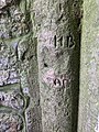 Carved Graffiti on Glastonbury Tor.jpg 3,024 × 4,032; 4.9 MB
-
 Caution Extreme care - geograph.org.uk - 2308833.jpg 1,024 × 768; 327 KB
-
 Cemetery Entrance - geograph.org.uk - 3723357.jpg 1,024 × 768; 211 KB
-
 Cemetery from under the tree - geograph.org.uk - 3722911.jpg 1,024 × 768; 348 KB
-
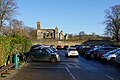 Central car park in Glastonbury - geograph.org.uk - 5243359.jpg 6,000 × 4,000; 4.59 MB
-

-
 Chalice Well ^ Garden Entrance - geograph.org.uk - 2818940.jpg 1,024 × 721; 264 KB
-
 Chalice well, Glastonbury - geograph.org.uk - 1973179.jpg 768 × 1,024; 310 KB
-
 Chasey's Drove - geograph.org.uk - 5999363.jpg 1,024 × 768; 170 KB
-
 Chilkwell Street Benchmark - geograph.org.uk - 2308980.jpg 600 × 800; 182 KB
-
 Church Lane - geograph.org.uk - 2817647.jpg 768 × 1,024; 188 KB
-
 Church Lane - geograph.org.uk - 2919247.jpg 600 × 800; 177 KB
-

-
 Church of St John the Baptist, Glastonbury 2.jpg 4,032 × 3,024; 4.93 MB
-
 Church of St John the Baptist, Glastonbury, view from the Car Park.jpg 3,024 × 4,032; 3.5 MB
-
 Church of St John the Baptist, Glastonbury.jpg 3,024 × 4,032; 3.26 MB
-

-
 Cider apple orchard, Glastonbury Abbey - geograph.org.uk - 5834162.jpg 2,048 × 1,368; 1.46 MB
-
 Cinnamon Lane Play Ground - geograph.org.uk - 5360571.jpg 800 × 600; 83 KB
-
 Closer view of the stone - geograph.org.uk - 3568084.jpg 600 × 800; 128 KB
-
 Coachman's Yard, Glastonbury - geograph.org.uk - 1998061.jpg 640 × 566; 80 KB
-
 Coldharbour Farm - geograph.org.uk - 5420743.jpg 1,024 × 802; 215 KB
-

-
 Common Moor - geograph.org.uk - 2618483.jpg 640 × 480; 83 KB
-
 Common Moor Drove, looking south west - geograph.org.uk - 5499649.jpg 640 × 480; 179 KB
-
 Compass of the Toposcope - geograph.org.uk - 3577592.jpg 1,024 × 768; 209 KB
-
 Converted barn - geograph.org.uk - 2310822.jpg 1,024 × 768; 207 KB
-

-

-

-
 Cottages on Chilkwell Street - geograph.org.uk - 5244051.jpg 6,000 × 4,000; 6.75 MB
-
 Couple of flat ones - geograph.org.uk - 2906570.jpg 1,024 × 768; 207 KB
-
 Coursing Batch, Glastonbury - geograph.org.uk - 2586698.jpg 1,496 × 1,122; 586 KB
-
 Cow Bridge - geograph.org.uk - 3137793.jpg 2,304 × 1,704; 2.01 MB
-
 Cow Bridge - geograph.org.uk - 4442905.jpg 800 × 533; 188 KB
-
 Cows by Glastonbury - geograph.org.uk - 2510174.jpg 1,024 × 768; 335 KB
-
 Cradle Bridge and River Brue - geograph.org.uk - 81261.jpg 640 × 320; 62 KB
-
 Cradle Bridge over River Brue - geograph.org.uk - 5604716.jpg 1,600 × 1,200; 811 KB
-
 Crossroads on Godney Road - geograph.org.uk - 5568244.jpg 1,024 × 768; 293 KB
-
 Crown Barton, Glastonbury - geograph.org.uk - 1998076.jpg 480 × 640; 65 KB
-
 Crypt under the lady Chapel - Glastonbury Abbey - geograph.org.uk - 5834310.jpg 1,600 × 1,069; 313 KB
-
 Cul-de-sac off Silver Street, Glastonbury - geograph.org.uk - 5834102.jpg 1,600 × 1,069; 469 KB
-
 Cycle route across the levels using old railway route - geograph.org.uk - 5604701.jpg 1,600 × 1,200; 821 KB
-

-
 Direction Finder - geograph.org.uk - 5381046.jpg 679 × 800; 150 KB
-
 Dirty Roadsign - geograph.org.uk - 2308253.jpg 1,024 × 768; 323 KB
-
 Disc on the post - geograph.org.uk - 2311658.jpg 1,024 × 768; 245 KB
-
 Distant view of Glastonbury Tor - geograph.org.uk - 2447851.jpg 1,024 × 768; 127 KB
-
 Disused drinking fountain, Glastonbury - geograph.org.uk - 5161348.jpg 1,222 × 1,600; 487 KB
-
 Disused Railway Bridge and River Brue - geograph.org.uk - 81268.jpg 640 × 480; 102 KB
-
 Ditch by the hedge - geograph.org.uk - 2312573.jpg 600 × 800; 138 KB
-
 Dog in the doorway - geograph.org.uk - 3560326.jpg 600 × 800; 71 KB
-
 Down Ashwell Lane - geograph.org.uk - 2309030.jpg 600 × 800; 118 KB
-
 Down Brindham lane - geograph.org.uk - 2909321.jpg 1,024 × 768; 153 KB
-
 Down to the bend - geograph.org.uk - 2307832.jpg 600 × 800; 129 KB
-
 Down Wick Lane - geograph.org.uk - 2306363.jpg 600 × 800; 72 KB
-
 Drain on Crannel Moor - geograph.org.uk - 5999369.jpg 1,024 × 768; 157 KB
-
 Drain on Kennard Moor - geograph.org.uk - 5899910.jpg 1,024 × 768; 195 KB
-
 Draper ^ Co Ltd - geograph.org.uk - 2308880.jpg 1,024 × 768; 152 KB
-
 Drinking fountain in Glastonbury - geograph.org.uk - 1250671.jpg 428 × 640; 102 KB
-
 Drinking fountain, Glastonbury - geograph.org.uk - 3027093.jpg 473 × 640; 103 KB
-
 Dye House Crossing - geograph.org.uk - 2911854.jpg 1,024 × 768; 186 KB
-
 Dye House Lane Crossing - geograph.org.uk - 2510404.jpg 1,663 × 1,109; 1.74 MB
-
 Dyehouse Lane - geograph.org.uk - 2911858.jpg 1,024 × 768; 170 KB
-
 Early morning on Glastonbury Tor - geograph.org.uk - 5381172.jpg 800 × 606; 69 KB


%27_(11149787944).jpg)


