Category:Merritt Island, Florida
Jump to navigation
Jump to search
census designated place in Brevard County, Florida, United States   | |||||
| Upload media | |||||
| Instance of | |||||
|---|---|---|---|---|---|
| Location | Brevard County, Florida | ||||
| Population |
| ||||
| Area |
| ||||
| Elevation above sea level |
| ||||
| official website | |||||
 | |||||
Subcategories
This category has the following 19 subcategories, out of 19 total.
2
A
B
E
K
- Kiwanis Island Park (4 F)
L
M
- Lindsay McCaul (8 F)
- Merritt Island Airport (4 F)
- Merritt Island Dragon (1 F)
- Ms. Apples Crab Shack (2 F)
N
- NASA Causeway (22 F)
V
Media in category "Merritt Island, Florida"
The following 48 files are in this category, out of 48 total.
-
 Abandoned House, Merritt Island (3207778282).jpg 2,828 × 2,262; 484 KB
-
 Banana River - Merritt Island, FL - panoramio.jpg 4,000 × 3,000; 4.33 MB
-
 Bridge at Merritt Island, Florida.jpg 640 × 282; 63 KB
-
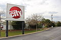 Circuit City entrance sign, Merritt Island, Florida.JPG 5,184 × 3,456; 6.3 MB
-
 Cumberland Farms - panoramio.jpg 4,000 × 3,000; 4.23 MB
-
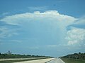 Cumulonimbus Incus with LC-39A.JPG 4,000 × 3,000; 2.04 MB
-
 Econolodge swimming pool, Merritt Island.JPG 5,184 × 3,456; 7.11 MB
-
 Eucalypts in Florida (1911) (14578809759).jpg 3,056 × 2,140; 2.21 MB
-
 Field Manor Homestead.jpg 2,200 × 1,649; 693 KB
-
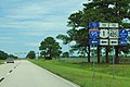 FL3nRoadEnds-ToInt95US1FL405 (23886153287).jpg 2,400 × 1,600; 1.86 MB
-
 FL520eRoad-FL3nSign (23886158857).jpg 2,400 × 1,600; 1.63 MB
-
 Florida State Road 520 WB at Tropical Trail.JPG 5,184 × 3,456; 5.23 MB
-
 FLSR3.JPG 640 × 480; 36 KB
-
 Girl in the Garden - panoramio.jpg 4,000 × 3,000; 4.3 MB
-
 Good for a sundowner 1011 - panoramio.jpg 1,024 × 768; 391 KB
-
 Jacaranda and Quince - panoramio.jpg 4,000 × 3,000; 4.27 MB
-
 Kelly Park - Merritt Island, FL - panoramio.jpg 4,000 × 3,000; 4.34 MB
-
 Kelly Park - panoramio (1).jpg 4,000 × 3,000; 4.32 MB
-
 Kelly Park - panoramio (2).jpg 4,000 × 3,000; 4.28 MB
-
 Kelly Park - panoramio (3).jpg 4,000 × 3,000; 4.35 MB
-
 Kelly Park - panoramio (4).jpg 4,000 × 3,000; 4.39 MB
-
 Kelly Park - panoramio (5).jpg 4,000 × 3,000; 4.34 MB
-
 Kelly Park - panoramio.jpg 4,000 × 3,000; 4.31 MB
-
 Kelly Park East, Merritt Island FL (31080954231).jpg 4,320 × 3,240; 4.45 MB
-
 KSC Entrance - panoramio.jpg 2,304 × 1,728; 1.2 MB
-
 Manatee Cove Park.jpg 1,024 × 768; 86 KB
-
 Marsh grass.jpg 900 × 1,200; 654 KB
-
 Merritt Island 2.JPG 2,048 × 1,536; 1.22 MB
-
 Merritt Island Banner.jpg 5,017 × 717; 1.2 MB
-
 Merritt Island colored school plaque01.jpg 2,448 × 3,264; 2.01 MB
-
 Merritt Island FL barge canal01.jpg 3,264 × 2,448; 1.39 MB
-
 Merritt Island FL barge canal02.jpg 3,264 × 2,448; 2.03 MB
-
 Merritt Island High School.JPG 5,184 × 3,456; 7.74 MB
-
 Merritt Island sign FL520EB.JPG 5,184 × 3,456; 5.63 MB
-
 Merritt Island, FL, USA - panoramio.jpg 2,048 × 1,536; 666 KB
-
 Merritt Island, Florida (southern tip).jpg 3,072 × 2,304; 1.87 MB
-
 Merritt Square sign along Merritt Island Causeway.JPG 5,184 × 3,456; 6.21 MB
-
 Merrittislandhighschool logo1.png 1,600 × 2,000; 112 KB
-
 MILA 9-meter S-band tracking antenna (KSC-2011-6004).jpg 2,008 × 3,000; 3.3 MB
-
 Outback Steakhouse, Florida State Road 520, Merritt Island.JPG 5,184 × 3,456; 5.72 MB
-
 Roseate Spoonbill (Ajaia ajaja) taking flight.jpg 8,256 × 5,504; 22.94 MB
-
 Sea Ray Sykes Creek manufacturing plant (9307629605).jpg 4,320 × 3,240; 3.7 MB
-
 Social Media Press at NASA Causeway.jpg 3,648 × 2,736; 5.64 MB
-
 SpaceCoastFromSpaceStation.jpg 679 × 1,024; 126 KB
-
 SpectralBittersweetClams.jpg 3,024 × 4,032; 2.16 MB
-
 Survey Marker Witness Post DK6651, Florida State Road 520, Meritt Island.JPG 5,184 × 3,456; 8.21 MB
-
 Sykes Creek Pkwy and N Banana River Dr - Merritt Island, FL - panoramio.jpg 4,000 × 3,000; 4.38 MB
-
 View of Sykes Creek and E Merritt Island Causeway from Kiwanis Island Park.JPG 5,184 × 3,456; 5.08 MB
.jpg)


_(14578809759).jpg)

.jpg)
.jpg)


.jpg)
.jpg)
.jpg)
.jpg)
.jpg)

.jpg)


.jpg)


_taking_flight.jpg)
.jpg)


.jpg)