Category:Michaëlskerk (1853, Blokker)
Jump to navigation
Jump to search
| Object location | | View all coordinates using: OpenStreetMap |
|---|
church in Blokker, the Netherlands  | |||||
| Upload media | |||||
| Instance of | |||||
|---|---|---|---|---|---|
| Location | Blokker, Hoorn, North Holland, Netherlands | ||||
| Located on street | |||||
| Architect | |||||
| Heritage designation | |||||
| Inception |
| ||||
| Significant event |
| ||||
 | |||||
English: Tapijtkerk is the nickname for the former St. Michaelschurch at the Westerblokker in Hoorn, North Holland, the Nederlands. Up until ± 2012 there was a carpet (tapijt) store in the church
Nederlands: Tapijtkerk is de bijnaam voor de voormalige Sint Michaëlkerk aan de Westerblokker in Hoorn. Tot ± 2012 was er een tapijtwinkel in gevestigd.
| Address |
|
Subcategories
This category has the following 2 subcategories, out of 2 total.
B
R
Media in category "Michaëlskerk (1853, Blokker)"
The following 35 files are in this category, out of 35 total.
-
 2 ampullen - Westerblokker - 20253978 - RCE.jpg 1,200 × 938; 145 KB
-
 Ampullenblad (1699) - Westerblokker - 20253975 - RCE.jpg 1,200 × 943; 227 KB
-
 Beeltenis van de H. Antonius, Tapijtkerk Westerblokker.JPG 2,592 × 3,888; 4.61 MB
-
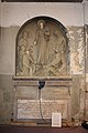
 Beschrijving onder H. Antoniusbeeltenis, Tapijtkerk Westerblokker.JPG 3,888 × 2,592; 5.37 MB
-
 Detail muur.JPG 3,264 × 2,448; 1.8 MB
-
 Doopvont, Michaëlkerk (Blokker).JPG 2,592 × 3,888; 3.64 MB
-
 Een lege nis rechts.JPG 2,448 × 3,264; 1.69 MB
-
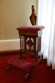 Gebedsbankje met Mariabeeld, Michaëlkerk (Blokker).JPG 2,592 × 3,888; 2.54 MB
-
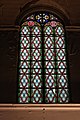 Glas in loodraam, Tapijtkerk Westerblokker.JPG 2,592 × 3,888; 5.27 MB
-
 Lege nis links.JPG 2,448 × 3,264; 1.73 MB
-
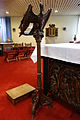 Lezenaar, Michaëlkerk (Blokker).JPG 2,592 × 3,888; 2.9 MB
-
 Maria, Michaëlkerk (Blokker).JPG 2,592 × 3,888; 3.12 MB
-
 Maria-altaar, Michaëlkerk (Blokker).JPG 2,592 × 3,888; 3.72 MB
-
 Michaël, Michaëlkerk (Blokker) 01.JPG 2,592 × 3,888; 3.69 MB
-
 Michaël, Michaëlkerk (Blokker) 02.JPG 2,592 × 3,888; 3.61 MB
-
 Miskelk (1660) - Westerblokker - 20253976 - RCE.jpg 948 × 1,200; 143 KB
-
 Orgel - Westerblokker - 20253983 - RCE.jpg 946 × 1,200; 210 KB
-
 Orgel met klaviatuur - Westerblokker - 20253984 - RCE.jpg 1,200 × 939; 243 KB
-
 Orgel, klaviatuur of speeltafel - Westerblokker - 20253985 - RCE.jpg 950 × 1,200; 184 KB
-
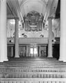 Orgel, overzicht - Westerblokker - 20253982 - RCE.jpg 960 × 1,200; 195 KB
-
 Overzicht interieur.JPG 3,264 × 2,448; 1.75 MB
-
 Overzicht richting ingang, Tapijtkerk Westerblokker.JPG 3,888 × 2,592; 4.37 MB
-
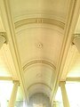 Plafond met zuilen Tapijtkerk.jpg 2,448 × 3,264; 1.68 MB
-
 Plafond Tapijtkerk.jpg 2,448 × 3,264; 1.74 MB
-
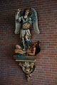
 Rafaël, Michaëlkerk (Blokker).JPG 2,592 × 3,888; 3.83 MB
-
 Religieus stuk in de kerk.JPG 2,448 × 3,264; 1.71 MB
-
 Sedilia, Michaëlkerk (Blokker).JPG 3,888 × 2,592; 3.92 MB
-
 Signering H. Antonius beeltenis, Tapijtkerk Westerblokker.JPG 2,592 × 3,888; 5.39 MB
-
 Tapijtkerk gevelsteen.JPG 3,264 × 2,448; 1.75 MB
-
 Vm pastorie, Tapijtkerk Westerblokker.JPG 3,888 × 2,592; 5.05 MB
-
 Voorgevel nummer 44 - Westerblokker - 20253979 - RCE.jpg 809 × 1,200; 139 KB
-
 Voorgevel, met pastorie - Westerblokker - 20253980 - RCE.jpg 806 × 1,200; 199 KB
-
 Voorgevel, met pastorie - Westerblokker - 20253981 - RCE.jpg 1,200 × 803; 269 KB
-
 Voormalige St. Michaelskerk, Blokker.JPG 480 × 640; 89 KB
-
 Zilveren godslamp (1753) - Westerblokker - 20253977 - RCE.jpg 956 × 1,200; 191 KB

_-_Westerblokker_-_20253975_-_RCE.jpg)


.JPG)

.JPG)


.JPG)
.JPG)
.JPG)
_01.JPG)
_02.JPG)
_-_Westerblokker_-_20253976_-_RCE.jpg)


.JPG)

.JPG)


_-_Westerblokker_-_20253977_-_RCE.jpg)