Category:Midgley, Calderdale
Jump to navigation
Jump to search
English: Midgley is a hill-top village in Calderdale, West Yorkshire, England. It is west-north-west of Halifax.
village in Calderdale, West Yorkshire, United Kingdom .jpg) | |||||
| Upload media | |||||
| Instance of | |||||
|---|---|---|---|---|---|
| Location | Calderdale, West Yorkshire, Yorkshire and the Humber, England | ||||
 | |||||
Subcategories
This category has the following 11 subcategories, out of 11 total.
B
- Bracken's Folly (11 F)
C
D
- Delph Hill Lane (9 F)
H
J
- Jim Allen Lane, Midgley (6 F)
M
- Midgley Pinfold (3 F)
P
- Pin Hill Lane (7 F)
T
- Thorney Lane, Midgley (11 F)
W
- Workhouse Lane, Midgley (5 F)
Media in category "Midgley, Calderdale"
The following 127 files are in this category, out of 127 total.
-
 A branch of Sowerby Bridge FP17, Midgley - geograph.org.uk - 4478186.jpg 2,000 × 1,407; 845 KB
-
 Blind Lane - geograph.org.uk - 1325403.jpg 640 × 480; 102 KB
-
 Brearley Lane - geograph.org.uk - 1325411.jpg 640 × 480; 99 KB
-
 Brearley Lane - geograph.org.uk - 1325414.jpg 640 × 480; 93 KB
-

-
 Brearley Lock - geograph.org.uk - 6839.jpg 640 × 400; 43 KB
-
 Bridge on Brearley Lane - geograph.org.uk - 984601.jpg 484 × 640; 97 KB
-
 Bridleway off Thorney Lane, Midgley - geograph.org.uk - 2423303.jpg 2,000 × 1,500; 1.12 MB
-
 Bus stop (2326783397).jpg 1,920 × 2,560; 3.21 MB
-
 Calderdale Way High on the Edge above Luddenden Dean - geograph.org.uk - 6071029.jpg 5,184 × 3,456; 5.78 MB
-
 Chapel Lane, Midgley - geograph.org.uk - 4478177.jpg 2,000 × 1,500; 1.11 MB
-
 Cliff Hill - geograph.org.uk - 717845.jpg 640 × 464; 120 KB
-
 Cotton grass on Sowerby Bridge FP15, Midgley - geograph.org.uk - 5791169.jpg 2,000 × 1,500; 1.13 MB
-
 Dated lintel, Tray Royd - geograph.org.uk - 4234772.jpg 2,000 × 1,468; 973 KB
-
 Descending towards Thorney Lane - geograph.org.uk - 6070998.jpg 5,184 × 3,456; 7.53 MB
-
 Dry Carr, Midgley - geograph.org.uk - 5291878.jpg 2,000 × 1,500; 915 KB
-
 Duke Street - Solomon Hill, Midgley - geograph.org.uk - 810692.jpg 640 × 480; 64 KB
-
 Footpath - Solomon Hill, Midgley - geograph.org.uk - 810689.jpg 449 × 640; 66 KB
-
 Former chapel, Midgley - geograph.org.uk - 1039837.jpg 640 × 480; 98 KB
-

-
 Frank Lane, Midgley - geograph.org.uk - 4478169.jpg 2,000 × 1,500; 1.25 MB
-
 Frank Lane, Midgley - geograph.org.uk - 5790770.jpg 2,000 × 1,500; 1.38 MB
-
 Gate on Sowerby bridge FP 18 - geograph.org.uk - 4236240.jpg 2,000 × 1,500; 1.32 MB
-
 Gate on Sowerby Bridge FP18, Midgley - geograph.org.uk - 5790788.jpg 2,000 × 1,500; 1,020 KB
-
 Gate on Sowerby Bridge FP20 - geograph.org.uk - 5790964.jpg 2,000 × 1,500; 1.11 MB
-
 Gate on Sowerby Bridge FP20, Midgley - geograph.org.uk - 5790971.jpg 2,000 × 1,500; 1.14 MB
-
 George V Postbox, Old Post Office, Midgley - geograph.org.uk - 426564.jpg 683 × 1,024; 177 KB
-
 Great House Witches Post.jpg 1,200 × 900; 320 KB
-
 Green Lane, Midgley - geograph.org.uk - 4236288.jpg 2,000 × 1,500; 882 KB
-
 Greenhouses - geograph.org.uk - 1540329.jpg 640 × 480; 60 KB
-
 Junction of Sowerby Bridge FP10 and the Calderdale Way - geograph.org.uk - 5291907.jpg 2,000 × 1,500; 976 KB
-
 Lane Ends - Solomon Hill, Midgley - geograph.org.uk - 810706.jpg 640 × 480; 82 KB
-

-
 Midgley - geograph.org.uk - 4959681.jpg 5,184 × 3,224; 1.87 MB
-
 Midgley Chapel (2327632872).jpg 1,388 × 1,443; 1.59 MB
-

-

-

-
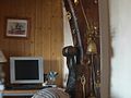
 Midgley reflections (2327601884).jpg 2,560 × 1,920; 2.66 MB
-
 Midgley School - geograph.org.uk - 17978.jpg 800 × 600; 145 KB
-
 Modern building at Midgley School - geograph.org.uk - 4381466.jpg 2,000 × 1,500; 1.3 MB
-
 Moderna Way - geograph.org.uk - 1626266.jpg 476 × 640; 66 KB
-
 Naylor Lane - Midgley - geograph.org.uk - 810683.jpg 508 × 640; 75 KB
-
 Naylor Lane at junction with Sowerby Bridge FP20 - geograph.org.uk - 4236281.jpg 2,000 × 1,500; 1.44 MB
-
 Naylor Lane, Midgley - geograph.org.uk - 4234210.jpg 1,316 × 1,812; 901 KB
-
 No14 Brearley Lane - geograph.org.uk - 1325419.jpg 640 × 480; 63 KB
-
 Oats Royd Mill, Midgley - geograph.org.uk - 177056.jpg 428 × 640; 83 KB
-

-
 Old house, Midgley (2327608386).jpg 2,537 × 1,920; 3.86 MB
-
 Path junction on Sowerby Bridge FP20, Midgley - geograph.org.uk - 5790983.jpg 2,000 × 1,500; 1.15 MB
-
 Pin Hill Lane - Midgley - geograph.org.uk - 810696.jpg 589 × 640; 83 KB
-
 Plantation adjacent to Radcliffe Lane, Luddenden - geograph.org.uk - 6071359.jpg 1,024 × 768; 261 KB
-
 Pollarded tree, Ellen Royd Lane, Midgley - geograph.org.uk - 4381437.jpg 2,000 × 1,500; 1.03 MB
-

-
 Reservoir in Baumes Clough - geograph.org.uk - 4381485.jpg 2,000 × 1,500; 1.07 MB
-
 Reservoir in Baumes Clough - geograph.org.uk - 4381488.jpg 2,000 × 1,500; 1.08 MB
-
 Road to Great Scout Farm - geograph.org.uk - 1325408.jpg 640 × 480; 102 KB
-
 Rochdale Canal at Brearley - geograph.org.uk - 6838.jpg 600 × 427; 41 KB
-
 Seen on Sustrans Route 66, Calder Valley - geograph.org.uk - 984634.jpg 473 × 640; 172 KB
-

-
 Sheep grazing, Midgley - geograph.org.uk - 39647.jpg 640 × 427; 101 KB
-
 Sopwerby Bridge FP10 on Midgley Low Moor - geograph.org.uk - 5291888.jpg 2,000 × 1,500; 779 KB
-
 Sowerby Bridge Bridleway 4 passing Far Broad Fold - geograph.org.uk - 5294935.jpg 1,500 × 2,000; 864 KB
-
 Sowerby Bridge FP1 at Wood Lane, Midgley - geograph.org.uk - 5087473.jpg 1,500 × 2,000; 1.44 MB
-
 Sowerby Bridge FP15 in Workhouse Slack, Midgley - geograph.org.uk - 5791010.jpg 2,000 × 1,500; 1.25 MB
-
 Sowerby Bridge FP15 near the top of Workhouse Slack, Midgley - geograph.org.uk - 5791023.jpg 2,000 × 1,500; 1.25 MB
-
 Sowerby Bridge FP15, Midgley - geograph.org.uk - 5791181.jpg 2,000 × 1,500; 1.22 MB
-
 Sowerby bridge FP17 next to a curved wall, Midgley - geograph.org.uk - 4478554.jpg 2,000 × 1,500; 1.42 MB
-

-
 Sowerby Bridge FP17, Midgley - geograph.org.uk - 4469760.jpg 2,000 × 1,500; 1.44 MB
-
 Sowerby Bridge FP18 - geograph.org.uk - 4234316.jpg 2,000 × 1,500; 1.22 MB
-
 Sowerby Bridge FP18 at Scotland - geograph.org.uk - 4236236.jpg 2,000 × 1,500; 1.2 MB
-
 Sowerby Bridge FP18, Midgley - geograph.org.uk - 5790794.jpg 2,000 × 1,500; 1,001 KB
-
 Sowerby Bridge FP18, Midgley - geograph.org.uk - 5790798.jpg 2,000 × 1,500; 1.39 MB
-
 Sowerby Bridge FP18, Midgley - geograph.org.uk - 5790804.jpg 2,000 × 1,500; 1.26 MB
-
 Sowerby Bridge FP18, Midgley - geograph.org.uk - 5790811.jpg 2,000 × 1,500; 1.1 MB
-
 Sowerby Bridge FP19 passing Lacey Hey Farm - geograph.org.uk - 4234125.jpg 2,000 × 1,484; 1.04 MB
-
 Sowerby Bridge FP19, Midgley - geograph.org.uk - 4487957.jpg 1,536 × 2,048; 773 KB
-
 Sowerby Bridge FP2 (7) at Dry Carr Lane - geograph.org.uk - 5291871.jpg 2,000 × 1,500; 964 KB
-
 Sowerby Bridge FP2, Midgley (2) - geograph.org.uk - 5291849.jpg 2,000 × 1,500; 1.15 MB
-
 Sowerby Bridge FP2, Midgley (3) - footpath gate - geograph.org.uk - 5291855.jpg 2,000 × 1,500; 1.38 MB
-
 Sowerby Bridge FP2, Midgley (4) - geograph.org.uk - 5291859.jpg 2,000 × 1,500; 999 KB
-
 Sowerby Bridge FP2, Midgley (5) - geograph.org.uk - 5291862.jpg 2,000 × 1,500; 879 KB
-
 Sowerby Bridge FP2, Midgley (6) - narrow footpath gate - geograph.org.uk - 5291864.jpg 2,230 × 2,900; 1.51 MB
-
 Sowerby Bridge FP20 - geograph.org.uk - 4236269.jpg 2,000 × 1,500; 1.34 MB
-
 Sowerby bridge FP20 entering green lane - geograph.org.uk - 4234301.jpg 2,000 × 1,500; 1.14 MB
-
 Sowerby Bridge FP4 (W4) - geograph.org.uk - 5294952.jpg 2,000 × 1,500; 990 KB
-
 Sowerby Bridge FP4 (W6) - geograph.org.uk - 5294964.jpg 2,000 × 1,500; 900 KB
-
 Sowerby Bridge FP4 (W7) passing a tree house - geograph.org.uk - 5294967.jpg 2,000 × 1,500; 894 KB
-
 Sowerby Bridge FP55 leaving FP13, Midgley - geograph.org.uk - 5791121.jpg 2,000 × 1,500; 1,003 KB
-
 Sowerby Bridge FP55, Midgley - geograph.org.uk - 5791127.jpg 2,000 × 1,500; 1,015 KB
-
 Sowerby Bridge FP55, Midgley - geograph.org.uk - 5791153.jpg 2,000 × 1,500; 1.01 MB
-
 Sowerby Bridge FP7 (1) - Stile and gate at Midgley Low Moor - geograph.org.uk - 5292095.jpg 2,000 × 1,500; 1.18 MB
-
 Sowerby Bridge FP7 (2) - gate - geograph.org.uk - 5292100.jpg 2,000 × 1,500; 1.37 MB
-
 Sowerby Bridge FP7 (3) - stile - geograph.org.uk - 5292104.jpg 2,000 × 1,500; 1.1 MB
-
 Sowerby Bridge FP7, Midgley (4) - gate - geograph.org.uk - 5292107.jpg 2,000 × 1,500; 1,021 KB
-
 Sowerby Lane, Sowerby - geograph.org.uk - 995546.jpg 640 × 472; 73 KB
-

-
 Steps and gated stile on Sowerby Bridge FP4 (W3) - geograph.org.uk - 5294945.jpg 2,000 × 1,500; 1.22 MB
-
 Stile and dog hatch on Sowerby Bridge FP10 - geograph.org.uk - 4234288.jpg 2,000 × 1,500; 929 KB
-
 Stile and gate on Sowerby Bridge FP18 - geograph.org.uk - 4234293.jpg 1,534 × 2,000; 825 KB
-
 Stile and pool on Sowerby Bridge FP 7 - geograph.org.uk - 4236248.jpg 2,000 × 1,500; 1.03 MB
-
 Stile on Sowerby Bridge FP 10 - geograph.org.uk - 4236243.jpg 2,000 × 1,500; 847 KB
-
 Stile on Sowerby Bridge FP 7 at Moorside Farm - geograph.org.uk - 4236254.jpg 2,000 × 1,500; 1.19 MB
-
 Stile on Sowerby bridge FP10 - geograph.org.uk - 5291899.jpg 2,000 × 1,466; 835 KB
-
 Stile on Sowerby Bridge FP18 at Tray Royd - geograph.org.uk - 4234313.jpg 2,000 × 1,483; 928 KB
-
 Stile on Sowerby Bridge FP20 at Towngate, Midgley - geograph.org.uk - 4234283.jpg 2,000 × 1,500; 910 KB
-
 Stile on Sowerby Bridge FP4 (W5) - geograph.org.uk - 5294958.jpg 2,000 × 1,500; 1.04 MB
-
 Stile onto the moor on Sowerby Bridge FP07 - geograph.org.uk - 4236261.jpg 2,000 × 1,500; 1.17 MB
-
 Stile onto Workhouse Slack from the Calderdale Way - geograph.org.uk - 4234162.jpg 2,000 × 1,500; 961 KB
-
 Stocks - Towngate, Midgley - geograph.org.uk - 810648.jpg 640 × 527; 100 KB
-
 The chapel graveyard, Midgley - geograph.org.uk - 4478167.jpg 2,000 × 1,500; 957 KB
-
 The moor-edge path at the top of Workhouse Slack - geograph.org.uk - 4234133.jpg 2,000 × 1,500; 1.08 MB
-
 The Old Lord Nelson - geograph.org.uk - 2869663.jpg 3,072 × 2,304; 1.1 MB
-
 The Sawmill, Midgley - geograph.org.uk - 364109.jpg 640 × 480; 68 KB
-
 The Sawmill, Midgley - geograph.org.uk - 364115.jpg 640 × 480; 75 KB
-
 The Sportsman, Midgley (Taken by Flickr usern 6th October 2013).jpg 2,423 × 2,130; 3.61 MB
-
 Town Syke Well - Towngate, Midgley - geograph.org.uk - 810646.jpg 640 × 480; 100 KB
-
 Tray Royd Lane - Midgley - geograph.org.uk - 810656.jpg 640 × 451; 52 KB
-
 Tray Royd Lane, Midgley - geograph.org.uk - 4234310.jpg 2,000 × 1,500; 1.37 MB
-
 Tray Royd, Midgley - geograph.org.uk - 4234323.jpg 2,000 × 1,481; 1.21 MB
-
 Two stiles on Sowerby Bridge FP18 - geograph.org.uk - 5796942.jpg 2,000 × 1,500; 1.04 MB
-
 View towards Midgley, through gateway (4718300464).jpg 2,332 × 1,640; 3.84 MB
-

-
 Welcome to Midgley (2327612154).jpg 1,920 × 1,920; 3.89 MB
-
 Workhouse Slack, Midgley - geograph.org.uk - 5791043.jpg 2,000 × 1,500; 1.06 MB
-
 Standing stone, Crow Hill Nook - geograph.org.uk - 16661.jpg 1,024 × 773; 133 KB


.jpg)


.jpg)


.jpg)


.jpg)
.jpg)


_at_Dry_Carr_Lane_-_geograph.org.uk_-_5291871.jpg)
_-_geograph.org.uk_-_5291849.jpg)
_-_footpath_gate_-_geograph.org.uk_-_5291855.jpg)
_-_geograph.org.uk_-_5291859.jpg)
_-_geograph.org.uk_-_5291862.jpg)
_-_narrow_footpath_gate_-_geograph.org.uk_-_5291864.jpg)


_-_geograph.org.uk_-_5294952.jpg)
_-_geograph.org.uk_-_5294964.jpg)
_passing_a_tree_house_-_geograph.org.uk_-_5294967.jpg)


_-_Stile_and_gate_at_Midgley_Low_Moor_-_geograph.org.uk_-_5292095.jpg)
_-_gate_-_geograph.org.uk_-_5292100.jpg)
_-_stile_-_geograph.org.uk_-_5292104.jpg)
_-_gate_-_geograph.org.uk_-_5292107.jpg)


_-_geograph.org.uk_-_5294945.jpg)


_-_geograph.org.uk_-_5294958.jpg)


.jpg)

.jpg)

