Category:Mill in Romaszkówka
Jump to navigation
Jump to search
| Object location | | View all coordinates using: OpenStreetMap |
|---|
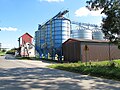
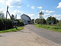
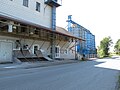
- Polski: Młyn wodny we wsi Romaszkówka
- English: Water mill in Romaszkówka village
 | |||||
| Upload media | |||||
| Instance of | |||||
|---|---|---|---|---|---|
| Location | Romaszkówka, Gmina Korycin, Sokółka County, Podlaskie Voivodeship, Poland | ||||
| Heritage designation |
| ||||
| Inception |
| ||||
 | |||||
Media in category "Mill in Romaszkówka"
The following 6 files are in this category, out of 6 total.
-
 Podlaskie - Korycin - Romaszkówka - Młyn - Kumiałka - v-SSW.jpg 2,736 × 3,648; 3.49 MB
-
 Podlaskie - Korycin - Romaszkówka - Młyn - Silosy - v-SSE.jpg 3,565 × 2,673; 2.31 MB
-
 Podlaskie - Korycin - Romaszkówka - Młyn - v-E.jpg 3,648 × 2,736; 3.37 MB
-
 Podlaskie - Korycin - Romaszkówka - Młyn; blisko - v-E.jpg 3,408 × 2,555; 1.6 MB
-
 Romaszkowka - mlyn wodny 1.PNG 789 × 592; 1.24 MB
-
 Romaszkowka - mlyn wodny 2.PNG 789 × 592; 639 KB


