Category:Millington, East Riding of Yorkshire
Jump to navigation
Jump to search
English: Millington is a small village and civil parish in the East Riding of Yorkshire, England. It is situated approximately 2 miles (3.2 km) north east of Pocklington.
village and civil parish in the East Riding of Yorkshire, UK  | |||||
| Upload media | |||||
| Instance of | |||||
|---|---|---|---|---|---|
| Location | East Riding of Yorkshire, Yorkshire and the Humber, England | ||||
| Said to be the same as | Millington (Wikimedia duplicated page, civil parish) | ||||
 | |||||
Subcategories
This category has the following 12 subcategories, out of 12 total.
F
- Frendal Dale (17 F)
G
- Grimthorpe Wood (11 F)
M
- Millington Dale (19 F)
- Millington Wood (27 F)
O
- Ousethorpe (22 F)
S
- Sylvan Dale (19 F)
T
- Tun Dale (10 F)
Media in category "Millington, East Riding of Yorkshire"
The following 200 files are in this category, out of 419 total.
(previous page) (next page)-
 A bridleway to Millington Dale - geograph.org.uk - 2923832.jpg 800 × 600; 155 KB
-
 A Cow Water Butt in Frendal Dale - geograph.org.uk - 4565314.jpg 3,448 × 4,592; 6.64 MB
-
 A junction of paths at Millington Dale - geograph.org.uk - 2299885.jpg 800 × 600; 327 KB
-
 A misty day in Given Dale - geograph.org.uk - 5650168.jpg 640 × 480; 77 KB
-
 A Tree in Frendal Dale - geograph.org.uk - 4563544.jpg 4,133 × 3,104; 3.43 MB
-
 A typical large Wolds field - geograph.org.uk - 5984580.jpg 1,024 × 768; 147 KB
-
 A walk through Given Dale - geograph.org.uk - 2497842.jpg 3,264 × 2,448; 2.2 MB
-
 A Walk with a View - geograph.org.uk - 2497924.jpg 3,264 × 2,448; 1.66 MB
-
 A Wolds Picture - geograph.org.uk - 2497800.jpg 3,264 × 2,448; 2.04 MB
-
 Access road to Millington Heights - geograph.org.uk - 4524256.jpg 4,608 × 3,456; 3.82 MB
-
 Across Millington Bottom to Woodgate Farm - geograph.org.uk - 4524189.jpg 4,608 × 3,456; 4.62 MB
-
 Across Millington Dale - geograph.org.uk - 1971619.jpg 640 × 457; 223 KB
-
 Allison Nab - geograph.org.uk - 3763811.jpg 640 × 427; 80 KB
-
 Along Millington Dale - geograph.org.uk - 3763757.jpg 427 × 640; 96 KB
-
 Along Millington Dale - geograph.org.uk - 4881079.jpg 640 × 427; 86 KB
-
 Along the footpath into Nettle Dale - geograph.org.uk - 4877406.jpg 640 × 427; 106 KB
-

-
 An old pit - now used as a farm dump - geograph.org.uk - 1170022.jpg 640 × 480; 75 KB
-
 Another stone bollard - geograph.org.uk - 5984570.jpg 1,024 × 768; 317 KB
-
 Autumnal Tree - geograph.org.uk - 16885.jpg 640 × 480; 144 KB
-
 Autumnal view of the Ponds at Great Givendale - geograph.org.uk - 2659603.jpg 4,032 × 3,024; 4.25 MB
-
 Balk Pit, near Millington - geograph.org.uk - 5744281.jpg 640 × 427; 417 KB
-
 Barns at Little Givendale - geograph.org.uk - 3862189.jpg 4,294 × 2,160; 1.28 MB
-
 Barns at Little Givendale Farm - geograph.org.uk - 4391810.jpg 1,600 × 1,062; 633 KB
-
 Beacon Road towards the A166 - geograph.org.uk - 1846865.jpg 640 × 480; 54 KB
-
 Beacon Road, north towards Great Givendale (geograph 2325613).jpg 800 × 600; 168 KB
-
 Beside the Wolds Way - geograph.org.uk - 23063.jpg 640 × 480; 135 KB
-
 Bottom of Grimthorpe Hill, near Millington (geograph 5744303).jpg 640 × 486; 346 KB
-
 Bridge over Millington Beck Ford - panoramio.jpg 3,264 × 2,448; 3.61 MB
-
 Bridleway heading north through Great Plantation - geograph.org.uk - 2998406.jpg 3,437 × 2,455; 3.63 MB
-
 Bridleway heading south through Great Plantation - geograph.org.uk - 2998412.jpg 3,457 × 2,469; 3.36 MB
-
 Bridleway near Little Givendale Farm - geograph.org.uk - 1845092.jpg 640 × 480; 99 KB
-
 Camping at the roadside - geograph.org.uk - 656197.jpg 427 × 640; 62 KB
-
 Car Park in Millington Wood - geograph.org.uk - 4881083.jpg 640 × 427; 127 KB
-
 Cattle in Frendal Dale - geograph.org.uk - 4878502.jpg 427 × 640; 73 KB
-
 Cattle out to Pasture - geograph.org.uk - 2497928.jpg 3,264 × 2,448; 2.2 MB
-
 Cellphone mast and equipment cabin - geograph.org.uk - 1170028.jpg 640 × 480; 127 KB
-
 Chalk land Way by Grimthorpe Wood (geograph 5808621).jpg 1,024 × 768; 229 KB
-
 Chalk Pit - geograph.org.uk - 125348.jpg 640 × 480; 120 KB
-
 Chalkland Way - geograph.org.uk - 4876913.jpg 640 × 427; 85 KB
-
 Chalkland Way at Brimlands Wood - geograph.org.uk - 4391906.jpg 1,600 × 1,062; 936 KB
-
 Chalkland Way at Brimlands Wood - geograph.org.uk - 4391909.jpg 1,600 × 1,062; 1.02 MB
-
 Chalkland Way at Brimlands Wood - geograph.org.uk - 4391914.jpg 1,600 × 1,062; 838 KB
-
 Chalkland Way at Brimlands Wood - geograph.org.uk - 4391919.jpg 1,600 × 1,062; 928 KB
-
 Chalkland Way at Grimthorpe Wood (geograph 4391981).jpg 1,600 × 1,062; 744 KB
-
 Chalkland Way at Grimthorpe Wood (geograph 4391984).jpg 1,600 × 1,062; 981 KB
-
 Chalkland Way at Grimthorpe Wood (geograph 4391986).jpg 1,600 × 1,062; 807 KB
-
 Chalkland Way at Nettle Dale (geograph 6578632).jpg 1,600 × 1,065; 717 KB
-
 Chalkland Way at Nettle Dale (geograph 6578637).jpg 1,600 × 1,065; 760 KB
-
 Chalkland way in Tun Dale - geograph.org.uk - 4880569.jpg 640 × 427; 100 KB
-
 Chalkland Way near Grimthorpe Manor (geograph 4391970).jpg 1,600 × 1,062; 669 KB
-
 Chalkland Way south of Givendale - geograph.org.uk - 4391893.jpg 1,600 × 1,062; 857 KB
-
 Charcoal Oven - geograph.org.uk - 2379521.jpg 480 × 640; 149 KB
-
 Church Dale, Great Givendale - geograph.org.uk - 5609263.jpg 5,184 × 2,920; 4.51 MB
-
 Church of St Margaret, Millington - geograph.org.uk - 5369451.jpg 3,648 × 2,736; 3.5 MB
-
 Climbing up Sylvan Dale the hard way - geograph.org.uk - 2299860.jpg 800 × 600; 294 KB
-
 Climbing up Sylvan Dale the hard way - geograph.org.uk - 2299867.jpg 800 × 600; 301 KB
-
 Common Spotted Orchid - geograph.org.uk - 870011.jpg 480 × 640; 99 KB
-
 Common spotted orchid in Millington Dale - geograph.org.uk - 3028178.jpg 3,352 × 2,682; 1.92 MB
-
 Concrete feature beside a minor road - geograph.org.uk - 4150123.jpg 2,112 × 2,816; 1.15 MB
-
 Copper Copse - geograph.org.uk - 16886.jpg 640 × 480; 138 KB
-
 Cottages in Millington - geograph.org.uk - 3028086.jpg 4,130 × 2,950; 2.38 MB
-
 Cottages, Millington (geograph 7051372).jpg 1,024 × 727; 104 KB
-
 Cow and calf, near Great Givendale - geograph.org.uk - 2936762.jpg 485 × 640; 208 KB
-
 Cow Moor - geograph.org.uk - 3763768.jpg 640 × 427; 98 KB
-
 Cow Moor - geograph.org.uk - 4876926.jpg 640 × 427; 82 KB
-
 Cows in Millington Dale - geograph.org.uk - 3763814.jpg 640 × 427; 71 KB
-
 Cows in Millington Dale - geograph.org.uk - 4101890.jpg 640 × 427; 85 KB
-
 Crosroas at Greenwick Cottage - geograph.org.uk - 5984573.jpg 1,024 × 768; 173 KB
-
 Cross roads at Balk Pit, NW of Millington - geograph.org.uk - 5609257.jpg 5,184 × 2,920; 2.08 MB
-
 Dale panorama - geograph.org.uk - 1390748.jpg 640 × 480; 116 KB
-
 Deep Dale - geograph.org.uk - 1035160.jpg 640 × 480; 109 KB
-
 Deep Dale - Whitekeld Dale - geograph.org.uk - 1035211.jpg 640 × 480; 90 KB
-
 Deep Dale near Swinglingmoor Spring - geograph.org.uk - 3906284.jpg 800 × 532; 190 KB
-
 Deep Dale near White Keld Spring - geograph.org.uk - 3906287.jpg 800 × 532; 199 KB
-
 Deep Dale towards Swingling Moor - geograph.org.uk - 3906266.jpg 800 × 532; 176 KB
-
 Deep Dale towards Whitekeld Dale - geograph.org.uk - 3906283.jpg 800 × 532; 260 KB
-
 Down to Millington Bottom - geograph.org.uk - 3763698.jpg 640 × 427; 91 KB
-
 Dry and Dusty - geograph.org.uk - 2497808.jpg 3,264 × 2,448; 2.09 MB
-
 Earthwork, Cow Moor - geograph.org.uk - 1563573.jpg 640 × 480; 82 KB
-
 East of Givendale - geograph.org.uk - 586723.jpg 640 × 480; 71 KB
-
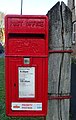 Elizabeth II postbox, Millington (geograph 7051362).jpg 646 × 1,024; 184 KB
-
 Entering Great Plantation - geograph.org.uk - 591088.jpg 480 × 640; 144 KB
-
 Entrance of Millington Woods looking out - panoramio (1).jpg 3,264 × 2,448; 4.02 MB
-
 Farclose Plantation - geograph.org.uk - 5794432.jpg 640 × 480; 83 KB
-
 Farclose Plantation on York Lane - geograph.org.uk - 5371029.jpg 3,648 × 2,736; 4.19 MB
-

-
 Farm Track - geograph.org.uk - 137460.jpg 480 × 640; 87 KB
-
 Farm Track from Greenwick Farm - geograph.org.uk - 1374569.jpg 640 × 480; 91 KB
-
 Farmland at Greenwick Farm - geograph.org.uk - 3524818.jpg 1,024 × 768; 124 KB
-
 Farmland in Frendal Dale - geograph.org.uk - 4878517.jpg 640 × 427; 89 KB
-
 Farmland near Great Plantation - geograph.org.uk - 4880575.jpg 640 × 427; 92 KB
-
 Farmland near High College Farm - geograph.org.uk - 1845058.jpg 640 × 480; 34 KB
-
 Farmland near Little Givendale Farm - geograph.org.uk - 1845097.jpg 640 × 480; 69 KB
-
 Farmland near Little Givendale Farm - geograph.org.uk - 2299609.jpg 800 × 600; 312 KB
-
 Farmland, Grimthorpe (geograph 1846838).jpg 640 × 480; 46 KB
-
 Field and Discarded Trailer - geograph.org.uk - 269949.jpg 640 × 480; 96 KB
-
 Field entrance, Huggate Wold - geograph.org.uk - 4150310.jpg 2,816 × 2,112; 1.12 MB
-
 Field gateway into Whitekeld Dale - geograph.org.uk - 4524474.jpg 4,608 × 3,456; 3.78 MB
-
 Field track to Millington Pasture - geograph.org.uk - 4524251.jpg 4,608 × 3,456; 4 MB
-
 Font at St Ethelburga Church, Great Givendale - geograph.org.uk - 5160441.jpg 1,065 × 1,600; 331 KB
-
 Footbridge and Ford at Millington Beck - geograph.org.uk - 4524227.jpg 4,608 × 3,456; 5.71 MB
-
 Footbridge near Grimthorpe Manor (geograph 5160466).jpg 1,600 × 1,065; 810 KB
-
 Footbridge on the Chalkland Way (geograph 4391972).jpg 1,600 × 1,062; 934 KB
-
 Footpath Crossings - geograph.org.uk - 4876933.jpg 640 × 427; 81 KB
-
 Footpath on route of Roman Road - panoramio.jpg 3,264 × 2,448; 3.34 MB
-

-

-
 Footpath to Waterman Hole - geograph.org.uk - 591089.jpg 640 × 480; 124 KB
-
 Footpaths cross on the Wolds-Minster Way - geograph.org.uk - 3109523.jpg 3,264 × 2,448; 1.89 MB
-
 Ford in Millington Dale - geograph.org.uk - 3028139.jpg 4,608 × 3,072; 3.49 MB
-
 Former chapel now Village Hall. Church Lane, Millington (geograph 7158953).jpg 5,152 × 3,864; 5.25 MB
-
 Frendal Dale - geograph.org.uk - 3763829.jpg 640 × 427; 96 KB
-
 Frendal Dale - geograph.org.uk - 4604408.jpg 1,024 × 768; 157 KB
-
 Frendal Dale from Millington Pastures - geograph.org.uk - 3565498.jpg 3,648 × 2,736; 3.87 MB
-
 Frendal Dale meets Millington Dale - geograph.org.uk - 3497415.jpg 640 × 426; 217 KB
-
 Frendal Dale Sheep - geograph.org.uk - 4878512.jpg 640 × 427; 77 KB
-
 From Millington to Huggate - geograph.org.uk - 728833.jpg 640 × 357; 144 KB
-

-
 From Pasture Gates to Becks - geograph.org.uk - 754392.jpg 640 × 480; 55 KB
-
 From Wood Gate - geograph.org.uk - 4101887.jpg 640 × 427; 87 KB
-
 Gate by Great Plantation - geograph.org.uk - 3497581.jpg 640 × 426; 223 KB
-
 Gate into Great Plantation - geograph.org.uk - 2998401.jpg 3,263 × 2,331; 2.61 MB
-
 Gateway view to Warren Farm from Wood Gate - geograph.org.uk - 3028277.jpg 4,212 × 3,009; 2.71 MB
-
 Given Dale - geograph.org.uk - 3862169.jpg 3,913 × 2,471; 1.45 MB
-
 Given Dale near Great Givendale, York Wolds - geograph.org.uk - 3290849.jpg 1,024 × 768; 188 KB
-
 Given Dale seen across Whitekeld Dale - geograph.org.uk - 2278768.jpg 1,600 × 980; 1.47 MB
-
 Given Dale, E Yorkshire - geograph.org.uk - 2936758.jpg 640 × 426; 172 KB
-
 Givendale - geograph.org.uk - 1417415.jpg 640 × 480; 118 KB
-
 Givendale entrance sign - geograph.org.uk - 4391901.jpg 1,600 × 1,062; 919 KB
-
 Givendale service reservoir - geograph.org.uk - 5532722.jpg 800 × 600; 147 KB
-
 Great Plantation - geograph.org.uk - 1390772.jpg 480 × 640; 139 KB
-
 Great Plantation - geograph.org.uk - 4880573.jpg 640 × 427; 142 KB
-
 Great plantation trackway - geograph.org.uk - 3109500.jpg 3,264 × 2,448; 1.92 MB
-
 Greenwick Farm farmland, Huggate Wold - geograph.org.uk - 3524805.jpg 1,024 × 768; 113 KB
-
 Greenwick Farm. - geograph.org.uk - 1036361.jpg 640 × 480; 47 KB
-
 Grimthorpe Hill - geograph.org.uk - 5532711.jpg 800 × 600; 81 KB
-
 Grimthorpe Hill towards Givendale (geograph 1846841).jpg 640 × 480; 72 KB
-
 Grimthorpe Hill towards Great Givendale (geograph 2325601).jpg 800 × 600; 297 KB
-
 Grimthorpe Wood - geograph.org.uk - 125408.jpg 640 × 480; 170 KB
-
 Ha-ha at Givendale House - geograph.org.uk - 3963416.jpg 1,024 × 768; 212 KB
-
 Heading south along the Chalkland Way in Tun Dale - geograph.org.uk - 2998419.jpg 3,284 × 2,346; 3.56 MB
-
 Heading south along to Millington road - geograph.org.uk - 2998425.jpg 3,392 × 2,423; 1.57 MB
-
 Heading up Swineridge Lane (geograph 3763578).jpg 640 × 427; 164 KB
-
 Highland Cattle grazing on First Heights - geograph.org.uk - 4524240.jpg 4,608 × 3,456; 3.58 MB
-
 Holiday cottages on Main Street, Millington (geograph 7052207).jpg 640 × 465; 56 KB
-
 Horse tethering posts near Woodgate Farm - geograph.org.uk - 3028260.jpg 4,216 × 3,012; 2.76 MB
-
 House on Main Street, Millington (geograph 7052206).jpg 1,024 × 649; 106 KB
-
 Houses on Manor Court Farm, Millington - geograph.org.uk - 4391790.jpg 1,600 × 1,062; 609 KB
-
 Huggate Dikes - geograph.org.uk - 1390172.jpg 640 × 480; 81 KB
-
 Huggate Dikes - geograph.org.uk - 1390188.jpg 640 × 480; 76 KB
-
 Huggate Wold In Winter - geograph.org.uk - 1264810.jpg 640 × 480; 143 KB
-
 Immature Cereal Crop above Millington - geograph.org.uk - 3565509.jpg 3,931 × 3,257; 4.02 MB
-
 In Millington Wood - geograph.org.uk - 3028237.jpg 3,072 × 4,608; 3.11 MB
-
 In the Great Plantation - geograph.org.uk - 5794430.jpg 640 × 480; 100 KB
-
 Into Greenwick Dale - geograph.org.uk - 6092364.jpg 3,240 × 4,320; 4.7 MB
-
 Junction at Waterman Hole - geograph.org.uk - 4150311.jpg 2,814 × 2,010; 914 KB
-
 Just north of Great Plantation - geograph.org.uk - 10216.jpg 640 × 480; 115 KB
-
 Linear earthwork, Huggate Dykes - geograph.org.uk - 402578.jpg 480 × 640; 117 KB
-
 Little Givendale Farm, near Millington - geograph.org.uk - 2299595.jpg 800 × 600; 295 KB
-

-
 Looking across Whitekeld Dale - geograph.org.uk - 2299582.jpg 800 × 600; 211 KB
-
 Looking down Church Lane, Millington (geograph 7158959).jpg 5,152 × 3,864; 6.8 MB
-
 Looking down into Millington Dale - geograph.org.uk - 4876929.jpg 640 × 427; 89 KB
-
 Looking down Millington Dale - geograph.org.uk - 3914137.jpg 1,024 × 647; 150 KB
-
 Looking down Millington Dale - geograph.org.uk - 4565320.jpg 4,592 × 3,448; 4.87 MB
-
 Looking into Church Dale - geograph.org.uk - 4617141.jpg 1,024 × 768; 234 KB
-
 Looking into Greenwick Dale, E. Yorks - geograph.org.uk - 3497587.jpg 640 × 426; 227 KB
-
 Looking into Whitekeld Dale - geograph.org.uk - 4524492.jpg 4,608 × 3,456; 4.11 MB
-
 Looking north up Whitekeld Dale - geograph.org.uk - 2299547.jpg 800 × 600; 268 KB
-

-

-
 Looking over Millington Bottom - geograph.org.uk - 754319.jpg 640 × 480; 115 KB
-
 Looking towards Millington Pastures - geograph.org.uk - 334093.jpg 640 × 480; 122 KB
-
 Looking towards Sylvan Dale - panoramio.jpg 3,264 × 2,448; 3.86 MB
-
 Looking up Millington Dale - geograph.org.uk - 3565505.jpg 4,592 × 3,448; 5.36 MB
-
 Manor Cottage, Millington - geograph.org.uk - 3028088.jpg 4,298 × 3,070; 2.82 MB
-
 Marker post at Grimthorpe Wood (geograph 4391991).jpg 1,600 × 1,062; 972 KB
-

-
 Millington (geograph 5808267).jpg 1,024 × 768; 228 KB
-
 Millington (geograph 7051368).jpg 1,024 × 710; 173 KB
-
 Millington - geograph.org.uk - 125426.jpg 640 × 480; 137 KB
-
 Millington - geograph.org.uk - 257182.jpg 640 × 480; 56 KB
-
 Millington - geograph.org.uk - 3763585.jpg 640 × 427; 73 KB
-
 Millington Beck - geograph.org.uk - 870022.jpg 640 × 480; 133 KB
-
 Millington Beck - geograph.org.uk - 898263.jpg 640 × 480; 165 KB
-
 Millington Beck - geograph.org.uk - 898271.jpg 640 × 484; 121 KB
-
 Millington Bottom - geograph.org.uk - 4101882.jpg 640 × 427; 73 KB
-
 Millington Bottom - geograph.org.uk - 4524197.jpg 4,608 × 3,456; 3.95 MB
-
 Millington crossroads - geograph.org.uk - 5808278.jpg 1,024 × 768; 216 KB
-
 Millington Dale - geograph.org.uk - 4744093.jpg 640 × 480; 48 KB
-
 Millington Dale - geograph.org.uk - 5371104.jpg 3,648 × 2,736; 3.94 MB
-
 Millington Dale - geograph.org.uk - 754379.jpg 640 × 480; 95 KB
-
 Millington Dale - geograph.org.uk - 872550.jpg 640 × 480; 64 KB
-
 Millington Dale and Allison Nab - geograph.org.uk - 4881082.jpg 640 × 427; 80 KB
-
 Millington Dale Ford - geograph.org.uk - 5253803.jpg 4,032 × 3,024; 4.93 MB
-
 Millington Dale from Cow Moor - geograph.org.uk - 3914183.jpg 1,600 × 1,064; 534 KB
-
 Millington Dale from the Yorkshire Wolds Way - geograph.org.uk - 5369493.jpg 3,648 × 2,736; 3.94 MB
-
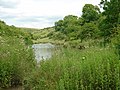
 Millington Dale pond beside the footpath - geograph.org.uk - 4876325.jpg 640 × 427; 104 KB
-
 Millington from poppy-lined Wolds Way - geograph.org.uk - 354497.jpg 640 × 480; 184 KB


.jpg)


.jpg)


.jpg)
.jpg)
.jpg)
.jpg)
.jpg)

.jpg)


.jpg)


.jpg)

.jpg)


.jpg)


.jpg)
.jpg)


.jpg)


.jpg)
.jpg)


.jpg)

.jpg)

.jpg)


.jpg)


.jpg)

.jpg)
.jpg)


.jpg)