Category:Milltown, Dublin
Jump to navigation
Jump to search
English: Milltown is marked by a spectacular 19th century railway bridge across the river, which was part of the Harcourt Street railway line which ran from Harcourt Street to Bray. In 2004 the bridge was re-opened for the Luas light rail system which runs from St. Stephen's Green to Sandyford. This bridge, and sometimes the area immediately surrounding it, became known informally as the 'Nine Arches'. Milltown railway station opened on 1 May 1860 and finally closed on 1 January 1959.
Français : Milltown est un quartier de la ville de Dublin en Irlande situé dans les quartiers sud de la ville et dans la section postale de Dublin 6.
suburb of Dublin, Ireland  La rivière Dodder dans Milltown | |||||
| Upload media | |||||
| Instance of | |||||
|---|---|---|---|---|---|
| Location | Dublin, Ireland | ||||
| Elevation above sea level |
| ||||
 | |||||
Subcategories
This category has the following 3 subcategories, out of 3 total.
Media in category "Milltown, Dublin"
The following 8 files are in this category, out of 8 total.
-
 Alexandracollege-schoolbus.jpg 535 × 301; 53 KB
-
 Clonskeagh Bridge - geograph.org.uk - 420814.jpg 640 × 480; 145 KB
-
 Clonskeagh Road - geograph.org.uk - 423045.jpg 640 × 480; 75 KB
-
 FootbridgeAtMilltown.JPG 5,184 × 3,456; 10.2 MB
-
 MILLTOWN AREA OF DUBLIN (ON THE BANKS OF THE RIVER DODDER)-146745.jpg 5,046 × 11,047; 35.69 MB
-
 MILLTOWN AREA OF DUBLIN (ON THE BANKS OF THE RIVER DODDER)-146751.jpg 35,500 × 3,470; 88.04 MB
-
 MilltownBridge.JPG 5,184 × 3,456; 8.19 MB
-
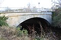
 Old Milltown Bridge (geograph 7076169).jpg 800 × 600; 488 KB


-146745.jpg)

.jpg)
-146751.jpg)