Category:Minneapolis–Saint Paul
Vai alla navigazione
Vai alla ricerca
metropolitan area in Minnesota, United States    | |||||
| Carica un file multimediale | |||||
| Istanza di | |||||
|---|---|---|---|---|---|
| Luogo |
| ||||
| Popolazione |
| ||||
| Altezza sul mare |
| ||||
| Distinto da | |||||
 | |||||
English: Minneapolis–Saint Paul is the most populous urban area in the state of Minnesota, United States, and is composed of 186 cities and townships. Built around the Mississippi, Minnesota and St. Croix rivers, the area is also nicknamed the Twin Cities for its two largest cities, Minneapolis and Saint Paul, the former the larger and the latter the state capital. It is one of the most typical examples of twin cities in geography.
Sottocategorie
Questa categoria contiene le 30 sottocategorie indicate di seguito, su un totale di 30.
File nella categoria "Minneapolis–Saint Paul"
Questa categoria contiene 46 file, indicati di seguito, su un totale di 46.
-
 2022 MPS Teacher Strike 01.jpg 3 024 × 4 032; 1,75 MB
-
 Amir Lock, Minneapolis Police shooting death (51858433183).jpg 4 096 × 2 731; 4,39 MB
-
 Amir Locke (51884508352).jpg 4 096 × 2 731; 4,85 MB
-

-

-

-

-

-

-

-

-

-

-

-

-

-

-

-

-

-

-

-
 C-130 and F-16s Flyover - Minnesota National Guard (49864304287).jpg 7 952 × 5 304; 22,14 MB
-
 Country Singles newspaper box.JPG 2 736 × 3 648; 4,29 MB
-
 ISS066-E-23938 - View of Earth.jpg 5 568 × 3 712; 3,81 MB
-
 Landsat minneapolis 03282000.jpg 3 272 × 2 614; 4,19 MB
-
 Map of the USA highlighting the Twin Cities.gif 4 200 × 3 105; 1,64 MB
-
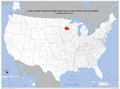 Map of the USA highlighting the Twin Cities.png 1 050 × 776; 527 KB
-
 Minneapolis st paul web.jpg 320 × 240; 20 KB
-
 Minneapolis-St. Paul, Minnesota 1955 Yellow Book.jpg 800 × 959; 183 KB
-
 Minneapolis-St. Paul-St. Cloud Combined Statistical Area.svg 512 × 544; 81 KB
-
 Minneapolis-StPaul-2000.jpg 2 592 × 2 376; 1,06 MB
-
 Minneapolis–St. Paul–St. Cloud CSA.png 394 × 426; 22 KB
-
 Race and ethnicity 2010- Minneapolis (5560453662).png 3 009 × 3 009; 4,59 MB
-
 Race and ethnicity Minneapolis and St. Paul (2000).png 3 009 × 3 009; 4,92 MB
-
 Red Light for the A330 (389658576).jpg 1 280 × 960; 254 KB
-
 Tretter Collection, QSCC Files.JPG 1 200 × 1 600; 508 KB
-
 Twin Cities 7 Metro map.png 1 939 × 1 504; 272 KB
-
 Twin Cities 7County Metro.svg 654 × 440; 6,34 MB
-
 Twin Cities Map 2.svg 1 726 × 1 923; 6,39 MB
-
 Twin Cities Map 3.svg 1 718 × 1 718; 5,97 MB
-
 Twin Cities Map.svg 1 726 × 1 923; 6,44 MB
-
 Twin Cities Metro Area (13 County).png 1 500 × 1 161; 866 KB
-
 Twin Cities.svg 5 805 × 6 589; 126 KB
-
 TwinCities.jpg 660 × 599; 82 KB
-
 US metro areas-Minneapolis-StPaul-Bloomington.jpg 605 × 570; 208 KB

.jpg)
.jpg)
_in_Twin_Cities,_MN,_on_May_30,_2024_-_1.jpg)
_in_Twin_Cities,_MN,_on_May_30,_2024_-_10.jpg)
_in_Twin_Cities,_MN,_on_May_30,_2024_-_11.jpg)
_in_Twin_Cities,_MN,_on_May_30,_2024_-_12.jpg)
_in_Twin_Cities,_MN,_on_May_30,_2024_-_13.jpg)
_in_Twin_Cities,_MN,_on_May_30,_2024_-_14.jpg)
_in_Twin_Cities,_MN,_on_May_30,_2024_-_15.jpg)
_in_Twin_Cities,_MN,_on_May_30,_2024_-_16.jpg)
_in_Twin_Cities,_MN,_on_May_30,_2024_-_17.jpg)
_in_Twin_Cities,_MN,_on_May_30,_2024_-_18.jpg)
_in_Twin_Cities,_MN,_on_May_30,_2024_-_19.jpg)
_in_Twin_Cities,_MN,_on_May_30,_2024_-_2.jpg)
_in_Twin_Cities,_MN,_on_May_30,_2024_-_3.jpg)
_in_Twin_Cities,_MN,_on_May_30,_2024_-_4.jpg)
_in_Twin_Cities,_MN,_on_May_30,_2024_-_5.jpg)
_in_Twin_Cities,_MN,_on_May_30,_2024_-_6.jpg)
_in_Twin_Cities,_MN,_on_May_30,_2024_-_7.jpg)
_in_Twin_Cities,_MN,_on_May_30,_2024_-_8.jpg)
_in_Twin_Cities,_MN,_on_May_30,_2024_-_9.jpg)
.jpg)


.png)
.png)
.jpg)


.png)

