Category:Minto, Scottish Borders
Jump to navigation
Jump to search
Nederlands: Minto is een stadje in het raadsgebied Scottish Borders in Schotland met ongeveer 2.000 inwoners. De plaats ligt aan de noordelijke oever van de Teviot, halverwege Hawick en Jedburgh.
village in Scottish Borders, Scotland, UK  | |||||
| Upload media | |||||
| Instance of | |||||
|---|---|---|---|---|---|
| Location |
| ||||
 | |||||
Subcategories
This category has the following 3 subcategories, out of 3 total.
Media in category "Minto, Scottish Borders"
The following 53 files are in this category, out of 53 total.
-
 A bridge over Hassendean Burn - geograph.org.uk - 340874.jpg 640 × 496; 95 KB
-
 A track through Kipps Plantation - geograph.org.uk - 401728.jpg 480 × 640; 119 KB
-

-
 Millennium seat at Minto Parish Church - geograph.org.uk - 763748.jpg 640 × 480; 141 KB
-
 Minto Church, near Hawick.jpg 5,184 × 2,920; 5.4 MB
-
 Old church site at Minto - geograph.org.uk - 766359.jpg 640 × 427; 126 KB
-
 Old headstones at Minto - geograph.org.uk - 766382.jpg 640 × 427; 121 KB
-
 Remember to bang the cylinder - geograph.org.uk - 766345.jpg 480 × 640; 135 KB
-
 Ruberslaw Parish Church, Minto - geograph.org.uk - 763740.jpg 640 × 427; 130 KB
-
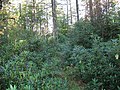
 Spring woodland - geograph.org.uk - 766424.jpg 480 × 640; 187 KB
-
 Symbolic gravestone - geograph.org.uk - 766413.jpg 478 × 624; 135 KB
-
 The 18th green at Minto Golf Course - geograph.org.uk - 766325.jpg 640 × 480; 133 KB
-
 The jougs at Minto Old Parish Church site - geograph.org.uk - 766371.jpg 480 × 640; 155 KB
-
 The path from Fatlips Castle - geograph.org.uk - 770351.jpg 640 × 480; 178 KB
-
 Woodland path at Minto - geograph.org.uk - 766318.jpg 640 × 480; 152 KB
-
 A woodland path - geograph.org.uk - 773903.jpg 480 × 640; 167 KB
-
 An inside wall of Barnhills Tower - geograph.org.uk - 753162.jpg 480 × 640; 139 KB
-
 Arable field at Barnhills Farm - geograph.org.uk - 251857.jpg 640 × 480; 112 KB
-
 Ash avenue, Hillend - geograph.org.uk - 575774.jpg 480 × 640; 153 KB
-
 Barnhills Moor Plantation - geograph.org.uk - 575913.jpg 640 × 480; 120 KB
-
 Barnhills Tower - geograph.org.uk - 753152.jpg 640 × 480; 184 KB
-
 Bogland pool - geograph.org.uk - 575879.jpg 640 × 480; 85 KB
-

-
 Country road - geograph.org.uk - 442466.jpg 640 × 480; 99 KB
-
 Country track - geograph.org.uk - 396372.jpg 459 × 640; 158 KB
-
 Dead elm tree on Minto Craigs - geograph.org.uk - 770375.jpg 427 × 640; 124 KB
-
 Dear seat, Lambslair Plantation - geograph.org.uk - 575796.jpg 480 × 640; 101 KB
-
 Denholm Cemetery - geograph.org.uk - 351422.jpg 640 × 480; 128 KB
-
 Departing sheep - geograph.org.uk - 575910.jpg 640 × 480; 86 KB
-
 Door detail at Minto Parish Church - geograph.org.uk - 768803.jpg 480 × 640; 131 KB
-
 Farm sign at Minto - geograph.org.uk - 763772.jpg 640 × 480; 117 KB
-
 Forest walk - geograph.org.uk - 410066.jpg 640 × 480; 138 KB
-
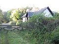
 Garden Cottage at Spittal-on-Rule - geograph.org.uk - 255050.jpg 640 × 409; 44 KB
-

-
 Inside the ruined Barnhills Tower - geograph.org.uk - 753172.jpg 640 × 480; 176 KB
-
 Kipps Plantation - geograph.org.uk - 575779.jpg 480 × 640; 138 KB
-
 Lambslair Plantation - geograph.org.uk - 575790.jpg 640 × 480; 104 KB
-
 Lambslair Plantation - geograph.org.uk - 575800.jpg 480 × 640; 117 KB
-
 Lambslair Plantation - geograph.org.uk - 575860.jpg 480 × 640; 117 KB
-
 Malcolm's Moss - geograph.org.uk - 575868.jpg 640 × 480; 71 KB
-
 Minto Golf Club - geograph.org.uk - 575768.jpg 640 × 480; 87 KB
-
 North Lodge - geograph.org.uk - 575943.jpg 640 × 480; 106 KB
-
 Old graveyard behind Garden Cottage - geograph.org.uk - 255048.jpg 640 × 437; 54 KB
-
 Pasture field at Deanfoot Farm - geograph.org.uk - 253722.jpg 640 × 428; 52 KB
-
 Rhododendrons, Lambslair Plantation - geograph.org.uk - 575865.jpg 640 × 480; 133 KB
-
 Rolling a field at Howdales - geograph.org.uk - 396363.jpg 640 × 480; 106 KB
-
 Spring farmland at Howdales - geograph.org.uk - 394859.jpg 640 × 480; 90 KB
-
 The clubhouse at Minto Golf Course - geograph.org.uk - 340871.jpg 640 × 480; 128 KB
-
 The Hassendean Burn - geograph.org.uk - 352804.jpg 640 × 480; 103 KB
-
 Toll Cottage at Spittal-on-Rule - geograph.org.uk - 255041.jpg 640 × 480; 56 KB
-
 Track, Barnhills Moor Plantation - geograph.org.uk - 575927.jpg 640 × 480; 107 KB
-
 Track, Barnhills Moor Plantation - geograph.org.uk - 575931.jpg 640 × 480; 104 KB
-
 Troneyhill Wood - geograph.org.uk - 401734.jpg 640 × 480; 108 KB


