Category:Mira River (Nova Scotia)
watercourse in Nova Scotia, Canada  | |||||
| Upload media | |||||
| Instance of | |||||
|---|---|---|---|---|---|
| Location | |||||
 | |||||
The Mira River is a Canadian river located Cape Breton County (The Cape Breton Regional Municipality) in eastern Cape Breton Island, Nova Scotia, Canada.
With a meander length of approximately 55 km (34 mi), the Mira has a very slow flow rate. The river's source is traced to a series of lakes clustered around Victoria Bridge near the boundary with Richmond County. It is also fed by the Salmon River. Flowing past the communities of Marion Bridge and Albert Bridge, the river discharges through the "Mira Gut" at the community of the same name into the Mira Bay. The river occupies a trench arching from southwest to northeast across the southern part of Cape Breton County; much of the eastern part of the river is a tidal estuary, with noticeable tides extending beyond Albert Bridge approximately 10 km (6.2 mi) upstream of the Gut.
Media in category "Mira River (Nova Scotia)"
The following 16 files are in this category, out of 16 total.
-
-

-
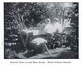 FMIB 35393 Supper Time at the Mira River Trout Fishing Resort.jpeg 656 × 518; 80 KB
-
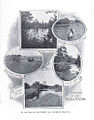
 FMIB 35416 Scenes on the Mira River.jpeg 806 × 1,236; 253 KB
-
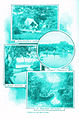
 FMIB 35419 Scenes on the Mira River.jpeg 815 × 1,191; 318 KB
-
 FMIB 35424 Scenes on the Mira River.jpeg 801 × 1,157; 358 KB
-
 FMIB 35427 Scenes on the Mira River.jpeg 840 × 1,268; 389 KB
-
 FMIB 35433 Mill Brook, Mira River.jpeg 812 × 331; 53 KB
-
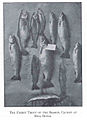 FMIB 35434 Finest Trout of the Season, Caught at Mira River.jpeg 498 × 688; 58 KB
-
 FMIB 44366 Railway Viaduct at Mira Gut.jpeg 1,060 × 877; 152 KB
-
 Mira Gut Road and Rail Road Bridges - ca 1900-1925.jpg 760 × 438; 86 KB
-
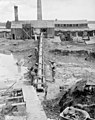
 Mira River Brick Works - Kiln buildings, NS - 1910.jpg 600 × 474; 66 KB
-
 Mira River Brick Works Conveyor - 1910.jpg 600 × 761; 120 KB
-
 Mira River Railroad Bridge - 1876.jpg 640 × 451; 55 KB
-
 Miraferry.jpg 700 × 461; 213 KB
-
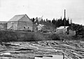 Saw Mill, Salmon River, Mira, Cape Breton, NS.jpg 760 × 532; 101 KB


