Category:Moelfre, Anglesey
Jump to navigation
Jump to search
community and village in Anglesey, in north-west Wales  | |||||
| Upload media | |||||
| Pronunciation audio | |||||
|---|---|---|---|---|---|
| Instance of | |||||
| Location | Isle of Anglesey, Wales | ||||
| Inception |
| ||||
| official website | |||||
 | |||||
Cymraeg: Mae Moelfre yn bentref ar arfordir dwyreiniol Ynys Môn, tua hanner y ffordd rhwng Benllech ac Amlwch. Pysgota oedd prif weithgaredd y trigolion yn y gorffennol, ond yn awr mae'n bentref gwyliau pur boblogaidd. Mae yno harbwr bychan, a heb fod ymhell o'r pentref mae ynys fechan, Ynys Moelfre. Gellir dilyn Llwybr Arfordirol Ynys Môn trwy'r pentref.
English: Moelfre is a village and community on the Isle of Anglesey in Wales, at and on the Anglesey Coastal Path. It has a population of 1,129.The Royal Mail postcode begins LL72.
Español: Moelfre es un pueblo en Anglesey, al norte de Gales, y en el Sendero Marítimo de Anglesey. El código postal del Royal Mail empieza por LL72.
Subcategories
This category has the following 7 subcategories, out of 7 total.
B
- Brynrefail, Anglesey (9 F)
C
- City Dulas (20 F)
L
- Lligwy Burial Chamber (26 F)
M
R
Y
- Ynys Moelfre (22 F)
Media in category "Moelfre, Anglesey"
The following 200 files are in this category, out of 613 total.
(previous page) (next page)-
 "The Pilot Boat Inn" - geograph.org.uk - 5347832.jpg 5,184 × 3,888; 5.27 MB
-
 'Royal Charter' Memorial. - geograph.org.uk - 1031393.jpg 640 × 480; 66 KB
-
 1976 Din Lligwy Neolithic Stone Circle, Anglesey, Wales - geograph.org.uk - 5232072.jpg 3,473 × 2,164; 5.81 MB
-
 A blind bend in the A5108 - geograph.org.uk - 753068.jpg 640 × 480; 62 KB
-

-

-

-

-
 A sheltered Porth Moelfre - geograph.org.uk - 1227647.jpg 640 × 512; 57 KB
-

-
 A welcoming scarecrow - geograph.org.uk - 4556717.jpg 1,600 × 1,200; 390 KB
-
 A wood with secrets - geograph.org.uk - 4556622.jpg 1,600 × 1,200; 492 KB
-
 A5025 at Llanallgo - geograph.org.uk - 4380683.jpg 640 × 426; 39 KB
-
 A5108, Moelfre - geograph.org.uk - 4380745.jpg 640 × 426; 57 KB
-
 A5108, Moelfre - geograph.org.uk - 4380973.jpg 640 × 426; 60 KB
-
 Afon Goch - geograph.org.uk - 3985484.jpg 640 × 467; 56 KB
-
 Afon Llugwy downstream of the bridge - geograph.org.uk - 931410.jpg 640 × 480; 147 KB
-
 An entry leading down to the harbour - geograph.org.uk - 753015.jpg 640 × 441; 68 KB
-
 An evening view from Moelfre - geograph.org.uk - 2073034.jpg 640 × 426; 24 KB
-

-
 Anchor from the shipwrecked MV "Hindlea" - geograph.org.uk - 468834.jpg 640 × 480; 153 KB
-
 Ancient and relatively modern - geograph.org.uk - 4556619.jpg 1,600 × 1,200; 550 KB
-
 Anglesey Coast Path - geograph.org.uk - 4387789.jpg 640 × 426; 74 KB
-
 Anglesey Coast Path - geograph.org.uk - 4387794.jpg 640 × 426; 99 KB
-
 Anglesey Coast Path - geograph.org.uk - 4387803.jpg 640 × 426; 86 KB
-
 Anglesey Coast Path - geograph.org.uk - 4387818.jpg 640 × 426; 81 KB
-

-

-
 Anglesey Coast Path, Nant Bychan - geograph.org.uk - 4387806.jpg 640 × 426; 64 KB
-
 Anglesey Coastal Path - geograph.org.uk - 3983511.jpg 640 × 464; 93 KB
-
 Anglesey Coastal Path - geograph.org.uk - 3985482.jpg 640 × 478; 95 KB
-
 Anglesey Coastal Path - geograph.org.uk - 4002785.jpg 478 × 640; 109 KB
-
 Anglesey Coastal Path - geograph.org.uk - 4002834.jpg 640 × 478; 94 KB
-
 Anglesey Coastal Path Logo - geograph.org.uk - 4380990.jpg 640 × 426; 66 KB
-
 Anglesey Coastal Path markers - geograph.org.uk - 3983528.jpg 640 × 478; 139 KB
-

-
 Anglesey Coastal Path, kissing gate - geograph.org.uk - 3985479.jpg 640 × 478; 104 KB
-

-
 Anglesey Coastal Path, Port Helaeth - geograph.org.uk - 2424101.jpg 1,280 × 960; 670 KB
-
 Anglesey Coastal Path, Porth Helaeth - geograph.org.uk - 2424087.jpg 1,280 × 960; 629 KB
-
 Ann's Pantry - geograph.org.uk - 4380985.jpg 640 × 426; 91 KB
-
 Ann's Pantry, Moelfre - geograph.org.uk - 3900740.jpg 640 × 426; 106 KB
-
 Ann's Pantry, Moelfre - geograph.org.uk - 5769490.jpg 851 × 1,280; 402 KB
-
 Ann's Pantry, Moelfre - geograph.org.uk - 5769492.jpg 1,280 × 851; 328 KB
-
 Anticline and Fault - geograph.org.uk - 1940841.jpg 640 × 427; 292 KB
-

-

-
 Arlanfor - geograph.org.uk - 4380971.jpg 640 × 426; 52 KB
-
 Arlanfor, Moelfre - geograph.org.uk - 4380972.jpg 640 × 426; 64 KB
-
 Bae Moelfra - Moelfre Bay. - geograph.org.uk - 753592.jpg 640 × 480; 43 KB
-
 Beach access at Traeth Lligwy - geograph.org.uk - 3982193.jpg 640 × 470; 63 KB
-
 Beach Cafe, Traeth Lligwy - geograph.org.uk - 4293748.jpg 1,600 × 1,200; 392 KB
-
 Beach, Porth Yr Aber - geograph.org.uk - 4387796.jpg 640 × 426; 90 KB
-
 Bench mark, Llanallgo - geograph.org.uk - 1738772.jpg 480 × 640; 89 KB
-
 Benchmark at Tyddyn Main, Penrhoslligwy - geograph.org.uk - 2369575.jpg 3,000 × 4,000; 1.39 MB
-
 Benchmark on gatepost, Rhôs Lligwy - geograph.org.uk - 2374415.jpg 3,000 × 4,000; 5.39 MB
-
 Benchmark on St. Michael's Church, Penrhoslligwy - geograph.org.uk - 2371559.jpg 3,000 × 4,000; 5.47 MB
-
 Benchmark on wall opposite Bronllwyd, Rhôs Lligwy - geograph.org.uk - 2374421.jpg 3,000 × 4,000; 1.4 MB
-
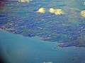 Benllech and Moelfre (Anglesey) (50354749438).jpg 3,264 × 2,448; 6.5 MB
-
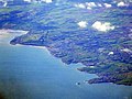 Benllech and Moelfre, Anglesey (50355454786).jpg 3,264 × 2,448; 2.73 MB
-

-
 Boat at Moelfre - geograph.org.uk - 3397523.jpg 1,280 × 856; 240 KB
-
 Boathouse - geograph.org.uk - 3685663.jpg 800 × 530; 482 KB
-
 Boathouse at Moelfre - geograph.org.uk - 3397534.jpg 1,280 × 856; 341 KB
-
 Boats at Moelfre - geograph.org.uk - 3149721.jpg 1,129 × 746; 127 KB
-
 Boats on the beach - geograph.org.uk - 3685636.jpg 800 × 530; 356 KB
-
 Boats on the beach - geograph.org.uk - 4380979.jpg 640 × 426; 87 KB
-
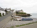 Boats on the beach at Moelfre - geograph.org.uk - 753674.jpg 640 × 480; 64 KB
-
 Bricks and concrete - geograph.org.uk - 2405952.jpg 3,648 × 2,736; 4.79 MB
-
 Bryn Wylfa, Moelfre - geograph.org.uk - 4002749.jpg 640 × 473; 53 KB
-
 Brynrefail - geograph.org.uk - 3997002.jpg 640 × 478; 57 KB
-
 Bungalow A5108 - geograph.org.uk - 4380697.jpg 640 × 426; 53 KB
-

-
 Bythynod y Swnt cottages - geograph.org.uk - 1227862.jpg 640 × 480; 49 KB
-

-
 Bythynod y Swnt, Moelfre - geograph.org.uk - 4002687.jpg 640 × 478; 88 KB
-
 Bythynod y Swnt. Swnt Cottages - geograph.org.uk - 1227843.jpg 640 × 480; 68 KB
-
 Calcrete - geograph.org.uk - 1940810.jpg 640 × 427; 268 KB
-
 Calcrete and Mud Clasts - geograph.org.uk - 1940830.jpg 640 × 427; 279 KB
-
 Capel Carmel, Moelfre - geograph.org.uk - 1341920.jpg 640 × 480; 59 KB
-
 Capel Lligwy - geograph.org.uk - 2584551.jpg 640 × 480; 89 KB
-
 Caravan park at Gell-bach Farm - geograph.org.uk - 1197502.jpg 640 × 480; 65 KB
-

-
 Caravan site, Traeth Bychan - geograph.org.uk - 4387826.jpg 640 × 426; 52 KB
-

-
 Cattle at Moelfre - geograph.org.uk - 2404477.jpg 2,430 × 1,824; 747 KB
-
 Cattle, Nant Bychan - geograph.org.uk - 4387804.jpg 640 × 426; 75 KB
-
 Chapel and roundabout at Llanallgo - geograph.org.uk - 4554735.jpg 1,600 × 1,200; 442 KB
-
 Chapel at Brynrefail - geograph.org.uk - 1031361.jpg 640 × 480; 64 KB
-
 Chapel at Llanallgo - geograph.org.uk - 2584400.jpg 640 × 480; 50 KB
-
 Church Rooms, Llanallgo - geograph.org.uk - 920471.jpg 640 × 443; 43 KB
-

-

-
 Cliff top above Porth Helaeth - geograph.org.uk - 754768.jpg 640 × 275; 39 KB
-
 Cliff top meadow at Nant Bychan Farm - geograph.org.uk - 1341658.jpg 640 × 480; 79 KB
-
 Cliff top path - geograph.org.uk - 754959.jpg 640 × 354; 43 KB
-
 Cliff top, Moelfre - geograph.org.uk - 2424030.jpg 1,280 × 960; 602 KB
-
 Cliffs between Moelfre and Lligwy - geograph.org.uk - 2424037.jpg 1,280 × 960; 854 KB
-
 Cliffs west of Pen y bonc - geograph.org.uk - 1227890.jpg 640 × 480; 92 KB
-
 Cliffs, Moelfre - geograph.org.uk - 2424019.jpg 1,280 × 960; 562 KB
-
 Cliffs, Port Helaeth - geograph.org.uk - 2424081.jpg 1,280 × 960; 490 KB
-
 Cliffs, Porth Helaeth - geograph.org.uk - 2424071.jpg 1,280 × 960; 997 KB
-
 Cliffs, Porth Helaeth - geograph.org.uk - 2424074.jpg 1,280 × 960; 941 KB
-
 Coastal pasture - geograph.org.uk - 4387817.jpg 640 × 426; 60 KB
-
 Coastal pasture - geograph.org.uk - 4387819.jpg 640 × 426; 57 KB
-

-

-
 Coastal quarrying - geograph.org.uk - 1259198.jpg 640 × 480; 98 KB
-
 Coastal view near Moelfre - geograph.org.uk - 4002824.jpg 640 × 470; 84 KB
-

-

-
 Cottage by the Anglesey Coast Path - geograph.org.uk - 4380994.jpg 640 × 426; 70 KB
-
 Cottages - geograph.org.uk - 3685647.jpg 800 × 530; 480 KB
-
 Cottages - geograph.org.uk - 3685781.jpg 800 × 530; 428 KB
-
 Cottages - geograph.org.uk - 3685785.jpg 800 × 530; 502 KB
-
 Cottages - Moelfre - geograph.org.uk - 2768709.jpg 1,350 × 1,013; 202 KB
-
 Cottages and the beach by Y Swnt - geograph.org.uk - 1969189.jpg 640 × 480; 123 KB
-
 Cottages facing Porth Moelfre - geograph.org.uk - 1227674.jpg 640 × 480; 74 KB
-
 Cottages, Moelfre - geograph.org.uk - 2403100.jpg 3,648 × 2,736; 5.16 MB
-
 Coxswain Dic Evans Road - geograph.org.uk - 1194823.jpg 640 × 480; 49 KB
-
 Craig-y-Mor, Moelfre - geograph.org.uk - 1342074.jpg 640 × 480; 91 KB
-
 Crashing surf at Moelfre - geograph.org.uk - 2403044.jpg 3,648 × 2,736; 5.53 MB
-
 Crashing waves at Porth yr Ynys - geograph.org.uk - 1228519.jpg 640 × 480; 41 KB
-
 Crossing the Nant-y-Perfedd - geograph.org.uk - 4556633.jpg 1,600 × 1,200; 408 KB
-
 Devonian Red Sandstone Strata - geograph.org.uk - 1940771.jpg 640 × 416; 221 KB
-
 Dic Evans - geograph.org.uk - 2423926.jpg 1,280 × 1,707; 1.05 MB
-
 Dic Evans - geograph.org.uk - 3397427.jpg 855 × 1,280; 181 KB
-
 Dic Evans - geograph.org.uk - 3397438.jpg 1,280 × 856; 208 KB
-
 Dic Evans Memorial - geograph.org.uk - 2424285.jpg 1,280 × 960; 576 KB
-
 Dic Evans memorial at Moelfre - geograph.org.uk - 2586251.jpg 640 × 480; 56 KB
-
 Dic Evans Memorial Sculpture - geograph.org.uk - 2111598.jpg 640 × 425; 79 KB
-
 Dic Evans Memorial Sculpture, Moelfre - geograph.org.uk - 851081.jpg 640 × 480; 134 KB
-
 Dic Evans Memorial, Moelfre - geograph.org.uk - 2423916.jpg 960 × 1,280; 615 KB
-
 Dic Evans statue at Moelfre - geograph.org.uk - 5349423.jpg 3,801 × 5,067; 4.09 MB
-

-
 Din Lligwy - geograph.org.uk - 2404485.jpg 3,648 × 2,736; 6.19 MB
-
 Din Lligwy Hut Circle - geograph.org.uk - 2952498.jpg 3,888 × 2,592; 3.49 MB
-
 Din Lliwgy ancient Settlement near Moelfre - geograph.org.uk - 5608271.jpg 5,184 × 2,920; 7.15 MB
-

-
 Disused stone quarry - geograph.org.uk - 931388.jpg 640 × 480; 64 KB
-
 Divided beach - geograph.org.uk - 4556708.jpg 1,600 × 1,200; 308 KB
-
 Dog in a window at Moelfre - geograph.org.uk - 5349418.jpg 3,236 × 4,315; 2.57 MB
-

-

-

-
 Entrance to City Dulas - geograph.org.uk - 3799137.jpg 640 × 480; 53 KB
-

-
 Entrance to Tyddyn Isaf caravan park - geograph.org.uk - 3997008.jpg 640 × 478; 60 KB
-
 Estuary of Afon Goch at Dulas Bay - geograph.org.uk - 3983537.jpg 640 × 478; 66 KB
-
 Falls in Moelfre - geograph.org.uk - 2069343.jpg 2,000 × 1,500; 645 KB
-
 Farm near Plas Bodafon - geograph.org.uk - 4557125.jpg 1,600 × 1,200; 486 KB
-

-
 Farmhouse, Nant Bychan - geograph.org.uk - 4387807.jpg 640 × 426; 71 KB
-
 Farmhouse, north east coast of Anglesey - geograph.org.uk - 2403062.jpg 3,648 × 2,736; 5.52 MB
-

-

-
 Farmland near Traeth bychan - geograph.org.uk - 4387825.jpg 640 × 426; 76 KB
-
 Fault Hinge - geograph.org.uk - 1940850.jpg 640 × 427; 298 KB
-
 Ffordd Cocsyn Richard Evans, Moelfre - geograph.org.uk - 2424216.jpg 1,280 × 960; 632 KB
-
 Ffordd Cocsyn Richard Evans, Moelfre - geograph.org.uk - 2424254.jpg 1,280 × 960; 658 KB
-
 Ffordd Seiriol, Moelfre - geograph.org.uk - 1342106.jpg 640 × 480; 70 KB
-
 Field and chapel - geograph.org.uk - 4556611.jpg 1,600 × 1,200; 387 KB
-
 Field near the Dulas estuary - geograph.org.uk - 5775345.jpg 640 × 478; 85 KB
-

-
 Fields above Moelfre village - geograph.org.uk - 2584379.jpg 640 × 480; 71 KB
-
 Fishermen look out over Ynys Moelfre - geograph.org.uk - 1031414.jpg 640 × 480; 65 KB
-
 Fishing off the headland at Moelfre - geograph.org.uk - 1496059.jpg 640 × 442; 64 KB
-
 Footbridge on the Anglesey Coast Path - geograph.org.uk - 3982206.jpg 478 × 640; 121 KB
-

-
 Footbridge over Afon Lligwy - geograph.org.uk - 4002841.jpg 640 × 478; 83 KB
-
 Footpath near Pentre Eirianell - geograph.org.uk - 2585990.jpg 640 × 480; 118 KB
-
 Footpath off A5108 - geograph.org.uk - 4380700.jpg 640 × 468; 66 KB
-
 Footpath signpost - geograph.org.uk - 2405934.jpg 3,648 × 2,736; 6.18 MB
-
 Footpath to Ty'n Graig - geograph.org.uk - 5415616.jpg 640 × 480; 132 KB
-

-
 Former Post Office - geograph.org.uk - 1969569.jpg 640 × 480; 86 KB
-

-
 Gorse bushes at Lligwy Bay, Anglesey - geograph.org.uk - 2405914.jpg 3,648 × 2,736; 5.69 MB
-
 Grazing land at Cefnyddwyffrwd - geograph.org.uk - 1229951.jpg 640 × 480; 42 KB
-
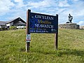 Gwylfan Moelfre Seawatch - geograph.org.uk - 851091.jpg 640 × 480; 153 KB
-
 Harbour at Moelfre . - geograph.org.uk - 487663.jpg 640 × 480; 135 KB
-
 Harbour House, Traeth Bychan - geograph.org.uk - 1342800.jpg 640 × 480; 73 KB
-
 Headland at Moelfre - geograph.org.uk - 4380992.jpg 640 × 426; 36 KB
-
 Headland, Porth Helaeth - geograph.org.uk - 1259143.jpg 640 × 480; 80 KB
-
 Hen Capel Lligwy (II) - geograph.org.uk - 5349404.jpg 5,184 × 3,888; 5.8 MB
-
 Hen Capel Lligwy - geograph.org.uk - 5349398.jpg 4,693 × 3,520; 3.26 MB
-
 Hen Gapel Lligwy - geograph.org.uk - 4293742.jpg 1,600 × 1,200; 381 KB
-
 Hindlea Anchor, Moelfre - geograph.org.uk - 1738716.jpg 480 × 640; 90 KB
-
 Hindlea memorial - geograph.org.uk - 4002709.jpg 640 × 468; 81 KB
-

-
 House at Traeth Bychan - geograph.org.uk - 4387829.jpg 640 × 426; 77 KB
-

-

-
 Houses in Trigfa - geograph.org.uk - 754829.jpg 640 × 348; 40 KB
-
 Houses on a hill, Moelfre - geograph.org.uk - 1969590.jpg 640 × 481; 83 KB
-
 Houses On Moelfre's Outskirts - geograph.org.uk - 1436449.jpg 640 × 480; 191 KB
-
 Houses on the B5108 - geograph.org.uk - 752388.jpg 640 × 480; 52 KB
-
 In memory - geograph.org.uk - 2405930.jpg 3,648 × 2,736; 4.91 MB
-
 Isle of Anglesey Coast Path, Moelfre - geograph.org.uk - 851101.jpg 640 × 480; 139 KB
-
 Junction with the A5108 - geograph.org.uk - 749318.jpg 640 × 480; 67 KB


_(50354749438).jpg)
.jpg)


,_Tyddyn_Isaf_Caravan_Park_-_geograph.org.uk_-_3982181.jpg)


_-_geograph.org.uk_-_754279.jpg)


_-_geograph.org.uk_-_5349404.jpg)


