Category:Moniaive
Zur Navigation springen
Zur Suche springen
village in Dumfries and Galloway, Scotland, UK  | |||||
| Medium hochladen | |||||
| Ist ein(e) | |||||
|---|---|---|---|---|---|
| Ort |
| ||||
| Einwohnerzahl |
| ||||
 | |||||
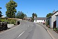
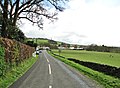
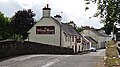
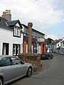
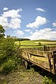
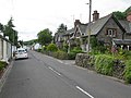
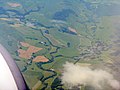
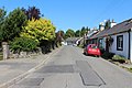
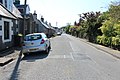
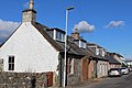
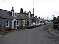
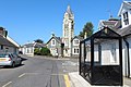
English: Moniaive is a village in the south of Scotland in Dumfries and Galloway, near Thornhill, on the A702 road and B729 road. Population 520 (2004). The name is from Gaelic monadh-abh and means "Hill of Streams". It is situated at the northern end of the very scenic and tranquil Cairn Valley. It is within the parish of Glencairn and a bi-monthly newspaper, called the Glencairn Gazette and free for local residents, is produced by volunteers .
Unterkategorien
Es werden 4 von insgesamt 4 Unterkategorien in dieser Kategorie angezeigt:
In Klammern die Anzahl der enthaltenen Kategorien (K), Seiten (S), Dateien (D)
M
- Moniaive railway station (15 D)
S
- St Ninian's Church, Moniaive (6 D)
T
- Tower House, Moniaive (15 D)
W
- White Hill, Moniaive (2 D)
Medien in der Kategorie „Moniaive“
Folgende 124 Dateien sind in dieser Kategorie, von 124 insgesamt.
-
 A Bench In The Sun - geograph.org.uk - 3924870.jpg 3.448 × 4.592; 3,54 MB
-
 A drystane dyke on Tererran Hill - geograph.org.uk - 1705727.jpg 427 × 640; 126 KB
-
-
 A field boundary wall on Margmony Hill - geograph.org.uk - 1702430.jpg 640 × 427; 149 KB
-
 A grazing field at Moniaive - geograph.org.uk - 1706487.jpg 640 × 420; 159 KB
-
 A sheepfold by the Glencrosh Burn - geograph.org.uk - 1702449.jpg 640 × 427; 147 KB
-
 A tight squeeze in Moniaive - geograph.org.uk - 2587079.jpg 3.264 × 2.448; 1,77 MB
-
 A702 running through Moniaive - geograph.org.uk - 2007475.jpg 3.072 × 2.304; 2,35 MB
-
 Approaching Moniaive from the west - geograph.org.uk - 1805058.jpg 640 × 427; 119 KB
-
 Arriving at Moniaive - geograph.org.uk - 4009753.jpg 1.920 × 1.280; 1,95 MB
-
 Ayr Street, Moniaive - geograph.org.uk - 4009788.jpg 1.920 × 1.280; 1,26 MB
-
 Ayr Street, Moniaive - geograph.org.uk - 4009798.jpg 1.920 × 1.280; 1,36 MB
-
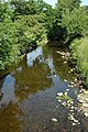
 Cairn Water, Moniaive. View upstream. Dumfries and Galloway.jpg 3.094 × 2.721; 2,16 MB
-
 Cairn Water, Moniave. View downstream. Dumfries and Galloway.jpg 3.212 × 2.712; 3,26 MB
-

-
 Car Park, Moniaive - geograph.org.uk - 4084227.jpg 1.920 × 1.280; 1,64 MB
-
 Car Park, Moniaive - geograph.org.uk - 4084760.jpg 1.920 × 1.280; 1,46 MB
-
 Car Park, Moniaive - geograph.org.uk - 4084780.jpg 1.920 × 1.280; 1,92 MB
-
 Castlefairn Water - geograph.org.uk - 436596.jpg 480 × 640; 145 KB
-
 Chain Saw Carving, Moniaive - geograph.org.uk - 870756.jpg 640 × 480; 85 KB
-
 Chapel Street, Moniaive - geograph.org.uk - 4084251.jpg 1.920 × 1.280; 1,13 MB
-
 Chapel Street, Moniaive - geograph.org.uk - 4084615.jpg 1.920 × 1.280; 1,49 MB
-
 Chapel Street, Moniaive - geograph.org.uk - 4084627.jpg 1.920 × 1.280; 1,3 MB
-
 Chapel Street, Moniaive - geograph.org.uk - 4101268.jpg 5.184 × 3.456; 7,16 MB
-
 Clock tower in Moniaive - geograph.org.uk - 3220784.jpg 1.200 × 803; 336 KB
-
 Clock Tower, Moniaive - geograph.org.uk - 3675677.jpg 1.024 × 768; 164 KB
-
 Cottage in Moniaive Village - geograph.org.uk - 927528.jpg 640 × 480; 73 KB
-
 Cottage Moniaive Village - geograph.org.uk - 925941.jpg 640 × 480; 86 KB
-
 Cottage near Auchencheyne, Moniaive - geograph.org.uk - 533587.jpg 640 × 480; 101 KB
-
 Cottages at Dunreggan, Moniaive - geograph.org.uk - 4101212.jpg 5.184 × 3.456; 7,61 MB
-
 Cottages at Dunreggan, Moniaive - geograph.org.uk - 4101221.jpg 1.600 × 1.067; 466 KB
-
 Craigdarroch Arms Hotel - geograph.org.uk - 925967.jpg 640 × 480; 79 KB
-
 Craigenvey (49555744753).jpg 6.000 × 4.000; 23,38 MB
-
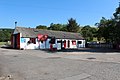
 Dalwhat Garage, Moniaive - geograph.org.uk - 1803805.jpg 640 × 406; 127 KB
-
 Dalwhat Garage, Moniaive - geograph.org.uk - 4084242.jpg 1.920 × 1.280; 1,5 MB
-
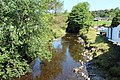
 Dalwhat Water - geograph.org.uk - 3690363.jpg 720 × 429; 68 KB
-
 Dalwhat Water - geograph.org.uk - 3924864.jpg 3.448 × 4.592; 4,02 MB
-
 Dalwhat water from the bridge - geograph.org.uk - 210630.jpg 425 × 640; 157 KB
-
 Dalwhat Water, Moniaive - geograph.org.uk - 4084238.jpg 1.920 × 1.280; 2,28 MB
-
 Dunreggan Brae, Moniaive - geograph.org.uk - 4084223.jpg 1.920 × 1.280; 1,35 MB
-
 Dunreggan Brae, Moniaive - geograph.org.uk - 4084225.jpg 1.920 × 1.280; 1,55 MB
-
 Dunreggan Brae, Moniaive - geograph.org.uk - 4084233.jpg 1.920 × 1.280; 1,52 MB
-
 Dunreggan Brae,Moniaive - geograph.org.uk - 925935.jpg 640 × 480; 82 KB
-
 Dunreggan, Moniaive - geograph.org.uk - 4084756.jpg 1.920 × 1.280; 1,53 MB
-
 Entering Moniaive - geograph.org.uk - 3488066.jpg 4.399 × 3.241; 3,15 MB
-
 Entering Moniaive from the southwest - geograph.org.uk - 1706484.jpg 640 × 427; 145 KB
-
 Footbridge over Dalwhat Water, Moniaive - geograph.org.uk - 4084236.jpg 1.920 × 1.280; 1,63 MB
-
 Footbridge over Dalwhat Water, Moniaive - geograph.org.uk - 4084747.jpg 1.920 × 1.280; 1,43 MB
-
 GeoDial, Wildflower Garden, Moniaive, Scotland.jpg 4.029 × 2.315; 2,95 MB
-
 George Hotel - geograph.org.uk - 3664173.jpg 1.600 × 1.200; 318 KB
-
 George Hotel, Moniaive, Dumfries and Galloway.jpg 4.896 × 2.752; 2,97 MB
-
 Glencairn Memorial Institute, Moniaive - geograph.org.uk - 4084621.jpg 1.920 × 1.280; 1,62 MB
-
 Glenluiart House - Dumfries and Galloway - Scotland.jpg 441 × 315; 133 KB
-
 Glenluiart House, Moniaive.jpg 441 × 315; 47 KB
-
 Hayrolls on farmland near Moniaive - geograph.org.uk - 210635.jpg 640 × 425; 121 KB
-
 High Street, Moniaive - geograph.org.uk - 4084229.jpg 1.920 × 1.280; 1,84 MB
-
 High Street, Moniaive - geograph.org.uk - 4084244.jpg 1.920 × 1.280; 1,46 MB
-
 High Street, Moniaive - geograph.org.uk - 4084257.jpg 1.920 × 1.280; 1,37 MB
-
 High Street, Moniaive - geograph.org.uk - 4084579.jpg 1.920 × 1.280; 1,34 MB
-
 High Street, Moniaive - geograph.org.uk - 4084739.jpg 1.920 × 1.280; 1,35 MB
-
 Inscription on Renwick Monument Moniaive..jpg 1.712 × 2.048; 4,42 MB
-
 James Renwick Covenanter Memorial detail, Moniaive, Dumfries and Galloway.jpg 4.412 × 2.726; 1,19 MB
-
 King Of The Hill (30702307122).jpg 4.758 × 3.172; 9,36 MB
-
 Mapa dg am mòine naomh.jpg 2.004 × 1.363; 605 KB
-
 Market Cross and Tower House, Moniaive - geograph.org.uk - 4084733.jpg 1.280 × 1.920; 1,22 MB
-
 Maxwelton Chapel (36289296592).jpg 4.288 × 2.848; 9,34 MB
-
 Mercat Cross Moniaive - geograph.org.uk - 927544.jpg 480 × 640; 67 KB
-
 Mercat Cross, Moniaive - geograph.org.uk - 4101199.jpg 800 × 1.200; 292 KB
-
 Mercat Cross, Moniaive.jpg 480 × 640; 65 KB
-
 Minnows in Dalwhat water. - geograph.org.uk - 210633.jpg 640 × 425; 147 KB
-
 Moniaive (30401982741).jpg 7.007 × 4.671; 30,84 MB
-
 Moniaive (31324394751).jpg 3.951 × 5.927; 21,84 MB
-
 Moniaive - geograph.org.uk - 4075649.jpg 640 × 480; 79 KB
-
 Moniaive from the east, Dumfries & Galloway, Scotland.jpg 4.896 × 2.752; 3,19 MB
-
 Moniaive from the northeast - geograph.org.uk - 3545971.jpg 3.264 × 2.448; 2,97 MB
-
 Moniaive Primary School - geograph.org.uk - 4084633.jpg 1.920 × 1.280; 1,45 MB
-
 Moniaive Primary School - geograph.org.uk - 4101279.jpg 1.600 × 1.067; 530 KB
-
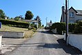
 North Street, Moniaive - geograph.org.uk - 4009801.jpg 1.920 × 1.280; 1,46 MB
-
 North Street, Moniaive - geograph.org.uk - 4084595.jpg 1.920 × 1.280; 1,64 MB
-
 North Street, Moniaive - geograph.org.uk - 4084602.jpg 1.920 × 1.280; 1,44 MB
-
 North Street, Moniaive - geograph.org.uk - 4084604.jpg 1.920 × 1.280; 1,81 MB
-
 North Street, Moniaive - geograph.org.uk - 4101328.jpg 5.184 × 3.456; 6,77 MB
-
 North Street, Moniaive - geograph.org.uk - 719665.jpg 640 × 480; 63 KB
-
 Old bakery Moniaive Village - geograph.org.uk - 927553.jpg 640 × 480; 84 KB
-
 Old railway bridge abutment, Dalwhat Water, Moniaive, Dumfries & Galloway, Scotland.jpg 4.896 × 2.752; 3,74 MB
-
 Old railway bridge, Dalwhat Water, Moniaive, Dumfries & Galloway, Scotland.jpg 4.896 × 2.752; 6,71 MB
-
 Old railway embankment, Dalwhat Water, Moniaive, Dumfries & Galloway, Scotland.jpg 4.896 × 2.752; 4,24 MB
-
 Park Road, Moniaive - geograph.org.uk - 4084594.jpg 1.920 × 1.280; 1,95 MB
-
 Picnic Area at Moniaive - geograph.org.uk - 4084772.jpg 1.920 × 1.280; 2,31 MB
-
 Plaque at James Renwick Covenanter Memorial site, Moniaive, Dumfries and Galloway.jpg 4.182 × 2.591; 1,78 MB
-
 Postbox - geograph.org.uk - 927519.jpg 480 × 640; 89 KB
-
 Renwick Monument Moniaive with Cairn Valley beyond.jpg 1.902 × 1.902; 4,08 MB
-
 Ruined manse at Dundreggan - geograph.org.uk - 3220783.jpg 1.200 × 803; 370 KB
-
 Shed near Waulkmill Bridge, Moniaive - geograph.org.uk - 4101292.jpg 1.600 × 1.067; 521 KB
-
 Site of disused pit in Trostan Estate - geograph.org.uk - 534402.jpg 640 × 480; 137 KB
-
 Smithy Cottage, Chapel Street, Moniaive - geograph.org.uk - 4101313.jpg 1.600 × 1.067; 476 KB
-
 Stile at James Renwick Covenanter Memorial site, Moniaive, Dumfries and Galloway.jpg 3.677 × 2.528; 2,39 MB
-
 The A702 in Moniaive - geograph.org.uk - 4084232.jpg 1.920 × 1.280; 1,51 MB
-
 The Clock Tower, Moniaive - geograph.org.uk - 3488073.jpg 4.488 × 3.290; 2,48 MB
-
 The Craigdarroch Arms Hotel, Moniaive - geograph.org.uk - 4084587.jpg 1.920 × 1.280; 590 KB
-

-
 The Dalwhat Water, Moniaive, Dumfries & Galloway, Scotland.jpg 4.896 × 2.752; 6,13 MB
-
 The George Hotel - geograph.org.uk - 925952.jpg 640 × 480; 62 KB
-
 The George Hotel, High Street, Moniaive - geograph.org.uk - 4101249.jpg 1.600 × 1.067; 495 KB
-
 The George Hotel, Moniaive, Dumfries and Galloway.jpg 3.657 × 2.298; 1,62 MB
-
 The Green Tea Room, Moniaive - geograph.org.uk - 4084248.jpg 1.920 × 1.280; 1,38 MB
-

-
 The James Renwick Covenanter Memorial, Moniaive, Dumfries and Galloway.jpg 4.621 × 2.597; 1,56 MB
-
 The James Renwick Monument at Moniaive - geograph.org.uk - 1803746.jpg 640 × 427; 133 KB
-
 The Market Cross, Moniaive - geograph.org.uk - 4084260.jpg 1.920 × 1.280; 1,54 MB
-
 The Market Cross, Moniaive - geograph.org.uk - 4084577.jpg 1.280 × 1.920; 1,55 MB
-
 The Moniaive GeoDial, Dumfries & Galloway, Scotland.jpg 4.209 × 2.384; 3,16 MB
-
 The Tower House, Moniaive - geograph.org.uk - 4084591.jpg 1.920 × 1.280; 1,29 MB
-
 Toll Cottage, Dunreggan, Moniaive - geograph.org.uk - 4101230.jpg 1.600 × 1.067; 577 KB
-
 Tower House Moniaive Village - geograph.org.uk - 927535.jpg 480 × 640; 58 KB
-
 Watson's Grocers in Moniaive - geograph.org.uk - 1729908.jpg 640 × 427; 121 KB
-
 Watson's Grocers, High Street, Moniaive - geograph.org.uk - 4101192.jpg 5.184 × 3.456; 6,83 MB
-
 Waulkmill Bridge - geograph.org.uk - 2587083.jpg 3.264 × 2.448; 1,84 MB
-
 Waulkmill Bridge on the A702 - geograph.org.uk - 3488077.jpg 4.143 × 2.912; 2,02 MB
-
 Who Goes There? (30223559030).jpg 3.923 × 5.884; 12,7 MB
-
 William West Neve - Glenluiart, Moniaive, Dumfriesshire, 1901.jpg 590 × 380; 110 KB
-
 Dunreggan Brae, Moniaive - geograph.org.uk - 759468.jpg 640 × 480; 94 KB
-
 Dunreggan, Moniaive - geograph.org.uk - 719547.jpg 640 × 480; 69 KB
-
 Moniaive Main Street - geograph.org.uk - 152050.jpg 640 × 480; 282 KB


.jpg)


.jpg)


.jpg)


.jpg)
.jpg)


.jpg)


