Category:Mortehoe
Vai alla navigazione
Vai alla ricerca
parrocchia civile del Devon  Església de Santa Maria a Mortehoe | |||||
| Carica un file multimediale | |||||
| Istanza di | |||||
|---|---|---|---|---|---|
| Luogo | North Devon, Devon, Sud Ovest dell'Inghilterra, Inghilterra | ||||
| sito web ufficiale | |||||
 | |||||
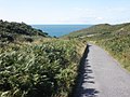
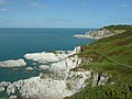
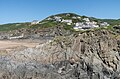
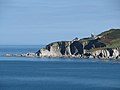
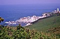
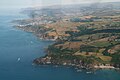
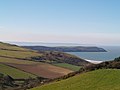
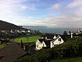
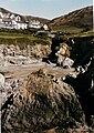
Mortehoe is a small village in the very top-left corner of North Devon, England, protected from the worst ravages of the Atlantic weather systems by the rugged promontary of Morte Point.
Sottocategorie
Questa categoria contiene le 7 sottocategorie indicate di seguito, su un totale di 7.
B
- Bull Point Lighthouse (24 F)
C
- Chichester Arms, Mortehoe (4 F)
M
- Morte Point (15 F)
- Mortehoe War Memorial (4 F)
W
File nella categoria "Mortehoe"
Questa categoria contiene 200 file, indicati di seguito, su un totale di 1 121.
(pagina precedente) (pagina successiva)-
 A disused pit near Barton Close Farm - geograph.org.uk - 1911266.jpg 1 024 × 768; 122 KB
-
 A few miles east of Woolacombe. - geograph.org.uk - 1381077.jpg 640 × 427; 56 KB
-
 A few miles east of Woolacombe. - geograph.org.uk - 1381099.jpg 640 × 427; 48 KB
-
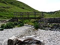 A footbridge at Bennett's Mouth - geograph.org.uk - 1896535.jpg 1 024 × 768; 294 KB
-
 A footbridge in Six Acre Wood. - geograph.org.uk - 1302631.jpg 640 × 480; 157 KB
-

-
 A footpath from Beach road to Sandy Lane - geograph.org.uk - 1978653.jpg 1 024 × 680; 252 KB
-

-
-
 A Footpath leading away from Challacombe Hill - geograph.org.uk - 1909879.jpg 1 024 × 768; 342 KB
-
 A footpath leading from Beach Road to Sandy Lane - geograph.org.uk - 1978652.jpg 680 × 1 024; 290 KB
-

-
 A footpath which leads to North Morte Road - geograph.org.uk - 1944140.jpg 1 024 × 680; 189 KB
-
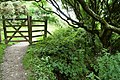
 A gate on Pennywill Lane - geograph.org.uk - 1911033.jpg 1 024 × 768; 387 KB
-

-

-

-

-

-

-
 A memorial plaque in Chapel Woods - geograph.org.uk - 2150088.jpg 1 024 × 683; 255 KB
-
 A memorial stone in Chapel Woods - geograph.org.uk - 2150081.jpg 1 024 × 680; 323 KB
-
 A memorial Stone in Chapel Woods - geograph.org.uk - 2150085.jpg 1 024 × 680; 276 KB
-

-

-
 A peaceful end - geograph.org.uk - 587594.jpg 640 × 480; 130 KB
-
 A Plaque near the foot of Potter's Hill - geograph.org.uk - 1909870.jpg 1 024 × 768; 342 KB
-
-
 A private road leading to Yarde Farm - geograph.org.uk - 1944117.jpg 1 024 × 680; 141 KB
-

-
 A road junction on Sandy Lane - geograph.org.uk - 1975700.jpg 1 024 × 680; 162 KB
-

-
 A sheep shelters under the gorse on a hot day - geograph.org.uk - 1940206.jpg 1 024 × 680; 216 KB
-
 A shorn Sheep on the South West Coast Path - geograph.org.uk - 1941338.jpg 1 024 × 682; 195 KB
-
 A short, overgrown footpath near Lee Bridge - geograph.org.uk - 1959486.jpg 1 024 × 680; 272 KB
-

-
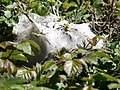 A Spiders Nest in a lane near Roadway Corner - geograph.org.uk - 1911402.jpg 1 024 × 768; 221 KB
-

-

-
-
-
 A stile on the footpath to Black Cloud hill - geograph.org.uk - 1975979.jpg 1 024 × 680; 269 KB
-
 A stile which leads to Twitchen Holiday Park - geograph.org.uk - 1975859.jpg 1 024 × 682; 276 KB
-
-

-
 A track which leads to Higher Spreacombe - geograph.org.uk - 1911042.jpg 768 × 1 024; 211 KB
-
 A view across Rockham Bay towards Bull Point - geograph.org.uk - 1940254.jpg 1 024 × 680; 187 KB
-
 A view down Georgeham Road - geograph.org.uk - 1911382.jpg 1 024 × 768; 163 KB
-
 A view to Potter's Hill - geograph.org.uk - 1327033.jpg 640 × 480; 122 KB
-
 Access path to Bull Point, Mortehoe, Devon - geograph.org.uk - 5735580.jpg 1 600 × 1 069; 559 KB
-
 Access road, Bull Point Lighthouse - geograph.org.uk - 4136213.jpg 1 024 × 768; 240 KB
-
 Access to Combesgate Beach - geograph.org.uk - 1329745.jpg 640 × 480; 126 KB
-
-
 Ada's Cottages - geograph.org.uk - 876001.jpg 640 × 427; 90 KB
-
 Admiralty Chart No 1178 Trevose Head to Bull Point, Published 1882.jpg 12 090 × 16 237; 58,79 MB
-
 Admiring the view - geograph.org.uk - 1327097.jpg 640 × 470; 126 KB
-
-
 Allotments on Gora Lane - geograph.org.uk - 1909211.jpg 1 024 × 768; 227 KB
-
 Almost vertical - geograph.org.uk - 1327077.jpg 480 × 640; 157 KB
-
 An Army of Caterpillars - geograph.org.uk - 1975819.jpg 1 024 × 680; 139 KB
-

-
 An entrance to property on Sandy Lane - geograph.org.uk - 1975733.jpg 1 024 × 680; 205 KB
-
 Anchor, SS Collier - geograph.org.uk - 4565176.jpg 480 × 640; 92 KB
-
 Another stile near windcutter hill. - geograph.org.uk - 1302642.jpg 640 × 480; 133 KB
-

-
 Approaching Combesgate Valley - geograph.org.uk - 1975909.jpg 1 024 × 680; 285 KB
-
 Approaching Mortehoe on Station Road - geograph.org.uk - 1942840.jpg 1 024 × 768; 194 KB
-
 Approaching Ossaborough from the East - geograph.org.uk - 1908564.jpg 1 024 × 768; 239 KB
-
 Approaching Sandy Lane from Black Cloud Hill - geograph.org.uk - 1976010.jpg 1 024 × 680; 195 KB
-

-
 Approaching Turnpike Cross from Willingcott - geograph.org.uk - 1943547.jpg 1 024 × 768; 141 KB
-
 Approaching Turnpike Cross on the B3343 - geograph.org.uk - 1943562.jpg 1 024 × 680; 150 KB
-
 Approaching Yarde Farm - geograph.org.uk - 1945706.jpg 1 024 × 680; 239 KB
-
 Arlington Road, Woolacombe - geograph.org.uk - 5532250.jpg 1 200 × 900; 322 KB
-

-
 Baggy Point and Hartland Bay from Morte Point (0733).jpg 4 288 × 2 848; 5,03 MB
-
 Baggy Point and Hartland Point from Morte Point (0741).jpg 4 288 × 2 848; 4,38 MB
-
 Baggy Point and Hartland Point from Morte Point (0765).jpg 4 288 × 2 848; 4,96 MB
-
 Baggy Point from Morte Point (0714).jpg 4 288 × 2 848; 4,02 MB
-
 Baggy Point from Morte Point (0721).jpg 4 288 × 2 848; 3,98 MB
-
 Baggy Point from Morte Point (0724).jpg 4 288 × 2 848; 4,99 MB
-
 Baggy Point from Morte Point (0744).jpg 4 288 × 2 848; 5,04 MB
-
 Baggy Point from Morte Point (0764).jpg 4 288 × 2 848; 4,53 MB
-
 Baggy Point from Woolacombe Beach - geograph.org.uk - 648993.jpg 640 × 275; 22 KB
-
 Barracane Beach - geograph.org.uk - 5466159.jpg 6 000 × 4 000; 4,73 MB
-
 Barricane Bay in 1955 - geograph.org.uk - 3329797.jpg 1 019 × 673; 134 KB
-
 Barricane Beach - geograph.org.uk - 4155829.jpg 1 600 × 1 200; 799 KB
-
 Barricane Beach - geograph.org.uk - 5466178.jpg 5 752 × 3 834; 4,83 MB
-
 Barricane Beach - geograph.org.uk - 5762026.jpg 3 264 × 2 448; 2,24 MB
-
 Barricane Beach - geograph.org.uk - 6011172.jpg 678 × 1 024; 1,06 MB
-
 Barricane Beach - geograph.org.uk - 6011173.jpg 1 024 × 678; 753 KB
-
 Barricane Beach - geograph.org.uk - 6011174.jpg 1 062 × 703; 1,04 MB
-
 Barricane Beach - geograph.org.uk - 6011175.jpg 1 024 × 678; 678 KB
-
 Barricane Beach - geograph.org.uk - 6011176.jpg 1 024 × 678; 730 KB
-
 Barricane Beach - geograph.org.uk - 6011177.jpg 1 024 × 678; 506 KB
-
 Barricane Beach - geograph.org.uk - 6011178.jpg 1 024 × 678; 906 KB
-
 Barricane Beach - geograph.org.uk - 6011368.jpg 1 024 × 678; 879 KB
-
 Barricane Beach and Morte Point - geograph.org.uk - 6169207.jpg 640 × 480; 26 KB
-
 Barricane Beach looking towards Morte Point - geograph.org.uk - 4652480.jpg 1 024 × 768; 169 KB
-
 Barton Close Farm - geograph.org.uk - 1911273.jpg 1 024 × 768; 185 KB
-
 Barton Close Farm - geograph.org.uk - 1911280.jpg 1 024 × 768; 183 KB
-
 Barton Close Farm - geograph.org.uk - 5837156.jpg 1 024 × 768; 122 KB
-
 Barton Close Lane adjacent to Barton Close Farm - geograph.org.uk - 1911292.jpg 1 024 × 768; 268 KB
-
 Barton Close Lane approaching Barton Close Farm - geograph.org.uk - 1911302.jpg 1 024 × 768; 346 KB
-

-
 Bay View Farmers Campsite - geograph.org.uk - 1943516.jpg 1 024 × 768; 134 KB
-
 Beach clean at Rockham beach in the sea mist.jpg 2 448 × 3 264; 2,2 MB
-
 Beach closure notice - geograph.org.uk - 4135262.jpg 1 024 × 761; 254 KB
-

-
 Beachcomber Café, Woolacombe - geograph.org.uk - 4893073.jpg 1 024 × 777; 205 KB
-
 Beaches of Morte Bay - geograph.org.uk - 1941645.jpg 1 024 × 683; 161 KB
-
 Beautiful sunset at Barricane Beach - geograph.org.uk - 3778188.jpg 640 × 480; 88 KB
-
 Bennett's Mouth - geograph.org.uk - 4410038.jpg 1 600 × 1 200; 461 KB
-
 Bennett's Mouth - geograph.org.uk - 880229.jpg 640 × 427; 75 KB
-
 Bennett's Mouth - geograph.org.uk - 880233.jpg 640 × 427; 91 KB
-
 Bennett's Mouth - geograph.org.uk - 880238.jpg 640 × 427; 70 KB
-
 Bennett's Mouth, near Morthoe - geograph.org.uk - 1896510.jpg 1 024 × 768; 215 KB
-
 Bird on a wire - geograph.org.uk - 876009.jpg 640 × 427; 24 KB
-
 Bluebells in Vollature Wood. - geograph.org.uk - 1302647.jpg 640 × 480; 155 KB
-

-
 Borough Cross - geograph.org.uk - 2899044.jpg 3 328 × 2 472; 2,47 MB
-
 Borough Cross - geograph.org.uk - 90395.jpg 640 × 480; 38 KB
-
 Borough Cross on Mortehoe Station Road - geograph.org.uk - 1944090.jpg 1 024 × 680; 186 KB
-
 Bull Point - geograph.org.uk - 2118042.jpg 640 × 480; 46 KB
-
 Bull Point - geograph.org.uk - 4136151.jpg 1 024 × 758; 237 KB
-
 Bull Point - geograph.org.uk - 5315722.jpg 1 600 × 1 200; 689 KB
-
 Bull Point - geograph.org.uk - 873152.jpg 640 × 427; 81 KB
-
 Bull Point and lighthouse - 1968 - geograph.org.uk - 3345835.jpg 1 022 × 664; 197 KB
-
 Bull Point bench - geograph.org.uk - 874893.jpg 640 × 427; 89 KB
-
 Bull Point Lighthouse - geograph.org.uk - 4135649.jpg 1 024 × 768; 129 KB
-
 Bull Point Lighthouse - geograph.org.uk - 4410028.jpg 1 600 × 1 200; 282 KB
-
 Bull Point Lighthouse - geograph.org.uk - 5743144.jpg 1 024 × 685; 144 KB
-
 Bull Point lighthouse from the sea - geograph.org.uk - 3114198.jpg 3 008 × 2 000; 1,42 MB
-
 Bull Point Lighthouse, Devon - geograph.org.uk - 5735610.jpg 1 600 × 1 043; 227 KB
-
 Bull Point Lighthouse, Devon - geograph.org.uk - 5735620.jpg 1 600 × 1 059; 432 KB
-
 Bull Point Lighthouse, Devon - geograph.org.uk - 5735622.jpg 1 600 × 1 048; 327 KB
-
-
 Bull Point, just beyond Rockham Bay - geograph.org.uk - 1940274.jpg 1 024 × 732; 138 KB
-
 Bungalows on Woolacombe Station Road - geograph.org.uk - 4892692.jpg 1 024 × 768; 144 KB
-
 Cafe fare - geograph.org.uk - 1329724.jpg 640 × 480; 128 KB
-
 Campsite at North Morte Farm - geograph.org.uk - 4135614.jpg 1 024 × 768; 229 KB
-
-
 Caravan site and shop at Mortehoe - geograph.org.uk - 5316964.jpg 1 600 × 1 200; 755 KB
-
 Cemetery, Mortehoe - geograph.org.uk - 1474762.jpg 640 × 480; 137 KB
-
 Cemetery, Mortehoe - geograph.org.uk - 632422.jpg 640 × 480; 78 KB
-
 Challacombe Hill - geograph.org.uk - 4768064.jpg 800 × 600; 119 KB
-
 Challacombe Hill and Potters Hill - geograph.org.uk - 118403.jpg 640 × 416; 113 KB
-
 Challacombe Hill from Woolacombe Down - geograph.org.uk - 5531981.jpg 1 200 × 900; 383 KB
-
 Challacombe Hill Road - geograph.org.uk - 5531911.jpg 1 200 × 900; 319 KB
-
 Channel View, Mortehoe - geograph.org.uk - 5316959.jpg 1 600 × 1 200; 786 KB
-
 Chapel Close Plantation - geograph.org.uk - 2748177.jpg 4 320 × 3 240; 4,91 MB
-
 Chapel Remains - geograph.org.uk - 2748095.jpg 4 320 × 3 240; 4,82 MB
-
 Chapel Wood, Spreacombe - geograph.org.uk - 73881.jpg 480 × 640; 61 KB
-
 Chapel Woods near Spreacombe Manor - geograph.org.uk - 1923125.jpg 1 024 × 768; 305 KB
-
 Chichester Arms - geograph.org.uk - 5762023.jpg 3 264 × 2 448; 1,91 MB
-
 Chichester Arms Mortehoe - 1983 - geograph.org.uk - 3242094.jpg 981 × 802; 418 KB
-
 Church and inn at Mortehoe - geograph.org.uk - 5314211.jpg 1 600 × 1 200; 777 KB
-
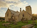 Church of St Mary, Mortehoe - geograph.org.uk - 4654145.jpg 1 024 × 768; 182 KB
-
 Church on the hill - geograph.org.uk - 2382991.jpg 640 × 480; 75 KB
-
 Cleavewood House and Park, Ossaborough - geograph.org.uk - 1908570.jpg 1 024 × 768; 146 KB
-
 Clever Wall - geograph.org.uk - 571922.jpg 640 × 480; 106 KB
-

-
 Cliffs north of Morte Point (0759).jpg 4 288 × 2 848; 5,9 MB
-
 Cliffs on the north side of Morte Point - geograph.org.uk - 5315047.jpg 1 200 × 1 600; 748 KB
-
 Cliffs to the east of Morte Point - geograph.org.uk - 6169298.jpg 640 × 480; 27 KB
-
 Clifftop above Woolacombe - geograph.org.uk - 2257773.jpg 1 024 × 688; 99 KB
-
 Climbing out of Bennett's Mouth - geograph.org.uk - 722247.jpg 425 × 640; 94 KB
-
 Clovelly from Morte Point (0746).jpg 4 288 × 2 848; 3,67 MB
-
-
 Coast North of Mortehoe - geograph.org.uk - 1302769.jpg 640 × 479; 115 KB
-
 Coastal path, Woolacombe - geograph.org.uk - 3118577.jpg 1 024 × 776; 196 KB
-
 Coastal Paths, near Mortehoe - geograph.org.uk - 609381.jpg 640 × 428; 108 KB
-
 Coastal View - geograph.org.uk - 4404923.jpg 1 600 × 1 200; 242 KB
-
 Coastguard offices in Mortehoe - geograph.org.uk - 5316971.jpg 1 600 × 1 200; 761 KB
-
 Combesgate - geograph.org.uk - 3697213.jpg 640 × 478; 58 KB
-
 Combesgate Beach - geograph.org.uk - 1318118.jpg 640 × 473; 148 KB
-
 Combesgate Beach - geograph.org.uk - 6284420.jpg 454 × 640; 123 KB
-
 Combesgate Beach in Morte Bay - geograph.org.uk - 1941657.jpg 1 024 × 683; 188 KB
-
 Combesgate Valley - geograph.org.uk - 1975932.jpg 1 024 × 680; 238 KB
-
 Combesgate Valley - geograph.org.uk - 1975940.jpg 1 024 × 680; 254 KB
-

-
 Commandment Gut - geograph.org.uk - 874864.jpg 640 × 427; 82 KB
-
 Commandment Gut - geograph.org.uk - 880190.jpg 640 × 427; 83 KB
-
 Coombesgate Beach - geograph.org.uk - 3066500.jpg 640 × 480; 65 KB
-
 Cottages to the south of Mortehoe - geograph.org.uk - 1943012.jpg 1 024 × 680; 177 KB
-
 Cove - geograph.org.uk - 4404911.jpg 1 600 × 1 200; 521 KB
-
 Crashing surf - geograph.org.uk - 1327459.jpg 640 × 451; 98 KB
-
 Crevices - geograph.org.uk - 1327131.jpg 480 × 640; 170 KB
-

-
 Cycletrack near Mortehoe Station - geograph.org.uk - 84265.jpg 640 × 480; 19 KB
-

-

-
 Damage Hills - geograph.org.uk - 874912.jpg 640 × 427; 63 KB
-
 Damagehue Cliff - geograph.org.uk - 4136173.jpg 1 024 × 768; 202 KB
-

-
 Deer on Woolacombe Down - geograph.org.uk - 5531989.jpg 1 200 × 904; 485 KB
-
 Deer on Woolacombe Down - geograph.org.uk - 5531993.jpg 1 200 × 902; 395 KB
-
 Descent to Grunta Beach - geograph.org.uk - 876084.jpg 640 × 427; 88 KB
-
 Devon coast near Bull Point - geograph.org.uk - 1421875.jpg 640 × 480; 97 KB
-
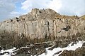
 Devonian Morte Slates - geograph.org.uk - 1327073.jpg 640 × 480; 126 KB


.jpg)
.jpg)
.jpg)
.jpg)
.jpg)
.jpg)
.jpg)
.jpg)


.jpg)


.jpg)


_-_geograph.org.uk_-_5532155.jpg)


