Category:North Devon District
Jump to navigation
Jump to search
northern part of the English county of Devon; local government district in Devon  | |||||
| Upload media | |||||
| Instance of | |||||
|---|---|---|---|---|---|
| Location | Devon, South West England, England | ||||
| Capital | |||||
| Legislative body |
| ||||
| Population |
| ||||
| Area |
| ||||
| official website | |||||
 | |||||
Subcategories
This category has the following 66 subcategories, out of 66 total.
Pages in category "North Devon District"
The following 3 pages are in this category, out of 3 total.
Media in category "North Devon District"
The following 93 files are in this category, out of 93 total.
-
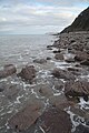
 'Rugged Jack', Valley of the Rocks - geograph.org.uk - 3551764.jpg 1,024 × 779; 246 KB
-
 14939609 1790694021193035 8707002901813576594 o 01.jpg 680 × 960; 81 KB
-
 A mural on Fore Street near Albert Court, Ilfracombe - geograph.org.uk - 3607188.jpg 1,600 × 1,200; 677 KB
-
 Abseiling on Castle Rock, Wringcliff Bay - geograph.org.uk - 3551730.jpg 768 × 1,024; 222 KB
-
 Barnstablemap 1937.jpg 2,544 × 3,504; 1.67 MB
-
 Berrynarbor - panoramio.jpg 3,072 × 1,587; 3.02 MB
-
 Between Exmoor and the sea-Lee Abbey, North Devon - geograph.org.uk - 3574921.jpg 3,072 × 2,304; 4.75 MB
-
 Big lake for one boat.....August 2011 - panoramio.jpg 2,288 × 1,712; 772 KB
-
 Bridge - panoramio (100).jpg 1,929 × 3,072; 3.52 MB
-
 Bridge over the Little Dart River near Chawleigh - August 2011 - panoramio.jpg 2,288 × 1,712; 894 KB
-
 Bridge where the Lynton ^ Barnstaple Railway passed^ August 2011 - panoramio.jpg 2,288 × 1,712; 828 KB
-
 Buttons ^ Stars, 57, Fore Street, Ilfracombe - geograph.org.uk - 3607210.jpg 1,600 × 1,200; 456 KB
-
 Camping ^ Caravanning Club, Umberleigh - August 2011 - panoramio.jpg 2,288 × 1,712; 790 KB
-
 Caramelo, No. 22, St James Place, Ilfracombe - geograph.org.uk - 3594184.jpg 1,600 × 1,200; 492 KB
-
 Caravans from the games field - Umberleigh - August 2011 - panoramio.jpg 2,288 × 1,712; 787 KB
-
 Castles in the sand - August 2011 - panoramio.jpg 2,288 × 1,712; 784 KB
-
 Coastal retreat-Lee Abbey, North Devon - geograph.org.uk - 3568241.jpg 3,072 × 2,304; 2.12 MB
-
-
 Douglas ^ Dean, 7, The Candar, Fore Street, Ilfracombe - geograph.org.uk - 3607259.jpg 1,600 × 1,200; 435 KB
-
 Echo Beach, No. 4 Broad Street, Ilfracombe - geograph.org.uk - 3607170.jpg 1,600 × 1,200; 445 KB
-
 Entering the Copse, Umberleigh Caravan site - panoramio.jpg 2,288 × 1,712; 875 KB
-
 Fishing.....Wistlandpound - August 2011 - panoramio.jpg 2,288 × 1,712; 781 KB
-
 From the walk to the lake, Umberleigh Caravan site. August 2011 - panoramio.jpg 2,288 × 1,712; 840 KB
-
 Gallery Jessica Dove, No. 8, The High Street, Ilfracombe - geograph.org.uk - 3594143.jpg 1,600 × 1,200; 481 KB
-
 Graffiti in Shrubbery Close - geograph.org.uk - 3541617.jpg 1,600 × 1,063; 565 KB
-

-
 Harbour Deli, No. 21, St. James Place, Ilfracombe - geograph.org.uk - 3594215.jpg 1,600 × 1,200; 389 KB
-
-
 Little Dart River below the bridge - August 2011 - panoramio.jpg 2,288 × 1,712; 867 KB
-
 Little Dart River meandering in the woods - August 2011 - panoramio.jpg 1,712 × 2,288; 1.5 MB
-
 Little Dart River near Chawleigh - August 2011 - panoramio.jpg 2,288 × 1,712; 870 KB
-
 Little Dart River passing under the bridge - Chawleigh August 2011 - panoramio.jpg 2,288 × 1,712; 890 KB
-
 Littlebirds, 76, The High Street, Ilfracombe - geograph.org.uk - 3594113.jpg 1,600 × 1,200; 331 KB
-
 Long Bridge, Barnstaple - geograph.org.uk - 3549573.jpg 640 × 480; 54 KB
-
 Looking down, towards Sillery Sands - geograph.org.uk - 3588130.jpg 1,024 × 768; 180 KB
-
 Lynton C C cricket ground - geograph.org.uk - 3551792.jpg 1,024 × 774; 254 KB
-
 Meadows and woods - August 2011 - panoramio.jpg 2,288 × 1,712; 841 KB
-
 Meadows in to the trees - August 2011 - panoramio.jpg 2,288 × 1,712; 811 KB
-
 Meadows near Cheldon - August 2011 - panoramio.jpg 2,288 × 1,712; 783 KB
-
 Morthoe to Lee Bay Lighthouse - panoramio.jpg 3,600 × 2,702; 7.15 MB
-
 Narrow meadow by the Little Dart River - August 2011 - panoramio.jpg 1,712 × 2,288; 1.16 MB
-
 Neck Woods, Devon (52357188444).jpg 3,072 × 4,096; 6.8 MB
-
 Neck Woods, Devon (52357189859).jpg 4,096 × 3,072; 13.6 MB
-
 No. 105a, The High Street, Ilfracombe is no more - geograph.org.uk - 3594134.jpg 1,600 × 1,200; 352 KB
-
 No. 44 Fore Street, Ilfracombe - geograph.org.uk - 3607236.jpg 1,600 × 1,200; 357 KB
-
 No. 45, Fore Street, Ilfracombe - geograph.org.uk - 3607222.jpg 1,600 × 1,200; 399 KB
-
 North Devon , Coastal Scenery - geograph.org.uk - 6254458.jpg 6,000 × 4,000; 4.54 MB
-
 North Devon , Coastal Scenery - geograph.org.uk - 6254468.jpg 6,000 × 4,000; 5.89 MB
-
 North Devon , Dolphin - geograph.org.uk - 6254464.jpg 4,000 × 6,000; 3.88 MB
-
 North Devon , Pebble Beach - geograph.org.uk - 5241169.jpg 6,000 × 4,000; 5.44 MB
-
 North Devon , Pebble Beach - geograph.org.uk - 5241171.jpg 4,000 × 6,000; 5.95 MB
-
 North Devon , Pebble Beach - geograph.org.uk - 5241174.jpg 6,000 × 4,000; 5.8 MB
-
 North Devon , Pebble Beach - geograph.org.uk - 5241176.jpg 6,000 × 4,000; 5.79 MB
-
 North Devon , Pebble Beach - geograph.org.uk - 5241177.jpg 6,000 × 4,000; 7.43 MB
-
 North Devon Maritime Museum.jpg 2,752 × 4,896; 6.32 MB
-
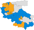 North Devon UK ward map 2019.svg 699 × 620; 748 KB
-
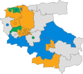 North Devon UK ward map 2023.svg 699 × 620; 748 KB
-
 Old Chapel - panoramio.jpg 2,981 × 2,235; 4.28 MB
-
 Play area at the Umberleigh Camping Site - August 2011 - panoramio.jpg 2,288 × 1,712; 802 KB
-
 Queen Anne's Walk, Barnstaple - geograph.org.uk - 3549557.jpg 640 × 480; 95 KB
-
 Raleigh Cabinet Works, Barnstaple - geograph.org.uk - 3549606.jpg 640 × 480; 65 KB
-
 Reflection in the fishing pond - August 2011 - panoramio.jpg 1,712 × 2,288; 1.17 MB
-
 Retirement flats on Hillsboro Road - geograph.org.uk - 3607154.jpg 1,600 × 939; 373 KB
-
 River Taw ^ Railway Bridge - August 2011 - panoramio.jpg 1,712 × 2,288; 1.05 MB
-
 Riverside meadow near Chawleigh - August 2011 - panoramio.jpg 2,288 × 1,712; 851 KB
-
 Rocks in the Little Dart River - August 2011 - panoramio.jpg 2,288 × 1,712; 890 KB
-
 Ruined barn near Cheldon above the Little Dart River - August 2011 - panoramio.jpg 1,712 × 2,288; 1.16 MB
-
 Signal maintenance, Woody Bay, Lynton, North Devon. - panoramio.jpg 3,888 × 2,592; 2.48 MB
-
 Slade Fishery, the lower of two pools of water - geograph.org.uk - 1965554.jpg 1,024 × 680; 202 KB
-
 Statue - panoramio (13).jpg 1,988 × 2,969; 3.2 MB
-
 Swanpool SSSI.jpg 3,264 × 2,448; 2.53 MB
-
 Tawstock, Barnstaple, North Devon. 1805.jpg 3,240 × 2,306; 2.25 MB
-
 The cliffs above Wringcliff Bay - geograph.org.uk - 3551741.jpg 1,024 × 768; 198 KB
-
 The Fishing Lake at Umberleigh - August 2011 - panoramio.jpg 1,712 × 2,288; 1.06 MB
-
-
 The Lifeboat out in the estuary - August 2011 - panoramio.jpg 2,288 × 1,712; 756 KB
-

-
 The Tarka Line - looking towards Barnstaple - Aug 2011 - panoramio.jpg 1,712 × 2,288; 1.38 MB
-
 The Tarka Line - looking towards Exeter - panoramio.jpg 1,712 × 2,288; 1.4 MB
-
 The weak bridge - looks pretty solid - August 2011 - panoramio.jpg 2,288 × 1,712; 868 KB
-
 Train on the Tarka Line heading north from Umberleigh - August 2011 - panoramio.jpg 2,288 × 1,712; 768 KB
-
 UK North Devon District Council 2023.svg 360 × 185; 3 KB
-
 Umberleigh Caravan Site - August 2011 - panoramio.jpg 2,288 × 1,712; 756 KB
-
 Umberleigh Caravan site - August 2011 - panoramio.jpg 2,288 × 1,712; 799 KB
-
 Umberleigh Caravan ^ Camping Site - August 2011 - panoramio.jpg 2,288 × 1,712; 812 KB
-
 United Kingdom North Devon District Council 2019.svg 360 × 185; 3 KB
-
 View towards the Lyn Mouth - geograph.org.uk - 3591311.jpg 1,024 × 768; 270 KB
-
 Village Centre - panoramio.jpg 3,264 × 2,448; 4.62 MB
-
 Weak bridge over the Little Dart River - August 2011 - panoramio.jpg 2,288 × 1,712; 836 KB
-
 Wistlandpound Reservoir - August 2011 - panoramio (1).jpg 2,288 × 1,712; 786 KB
-
 Wistlandpound Reservoir - August 2011 - panoramio.jpg 2,288 × 1,712; 774 KB
-
 Woolacome Bay - panoramio.jpg 1,024 × 638; 319 KB
-
 Wringcliff Bay from Castle Rock, Valley of the Rocks - panoramio.jpg 3,240 × 4,320; 4.41 MB


.jpg)


.jpg)
.jpg)


.jpg)


.jpg)


