Category:Morton and Hanthorpe
Jump to navigation
Jump to search
English: Morton and Hanthorpe is a civil parish, formerly known as Morton by Bourne in the District of South Kesteven in Lincolnshire, England. There are several villages and hamlets in the county with the name of Morton. They were once far enough apart not to be confused but in an age of easy communication it has become necessary to distinguish between them. There are 921 households in Morton and 74 in Hanthorpe.
civil parish in South Kesteven  | |||||
| Upload media | |||||
| Instance of | |||||
|---|---|---|---|---|---|
| Location | South Kesteven, Lincolnshire, East Midlands, England | ||||
| Has part(s) | |||||
 | |||||
Subcategories
This category has the following 3 subcategories, out of 3 total.
H
- Hanthorpe (15 F)
M
- Morton Road railway station (2 F)
Media in category "Morton and Hanthorpe"
The following 200 files are in this category, out of 204 total.
(previous page) (next page)-
 A jolly band - geograph.org.uk - 5561423.jpg 4,320 × 2,880; 6.94 MB
-
 A15 Bourne Road enters Morton - geograph.org.uk - 3139214.jpg 2,256 × 1,504; 1.22 MB
-
 Abandoned Cat near Morton - geograph.org.uk - 2467675.jpg 640 × 480; 126 KB
-
 Access road - geograph.org.uk - 5665856.jpg 640 × 480; 61 KB
-
 After the harvest near Bourne, Lincolnshire - geograph.org.uk - 4277708.jpg 1,183 × 821; 347 KB
-
 Approaching the north end of Bourne Wood (Fox Wood) - geograph.org.uk - 5681641.jpg 3,776 × 2,520; 3.72 MB
-
 Architectural detail - geograph.org.uk - 5781040.jpg 6,032 × 4,014; 4.53 MB
-
 Auger near Elvidge's Farm, Morton Drove - geograph.org.uk - 6308028.jpg 1,024 × 768; 169 KB
-
 Bakers Way - geograph.org.uk - 5665849.jpg 640 × 480; 46 KB
-
 Barn and farm belonging to Boarden House Farm - geograph.org.uk - 3173288.jpg 4,000 × 3,000; 3.8 MB
-
 Barn and farm equipment belonging to Boarden House Farm - geograph.org.uk - 3173278.jpg 4,000 × 3,000; 4.22 MB
-
 Behind the chip shop - geograph.org.uk - 5649783.jpg 6,032 × 4,014; 3.83 MB
-
 Bend in farm track - geograph.org.uk - 5044563.jpg 640 × 480; 67 KB
-
 Bend in the road - geograph.org.uk - 5665926.jpg 640 × 480; 40 KB
-
 Beware of the Bull - geograph.org.uk - 4468226.jpg 4,320 × 3,240; 5.56 MB
-
 Bottom Farm, Morton Fen - geograph.org.uk - 128414.jpg 640 × 427; 75 KB
-
 Bourne 2 - geograph.org.uk - 2868920.jpg 768 × 1,024; 376 KB
-
 Bourne Road (A15) - geograph.org.uk - 3847098.jpg 640 × 480; 73 KB
-
 Bourne Road, Morton - geograph.org.uk - 6193126.jpg 1,920 × 1,280; 1.11 MB
-
 Bridge over Morton Drain, Morton Fen - geograph.org.uk - 144715.jpg 640 × 427; 144 KB
-
 Brightly coloured - geograph.org.uk - 5561424.jpg 4,320 × 2,880; 6.23 MB
-
 Built in 1851 - geograph.org.uk - 3727451.jpg 4,896 × 3,672; 6.69 MB
-
 Bushes by a pit, Morton Fen - geograph.org.uk - 6308061.jpg 1,024 × 768; 297 KB
-
 Butcher's shop - geograph.org.uk - 3727448.jpg 4,896 × 3,672; 6.81 MB
-
 Car Dyke - geograph.org.uk - 4379123.jpg 1,024 × 683; 256 KB
-
 Car Dyke culvert and river gauge - geograph.org.uk - 283392.jpg 640 × 480; 153 KB
-
 Car park entrance - geograph.org.uk - 5781020.jpg 6,032 × 4,014; 3.31 MB
-
 Car park entrance - geograph.org.uk - 5781037.jpg 6,032 × 4,014; 3.43 MB
-
 Cleaning the dykes near Bourne, Lincolnshire - geograph.org.uk - 4442769.jpg 1,781 × 1,185; 871 KB
-
 Clipsey Gap Lane, part of King street - geograph.org.uk - 5681655.jpg 3,776 × 2,520; 3.51 MB
-
 Collapsing building on Morton Fen - geograph.org.uk - 3173305.jpg 4,000 × 3,000; 4.19 MB
-
 Colourful shopfront - geograph.org.uk - 5781007.jpg 6,032 × 4,014; 4.53 MB
-
 Course of old railway - geograph.org.uk - 4379095.jpg 1,024 × 683; 408 KB
-
 Crossroads near Morton - geograph.org.uk - 3139299.jpg 2,256 × 1,504; 959 KB
-
 Culvert bridge for former railway tracks - geograph.org.uk - 1162194.jpg 640 × 480; 126 KB
-
 Derelict barn, Morton Drove, Morton Fen - geograph.org.uk - 144659.jpg 640 × 427; 124 KB
-
 Disrupted sightlines - geograph.org.uk - 5649685.jpg 6,032 × 4,014; 3.9 MB
-
 Distant buildings - geograph.org.uk - 4103429.jpg 4,896 × 3,672; 6.38 MB
-
 Distinctive roadside sign near Bourne, Lincolnshire - geograph.org.uk - 4386336.jpg 1,782 × 1,191; 1,017 KB
-
 Drain along Morton Drove - geograph.org.uk - 3135239.jpg 2,256 × 1,504; 977 KB
-
 Drain running south from Morton North Drove - geograph.org.uk - 3135272.jpg 2,256 × 1,504; 1.15 MB
-
 Dubious sight lines - geograph.org.uk - 5781002.jpg 6,032 × 4,014; 2.64 MB
-
 Dyke and un-named track - geograph.org.uk - 4103433.jpg 4,896 × 3,672; 6.95 MB
-
 Electricity pole by Morton North Drove - geograph.org.uk - 6307313.jpg 1,024 × 768; 221 KB
-

-
 End of restricted byway - geograph.org.uk - 6308085.jpg 1,024 × 768; 240 KB
-
 Engine Farm - geograph.org.uk - 3479687.jpg 4,320 × 3,240; 5.53 MB
-
 Engine Farm on Morton North Drove - geograph.org.uk - 3135276.jpg 2,256 × 1,504; 1,005 KB
-
 Entrance to Morton - geograph.org.uk - 5665834.jpg 640 × 522; 54 KB
-
 Fake Chimney - geograph.org.uk - 4004124.jpg 4,896 × 3,672; 6.76 MB
-
 Farm at end of Morton North Drove - geograph.org.uk - 144734.jpg 640 × 427; 118 KB
-
 Farm at end of Morton North Drove - geograph.org.uk - 144735.jpg 640 × 427; 130 KB
-
 Farm at end of Morton North Drove - geograph.org.uk - 144739.jpg 640 × 427; 144 KB
-
 Farm at the end of Morton North Drove - geograph.org.uk - 3142078.jpg 2,256 × 1,504; 826 KB
-
 Farm buildings on Morton North Drove - geograph.org.uk - 144724.jpg 640 × 427; 107 KB
-
 Farm on Morton Drove, Morton Fen - geograph.org.uk - 144664.jpg 640 × 427; 109 KB
-
 Farm track - geograph.org.uk - 5044554.jpg 640 × 480; 71 KB
-
 Farm track north from Morton Drove - geograph.org.uk - 3135260.jpg 2,196 × 1,425; 2.15 MB
-
 Farm track on Morton Fen - geograph.org.uk - 144650.jpg 640 × 427; 90 KB
-
 Farmhouse Morton Fen - geograph.org.uk - 144669.jpg 640 × 427; 135 KB
-
 Farmland near Morton - geograph.org.uk - 3847115.jpg 640 × 480; 72 KB
-
 Farmland west of the A15 - geograph.org.uk - 3847097.jpg 640 × 480; 53 KB
-
 Field entrance with Dry Drain - geograph.org.uk - 3139115.jpg 2,256 × 1,504; 1.11 MB
-
 Folkingham Road (A15) - geograph.org.uk - 3847117.jpg 640 × 480; 60 KB
-
 Football pitch near Haconby - geograph.org.uk - 2467973.jpg 640 × 480; 70 KB
-
 Footbridge across the South Forty Foot Drain - geograph.org.uk - 3173168.jpg 4,000 × 3,000; 4.12 MB
-
 Footbridge over a drain near Haconby - geograph.org.uk - 2467984.jpg 640 × 480; 134 KB
-
 Footbridge over South Forty Foot Drain - geograph.org.uk - 5044635.jpg 640 × 480; 109 KB
-
 Footpath across a stubble field - geograph.org.uk - 6307281.jpg 1,024 × 768; 221 KB
-
 Footpath to Morton - geograph.org.uk - 5681683.jpg 3,776 × 2,520; 3.78 MB
-
 Footpath to Morton - geograph.org.uk - 5681688.jpg 3,776 × 2,520; 3.48 MB
-
 Footpath to nowhere - geograph.org.uk - 4468237.jpg 4,320 × 3,240; 6.06 MB
-
 Footpath, near Morton - geograph.org.uk - 643084.jpg 632 × 478; 161 KB
-
 Ford Lane, Morton - geograph.org.uk - 6193326.jpg 1,920 × 1,280; 1.38 MB
-
 Former railway station, Morton - geograph.org.uk - 6307275.jpg 1,024 × 768; 194 KB
-
 Forty Foot Farm - geograph.org.uk - 5044558.jpg 640 × 480; 68 KB
-
 Gushing drain near Haconby - geograph.org.uk - 6307265.jpg 1,024 × 768; 249 KB
-
 Hall's Garage - geograph.org.uk - 5649787.jpg 6,032 × 4,014; 3.76 MB
-
 Halls Garage - geograph.org.uk - 5561418.jpg 4,320 × 2,880; 5.04 MB
-
 Hanthorpe pasture - geograph.org.uk - 3902399.jpg 1,024 × 683; 198 KB
-
 Hanthorpe pasture - geograph.org.uk - 4382514.jpg 1,024 × 683; 218 KB
-
 Hanthorpe Road, Morton - geograph.org.uk - 3847103.jpg 640 × 480; 66 KB
-
 Hanthorpe verges near Bourne, Lincolnshire - geograph.org.uk - 4448714.jpg 2,848 × 2,134; 1.99 MB
-
 Hanthorpe, aerial 2020 - geograph.org.uk - 6421625.jpg 640 × 427; 54 KB
-
 Heavy metal near Morton - geograph.org.uk - 2467668.jpg 640 × 480; 117 KB
-
 High Street - geograph.org.uk - 5665839.jpg 640 × 480; 49 KB
-

-
 Hour stones - geograph.org.uk - 4970611.jpg 5,200 × 3,467; 7.22 MB
-
 King's Head has gone - geograph.org.uk - 4004350.jpg 4,896 × 3,672; 6.67 MB
-
 Large hedge on Bourne Road, Morton - geograph.org.uk - 6193327.jpg 1,920 × 1,280; 1.48 MB
-
 Large piles of wood chippings, Hanthorpe - geograph.org.uk - 5681673.jpg 3,776 × 2,520; 3.53 MB
-
 Last year's bales - geograph.org.uk - 4102778.jpg 4,896 × 3,672; 6.98 MB
-
 Leaving the car park - geograph.org.uk - 5781014.jpg 6,032 × 4,014; 3.61 MB
-
 Looking down on me - geograph.org.uk - 4468232.jpg 4,320 × 3,240; 5.62 MB
-
 Lorries at Morton Show - geograph.org.uk - 5690977.jpg 4,000 × 2,248; 1.76 MB
-
 Many paths south from Morton - geograph.org.uk - 5681681.jpg 3,776 × 2,520; 3.71 MB
-
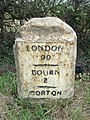
 Milestone - geograph.org.uk - 2868924.jpg 1,024 × 768; 303 KB
-
 Milestone - geograph.org.uk - 2868929.jpg 1,024 × 768; 268 KB
-
 Modern house, old trade - geograph.org.uk - 4008398.jpg 4,896 × 3,672; 7.01 MB
-
 Morton Drove - geograph.org.uk - 3173376.jpg 4,000 × 3,000; 4.13 MB
-
 Morton Drove - geograph.org.uk - 4379130.jpg 1,024 × 683; 265 KB
-
 Morton Drove - geograph.org.uk - 4379189.jpg 1,024 × 683; 176 KB
-
 Morton Drove - geograph.org.uk - 4379249.jpg 1,024 × 683; 217 KB
-
 Morton Drove - geograph.org.uk - 5666032.jpg 640 × 480; 31 KB
-
 Morton Drove - geograph.org.uk - 5666034.jpg 640 × 480; 49 KB
-
 Morton Drove - geograph.org.uk - 5666036.jpg 640 × 480; 44 KB
-
 Morton Drove - geograph.org.uk - 5666038.jpg 640 × 480; 63 KB
-
 Morton Drove and Fen - geograph.org.uk - 4379549.jpg 1,024 × 683; 200 KB
-
 Morton Drove and Fen - geograph.org.uk - 4379604.jpg 1,024 × 683; 256 KB
-
 Morton Drove and Morton Fen - geograph.org.uk - 3173187.jpg 4,000 × 3,000; 4.19 MB
-
 Morton Drove and Morton Fen - geograph.org.uk - 3173245.jpg 4,000 × 3,000; 3.73 MB
-
 Morton Drove looking west - geograph.org.uk - 3142075.jpg 2,256 × 1,504; 1,015 KB
-
 Morton Fen - geograph.org.uk - 4103245.jpg 4,896 × 3,672; 6.54 MB
-
 Morton Fen - geograph.org.uk - 4379196.jpg 1,024 × 683; 407 KB
-
 Morton Fen - geograph.org.uk - 6308048.jpg 1,024 × 768; 231 KB
-
 Morton Fen from Morton Drove - geograph.org.uk - 3173333.jpg 4,000 × 3,000; 4.2 MB
-
 Morton North Drove - geograph.org.uk - 5665932.jpg 640 × 480; 51 KB
-
 Morton North Drove - geograph.org.uk - 5665939.jpg 640 × 480; 53 KB
-
 Morton North Drove - geograph.org.uk - 5666028.jpg 640 × 480; 53 KB
-
 Morton North Drove - geograph.org.uk - 6307319.jpg 1,024 × 717; 180 KB
-
 Morton, aerial 2020 (1) - geograph.org.uk - 6421678.jpg 800 × 533; 71 KB
-

-
 Mr Ellis' Lorry - geograph.org.uk - 5690978.jpg 4,000 × 2,248; 1.64 MB
-
 Muddy track off Morton Drove - geograph.org.uk - 3173423.jpg 4,000 × 3,000; 4.07 MB
-
 New House Farm on Morton Drove North - geograph.org.uk - 3135243.jpg 2,256 × 1,504; 793 KB
-
 New House Farm seen across Morton Fen - geograph.org.uk - 3173319.jpg 4,000 × 3,000; 3.94 MB
-
 New houses - geograph.org.uk - 4376945.jpg 4,896 × 3,672; 7.08 MB
-
 New houses - geograph.org.uk - 4376953.jpg 4,896 × 3,672; 6.39 MB
-
 New Housing - geograph.org.uk - 4376947.jpg 4,896 × 3,672; 6.92 MB
-

-
 On Morton Fen - geograph.org.uk - 3173233.jpg 4,000 × 3,000; 4.02 MB
-
 On Morton Fen - geograph.org.uk - 3173346.jpg 4,000 × 3,000; 4.11 MB
-
 Ordnance Survey Cut Mark - geograph.org.uk - 4111188.jpg 3,000 × 4,000; 3.36 MB
-
 Ordnance Survey Flush Bracket G5241 - geograph.org.uk - 4111422.jpg 4,000 × 3,000; 4.45 MB
-
 Paddocks Lane - geograph.org.uk - 3902629.jpg 1,024 × 683; 277 KB
-
 Paddocks Lane - geograph.org.uk - 3902634.jpg 1,024 × 683; 262 KB
-
 Paddocks Lane - geograph.org.uk - 3902639.jpg 1,024 × 683; 238 KB
-

-
 Pasture Drove - geograph.org.uk - 5665922.jpg 640 × 480; 58 KB
-
 Plaque for Morton Sundial - geograph.org.uk - 4970417.jpg 5,200 × 3,467; 8 MB
-
 Post office and shop - geograph.org.uk - 4770917.jpg 4,896 × 3,672; 6.86 MB
-
 Posting box - geograph.org.uk - 4770920.jpg 3,672 × 4,896; 5 MB
-
 Prepared field near Haconby - geograph.org.uk - 6307271.jpg 1,024 × 768; 315 KB
-
 Private track along Scotten Dike - geograph.org.uk - 3135237.jpg 2,256 × 1,504; 1.17 MB
-

-
 Quizzical Sheep - geograph.org.uk - 590669.jpg 640 × 480; 132 KB
-
 Reconfigured road junction - geograph.org.uk - 5781035.jpg 6,032 × 4,014; 4.29 MB
-
 Reed-filled Drain, off Morton Drove - geograph.org.uk - 3135251.jpg 1,504 × 1,954; 2.68 MB
-
 Ridge ^ furrow at Hanthorpe - geograph.org.uk - 3902412.jpg 1,024 × 683; 230 KB
-
 Road junction - geograph.org.uk - 5665868.jpg 640 × 480; 105 KB
-
 Road to Cardyke Farm - geograph.org.uk - 3135233.jpg 2,256 × 1,504; 906 KB
-
 Roadside cabinet - geograph.org.uk - 5783517.jpg 6,032 × 4,014; 6.62 MB
-
 Scotten Dike and plantation - geograph.org.uk - 6307288.jpg 1,024 × 736; 177 KB
-
 Scotten Dike Drove - geograph.org.uk - 3173360.jpg 4,000 × 3,000; 4.02 MB
-
 Scotten Dike Drove and Morton Fen - geograph.org.uk - 3173365.jpg 4,000 × 3,000; 4.26 MB
-
 Semi-detached houses - geograph.org.uk - 5783481.jpg 6,032 × 4,014; 5.59 MB
-
 Shop parking - geograph.org.uk - 5781012.jpg 6,032 × 4,014; 4.38 MB
-
 Signs in the middle of nowhere - geograph.org.uk - 4103229.jpg 4,896 × 3,672; 6.6 MB
-
 Slow progress - geograph.org.uk - 5649470.jpg 6,032 × 4,014; 4.76 MB
-
 Soggy tates - geograph.org.uk - 6307327.jpg 1,024 × 768; 243 KB
-
 Somebody's been upset - geograph.org.uk - 6308000.jpg 1,024 × 768; 290 KB
-
 South Forty Foot Drain - geograph.org.uk - 4379593.jpg 1,024 × 683; 208 KB
-
 South Forty Foot Drain - geograph.org.uk - 4782413.jpg 640 × 480; 71 KB
-
 South Forty Foot Drain - geograph.org.uk - 5044541.jpg 640 × 480; 69 KB
-
 South Forty Foot Drain at Forty Foot Farm - geograph.org.uk - 3173210.jpg 4,000 × 3,000; 4.02 MB
-
 South Forty Foot Drain at Morton Fen - geograph.org.uk - 3173204.jpg 4,000 × 3,000; 3.86 MB
-
 South Forty Foot Drain footbridge - geograph.org.uk - 4379583.jpg 1,024 × 683; 302 KB
-
 South Forty Foot Drain near Forty Foot Farm - geograph.org.uk - 3173207.jpg 4,000 × 3,000; 4.03 MB
-
 Spinney Farm, Morton Fen - geograph.org.uk - 128409.jpg 640 × 427; 80 KB
-
 Stainfield Road - geograph.org.uk - 3902404.jpg 1,024 × 683; 307 KB
-
 Stainfield Road leading north out of Hanthorpe - geograph.org.uk - 5681675.jpg 3,776 × 2,520; 2.68 MB
-
 Stile into bull field - geograph.org.uk - 4468239.jpg 4,320 × 3,240; 5.78 MB
-
 Still rusting away but only very slowly - geograph.org.uk - 2467660.jpg 640 × 480; 137 KB
-
 Stone buildings - geograph.org.uk - 4004144.jpg 4,896 × 3,672; 6.69 MB
-
 Stubble field and Cardyke Farm - geograph.org.uk - 6307286.jpg 1,024 × 768; 215 KB
-
 Stubble field near Hanthorpe - geograph.org.uk - 6308078.jpg 1,024 × 768; 226 KB
-
 Stubble fields off Morton North Drove - geograph.org.uk - 6307290.jpg 1,024 × 765; 202 KB
-
 Subsidence on Morton Fen - geograph.org.uk - 3173311.jpg 4,000 × 3,000; 3.98 MB
-
 Sugar beet - geograph.org.uk - 4103437.jpg 4,896 × 3,672; 6.63 MB
-
 The A15 from the refuge - geograph.org.uk - 5781033.jpg 6,032 × 4,014; 4.66 MB
-
 The construction site - geograph.org.uk - 5561415.jpg 4,320 × 2,880; 6.1 MB
-
 The crop - geograph.org.uk - 4103222.jpg 4,896 × 3,672; 6.68 MB
-
 The end of Morton Drove - geograph.org.uk - 3173180.jpg 4,000 × 3,000; 4.28 MB
-
 The Gap in the Trees(3) - geograph.org.uk - 5609333.jpg 4,896 × 3,672; 6.42 MB
-
 The Gnomon plate - geograph.org.uk - 4970608.jpg 5,000 × 3,333; 7.75 MB
-
 The house on the corner - geograph.org.uk - 5649782.jpg 6,032 × 4,014; 3.43 MB
-
 The new co-op - geograph.org.uk - 5780997.jpg 6,032 × 4,014; 3.87 MB
-
 The other pub - geograph.org.uk - 3727438.jpg 4,896 × 3,672; 6.94 MB
-
 The pub is closed - geograph.org.uk - 4004329.jpg 4,896 × 3,672; 6.88 MB
-
 The South Forty Foot Drain near Bourne, Lincolnshire - geograph.org.uk - 4407392.jpg 1,782 × 1,176; 697 KB
-
 The sundial in the grass - geograph.org.uk - 4970421.jpg 6,000 × 4,000; 8 MB
-
 The sundial in the grass - geograph.org.uk - 4970613.jpg 5,000 × 3,333; 7.75 MB
-
 The surviving pub - geograph.org.uk - 4004361.jpg 4,896 × 3,672; 6.69 MB
-
 Track off Morton Drove - geograph.org.uk - 3139251.jpg 2,256 × 1,504; 1.05 MB
-
 Turning the straw - geograph.org.uk - 4102770.jpg 4,896 × 3,672; 6.7 MB
-
 Uncontrolled crossing - geograph.org.uk - 5781028.jpg 6,032 × 4,014; 5.71 MB
-
 Unloading for the show - geograph.org.uk - 5690998.jpg 4,000 × 2,248; 1.96 MB
-
 View from Morton Drove - geograph.org.uk - 3173463.jpg 4,000 × 3,000; 4.28 MB
-
 Village Hall - geograph.org.uk - 5561426.jpg 4,320 × 2,880; 5.91 MB
-
 Warning label on power pole. - geograph.org.uk - 5783527.jpg 6,032 × 4,014; 3.17 MB


_-_geograph.org.uk_-_5681641.jpg)


_-_geograph.org.uk_-_3847098.jpg)


_-_geograph.org.uk_-_3847117.jpg)


_-_geograph.org.uk_-_6421678.jpg)
_and_some_circular_parch_marks,_aerial_2020_-_geograph.org.uk_-_6421683.jpg)


_-_geograph.org.uk_-_5609333.jpg)


