Category:Mount Katahdin
Aller à la navigation
Aller à la recherche
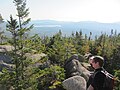
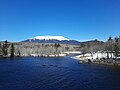
English: Mount Katahdin —a National Natural Landmark within Baxter State Park, in Piscataquis County, central Maine.
- At 5,268 feet (1,606 m), the summit is the highest point in Maine.
montagne du Maine, aux États-Unis  | |||||
| Téléverser des médias | |||||
| Nature de l’élément | |||||
|---|---|---|---|---|---|
| Matériau | |||||
| Lieu | comté de Piscataquis, Maine, É.-U. | ||||
| Statut patrimonial | |||||
| Événement clé |
| ||||
| Chaîne de montagnes | |||||
| Proéminence |
| ||||
| Voie d'accès au sommet | |||||
| Altitude |
| ||||
 | |||||
Sous-catégories
Cette catégorie comprend 5 sous-catégories, dont les 5 ci-dessous.
P
T
V
Média dans la catégorie « Mount Katahdin »
Cette catégorie comprend 39 fichiers, dont les 39 ci-dessous.
-
 06 Mt. Katahdin.jpg 4 000 × 3 000 ; 1,39 Mio
-

-

-

-

-
 Appalachian Trail and view of Mount Katahdin, Maine LCCN2011630251.tif 3 449 × 4 290 ; 42,36 Mio
-
 Appalachian Trail and view of Mount Katahdin, Maine LCCN2011630252.tif 4 371 × 3 277 ; 41,01 Mio
-
 Bangor and Aroostook newspaper ad New York Tribune 1921.jpg 353 × 560 ; 59 kio
-
 Baxter SP banner.jpg 2 592 × 370 ; 217 kio
-
-

-

-
 J H Miller at Summit.jpg 1 600 × 1 200 ; 678 kio
-
 Katahdin and Moose - panoramio.jpg 2 816 × 2 112 ; 1,99 Mio
-
 Katahdin Chimney Pond 1.JPG 2 592 × 1 944 ; 1,26 Mio
-
 Katahdin Chimney Pond 2.JPG 2 592 × 1 944 ; 1,32 Mio
-
 Katahdin Vegetation.svg 512 × 384 ; 209 kio
-
 Katahdin.jpg 2 592 × 1 944 ; 1,76 Mio
-
 Kathadin Chimney Pond 3.JPG 2 592 × 1 944 ; 1,3 Mio
-

-
 Mont Katahdin.jpg 891 × 429 ; 42 kio
-
 Mount Katahdin - Abol Bridge.jpg 4 000 × 3 000 ; 2,51 Mio
-
 Mount Katahdin - panoramio (1).jpg 2 816 × 2 112 ; 1,38 Mio
-
 Mount Katahdin - panoramio (2).jpg 2 816 × 2 112 ; 2,27 Mio
-
 Mount Katahdin as seen from South Twin Lake image 1.jpg 4 608 × 3 456 ; 4,36 Mio
-
 Mount Katahdin as seen from South Twin Lake image 2.jpg 4 608 × 3 456 ; 3,73 Mio
-
 Mount Katahdin as seen from South Twin Lake image 3.jpg 4 608 × 3 456 ; 3,65 Mio
-
 Mount Katahdin as seen from South Twin Lake image 4.jpg 4 608 × 3 456 ; 3,52 Mio
-
 Mount Katahdin as seen from South Twin Lake image 5.jpg 4 608 × 3 456 ; 3,25 Mio
-
 Mount Katahdin from Togue Pond.jpg 450 × 278 ; 25 kio
-
 Mount Katahdin.jpg 4 000 × 3 000 ; 1,67 Mio
-
 Mt katahdin, located in Baxter State Park, the highest mountain in the state of Maine.jpg 2 048 × 1 370 ; 577 kio
-
 Mt. Katahdin loftiest Peak in Maine, Vacationland (77042).jpg 3 360 × 2 183 ; 2,78 Mio
-
 Mt. Katahdin, 5,273 feet -- Loftiest Peak in Maine, Vacationland (64270).jpg 3 309 × 2 111 ; 3,04 Mio
-
 Penobscot River.jpg 1 000 × 259 ; 324 kio
-
 TJWikiBaxterKatahdin.JPG 1 305 × 1 049 ; 469 kio
-
 TjWikiKatahdin.jpg 1 716 × 403 ; 430 kio
-
 Mount Katahdin from Katepskonegan Lake, by Hinds, A. L., fl. 1870-1879.jpg 2 737 × 1 397 ; 1,25 Mio
-
 Millinocket, Maine & Mount Katahdin.jpg 590 × 378 ; 33 kio


_(14598681267).jpg)
_(14759808122).jpg)
_(14574711017).jpg)


.jpg)
.jpg)


.jpg)
.jpg)


Catégories :
- Mountains of Maine
- Baxter State Park
- National Natural Landmarks of Maine
- Geography of Piscataquis County, Maine
- Laccoliths in Maine
- Granite formations in Maine
- Native American religious places
- Sacred mountains
- 1600s mountains of the United States
- Highest points of U.S. states
- Northeast Piscataquis, Maine
- Katahdin Pluton
- Moraines in Maine
- Eskers in the United States