Category:Mount Rundle
Zur Navigation springen
Zur Suche springen
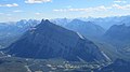
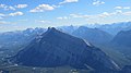
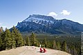
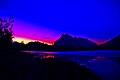
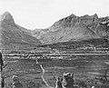
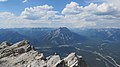
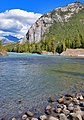
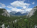
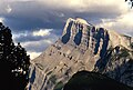
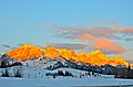
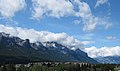
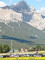
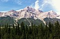
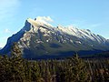
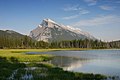
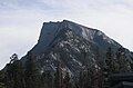
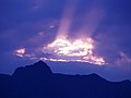
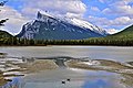
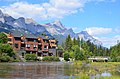
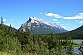
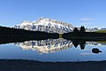
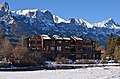
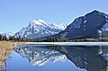
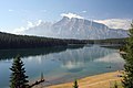
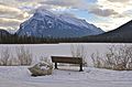
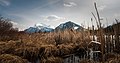
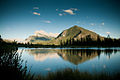
English: Mount Rundle is a mountain with an elevation of 2,948 metres (9,672 ft), which overlooks the town of Banff, Alberta.
| Objektposition | | Karte mit allen Koordinaten: OpenStreetMap |
|---|
Berg in Kanada  | |||||
| Medium hochladen | |||||
| Ist ein(e) | |||||
|---|---|---|---|---|---|
| Liegt in Schutzgebiet | |||||
| Ort | Alberta, Kanada | ||||
| Schlüsselereignis |
| ||||
| Gebirgszug | |||||
| Schartenhöhe |
| ||||
| Höhe über dem Meeresspiegel |
| ||||
 | |||||
Medien in der Kategorie „Mount Rundle“
Folgende 125 Dateien sind in dieser Kategorie, von 125 insgesamt.
-
 . Bow Valley & River, Banff, Mount Rundle and Sulphur Mountain.jpg 4.608 × 2.592; 3,41 MB
-
 .Bow Valley & River.jpg 4.608 × 2.592; 3,49 MB
-
 .Cascade Mountain seen from top Mount Rundle.jpg 4.608 × 2.592; 2,9 MB
-
 .mount Lawrence grassi summit.jpg 4.032 × 3.024; 4,27 MB
-
 .Mount Rundle.jpg 5.472 × 3.648; 18,03 MB
-
 .Rundle Summit.jpg 5.472 × 3.648; 9,84 MB
-
 .Sulphur Mountain view from Mount Rundle.jpg 4.608 × 2.592; 2,94 MB
-
 1 Mount Rundle.jpg 4.608 × 2.592; 2,94 MB
-
 2 Mount Rundle.jpg 4.608 × 2.592; 2,82 MB
-
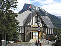
 Administration Building & Rundle.jpg 2.688 × 2.016; 3,33 MB
-
 Alberta IMG 3794 (17081695960).jpg 5.184 × 3.456; 1,53 MB
-
 Alberta IMG 3869 (17267689152).jpg 5.184 × 3.456; 2,01 MB
-
 Banff - Rundle Mountain - Summer Sunrise.jpg 3.872 × 2.592; 6,39 MB
-
 Banff Bridge - panoramio.jpg 4.681 × 3.100; 4,05 MB
-
 Banff Bridge over the Bow River - panoramio.jpg 4.928 × 3.264; 3,73 MB
-
 Banff monsoon.jpg 4.608 × 3.072; 2,9 MB
-
 Banff N.P., panorámicas (1996) 01.jpg 5.348 × 2.041; 7,53 MB
-
 Banff National Park (9).jpg 4.272 × 2.848; 3,02 MB
-
 Banff panorama.jpg 8.020 × 2.403; 3,35 MB
-
 Banff, Alberta, Canada (230089894).jpg 900 × 675; 244 KB
-
 Banff2.JPG 800 × 536; 184 KB
-
 Behind Rundle Mountain - panoramio.jpg 2.377 × 1.584; 1,44 MB
-
 Bleu jaune vert.jpg 4.256 × 2.432; 7,32 MB
-
 Bow River Valley at Canmore, AB, 1892 (7598814388).jpg 768 × 620; 209 KB
-
 Cambrian Pavilion & Rundle.jpg 1.920 × 2.560; 3,89 MB
-
 Canadian forestry journal (19903053293).jpg 2.976 × 1.902; 1,39 MB
-
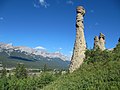
 Canmore Hoodoos - panoramio.jpg 2.971 × 2.228; 2,44 MB
-
 Cascade Mountain & Bow Valley & Bow River & Lake Minnewanka.jpg 4.608 × 2.592; 3,49 MB
-
 Cascade Mountain & Bow Valley and Lake Minnewanka.jpg 4.608 × 2.592; 3,28 MB
-
 Cascade Mountain & Bow Valley.jpg 4.608 × 2.592; 3,13 MB
-
 Cascade pond bridge looking towards Rundle mountain Banff Alberta Canada (9922897903).jpg 5.184 × 3.456; 6,39 MB
-
-
 Dawn, Mt. Rundle, Alberta (11842970135).jpg 3.214 × 2.101; 614 KB
-
 Gezicht op Mount Rundle Banff Hotel and Mount Rundle (titel op object), RP-F-F16117-A.jpg 5.452 × 4.384; 2,33 MB
-
 Goat Creek.jpg 4.608 × 2.592; 3,55 MB
-
 Ha ling and rundle.jpg 4.608 × 2.592; 3,52 MB
-
 Ha ling peak and East End of Rundle.jpg 4.608 × 2.592; 3,85 MB
-
 Hoodoos looking west - panoramio.jpg 4.000 × 3.000; 3,36 MB
-
 Improvement District No. 9, AB T0L, Canada - panoramio (4).jpg 3.072 × 2.304; 3,24 MB
-
 Information Building & Rundle.jpg 2.560 × 1.920; 3,61 MB
-
 Kite skiing by Mt. Rundle, Banff N.P., AB, Canada.jpg 960 × 1.440; 488 KB
-
 Lake on the way to Banff.jpg 4.272 × 2.797; 1,92 MB
-
 Lake Vermillion.jpg 3.264 × 2.448; 1,25 MB
-
 Luxton Residence & Rundle.jpg 3.072 × 2.304; 5,07 MB
-
 Mont Rundle vu depuis l'hôtel Fairmont Banff Springs.jpg 3.264 × 2.448; 1,46 MB
-
 Mont Rundle.jpg 3.264 × 2.448; 1,17 MB
-
 Mont Tunnel et mont Rundle sertissant le paysage entre eux deux.jpg 3.264 × 2.448; 1,07 MB
-
 Mount Rundle (50043127626).jpg 5.222 × 3.532; 1,67 MB
-
 Mount Rundle - Banff, AB.jpg 1.600 × 1.200; 706 KB
-
 Mount Rundle - Banff-Canmore - panoramio.jpg 4.928 × 3.264; 4,31 MB
-
 Mount Rundle - Canmore - panoramio.jpg 4.019 × 2.669; 3,78 MB
-
 Mount Rundle - Flickr - docoverachiever.jpg 3.471 × 2.169; 5,24 MB
-
 Mount Rundle - panoramio (1).jpg 3.445 × 2.044; 839 KB
-
 Mount Rundle - panoramio (2).jpg 4.928 × 3.264; 4,82 MB
-
 Mount Rundle - panoramio (3).jpg 4.928 × 3.264; 4,37 MB
-
 Mount Rundle - panoramio (4).jpg 7.360 × 4.912; 9,08 MB
-
 Mount Rundle - panoramio (5).jpg 7.360 × 4.912; 12,22 MB
-
 Mount Rundle - panoramio.jpg 4.928 × 3.264; 4,97 MB
-
 Mount Rundle and the golf house (24020).jpg 1.024 × 603; 417 KB
-
 Mount Rundle as seen from Two Jack Lake.jpg 2.048 × 1.357; 948 KB
-
 Mount Rundle at Dusk.jpg 600 × 422; 95 KB
-
 Mount Rundle by Hwy One - panoramio.jpg 5.081 × 3.391; 4,41 MB
-
 Mount Rundle Cascades of Time Garden.jpg 4.032 × 3.024; 5,24 MB
-
 Mount Rundle Saltlik.jpg 3.024 × 4.032; 2,52 MB
-
 Mount Rundle Summit 01.jpg 5.472 × 3.648; 10,69 MB
-
 Mount Rundle Summit 02.jpg 5.472 × 3.648; 12,81 MB
-
 Mount Rundle Summit 03.jpg 5.472 × 3.648; 10,64 MB
-
 Mount Rundle Tunnel Mountain.jpg 4.032 × 3.024; 3,98 MB
-
 Mount Rundle ^ 'Adrenaline' parkers - panoramio.jpg 3.000 × 4.000; 5,75 MB
-
 Mount Rundle, Banff, Canada (200544945).jpg 2.592 × 1.944; 2,61 MB
-
 Mount Rundle, Banff.jpg 1.728 × 2.304; 2,45 MB
-
 Mount Rundle, summit.jpg 1.882 × 1.237; 765 KB
-
 Mount Rundle.jpg 2.592 × 1.944; 2,99 MB
-
 Mountain peak in Banff National Park - Alberta Canada (24854285060).jpg 6.000 × 4.000; 12,71 MB
-
 MountRundle.jpg 1.024 × 683; 469 KB
-
 Mt Rundle Feb 2008 (2).JPG 3.072 × 2.304; 1,42 MB
-
 Mt Rundle Feb 2008.JPG 3.072 × 2.304; 1,25 MB
-
 Mt Rundle Nov 2008 (2).JPG 3.072 × 2.304; 1,1 MB
-
 Mt Rundle Nov 2008.JPG 3.072 × 2.304; 1,19 MB
-
 Mt Rundle, Banff (HS85-10-19333) original.tif 2.266 × 1.155; 8,13 MB
-
 Mt Rundle, Banff (HS85-10-19333).jpg 1.797 × 957; 2,07 MB
-
 Mt Rundle.jpg 2.048 × 1.363; 247 KB
-
 Mt. Rundle - panoramio.jpg 640 × 480; 135 KB
-
 MtRundle.jpg 2.300 × 1.512; 423 KB
-
 Policemen's Creek - panoramio.jpg 4.640 × 3.073; 4,61 MB
-
 Reflection at Two Jack Lake.jpg 2.048 × 1.360; 1,8 MB
-
 Rundle - panoramio.jpg 4.928 × 3.264; 4,57 MB
-
 Rundle and ha ling peak.jpg 4.608 × 2.592; 3,54 MB
-
 Rundle Mountain - Canmore - panoramio.jpg 3.264 × 2.448; 2,36 MB
-
 Rundle Mountain - panoramio (1).jpg 4.194 × 2.786; 4,6 MB
-
 Rundle Mountain - panoramio.jpg 3.629 × 2.429; 2,67 MB
-
 Rundle Mountain backdrop - panoramio.jpg 4.928 × 3.264; 8,17 MB
-
 Rundle mountain from Banff Golf course Alberta Canada (10565736414).jpg 5.184 × 3.456; 9,44 MB
-
 Rundle Mountain from Vermillions Lakes - panoramio.jpg 2.888 × 1.925; 2,71 MB
-
 Rundle Mountain over Two jack - panoramio.jpg 5.664 × 3.780; 6,2 MB
-
 Rundle Mountain Range - panoramio (1).jpg 4.288 × 2.848; 4,6 MB
-
 Rundle Mountain Range - panoramio (2).jpg 4.286 × 2.839; 3,77 MB
-
 Rundle Mountain Range - panoramio.jpg 4.288 × 2.848; 3,83 MB
-
 Rundle Mountain Sunset - panoramio.jpg 2.592 × 1.944; 1,71 MB
-
 Rundle Mountain Winds - panoramio.jpg 4.288 × 2.848; 5,64 MB
-
 Rundle Mountain 浪得山 - panoramio.jpg 1.894 × 1.422; 852 KB
-
 Rundle Mtn 9.jpg 720 × 496; 25 KB
-
 Rundle North - panoramio.jpg 4.928 × 3.264; 3,74 MB
-
 Rundle on Two Jack - panoramio.jpg 7.360 × 4.912; 10,06 MB
-
 Rundle over Vermillion - panoramio.jpg 4.183 × 2.770; 2,71 MB
-
 Rundle Peaks.jpg 5.472 × 3.648; 9,46 MB
-
 Rundle Reservoir ^ Mount Rundle - panoramio.jpg 3.000 × 4.000; 3,09 MB
-
 Rundle Summit.jpg 5.472 × 3.648; 9,83 MB
-
 Rundle.jpg 4.608 × 3.072; 4,35 MB
-
 Rustic Pavilion & Rundle.jpg 1.920 × 2.560; 5,08 MB
-
 Skiing at Mt. Norquay (20700483184).jpg 3.000 × 2.388; 953 KB
-
 Trans Canada Highway - West - panoramio.jpg 4.928 × 3.264; 5,26 MB
-
 Two Jack Lake - Banff.jpg 4.928 × 3.264; 8,05 MB
-
 Two Jack Lake near Banff (220439493).jpg 3.456 × 2.304; 3,11 MB
-
 Two Jack Lake near Banff 2 (222395832).jpg 2.304 × 3.456; 2,52 MB
-
 Two Jack Lake near Banff 3 (222395239).jpg 3.456 × 2.304; 2,8 MB
-
 Vermilion Lakes - Banff.jpg 4.928 × 3.264; 10,85 MB
-
 Vermilion Lakes - panoramio.jpg 4.778 × 3.165; 3,31 MB
-
 Vermilion Lakes.jpg 3.888 × 1.898; 1,28 MB
-
 Vermillion Lake Dwayne Reilander-1.jpg 6.345 × 3.327; 14,7 MB
-
 Vermillion Lake Sunrise.jpg 5.968 × 3.363; 9,76 MB
-
 Vermillion Lakes, Banff.jpg 1.024 × 680; 526 KB
-
 VermillionLakes2001-09-28.jpg 3.119 × 2.132; 502 KB
-
 View towards Mount Rundle near semi-subterranean house sites (25654).jpg 1.024 × 631; 532 KB
-
 カナダ バンフ キャンモア Mt Rundle(2948m) Range and Hoodoos (Canmore) @ - panoramio.jpg 3.241 × 1.480; 1,12 MB


.jpg)
.jpg)


.jpg)
.jpg)


.jpg)

.jpg)


.jpg)
_September_2019_(49581716947).jpg)
.jpg)
,_RP-F-F16117-A.jpg)


.jpg)


.jpg)


.jpg)
.jpg)
.jpg)
.jpg)
.jpg)

.jpg)


.jpg)


.jpg)

.JPG)

.JPG)

.jpg)


.jpg)


.jpg)


.jpg)
.jpg)


.jpg)

.jpg)
.jpg)
.jpg)


.jpg)
_Range_and_Hoodoos_%EF%BC%88Canmore%EF%BC%89_%EF%BC%A0_-_panoramio.jpg)
_01.jpg)