Category:Mountain passes of Ireland
Zur Navigation springen
Zur Suche springen
Staaten in Europa: Albanien · Andorra · Armenien‡ · Aserbaidschan‡ · Bosnien und Herzegowina · Bulgarien · Deutschland · Frankreich‡ · Georgien‡ · Griechenland · Irland · Island · Italien · Kasachstan‡ · Kroatien · Norwegen · Österreich · Polen · Portugal‡ · Rumänien · Russland‡ · Schweden · Schweiz · Slowakei · Slowenien · Spanien‡ · Tschechien · Türkei‡ · Ukraine · Vereinigtes Königreich
Begrenzte Anerkennung: Kosovo · Südossetien‡
‡: teilweise in Europa
Begrenzte Anerkennung: Kosovo · Südossetien‡
‡: teilweise in Europa
Wikimedia-Kategorie | |||||
| Medium hochladen | |||||
| Ist ein(e) | |||||
|---|---|---|---|---|---|
| Kategorie kombiniert die Themen | |||||
| Irland | |||||
Insel in Nordwest-Europa, antikes Kleinbritannien, Hibernia .jpg)   Kaart vun Irland | |||||
| Aussprache (Audiodatei) | |||||
| Ist ein(e) | |||||
| Ist Teil von | |||||
| Ort | Britische Inseln, Europa, Nordhalbkugel | ||||
| Liegt am oder im Gewässer | |||||
| Breite |
| ||||
| Länge |
| ||||
| Höchster Punkt |
| ||||
| Einwohnerzahl |
| ||||
| Fläche |
| ||||
| Verschieden von | |||||
 | |||||
English: Mountain passes of Ireland.
Unterkategorien
Es werden 12 von insgesamt 12 Unterkategorien in dieser Kategorie angezeigt:
In Klammern die Anzahl der enthaltenen Kategorien (K), Seiten (S), Dateien (D)
B
- Ballaghbeama Gap (10 D)
- Bealach Oisín Pass (3 D)
C
- Conor Pass (93 D)
D
G
H
- Healy Pass, County Cork (52 D)
M
- Moll's Gap (19 D)
- Máméan (22 D)
N
P
- Priest's Leap (14 D)
S
- Sally Gap (23 D)
W
- Wicklow Gap (17 D)
Medien in der Kategorie „Mountain passes of Ireland“
Folgende 27 Dateien sind in dieser Kategorie, von 27 insgesamt.
-
 Ballaghbeama Gap - geograph.org.uk - 458166.jpg 640 × 427; 109 KB
-
 Ballaghbeama Gap, view east - geograph.org.uk - 458169.jpg 640 × 427; 134 KB
-
 Ballaghbeama Gap, view west - geograph.org.uk - 458173.jpg 640 × 427; 137 KB
-
 Conor Pass - geograph.org.uk - 876052.jpg 640 × 480; 44 KB
-
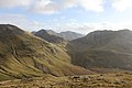 Intersection of Benbaun, Bencollaghduff and Benbreen (from Muckanaght).jpg 1.024 × 683; 441 KB
-

-
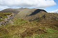
 Pass of Ballaghbema. Co. Kerry Ireland.jpg 1.067 × 840; 191 KB
-
 Pass on the Kerry Way - geograph.org.uk - 450283.jpg 640 × 427; 120 KB
-
 Priest's Leap - geograph.org.uk - 244996.jpg 640 × 480; 69 KB
-
 Priest's Leap. - geograph.org.uk - 249332.jpg 640 × 480; 76 KB
-
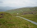
 R575 road - geograph.org.uk - 263626.jpg 640 × 480; 104 KB
-

-
 Sheep near the Kerry Way pass - geograph.org.uk - 451275.jpg 640 × 446; 146 KB
-
 Sign-1010424, Dingle Peninsula, Co. Kerry, Ireland.jpg 4.896 × 3.672; 1,24 MB
-

-
 The Gap - geograph.org.uk - 234237.jpg 640 × 480; 71 KB
-
 Ballahghacaherren - geograph.org.uk - 263742.jpg 640 × 480; 100 KB
-
 Barnancleeve - geograph.org.uk - 242912.jpg 640 × 480; 52 KB
-
 Connor Hill Pass - geograph.org.uk - 259753.jpg 640 × 480; 118 KB
-
 Firkeel Gap - geograph.org.uk - 263723.jpg 640 × 480; 90 KB
-
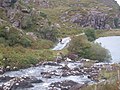 Gap of Dunloe - geograph.org.uk - 305580.jpg 640 × 480; 114 KB
-
 South of the pass on the Kerry Way - geograph.org.uk - 450314.jpg 439 × 640; 127 KB
-
 The Gap - geograph.org.uk - 235678.jpg 640 × 480; 113 KB
-
 The Goat's Path - geograph.org.uk - 270927.jpg 640 × 480; 86 KB
-

-
 View over the Bridia Valley - geograph.org.uk - 451316.jpg 640 × 427; 126 KB
-
 Windy Gap - geograph.org.uk - 446747.jpg 640 × 480; 66 KB


.jpg)


