Category:Murrieta, California
Пређи на навигацију
Пређи на претрагу
city in southwestern Riverside County, California, United States of America   | |||||
| Отпремање медија | |||||
| Је | |||||
|---|---|---|---|---|---|
| Локација | Округ Риверсајд, Калифорнија, Pacific States Region | ||||
| Председник владе |
| ||||
| Настанак |
| ||||
| Насељеност |
| ||||
| Површина |
| ||||
| Надморска висина |
| ||||
| званични веб-сајт | |||||
 | |||||
Поткатегорије
Приказано је 9 поткатегорија; укупно 9.
C
- Cole Canyon Natural Park (10 F)
F
- Falcons View Park (8 F)
G
- Glen Arbor Park (4 F)
M
- Minerals of Murrieta (3 F)
- Murrieta Creek (26 F)
- Murrieta Hogbacks (7 F)
W
- Tyler Wade (5 F)
- Warm Springs Park and Preserve (35 F)
Медији у категорији „Murrieta, California”
Следећих 34 датотека је у овој категорији, од укупно 34.
-
 1-window-cleaning-murrieta-ca.jpg 1.024 × 716; 170 kB
-
 99 cents only store.jpg 640 × 480; 146 kB
-
 Big Lots.jpg 640 × 480; 153 kB
-
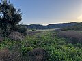
 By the Foothills of Santa Rosa Plateau.jpg 8.064 × 6.048; 24,78 MB
-
 California Buckwheat - Murrieta, California.jpg 6.048 × 8.064; 8,42 MB
-
 Chaparral Yucca, Black Sage, and Deerweed in Bloom.jpg 5.554 × 7.405; 19,79 MB
-
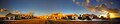
 Cole Canyon Panorama - Murrieta, California.jpg 27.838 × 7.544; 26,84 MB
-
 Flag of Murrieta, California.gif 360 × 216; 33 kB
-
 Foothills of Santa Ana Mountains - Murrieta, California.jpg 8.064 × 6.048; 38,04 MB
-
 Half Moon Circle.jpg 1.535 × 312; 404 kB
-
 Inland Valley Looking East From Santa Ana Mountains.jpg 8.064 × 6.048; 30,18 MB
-
 Inland Valley Looking Southeast From Santa Ana Mountains.jpg 8.064 × 6.048; 28,27 MB
-
 Interstate 15 southbound entering Temecula Valley.jpg 2.532 × 1.960; 700 kB
-
 Interstate 215 Interstate 15 Junction.jpg 4.272 × 2.848; 4,75 MB
-
 Juan Murrieta (cropped).jpg 584 × 618; 43 kB
-
 Juan Murrieta.jpg 620 × 849; 50 kB
-
 Keller Road - French Valley, Menifee, etc. 1.jpg 4.032 × 3.024; 9,73 MB
-
 Keller Road - French Valley, Menifee, etc. 2.jpg 8.064 × 6.048; 17,05 MB
-
 Keller Road - French Valley, Menifee, etc. 3.jpg 8.064 × 6.048; 14,06 MB
-
 Loma Linda University Medical Center - Murrieta, California.jpg 2.048 × 1.536; 5,41 MB
-
 Looking east across I-15 in Murrieta, California.jpg 8.064 × 6.048; 25,27 MB
-
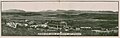
 Murrieta, California (circa 1915).webp 1.057 × 627; 290 kB
-
 Murrieta, California City Hall.jpg 2.048 × 2.048; 5,9 MB
-
 Murrieta, California Panorama from Santa Ana Mountains.jpg 20.616 × 7.844; 32,69 MB
-
 Murrieta, United States (Unsplash).jpg 3.642 × 3.642; 1,14 MB
-
 Murrieta-kalmia.jpg 500 × 333; 81 kB
-
 Murrieta01.JPG 1.024 × 768; 145 kB
-
 MVHS Logo on field.jpg 400 × 266; 41 kB
-
 Palomar Mountain from Gateway Hill, Murrieta.jpg 7.952 × 5.964; 18,62 MB
-
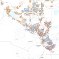 Race and ethnicity 2020 Murrieta, CA.png 2.400 × 2.404; 2,72 MB
-
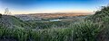
 Remote View of Santa Rosa Plateau from Murrieta, CA.jpg 8.064 × 6.048; 32,16 MB
-
 Seal of the City of Murrieta.png 2.048 × 2.048; 2,82 MB
-
-
 Wildomar and Greer Ranch Murrieta.jpg 8.064 × 6.048; 19,78 MB


.jpg)


.webp)

.jpg)


