Category:Namasia District, Kaohsiung
Jump to navigation
Jump to search
English: The Namasia District is a district level administrative division in Kaohsiung City, Taiwan. Its predecessor was called "Sanmin Township" that only existed between 1948 and 2008. "Namasia" is the word of Tsou language that means "Nanzihsien River" (or called "Nanzixian River").
日本語: 那瑪夏区は、台湾高雄市に位置する市轄区。那瑪夏はツォウ語の「楠梓仙渓」を意味している。高雄県と高雄市を合併前の郷級行政区の名称は「三民郷」、1948年から2008年の間に存在した那瑪夏区の旧称である。
中文(臺灣):那瑪夏區是臺灣高雄市轄下的一個區。其前身叫「三民鄉」,存在於1948年至2008年間的用名;經高雄縣市合併後,今已稱為那瑪夏區。那瑪夏在鄒語的意思中是「楠梓仙溪」。
district of Kaohsiung, Taiwan   | |||||
| Upload media | |||||
| Instance of |
| ||||
|---|---|---|---|---|---|
| Location |
| ||||
| Area |
| ||||
| Elevation above sea level |
| ||||
| official website | |||||
 | |||||
Subcategories
This category has the following 4 subcategories, out of 4 total.
D
H
N
Media in category "Namasia District, Kaohsiung"
The following 29 files are in this category, out of 29 total.
-
 Afternoon view of Mangacun surrounded by misty mountains on 1st October 2020.jpg 4,000 × 3,000; 2.46 MB
-
 Destroyed Namasia Township Office after 88 flood.JPG 4,000 × 3,000; 3.3 MB
-
 Gongyuan Bridge 公園橋 - panoramio.jpg 6,000 × 4,000; 4.99 MB
-
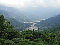
 Namasia 那瑪夏 - panoramio.jpg 5,904 × 3,936; 5.66 MB
-
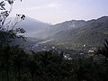
 Namasia, Kaohsiung.jpg 1,280 × 960; 1.34 MB
-
 Nanzihsian River through the canyon.jpg 3,000 × 4,000; 7.37 MB
-
 Overview of the Kanakanavu tribe of Maia (cropped).jpg 2,048 × 293; 459 KB
-
 Overview of the Kanakanavu tribe of Maia.jpg 2,048 × 1,536; 1.29 MB
-
 Sacred Bird of Bunun 布農聖鳥 - panoramio.jpg 5,058 × 3,372; 2.85 MB
-
 US Navy photo 090819-N-WJ771-275 Typhoon Morakot response .jpg 3,595 × 2,568; 2.4 MB
-
 US Navy photo 090819-N-WJ771-286 Morakot relief.jpg 2,569 × 1,835; 1.19 MB
-
 View south towards Mangacun from Qingshan Industrial Road, on 1st October 2020.jpg 4,000 × 3,000; 2.27 MB
-
 勝利大樓 Victory Building - panoramio.jpg 5,728 × 3,818; 5.22 MB
-
 南沙魯橋 Nanshalu Bridge - panoramio.jpg 4,093 × 3,070; 3.06 MB
-
 基路伯大門 Cherub Gate - panoramio (1).jpg 4,384 × 3,288; 4.03 MB
-
 基路伯大門 Cherub Gate - panoramio.jpg 4,452 × 3,338; 4.34 MB
-
 大光巷 Daguang Lane - panoramio.jpg 6,000 × 4,000; 7.16 MB
-
 天池 Tianchi Pond - panoramio (1).jpg 6,000 × 4,000; 5.97 MB
-
 天池 Tianchi Pond - panoramio.jpg 4,000 × 6,000; 7.97 MB
-
 山棕月語 木頭椅子 20161025.jpg 2,816 × 1,880; 1.23 MB
-
 立君亭 Lijun Gazebo - panoramio (1).jpg 6,000 × 4,000; 11.19 MB
-
 立君亭 Lijun Gazebo - panoramio.jpg 6,000 × 4,000; 10.63 MB
-
 紅嘴黑鵯圖騰柱 Totem Pole of Black Bulbul - panoramio.jpg 3,400 × 2,550; 2.14 MB
-
 自強道路 Ziqiang Road - panoramio.jpg 3,894 × 2,921; 3.79 MB
-
 茶山道路 Chashan road - panoramio.jpg 5,830 × 3,886; 11.34 MB
-
 那瑪夏 Namasia - panoramio.jpg 5,325 × 3,550; 5.53 MB
-
 那瑪夏鄉88水災後場景.JPG 3,264 × 2,448; 2.64 MB
-
 錫安聖殿 Mt Zion Temple - panoramio.jpg 6,000 × 4,000; 9.09 MB
-
 鞍輪名山 Anlunming Mountain - panoramio.jpg 6,000 × 4,000; 4.11 MB


.jpg)


.jpg)


.jpg)


.jpg)