Category:Narborough, Norfolk
Jump to navigation
Jump to search
English: Narborough is a village of 1405 hectares in the Breckland district of Norfolk, England with a population of 1095 as of the 2001 census. It is situated in the Nar Valley, with the river Nar flowing through on its way to the River Great Ouse.
village and civil parish in Norfolk, England  | |||||
| Upload media | |||||
| Instance of | |||||
|---|---|---|---|---|---|
| Location | Breckland, Norfolk, East of England, England | ||||
| Area |
| ||||
 | |||||
Subcategories
This category has the following 7 subcategories, out of 7 total.
A
N
- Narborough arms (6 F)
- Narborough Hall, Norfolk (4 F)
- Narborough Railway Line (4 F)
Media in category "Narborough, Norfolk"
The following 200 files are in this category, out of 255 total.
(previous page) (next page)-

-

-

-

-

-
 A47 near Chalk Farm - geograph.org.uk - 4673654.jpg 640 × 480; 458 KB
-

-
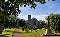 All Saints Church - geograph.org.uk - 3972479.jpg 1,600 × 1,000; 585 KB
-
 All Saints church, Narborough - geograph.org.uk - 2980407.jpg 640 × 479; 91 KB
-
 All Saints church, Narborough - geograph.org.uk - 2980417.jpg 480 × 640; 70 KB
-
 All Saints church, Narborough - geograph.org.uk - 2980420.jpg 640 × 480; 71 KB
-
 All Saints church, Narborough - geograph.org.uk - 2980425.jpg 438 × 640; 74 KB
-
 All Saints church, Narborough - geograph.org.uk - 2980438.jpg 480 × 640; 112 KB
-
 All Saints' church, Narborough - geograph.org.uk - 4996612.jpg 3,696 × 2,448; 2.3 MB
-

-

-
 Avenue of windblown trees - geograph.org.uk - 2162459.jpg 480 × 640; 271 KB
-
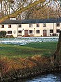 Barge Cottages - geograph.org.uk - 1638867.jpg 480 × 640; 159 KB
-

-
 Bridge, demolished - geograph.org.uk - 2162470.jpg 640 × 480; 283 KB
-
 Broad-leaved plantain (Plantago major) - geograph.org.uk - 5427995.jpg 637 × 640; 450 KB
-
 Broad-leaved plantain (Plantago major) - geograph.org.uk - 5427997.jpg 619 × 640; 444 KB
-
 Bungalow at Lower Farm, Narborough - geograph.org.uk - 2162520.jpg 640 × 480; 162 KB
-
 Catnip (Nepeta spec) - geograph.org.uk - 5427960.jpg 640 × 480; 513 KB
-
 Catnip (Nepeta spec) - geograph.org.uk - 5427962.jpg 640 × 480; 518 KB
-
 Centaurea spec - geograph.org.uk - 5428156.jpg 640 × 589; 321 KB
-
 Centaurea spec - geograph.org.uk - 5428159.jpg 640 × 606; 425 KB
-
 Chalk Farm, Squashes a Speciality - geograph.org.uk - 6124545.jpg 3,456 × 2,592; 3.87 MB
-
 Chalk Lane - geograph.org.uk - 5002038.jpg 2,140 × 1,380; 2.01 MB
-
 Chalk Lane - geograph.org.uk - 5002050.jpg 2,118 × 1,338; 1.66 MB
-
 Chalk Lane in Starknaked Plantation - geograph.org.uk - 5002158.jpg 2,256 × 1,496; 2.54 MB
-
 Chickens on the lawn - geograph.org.uk - 2162370.jpg 640 × 480; 130 KB
-
 Converted chapel in Main Road - geograph.org.uk - 1637653.jpg 640 × 480; 89 KB
-

-

-
 Cows grazing in the late afternoon sunshine - geograph.org.uk - 4363090.jpg 1,024 × 768; 191 KB
-

-
 Crop of maize at Narborough Field - geograph.org.uk - 2162497.jpg 640 × 480; 132 KB
-

-

-
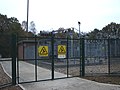 Danger of death - geograph.org.uk - 594286.jpg 600 × 450; 123 KB
-
 Dead trees and a pile of fertiliser - geograph.org.uk - 4486360.jpg 640 × 427; 59 KB
-
 Dianthus spec - geograph.org.uk - 5429394.jpg 640 × 610; 551 KB
-
 Dianthus spec - geograph.org.uk - 5429396.jpg 640 × 640; 332 KB
-
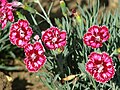 Dianthus spec - geograph.org.uk - 5429398.jpg 640 × 480; 295 KB
-
 Dismantled railway bridge - geograph.org.uk - 2162511.jpg 640 × 480; 178 KB
-
 Eastbound A47 at Chalk Farm - geograph.org.uk - 4617200.jpg 640 × 480; 396 KB
-

-
 Eastbound A47 near Narborough - geograph.org.uk - 4619373.jpg 640 × 480; 332 KB
-

-
 Evergreen tree by Fincham Drove - geograph.org.uk - 4486370.jpg 427 × 640; 110 KB
-
 Eye in the sky by Fincham Drove - geograph.org.uk - 4486363.jpg 640 × 427; 38 KB
-
 Farm buildings off the A47 - geograph.org.uk - 6124539.jpg 3,456 × 2,592; 3.92 MB
-
 Farm north of the River Nar - geograph.org.uk - 1639008.jpg 640 × 493; 147 KB
-
 Farm track through Narborough Field - geograph.org.uk - 2162492.jpg 640 × 480; 95 KB
-
 Feeders in pasture beside a farm track - geograph.org.uk - 2162533.jpg 640 × 457; 139 KB
-

-
 Fishing lake north of the A47 road - geograph.org.uk - 1745976.jpg 640 × 480; 211 KB
-

-
 Footpath at the end of River Close - geograph.org.uk - 1638095.jpg 480 × 640; 149 KB
-
 Footpath beside the River Nar - geograph.org.uk - 4363116.jpg 1,024 × 768; 466 KB
-
 Footpath past Lower Farm - geograph.org.uk - 2162518.jpg 640 × 460; 174 KB
-
 Footpath to River Close - geograph.org.uk - 1638848.jpg 640 × 468; 159 KB
-
 Foxglove (Digitalis purpurea) - geograph.org.uk - 5427978.jpg 540 × 640; 267 KB
-
 Foxglove (Digitalis purpurea) - geograph.org.uk - 5427980.jpg 569 × 640; 286 KB
-
 Foxglove (Digitalis purpurea) - geograph.org.uk - 5427982.jpg 537 × 640; 257 KB
-
 Foxglove (Digitalis purpurea) - geograph.org.uk - 5427984.jpg 492 × 640; 254 KB
-
 Foxglove (Digitalis purpurea) - geograph.org.uk - 5427985.jpg 480 × 640; 245 KB
-
 Foxglove (Digitalis purpurea) - geograph.org.uk - 5427988.jpg 485 × 640; 216 KB
-
 Foxgloves (Digitalis purpurea) - geograph.org.uk - 5427976.jpg 640 × 632; 660 KB
-
 Foxgloves (Digitalis purpurea) - geograph.org.uk - 5427977.jpg 480 × 640; 474 KB
-
 Frozen pond by the churchyard - geograph.org.uk - 1637746.jpg 640 × 480; 152 KB
-
 Gated entrance to Agricultural land - geograph.org.uk - 6124543.jpg 3,456 × 2,592; 3.85 MB
-

-
 Graffiti underneath A47 road bridge - geograph.org.uk - 1746002.jpg 640 × 480; 97 KB
-

-

-
 Hairpins in undergrowth, Narborough.jpg 2,848 × 2,136; 1.42 MB
-
 Hairpins, Narborough.jpg 2,848 × 2,136; 1.43 MB
-
 Harebells (Campanula rotundifolia) - geograph.org.uk - 2576739.jpg 480 × 640; 244 KB
-

-

-

-

-

-
 Hosta (Hosta) - foliage - geograph.org.uk - 5429388.jpg 640 × 615; 369 KB
-
 Hosta (Hosta) - foliage - geograph.org.uk - 5429391.jpg 640 × 603; 367 KB
-

-
 Inscription on the Narborough Field memorial - geograph.org.uk - 6027009.jpg 1,648 × 1,415; 891 KB
-
 Irrigator pipes waiting for dry weather - geograph.org.uk - 2162347.jpg 640 × 480; 159 KB
-

-

-
 Lady's Mantle (Alchemilla mollis) - geograph.org.uk - 5425719.jpg 640 × 622; 523 KB
-
 Lady's Mantle (Alchemilla mollis) - geograph.org.uk - 5425720.jpg 640 × 591; 486 KB
-
 Lavender (Lavandula officinalis) - geograph.org.uk - 5429370.jpg 640 × 592; 594 KB
-
 Lavender (Lavandula officinalis) - geograph.org.uk - 5429371.jpg 640 × 597; 556 KB
-
 Lavender (Lavandula officinalis) - geograph.org.uk - 5429373.jpg 640 × 591; 493 KB
-
 Lavender (Lavandula officinalis) - geograph.org.uk - 5429374.jpg 640 × 604; 543 KB
-
 Lavender (Lavandula officinalis) - geograph.org.uk - 5429376.jpg 640 × 599; 568 KB
-
 Lay-by by Tithe Spinney - geograph.org.uk - 2162542.jpg 640 × 480; 124 KB
-
 Layby on the A47 near to Narborough - geograph.org.uk - 4645060.jpg 640 × 480; 465 KB
-
 Life belt by pond - geograph.org.uk - 1637750.jpg 640 × 456; 184 KB
-
 Logs beside the Nar Valley Way - geograph.org.uk - 1745993.jpg 640 × 480; 144 KB
-
 Lorry coming round the bend - geograph.org.uk - 2162543.jpg 640 × 499; 90 KB
-
 Lower Farm, Narborough - geograph.org.uk - 2162522.jpg 640 × 480; 115 KB
-
 Memorial at Narborough Field - geograph.org.uk - 6026502.jpg 2,680 × 2,444; 2.06 MB
-

-

-
 House south of All Saints Church - geograph.org.uk - 1637761.jpg 640 × 480; 144 KB
-
 Narborough - All Saints Church - geograph.org.uk - 5620920.jpg 5,184 × 2,920; 1,020 KB
-
 Narborough All Saints church - geograph.org.uk - 3918331.jpg 640 × 480; 65 KB
-
 Narborough Community Centre - geograph.org.uk - 2162477.jpg 640 × 480; 126 KB
-
 Narborough Crossing Cottage 2.jpg 4,032 × 3,024; 3.28 MB
-
 Narborough Crossing Cottage.jpg 4,032 × 3,024; 3.05 MB
-
 Narborough Hall, a WW1 V.A.D. hospital - geograph.org.uk - 5798230.jpg 3,456 × 2,592; 3.91 MB
-
 Narborough Heritage Centre - geograph.org.uk - 1637657.jpg 640 × 495; 102 KB
-
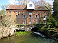
 Narborough Mill - geograph.org.uk - 1637733.jpg 640 × 494; 126 KB
-
 Narborough Mill - geograph.org.uk - 1637734.jpg 501 × 640; 140 KB
-
 Narborough Mill - geograph.org.uk - 1637736.jpg 510 × 640; 130 KB
-
 Narborough Mill - geograph.org.uk - 2980447.jpg 640 × 480; 121 KB
-
 Narborough Railway Bridge MTD 2349 remains 5.jpg 7,360 × 4,912; 9.09 MB
-
 Narborough Railway Line walk - geograph.org.uk - 2576514.jpg 640 × 480; 219 KB
-

-
 Narborough railway walk - geograph.org.uk - 630656.jpg 640 × 480; 113 KB
-
 Narborough Railway Walk 2.jpg 7,360 × 4,912; 12.88 MB
-
 Narborough Trout Farm creek - geograph.org.uk - 422068.jpg 420 × 640; 92 KB
-
 Narborough Trout Farm Foresters Lake - geograph.org.uk - 422079.jpg 640 × 512; 99 KB
-
 Narborough Village Sign - geograph.org.uk - 4891746.jpg 3,063 × 2,297; 2.32 MB
-
 Narborough War Memorial - geograph.org.uk - 4891483.jpg 3,456 × 2,592; 3.94 MB
-
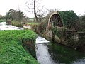
 Narborough Water Mill - geograph.org.uk - 3619316.jpg 640 × 476; 103 KB
-
 Narborough WW2 memorial in All Saints church - geograph.org.uk - 6026500.jpg 3,264 × 2,448; 1.67 MB
-
 Narborough, Chalk Lane - geograph.org.uk - 4628110.jpg 640 × 480; 451 KB
-
 Narborough, Denny's Walk - geograph.org.uk - 4619386.jpg 640 × 480; 415 KB
-
 Narbourough Watermill 22 04 2010.JPG 4,000 × 3,000; 2.34 MB
-

-

-
 Nipplewort (Lapsana communis) - geograph.org.uk - 5428017.jpg 496 × 640; 450 KB
-
 Nipplewort (Lapsana communis) - geograph.org.uk - 5428019.jpg 640 × 583; 205 KB
-

-
 Old bone mill wheel - geograph.org.uk - 630819.jpg 640 × 480; 103 KB
-
 Old building - geograph.org.uk - 754595.jpg 480 × 640; 130 KB
-
 Old railway embankment, Narborough - geograph.org.uk - 2576746.jpg 640 × 480; 228 KB
-
 Opium poppies (Papaver somniferum) - geograph.org.uk - 5427968.jpg 640 × 528; 280 KB
-
 Opium poppy (Papaver somniferum) - geograph.org.uk - 5427966.jpg 637 × 640; 237 KB
-
 Opium poppy (Papaver somniferum) - geograph.org.uk - 5427970.jpg 635 × 640; 136 KB
-
 Opium poppy (Papaver somniferum) - geograph.org.uk - 5427971.jpg 640 × 623; 294 KB
-

-
 Pasture south of the River Nar - geograph.org.uk - 1638958.jpg 640 × 512; 141 KB
-
 Pastures south of the River Nar - geograph.org.uk - 1639000.jpg 640 × 490; 126 KB
-

-
 Path to Narborough - geograph.org.uk - 2162526.jpg 480 × 640; 188 KB
-
 Petty spurge (Euphorbia peplus) - geograph.org.uk - 5428041.jpg 610 × 640; 531 KB
-
 Petty spurge (Euphorbia peplus) - geograph.org.uk - 5428042.jpg 638 × 640; 302 KB
-
 Petty spurge (Euphorbia peplus) - geograph.org.uk - 5428044.jpg 640 × 629; 374 KB
-
 Petty spurge (Euphorbia peplus) - geograph.org.uk - 5428046.jpg 640 × 589; 489 KB
-
 Pond south-west of All Saints Church - geograph.org.uk - 1637741.jpg 640 × 480; 191 KB
-

-
 Public footpath past Lower Farm - geograph.org.uk - 2162523.jpg 640 × 480; 141 KB
-
 Public footpath to Narborough - geograph.org.uk - 2162537.jpg 640 × 574; 133 KB
-
 Public footpath to Narborough Common - geograph.org.uk - 2162536.jpg 537 × 640; 170 KB
-
 Pump house at Lower Farm, Narborough - geograph.org.uk - 2162529.jpg 640 × 480; 96 KB
-
 Pump house beside the path - geograph.org.uk - 2162528.jpg 640 × 601; 197 KB
-
 Railway Line Nature Reserve, Narborough - geograph.org.uk - 2576536.jpg 640 × 480; 270 KB
-
 Railway walk, Narborough - geograph.org.uk - 2576532.jpg 640 × 480; 228 KB
-
 Railway walk, Narborough - geograph.org.uk - 2576750.jpg 640 × 480; 236 KB
-
 Remains of Narborough Bone Mill - geograph.org.uk - 2109040.jpg 640 × 480; 132 KB
-
 Restricted byway - geograph.org.uk - 777673.jpg 640 × 480; 117 KB
-
 RFC Narborough WW1 aerodrome - memorial plaque - geograph.org.uk - 5424056.jpg 2,000 × 1,500; 3.05 MB
-
 RFC Narborough WW1 aerodrome - memorial plaque - geograph.org.uk - 5424061.jpg 2,000 × 1,500; 3.13 MB
-
 Rich marshland beside the River Nar - geograph.org.uk - 4363102.jpg 1,024 × 768; 275 KB
-
 River Nar 22 04 2010.JPG 3,000 × 4,000; 2.31 MB
-
 Rosehips beside the path - geograph.org.uk - 2576740.jpg 480 × 640; 265 KB
-
 Sage (Salvia officinalis) - geograph.org.uk - 5427956.jpg 640 × 560; 613 KB
-
 Sage (Salvia officinalis) - geograph.org.uk - 5427957.jpg 640 × 619; 558 KB
-
 Sage (Salvia officinalis) - geograph.org.uk - 5427958.jpg 640 × 597; 515 KB
-
 Sage (Salvia officinalis) - geograph.org.uk - 5427959.jpg 640 × 480; 494 KB
-
 Scarlet pimpernel (Anagallis arvensis) - geograph.org.uk - 5427952.jpg 640 × 613; 264 KB
-
 Scarlet pimpernel (Anagallis arvensis) - geograph.org.uk - 5427953.jpg 640 × 624; 304 KB
-
 Scarlet pimpernel (Anagallis arvensis) - geograph.org.uk - 5427954.jpg 640 × 589; 310 KB
-
 Scarlet pimpernel (Anagallis arvensis) - geograph.org.uk - 5427955.jpg 635 × 640; 266 KB
-

-

-
 Ship Public House Narborough 22 04 2010 (1).JPG 4,000 × 3,000; 2.6 MB
-

-

-
 Slender Pearlwort (Sagina apetala) - geograph.org.uk - 5425739.jpg 640 × 590; 581 KB
-
 Slender Pearlwort (Sagina apetala) - geograph.org.uk - 5425740.jpg 639 × 640; 404 KB
-
 Slender Pearlwort (Sagina apetala) - geograph.org.uk - 5425742.jpg 635 × 640; 530 KB
-

-

-
 Stemless thistle (Cirsium acaule) - geograph.org.uk - 2576552.jpg 640 × 480; 349 KB
-
 Stemless thistle (Cirsium acaule) - geograph.org.uk - 2576555.jpg 591 × 640; 393 KB
-
 Sugar beet at Narborough Field - geograph.org.uk - 2162486.jpg 640 × 480; 126 KB
-

-

-

-

-
 The face of the pill box - geograph.org.uk - 754613.jpg 640 × 480; 156 KB
-
 The maltings in Narborough village - geograph.org.uk - 1638904.jpg 640 × 480; 103 KB
-
 The maltings in Narborough village - geograph.org.uk - 1638905.jpg 640 × 480; 97 KB


_-_geograph.org.uk_-_5427995.jpg)
_-_geograph.org.uk_-_5427997.jpg)

_-_geograph.org.uk_-_5427960.jpg)
_-_geograph.org.uk_-_5427962.jpg)


_-_geograph.org.uk_-_5429355.jpg)
_-_geograph.org.uk_-_5429359.jpg)

_-_geograph.org.uk_-_5429353.jpg)


_crossing_former_Lynn_and_Dereham_Railway_-_geograph.org.uk_-_4485822.jpg)

_on_the_A47_near_Narborough_-_geograph.org.uk_-_4673668.jpg)


_-_geograph.org.uk_-_5427978.jpg)
_-_geograph.org.uk_-_5427980.jpg)
_-_geograph.org.uk_-_5427982.jpg)
_-_geograph.org.uk_-_5427984.jpg)
_-_geograph.org.uk_-_5427985.jpg)
_-_geograph.org.uk_-_5427988.jpg)
_-_geograph.org.uk_-_5427976.jpg)
_-_geograph.org.uk_-_5427977.jpg)


_-_geograph.org.uk_-_2576739.jpg)


_-_flower_-_geograph.org.uk_-_5427991.jpg)
_-_flower_-_geograph.org.uk_-_5427994.jpg)

_-_foliage_-_geograph.org.uk_-_5429388.jpg)
_-_foliage_-_geograph.org.uk_-_5429391.jpg)


_-_flowers_-_geograph.org.uk_-_5425727.jpg)
_-_flowers_-_geograph.org.uk_-_5425734.jpg)
_-_geograph.org.uk_-_5425719.jpg)
_-_geograph.org.uk_-_5425720.jpg)
_-_geograph.org.uk_-_5429370.jpg)
_-_geograph.org.uk_-_5429371.jpg)
_-_geograph.org.uk_-_5429373.jpg)
_-_geograph.org.uk_-_5429374.jpg)
_-_geograph.org.uk_-_5429376.jpg)


_-_geograph.org.uk_-_5428017.jpg)
_-_geograph.org.uk_-_5428019.jpg)


_-_geograph.org.uk_-_5427968.jpg)
_-_geograph.org.uk_-_5427966.jpg)
_-_geograph.org.uk_-_5427970.jpg)
_-_geograph.org.uk_-_5427971.jpg)


_-_geograph.org.uk_-_5428041.jpg)
_-_geograph.org.uk_-_5428042.jpg)
_-_geograph.org.uk_-_5428044.jpg)
_-_geograph.org.uk_-_5428046.jpg)


_-_geograph.org.uk_-_5427956.jpg)
_-_geograph.org.uk_-_5427957.jpg)
_-_geograph.org.uk_-_5427958.jpg)
_-_geograph.org.uk_-_5427959.jpg)
_-_geograph.org.uk_-_5427952.jpg)
_-_geograph.org.uk_-_5427953.jpg)
_-_geograph.org.uk_-_5427954.jpg)
_-_geograph.org.uk_-_5427955.jpg)


.JPG)


_-_geograph.org.uk_-_5425739.jpg)
_-_geograph.org.uk_-_5425740.jpg)
_-_geograph.org.uk_-_5425742.jpg)


_-_geograph.org.uk_-_2576552.jpg)
_-_geograph.org.uk_-_2576555.jpg)

,_Layby_near_Narborough_-_geograph.org.uk_-_4673633.jpg)
_-_seed_pods_-_geograph.org.uk_-_5429361.jpg)
_-_seed_pods_-_geograph.org.uk_-_5429366.jpg)
_-_seed_pods_-_geograph.org.uk_-_5429368.jpg)


