Category:National Cycle Network route 658
Jump to navigation
Jump to search

Main Wikipedia article: National Cycle Network route 658.
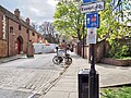
English: National Cycle Network route 658. A Sustrans route in York between Scarborough railway bridge and Tang Hall Lane bridge. It provides a connection between route 65 and route 66 through York city centre. The route is part of the Way of the Roses long-distance path.
cycling route in York, England, UK    | |||||
| Upload media | |||||
| Instance of | |||||
|---|---|---|---|---|---|
| Part of | |||||
| Location | York, City of York, North Yorkshire, Yorkshire and the Humber, England | ||||
| Connects with | |||||
| Length |
| ||||
| official website | |||||
| |||||
Subcategories
This category has the following 9 subcategories, out of 9 total.
A
B
D
H
- Hungate Bridge, York (19 F)
M
- Melrosegate bridge (3 F)
P
- Palmer Street, York (4 F)
S
T
- Tang Hall Lane bridge (5 F)
Media in category "National Cycle Network route 658"
The following 38 files are in this category, out of 38 total.
-
 A green corridor into York - geograph.org.uk - 3362991.jpg 3,264 × 2,448; 1.82 MB
-
 Black Swan Inn - geograph.org.uk - 1516772.jpg 640 × 480; 65 KB
-
 Foss Islands Path sign.jpg 3,077 × 4,103; 2.98 MB
-
 NCN 658 route off James Street York Apr24.jpg 4,356 × 3,267; 6.67 MB
-
 NCN 658 sign Aldwark York Apr24 01.jpg 4,587 × 3,440; 5.48 MB
-
 NCN 658 sign Aldwark York Apr24 02.jpg 4,425 × 3,319; 4.05 MB
-
 NCN 658 sign Aldwark York Apr24 03.jpg 4,608 × 3,456; 5.52 MB
-
 NCN 658 sign Aldwark York Apr24 04.jpg 4,534 × 3,401; 4.62 MB
-
 NCN 658 sign Aldwark York Apr24 05.jpg 4,435 × 3,326; 5.96 MB
-
 NCN 658 sign Black Horse Lane York Apr24 01.jpg 4,608 × 3,456; 6.06 MB
-
 NCN 658 sign Black Horse Lane York Apr24 02.jpg 4,454 × 3,341; 6.11 MB
-
 NCN 658 sign Bootham York Apr24.jpg 4,474 × 3,355; 5.05 MB
-
 NCN 658 sign Bootham York May24.jpg 4,608 × 3,456; 6.57 MB
-
 NCN 658 sign Deangate York Apr24 01.jpg 4,444 × 3,333; 5.35 MB
-
 NCN 658 sign Deangate York Apr24 02.jpg 4,494 × 3,370; 6.16 MB
-
 NCN 658 sign Duncombe Place York Apr24.jpg 4,514 × 3,386; 4.82 MB
-
 NCN 658 sign Foss Island Road York Apr24 01.jpg 4,587 × 3,440; 5.69 MB
-
 NCN 658 sign Foss Island Road York Apr24 02.jpg 4,583 × 3,437; 5.19 MB
-
 NCN 658 sign Foss Island Road York Apr24 03.jpg 4,368 × 3,276; 5.07 MB
-
 NCN 658 sign Foss Island Road York Apr24 04.jpg 4,587 × 3,440; 4.41 MB
-
 NCN 658 sign Foss Island Road York Apr24 05.jpg 4,514 × 3,386; 3.44 MB
-
 NCN 658 sign jnt St Leonard Place & Bootham York Apr24.jpg 4,566 × 3,424; 5.94 MB
-
 NCN 658 sign Minster Yard York Apr24 01.jpg 4,514 × 3,386; 5.54 MB
-
 NCN 658 sign Minster Yard York Apr24 02.jpg 4,251 × 3,188; 5.55 MB
-
 NCN 658 sign Minster Yard York Apr24 03.jpg 4,454 × 3,341; 5.75 MB
-
 NCN 658 sign Navigation Road York Apr24.jpg 4,494 × 3,370; 5.43 MB
-
 NCN 658 sign Peasholme Green York Apr24 01.jpg 4,396 × 3,297; 5.06 MB
-
 NCN 658 sign Peasholme Green York Apr24 02.jpg 4,504 × 3,378; 6.64 MB
-
 NCN 658 sign Peasholme Green York Apr24 03.jpg 4,597 × 3,448; 5.23 MB
-
 NCN 658 sign Peasholme Green York Apr24 04.jpg 4,608 × 3,456; 6.73 MB
-
 NCN 658 sign Rowntree Wharf York Apr24 01.jpg 4,484 × 3,363; 6.66 MB
-
 NCN 658 sign Rowntree Wharf York Apr24 02.jpg 4,484 × 3,363; 3.6 MB
-
 NCN 658 sign Rowntree Wharf York Apr24 03.jpg 4,349 × 3,262; 6.22 MB
-
 NCN Route Sign 658.svg 512 × 147; 26 KB
-
 One of York's less scenic spots - geograph.org.uk - 1130246.jpg 640 × 480; 87 KB
-
 Signs in Bootham York Apr24.jpg 1,918 × 3,411; 1.75 MB
-
 Start-of-NCN-658.jpg 1,500 × 1,500; 777 KB
-
 Temporary Ford - Route 66 - geograph.org.uk - 173703.jpg 479 × 640; 94 KB


