Category:National Cycle Network route 76
Jump to navigation
Jump to search
Cycle route in the United Kingdom    | |||||
| Upload media | |||||
| Instance of | |||||
|---|---|---|---|---|---|
| Part of | |||||
| Location |
| ||||
| |||||
Route: Berwick upon Tweed, Eyemouth, Dunbar, Haddington, Prestonpans, Musselburgh, Edinburgh, Queensferry, Falkirk, Stirling, Alloa, Kincardine, Valleyfield, Rosyth, Dalgety Bay, Kirkcaldy.
Media in category "National Cycle Network route 76"
The following 44 files are in this category, out of 44 total.
-
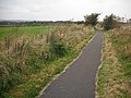
 "The Avenue" - geograph.org.uk - 41337.jpg 640 × 480; 179 KB
-
 2012 - panoramio (162).jpg 1,440 × 960; 1.03 MB
-
 Access road, Haughs of Airth - geograph.org.uk - 1726476.jpg 640 × 480; 95 KB
-
 Bellevue Road, Alloa - geograph.org.uk - 1758183.jpg 640 × 480; 88 KB
-
 Bridge over the River Carron - geograph.org.uk - 1721514.jpg 640 × 480; 58 KB
-
 Building a cycle path - geograph.org.uk - 1546905.jpg 640 × 480; 88 KB
-
 Cycle Path at Cambus Pools - geograph.org.uk - 172475.jpg 640 × 408; 140 KB
-
 Cycle path under the A91 - geograph.org.uk - 1748554.jpg 640 × 480; 138 KB
-
 Cycle path, Comely Bank - geograph.org.uk - 1760526.jpg 640 × 480; 77 KB
-
 Cycle path, Polmaise mineral line - geograph.org.uk - 1748544.jpg 640 × 480; 112 KB
-
 Cycleway - geograph.org.uk - 174764.jpg 640 × 480; 96 KB
-
 Cycleway - geograph.org.uk - 349215.jpg 640 × 424; 48 KB
-
 Cycleway - geograph.org.uk - 349430.jpg 640 × 424; 60 KB
-
 Forth Street, Kincardine - geograph.org.uk - 1546861.jpg 480 × 640; 93 KB
-
 Haddington Railway - geograph.org.uk - 1463942.jpg 640 × 480; 85 KB
-
 Haddington Railway - geograph.org.uk - 1464097.jpg 640 × 480; 131 KB
-
 Half Owre Half Owre to Aberdour... - geograph.org.uk - 44861.jpg 480 × 640; 110 KB
-
 Kinneil Wood - geograph.org.uk - 1627836.jpg 640 × 359; 113 KB
-
 Ladysneuk Road - geograph.org.uk - 1754710.jpg 640 × 480; 71 KB
-
 Longannet Railway and shoreline - geograph.org.uk - 1565835.jpg 640 × 480; 76 KB
-
 Lookaboutye Brae - geograph.org.uk - 991827.jpg 640 × 613; 137 KB
-
 Minor road and Cycleway - geograph.org.uk - 996813.jpg 640 × 426; 68 KB
-
 Minor road near Skinflats - geograph.org.uk - 636366.jpg 640 × 424; 30 KB
-
 National Cycle Network route 76 - geograph.org.uk - 1756585.jpg 640 × 480; 111 KB
-
 National Cycle Network route 76 - geograph.org.uk - 1756612.jpg 640 × 480; 129 KB
-
 National Cycle Network route 76 - geograph.org.uk - 1758153.jpg 640 × 480; 96 KB
-
 National Cycle Network route 76 - geograph.org.uk - 1758161.jpg 640 × 480; 137 KB
-
 National Cycle Network route 76 - geograph.org.uk - 1761054.jpg 640 × 480; 91 KB
-
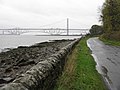
 National Cycle Route 76 - geograph.org.uk - 1609466.jpg 640 × 480; 167 KB
-
 National Cycle Route 76 - geograph.org.uk - 1609474.jpg 640 × 480; 133 KB
-
 National Cycle Route 76 at Culross - geograph.org.uk - 1036157.jpg 640 × 480; 86 KB
-
 NCN Route 76, Clackmannan - geograph.org.uk - 1760530.jpg 640 × 480; 91 KB
-
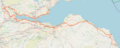 NCN-76 on OSM.png 2,996 × 1,202; 3.37 MB
-
 New bridge over A876 - geograph.org.uk - 996812.jpg 640 × 426; 54 KB
-
 Old alignment of the A907 - geograph.org.uk - 1754755.jpg 640 × 480; 95 KB
-
 Philpstoun from the canal - geograph.org.uk - 213896.jpg 640 × 480; 113 KB
-
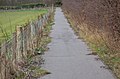
 Single track, National Cycle Route 76 - geograph.org.uk - 1475793.jpg 640 × 359; 109 KB
-
-
 Starleyburn - geograph.org.uk - 42942.jpg 480 × 640; 230 KB
-
 Subsidence, Haughs of Airth bridge - geograph.org.uk - 1726450.jpg 640 × 480; 80 KB
-
 The Goth. - geograph.org.uk - 33835.jpg 640 × 480; 67 KB
-
 Tunnel under railway - geograph.org.uk - 1358501.jpg 480 × 640; 133 KB
-
 Ward Street, Alloa - geograph.org.uk - 1760519.jpg 640 × 480; 100 KB
-
 Waterfall - geograph.org.uk - 1358492.jpg 480 × 640; 152 KB

.jpg)


