Category:Native American tribes in Nebraska
Zur Navigation springen
Zur Suche springen
Bundesstaaten der Vereinigten Staaten: Alabama · Alaska · Arizona · Arkansas · Colorado · Connecticut · Delaware · Florida · Idaho · Illinois · Indiana · Iowa · Kalifornien · Kansas · Louisiana · Maine · Maryland · Massachusetts · Michigan · Minnesota · Mississippi · Missouri · Montana · Nebraska · Nevada · New Hampshire · New Jersey · New Mexico · New York · North Carolina · North Dakota · Ohio · Oklahoma · Oregon · Pennsylvania · Rhode Island · South Carolina · South Dakota · Tennessee · Texas · Utah · Vermont · Virginia · Washington · West Virginia · Wisconsin · Wyoming
| Medium hochladen | |||||
| Unterklasse von |
| ||||
|---|---|---|---|---|---|
| |||||
Unterkategorien
Es werden 7 von insgesamt 7 Unterkategorien in dieser Kategorie angezeigt:
In Klammern die Anzahl der enthaltenen Kategorien (K), Seiten (S), Dateien (D)
Medien in der Kategorie „Native American tribes in Nebraska“
Folgende 14 Dateien sind in dieser Kategorie, von 14 insgesamt.
-

-
 Cheyenne and Arapaho territory (1851) and Pawnee territory with main settlements.png 1.468 × 904; 3,18 MB
-

-
 De Smet map of the 1851 Fort Laramie Indian territories (the light area). PNG.png 4.255 × 2.849; 20,73 MB
-
 Fort Laramie Treaty (1851). Definition of Crow territory west of Powder River enlarged.jpg 2.012 × 3.734; 1,94 MB
-
 Lakota 1851 treaty territory. (Area 408, 516, 584, 597, 598 and 632).png 1.790 × 1.438; 5,25 MB
-
 Map showing the route of the Omaha tribe during the last bison hunt, 1876.png 2.305 × 1.873; 7,96 MB
-
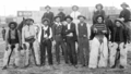 Nebraska Cowboys 1901.png 1.920 × 1.080; 1,49 MB
-
 Omaha tipi.jpg 672 × 885; 231 KB
-
 The area where the Pawnee captured the Sacred Arrows of the Cheyenne.jpg 2.041 × 999; 969 KB
-

-
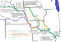
 The Ponca (Dhegiha) migration story according to oral tradition. (Map improved 2018).png 2.154 × 1.468; 1,57 MB
-
 The Ponca (Dhegiha) migration story.png 2.154 × 1.468; 1,78 MB
-
 Treaty of Fort Laramie (1851). Map (circa).png 2.185 × 2.790; 11,96 MB
_and_Pawnee_territory_with_main_settlements.png)
._1873-74._Massacre_Canyon_battle,_Nebraska.png)
._PNG.png)
._Definition_of_Crow_territory_west_of_Powder_River_enlarged.jpg)
.png)


.jpg)
_migration_story_according_to_oral_tradition._(Map_improved_2018).png)
_migration_story.png)
._Map_(circa).png)
._1843-44._The_return_of_a_sacred_arrow_of_the_Cheyenne.png)