Category:Naturschutzgebiet Stoltera
Jump to navigation
Jump to search
| Diese Kategorie repräsentiert ein Schutzgebiet nach Naturschutzrecht in Deutschland. |
|---|
| Diese Kategorie wurde nach einem klaren Schema angelegt, sie sollte nicht verschoben, gelöscht oder umkategorisiert werden. Sie ist unter anderem in dieser Uploadkarte hinterlegt. Beschreibung und Hintergründe auf der Seite des Wikiprojekts |
| Foto zu Wiki Loves Earth hochladen! - Seite von Wiki Loves Earth Deutschland |
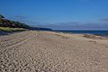
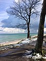
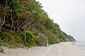
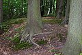
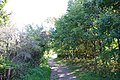
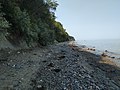
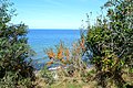
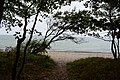
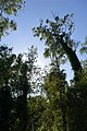
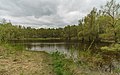
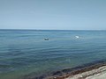
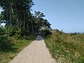
Deutsch: Naturschutzgebiet „Stoltera (bei Rostock)“, NSG N 11 in der Stadt Rostock, Mecklenburg-Vorpommern
nature reserve in Mecklenburg-Vorpommern, Germany  | |||||
| Upload media | |||||
| Instance of | |||||
|---|---|---|---|---|---|
| Named after | |||||
| Location | Rostock, Mecklenburg-Western Pomerania, Germany | ||||
| IUCN protected areas category | |||||
| Inception |
| ||||
| Area |
| ||||
 | |||||
Media in category "Naturschutzgebiet Stoltera"
The following 148 files are in this category, out of 148 total.
-
 2015 Stoltera 01.jpg 5,184 × 3,456; 3.38 MB
-
 2015 Stoltera 02.jpg 3,896 × 3,243; 1.92 MB
-
 2015 Stoltera 03.jpg 5,081 × 3,387; 3.11 MB
-
 2015 Stoltera 04.jpg 4,832 × 3,221; 2.69 MB
-
 2015 Stoltera 05.jpg 5,184 × 3,456; 3.01 MB
-
 2015 Stoltera 06.jpg 5,184 × 3,456; 4.01 MB
-
 2015 Stoltera 07.jpg 3,713 × 3,118; 2.49 MB
-
 Baum als Strandgut.jpg 4,592 × 3,056; 6.81 MB
-
 Baum am Meer.jpg 2,448 × 3,264; 2.83 MB
-
 Crab Movement (144718745).jpeg 1,280 × 1,280; 523 KB
-
 Kap Geinitzort Findlinge.jpg 4,912 × 3,264; 11.55 MB
-
 Küstenwald an der Stoltera.jpg 800 × 600; 467 KB
-
 Küstenwald Stoltera.jpg 4,000 × 3,000; 7.24 MB
-
 N 11 Stoltera - Blick zum Wasser.jpg 4,500 × 6,750; 5.6 MB
-
 N 11 Stoltera - Infotafel.jpg 4,500 × 3,000; 2.77 MB
-
 N 11 Stoltera - Küste(1).jpg 4,500 × 3,000; 3.3 MB
-
 N 11 Stoltera - Küste(2).jpg 4,500 × 3,000; 4.05 MB
-
 N 11 Stoltera - Küste(3).jpg 4,500 × 3,000; 5.96 MB
-
 N 11 Stoltera - Küste(4).jpg 4,500 × 3,000; 3.75 MB
-
 N 11 Stoltera - Küste(5).jpg 4,500 × 3,000; 3.4 MB
-
 N 11 Stoltera - Küste(6).jpg 4,500 × 6,750; 5.41 MB
-
 N 11 Stoltera - Küstenwald (1).jpg 4,500 × 6,750; 8.2 MB
-
 N 11 Stoltera - Küstenwald (10).jpg 4,500 × 3,000; 6.95 MB
-
 N 11 Stoltera - Küstenwald (2).jpg 4,500 × 6,750; 7.87 MB
-
 N 11 Stoltera - Küstenwald (3).jpg 4,500 × 6,750; 7.94 MB
-
 N 11 Stoltera - Küstenwald (4).jpg 4,500 × 3,000; 4.7 MB
-
 N 11 Stoltera - Küstenwald (5).jpg 4,500 × 6,750; 7.76 MB
-
 N 11 Stoltera - Küstenwald (6).jpg 4,500 × 6,750; 8.26 MB
-
 N 11 Stoltera - Küstenwald (7).jpg 4,500 × 6,750; 7.56 MB
-
 N 11 Stoltera - Küstenwald (8).jpg 4,500 × 6,750; 8.59 MB
-
 N 11 Stoltera - Küstenwald (9).jpg 4,500 × 3,000; 3.91 MB
-
 N 11 Stoltera - Steilküste (1).jpg 4,500 × 3,000; 5.15 MB
-
 N 11 Stoltera - Steilküste (2).jpg 4,500 × 3,000; 4.45 MB
-
 N 11 Stoltera - Steilküste (3).jpg 4,500 × 3,000; 3.88 MB
-
 N 11 Stoltera - Steilküste (4).jpg 4,500 × 3,000; 4.16 MB
-
 N 11 Stoltera - Steilküste (5).jpg 4,500 × 3,000; 4.48 MB
-
 N 11 Stoltera - Steilküste (6).jpg 4,500 × 6,750; 7.16 MB
-
 N 11 Stoltera - Steilküste (7).jpg 4,500 × 3,000; 4.41 MB
-
 N 11 Stoltera - Steilküste (8).jpg 4,500 × 3,000; 4.71 MB
-
 N 11 Stoltera - Steilküste (9).jpg 4,500 × 3,000; 4.07 MB
-
 N 11 Stoltera - Strandaufgang.jpg 4,500 × 3,000; 4.9 MB
-
 N 11 Stoltera - Weg (1).jpg 4,500 × 6,750; 10.58 MB
-
 N 11 Stoltera - Weg (2).jpg 4,500 × 3,000; 4.64 MB
-
 Naturschutzgebiet Stoltera.jpg 4,000 × 3,000; 5.93 MB
-
 NSG Stoltera - Blick vom Steilufer (westlicher Teil) (1).jpg 5,956 × 3,960; 6.08 MB
-
 NSG Stoltera - Blick vom Steilufer (westlicher Teil) (2).jpg 3,876 × 5,830; 5.84 MB
-
 NSG Stoltera - Blick vom Steilufer (westlicher Teil) (3).jpg 5,941 × 3,950; 5.83 MB
-
 NSG Stoltera - Blick vom Steilufer (westlicher Teil) (4).jpg 5,966 × 3,966; 5.82 MB
-
 NSG Stoltera - Blick vom Steilufer (westlicher Teil) (5).jpg 5,917 × 3,934; 5.97 MB
-
 NSG Stoltera - Blick vom Steilufer (westlicher Teil) (6).jpg 5,552 × 3,744; 5.23 MB
-
 NSG Stoltera - Blick vom Steilufer (westlicher Teil) (7).jpg 5,651 × 3,768; 5.22 MB
-
 NSG Stoltera - Blick vom Steilufer (westlicher Teil) (8).jpg 5,883 × 3,912; 6.13 MB
-
 NSG Stoltera - Kreuzspinne (Araneus) (1).jpg 5,718 × 3,802; 5.89 MB
-
 NSG Stoltera - Küste im westlichen Teil (1).jpg 5,936 × 3,947; 5.8 MB
-
 NSG Stoltera - Küste im westlichen Teil (10).jpg 3,949 × 5,939; 5.76 MB
-
 NSG Stoltera - Küste im westlichen Teil (11).jpg 5,961 × 3,963; 6.11 MB
-
 NSG Stoltera - Küste im westlichen Teil (2).jpg 3,935 × 5,918; 4.99 MB
-
 NSG Stoltera - Küste im westlichen Teil (3).jpg 5,903 × 3,925; 6.15 MB
-
 NSG Stoltera - Küste im westlichen Teil (4).jpg 5,912 × 3,931; 5.93 MB
-
 NSG Stoltera - Küste im westlichen Teil (5).jpg 5,946 × 3,954; 6.04 MB
-
 NSG Stoltera - Küste im westlichen Teil (6).jpg 5,898 × 3,921; 5.95 MB
-
 NSG Stoltera - Küste im westlichen Teil (7).jpg 5,951 × 3,957; 5.87 MB
-
 NSG Stoltera - Küste im westlichen Teil (8).jpg 5,864 × 3,899; 7.2 MB
-
 NSG Stoltera - Küste im westlichen Teil (9).jpg 5,888 × 3,915; 6.15 MB
-
 NSG Stoltera - Küste im westlichen Teil - Blick nach Warnemünde (1).jpg 5,849 × 3,889; 6.56 MB
-
 NSG Stoltera - Küste im westlichen Teil - Blick nach Warnemünde (2).jpg 5,873 × 3,905; 6.81 MB
-
 NSG Stoltera - Küste im westlichen Teil - Gedenkstein (1).jpg 3,944 × 5,932; 7.29 MB
-
 NSG Stoltera - Küste im westlichen Teil - Schwäne (Cygnus) (1).jpg 5,927 × 3,941; 7.3 MB
-
 NSG Stoltera - Küste im westlichen Teil - Schwäne (Cygnus) (2).jpg 5,456 × 3,628; 5.75 MB
-
 NSG Stoltera - Küste im westlichen Teil - Schwäne (Cygnus) (3).jpg 5,956 × 3,960; 6.85 MB
-
 NSG Stoltera - Küste im westlichen Teil - Schwäne (Cygnus) (4).jpg 5,912 × 3,931; 6.73 MB
-
 NSG Stoltera - Küste im westlichen Teil - Schwäne (Cygnus) (5).jpg 4,705 × 3,128; 3.8 MB
-
 NSG Stoltera - Küste im westlichen Teil - Schwäne (Cygnus) (6).jpg 5,248 × 3,489; 4.77 MB
-
 NSG Stoltera - Küste im westlichen Teil - Schwäne (Cygnus) (7).jpg 5,010 × 3,331; 4.58 MB
-
 NSG Stoltera - Küste im westlichen Teil - Schwäne (Cygnus) (8).jpg 5,534 × 3,680; 5.64 MB
-
 NSG Stoltera - Küste im westlichen Teil - Steilküste (1).jpg 5,888 × 3,915; 5.8 MB
-
 NSG Stoltera - Küste im westlichen Teil - Steilküste (10).jpg 5,873 × 3,905; 6.21 MB
-
 NSG Stoltera - Küste im westlichen Teil - Steilküste (2).jpg 5,932 × 3,944; 6.99 MB
-
 NSG Stoltera - Küste im westlichen Teil - Steilküste (3).jpg 5,975 × 3,973; 6.83 MB
-
 NSG Stoltera - Küste im westlichen Teil - Steilküste (4).jpg 5,956 × 3,960; 6.25 MB
-
 NSG Stoltera - Küste im westlichen Teil - Steilküste (5).jpg 5,927 × 3,941; 6.07 MB
-
 NSG Stoltera - Küste im westlichen Teil - Steilküste (6).jpg 5,966 × 3,966; 5.86 MB
-
 NSG Stoltera - Küste im westlichen Teil - Steilküste (7).jpg 5,825 × 3,873; 5.74 MB
-
 NSG Stoltera - Küste im westlichen Teil - Steilküste (8).jpg 5,912 × 3,931; 6.73 MB
-
 NSG Stoltera - Küste im westlichen Teil - Steilküste (9).jpg 5,946 × 3,954; 6.27 MB
-
 NSG Stoltera - Küste im westlichen Teil - Zugangstreppe (1).jpg 3,930 × 5,910; 5.87 MB
-
 NSG Stoltera - Küste im westlichen Teil - Zugangstreppe (2).jpg 3,847 × 5,786; 5.82 MB
-
 NSG Stoltera - Mittlerer Teil (Wilhelmshöhe) - Blick von der Steilküste (1).jpg 5,864 × 3,899; 5.63 MB
-
 NSG Stoltera - Mittlerer Teil (Wilhelmshöhe) - Blick von der Steilküste (2).jpg 5,898 × 3,921; 5.95 MB
-
 NSG Stoltera - Mittlerer Teil (Wilhelmshöhe) - Blick von der Steilküste (3).jpg 3,925 × 5,903; 5.72 MB
-
 NSG Stoltera - Mittlerer Teil (Wilhelmshöhe) - Blick von der Steilküste (4).jpg 5,859 × 3,896; 6.03 MB
-
 NSG Stoltera - Mittlerer Teil (Wilhelmshöhe) - Blick von der Steilküste (5).jpg 3,804 × 5,721; 5.51 MB
-
 NSG Stoltera - Mittlerer Teil (Wilhelmshöhe) - Strandzugang (1).jpg 3,901 × 5,867; 6.04 MB
-
 NSG Stoltera - Mittlerer Teil (Wilhelmshöhe) - Strandzugang (2).jpg 3,944 × 5,932; 6.02 MB
-
 NSG Stoltera - Mittlerer Teil (Wilhelmshöhe) - Strandzugang (3).jpg 5,873 × 3,905; 5.7 MB
-
 NSG Stoltera - Mittlerer Teil (Wilhelmshöhe) - Strandzugang (4).jpg 5,898 × 3,921; 5.58 MB
-
 NSG Stoltera - Mittlerer Teil (Wilhelmshöhe) - Uferwald (1).jpg 3,905 × 5,874; 6.47 MB
-
 NSG Stoltera - Mittlerer Teil (Wilhelmshöhe) - Uferwald (10).jpg 5,898 × 3,921; 6.33 MB
-
 NSG Stoltera - Mittlerer Teil (Wilhelmshöhe) - Uferwald (11).jpg 3,891 × 5,852; 6.27 MB
-
 NSG Stoltera - Mittlerer Teil (Wilhelmshöhe) - Uferwald (12).jpg 5,941 × 3,950; 6.38 MB
-
 NSG Stoltera - Mittlerer Teil (Wilhelmshöhe) - Uferwald (13).jpg 5,626 × 3,741; 5.82 MB
-
 NSG Stoltera - Mittlerer Teil (Wilhelmshöhe) - Uferwald (14).jpg 3,857 × 5,801; 6.1 MB
-
 NSG Stoltera - Mittlerer Teil (Wilhelmshöhe) - Uferwald (15).jpg 5,903 × 3,925; 5.81 MB
-
 NSG Stoltera - Mittlerer Teil (Wilhelmshöhe) - Uferwald (16).jpg 5,743 × 3,818; 5.8 MB
-
 NSG Stoltera - Mittlerer Teil (Wilhelmshöhe) - Uferwald (17).jpg 5,883 × 3,912; 6.05 MB
-
 NSG Stoltera - Mittlerer Teil (Wilhelmshöhe) - Uferwald (18).jpg 3,915 × 5,888; 7.16 MB
-
 NSG Stoltera - Mittlerer Teil (Wilhelmshöhe) - Uferwald (19).jpg 3,901 × 5,867; 5.73 MB
-
 NSG Stoltera - Mittlerer Teil (Wilhelmshöhe) - Uferwald (2).jpg 3,910 × 5,881; 6.64 MB
-
 NSG Stoltera - Mittlerer Teil (Wilhelmshöhe) - Uferwald (20).jpg 5,835 × 3,879; 5.69 MB
-
 NSG Stoltera - Mittlerer Teil (Wilhelmshöhe) - Uferwald (21).jpg 5,917 × 3,934; 5.87 MB
-
 NSG Stoltera - Mittlerer Teil (Wilhelmshöhe) - Uferwald (3).jpg 5,854 × 3,892; 6.26 MB
-
 NSG Stoltera - Mittlerer Teil (Wilhelmshöhe) - Uferwald (4).jpg 3,716 × 5,589; 5.75 MB
-
 NSG Stoltera - Mittlerer Teil (Wilhelmshöhe) - Uferwald (5).jpg 5,830 × 3,876; 6.56 MB
-
 NSG Stoltera - Mittlerer Teil (Wilhelmshöhe) - Uferwald (6).jpg 3,726 × 5,604; 5.47 MB
-
 NSG Stoltera - Mittlerer Teil (Wilhelmshöhe) - Uferwald (7).jpg 5,859 × 3,896; 6.3 MB
-
 NSG Stoltera - Mittlerer Teil (Wilhelmshöhe) - Uferwald (8).jpg 3,939 × 5,925; 6.4 MB
-
 NSG Stoltera - Mittlerer Teil (Wilhelmshöhe) - Uferwald (9).jpg 5,922 × 3,937; 6.33 MB
-
 NSG Stoltera - Schilder (1).jpg 5,869 × 3,902; 6.44 MB
-
 NSG Stoltera - Schilder (2).jpg 5,684 × 3,779; 5.53 MB
-
 NSG Stoltera - Schilder (3).jpg 3,459 × 5,203; 4.63 MB
-
 NSG Stoltera - Schilder (4).jpg 3,421 × 5,145; 4.19 MB
-
 NSG Stoltera - Uferwald im westlichen Teil (1).jpg 5,893 × 3,918; 6.06 MB
-
 NSG Stoltera - Uferwald im westlichen Teil (10).jpg 3,920 × 5,896; 5.74 MB
-
 NSG Stoltera - Uferwald im westlichen Teil (11).jpg 3,905 × 5,874; 7.65 MB
-
 NSG Stoltera - Uferwald im westlichen Teil (12).jpg 3,862 × 5,808; 5.67 MB
-
 NSG Stoltera - Uferwald im westlichen Teil (2).jpg 3,939 × 5,925; 5.71 MB
-
 NSG Stoltera - Uferwald im westlichen Teil (3).jpg 3,973 × 5,976; 5.82 MB
-
 NSG Stoltera - Uferwald im westlichen Teil (4).jpg 3,954 × 5,947; 6.06 MB
-
 NSG Stoltera - Uferwald im westlichen Teil (5).jpg 3,949 × 5,939; 5.97 MB
-
 NSG Stoltera - Uferwald im westlichen Teil (6).jpg 3,876 × 5,830; 5.64 MB
-
 NSG Stoltera - Uferwald im westlichen Teil (7).jpg 3,857 × 5,801; 5.57 MB
-
 NSG Stoltera - Uferwald im westlichen Teil (8).jpg 3,954 × 5,947; 6.36 MB
-
 NSG Stoltera - Uferwald im westlichen Teil (9).jpg 5,781 × 3,844; 5.54 MB
-
 NSG Stoltera - Uferwald im westlichen Teil - Blick nach oben (1).jpg 3,939 × 5,925; 5.99 MB
-
 NSG Stoltera - Uferwald im westlichen Teil - Blick nach oben (2).jpg 4,451 × 2,959; 4.34 MB
-
 NSG Stoltera - Uferwald im westlichen Teil - Blick nach oben (3).jpg 4,419 × 2,938; 4.52 MB
-
 NSG Stoltera - Uferwald im westlichen Teil - Klippenweg (1).jpg 3,930 × 5,910; 5.98 MB
-
 NSG Stoltera - Uferwald im westlichen Teil - Klippenweg (2).jpg 5,941 × 3,950; 5.62 MB
-
 NSG Stoltera - Uferwald im westlichen Teil - Klippenweg (3).jpg 5,932 × 3,944; 5.81 MB
-
 NSG Stoltera - Uferwald im westlichen Teil - Klippenweg (4).jpg 3,949 × 5,939; 5.89 MB
-
 Rostock asv2018-05 img11 Stoltera.jpg 6,600 × 4,400; 15.5 MB
-
 Rostock asv2018-05 img12 Stoltera.jpg 7,952 × 5,304; 18.29 MB
-
 Rostock asv2018-05 img13 Stoltera.jpg 7,044 × 4,403; 13.28 MB
-
 Rostock asv2018-05 img14 Stoltera.jpg 7,805 × 4,878; 15.63 MB
-
 Steilküste Aussicht Stoltera.jpg 4,000 × 3,000; 3.93 MB
-
 Steilküste Stoltera 2.JPG 800 × 600; 202 KB
-
 Stoltera-Warnemünde.jpg 1,944 × 2,592; 666 KB
-
 Wanderweg Stoltera.jpg 4,000 × 3,000; 6.23 MB


.jpeg)


.jpg)
.jpg)
.jpg)
.jpg)
.jpg)
.jpg)
.jpg)
.jpg)
.jpg)
.jpg)
.jpg)
.jpg)
.jpg)
.jpg)
.jpg)
.jpg)
.jpg)
.jpg)
.jpg)
.jpg)
.jpg)
.jpg)
.jpg)
.jpg)
.jpg)

.jpg)
.jpg)

_(1).jpg)
_(2).jpg)
_(3).jpg)
_(4).jpg)
_(5).jpg)
_(6).jpg)
_(7).jpg)
_(8).jpg)
_(1).jpg)
.jpg)
.jpg)
.jpg)
.jpg)
.jpg)
.jpg)
.jpg)
.jpg)
.jpg)
.jpg)
.jpg)
.jpg)
.jpg)
.jpg)
_(1).jpg)
_(2).jpg)
_(3).jpg)
_(4).jpg)
_(5).jpg)
_(6).jpg)
_(7).jpg)
_(8).jpg)
.jpg)
.jpg)
.jpg)
.jpg)
.jpg)
.jpg)
.jpg)
.jpg)
.jpg)
.jpg)
.jpg)
.jpg)
_-_Blick_von_der_Steilk%C3%BCste_(1).jpg)
_-_Blick_von_der_Steilk%C3%BCste_(2).jpg)
_-_Blick_von_der_Steilk%C3%BCste_(3).jpg)
_-_Blick_von_der_Steilk%C3%BCste_(4).jpg)
_-_Blick_von_der_Steilk%C3%BCste_(5).jpg)
_-_Strandzugang_(1).jpg)
_-_Strandzugang_(2).jpg)
_-_Strandzugang_(3).jpg)
_-_Strandzugang_(4).jpg)
_-_Uferwald_(1).jpg)
_-_Uferwald_(10).jpg)
_-_Uferwald_(11).jpg)
_-_Uferwald_(12).jpg)
_-_Uferwald_(13).jpg)
_-_Uferwald_(14).jpg)
_-_Uferwald_(15).jpg)
_-_Uferwald_(16).jpg)
_-_Uferwald_(17).jpg)
_-_Uferwald_(18).jpg)
_-_Uferwald_(19).jpg)
_-_Uferwald_(2).jpg)
_-_Uferwald_(20).jpg)
_-_Uferwald_(21).jpg)
_-_Uferwald_(3).jpg)
_-_Uferwald_(4).jpg)
_-_Uferwald_(5).jpg)
_-_Uferwald_(6).jpg)
_-_Uferwald_(7).jpg)
_-_Uferwald_(8).jpg)
_-_Uferwald_(9).jpg)
.jpg)
.jpg)
.jpg)
.jpg)
.jpg)
.jpg)
.jpg)
.jpg)
.jpg)
.jpg)
.jpg)
.jpg)
.jpg)
.jpg)
.jpg)
.jpg)
.jpg)
.jpg)
.jpg)
.jpg)
.jpg)
.jpg)
.jpg)


