Category:Neasham
Aller à la navigation
Aller à la recherche
English: Neasham is a village approximately four miles to the south east of Darlington in County Durham, England and has more than 1,000 years of history. The village sits on the banks of the river Tees which, at that point, marks the border between the counties of Durham and North Yorkshire. The crossing at the river Tees at Neasham is the point of the great road north and the point where the bishops crossed into Co Durham (the Land of the Prince Bishops). The layout of Neasham consists of one main street, Teesway, which runs west to east for about half a mile plus some minor turn-offs with residences.
village britannique  | |||||
| Téléverser des médias | |||||
| Nature de l’élément | |||||
|---|---|---|---|---|---|
| Lieu | Darlington, Durham, Angleterre du Nord-Est, Angleterre | ||||
 | |||||
Sous-catégories
Cette catégorie comprend 3 sous-catégories, dont les 3 ci-dessous.
Média dans la catégorie « Neasham »
Cette catégorie comprend 92 fichiers, dont les 92 ci-dessous.
-
 A66(T) Ringroad - geograph.org.uk - 195585.jpg 640 × 479 ; 111 kio
-
 Access Lane from The Ashes - geograph.org.uk - 1959243.jpg 2 816 × 2 112 ; 1,82 Mio
-
 Access Lane leading North towards Low Dinsdale - geograph.org.uk - 1959252.jpg 2 816 × 2 112 ; 2,04 Mio
-
 Black Wood - geograph.org.uk - 1343034.jpg 480 × 640 ; 116 kio
-
 Bridge over River Tees, Girsby - geograph.org.uk - 2131344.jpg 1 280 × 960 ; 773 kio
-
 Bridleway at High Sockburn - geograph.org.uk - 1352010.jpg 640 × 480 ; 82 kio
-
 Bull in Field - geograph.org.uk - 1343048.jpg 640 × 480 ; 102 kio
-
 Dinsdale Bridge - geograph.org.uk - 3620417.jpg 640 × 480 ; 123 kio
-
 Dinsdale Spa Golf Club - geograph.org.uk - 3283661.jpg 1 200 × 900 ; 240 kio
-
 Driveway from Dinsdale Spa - geograph.org.uk - 1959334.jpg 2 816 × 2 112 ; 2,59 Mio
-
 Driveway to Neasham Hall - geograph.org.uk - 1957533.jpg 2 816 × 2 112 ; 1,81 Mio
-
 Duckpond at High Sockburn - geograph.org.uk - 2231711.jpg 4 320 × 3 240 ; 1,57 Mio
-
 East end of Neasham village - geograph.org.uk - 1351996.jpg 640 × 480 ; 83 kio
-
 Farm buildings at Neasham Hill Farm - geograph.org.uk - 2972109.jpg 3 385 × 2 582 ; 1,19 Mio
-
 Farmland, Hunger Hill Farm - geograph.org.uk - 3283652.jpg 640 × 480 ; 60 kio
-
 Farmland, Low Dinsdale - geograph.org.uk - 3238497.jpg 640 × 480 ; 51 kio
-
 Farmland, Low Dinsdale - geograph.org.uk - 6166459.jpg 1 024 × 768 ; 266 kio
-
 Farmland, Neasham - geograph.org.uk - 6166460.jpg 1 024 × 768 ; 257 kio
-
 Farmland, Neasham - geograph.org.uk - 6166463.jpg 1 024 × 768 ; 267 kio
-
 Farmland, Neasham - geograph.org.uk - 6166465.jpg 1 024 × 768 ; 285 kio
-
 Farmland, Neasham Hill Farm - geograph.org.uk - 3238508.jpg 640 × 480 ; 45 kio
-
 Farmland, Sockburn - geograph.org.uk - 6166467.jpg 1 024 × 768 ; 299 kio
-
 Farmland, Sockburn - geograph.org.uk - 6166468.jpg 1 024 × 768 ; 250 kio
-
 Festering Piles near Manor House Farm - geograph.org.uk - 1959265.jpg 2 816 × 2 112 ; 1,83 Mio
-
 Field beside Sockburn Lane - geograph.org.uk - 1957541.jpg 2 816 × 2 112 ; 1,6 Mio
-
 Field entrance off the A66 - geograph.org.uk - 3283717.jpg 640 × 480 ; 108 kio
-
 Field entrance, Neasham Hill Farm - geograph.org.uk - 3238506.jpg 640 × 480 ; 89 kio
-
 Field west of Neasham Road - geograph.org.uk - 4054075.jpg 1 500 × 974 ; 1,09 Mio
-
 Footbridge and stile on footpath south of Middleton St George - geograph.org.uk - 2972114.jpg 3 648 × 2 736 ; 2,81 Mio
-
 Footbridge carrying The Teesdale Way in Dinsdale Wood - geograph.org.uk - 2972090.jpg 3 648 × 2 736 ; 2,4 Mio
-
 Footpath to Neasham Springs - geograph.org.uk - 1658732.jpg 640 × 480 ; 65 kio
-
 Girsby bridge - geograph.org.uk - 2231444.jpg 4 320 × 3 240 ; 2,37 Mio
-
 Girsby Bridge - geograph.org.uk - 2364170.jpg 640 × 427 ; 243 kio
-
 Headland footpath to Dinsdale Park Road - geograph.org.uk - 2972115.jpg 3 648 × 2 736 ; 1,68 Mio
-
 High Ford at Neasham - geograph.org.uk - 5716534.jpg 4 032 × 3 024 ; 3,47 Mio
-
 High Sockburn - geograph.org.uk - 1343011.jpg 640 × 480 ; 65 kio
-
 House in Neasham - geograph.org.uk - 3238512.jpg 640 × 480 ; 52 kio
-
 Lane to Dinsdale Park - geograph.org.uk - 3283662.jpg 640 × 480 ; 116 kio
-
 Low Dinsdale Farm - geograph.org.uk - 3619994.jpg 640 × 480 ; 119 kio
-
 Low Maidendale Farm - geograph.org.uk - 1658706.jpg 640 × 480 ; 43 kio
-
 Lower Ford at Neasham - geograph.org.uk - 5716513.jpg 4 032 × 3 024 ; 4,49 Mio
-
 Neasham Hall Bridge over the River Tees - geograph.org.uk - 2363984.jpg 640 × 427 ; 287 kio
-
 Neasham Hill heading west - geograph.org.uk - 3238511.jpg 640 × 480 ; 31 kio
-
 Neasham Road - geograph.org.uk - 3283657.jpg 1 200 × 900 ; 247 kio
-
 Neasham Springs - geograph.org.uk - 1658027.jpg 640 × 480 ; 79 kio
-
 Parkland at Neasham Hall - geograph.org.uk - 1352003.jpg 640 × 480 ; 106 kio
-
 Pasture, Sockburn Road - geograph.org.uk - 114298.jpg 640 × 482 ; 46 kio
-
 Path along the Tees flood bank, Neasham - geograph.org.uk - 3238517.jpg 640 × 480 ; 64 kio
-
 River Tees at Dinsdale - geograph.org.uk - 3620405.jpg 640 × 480 ; 127 kio
-
 River Tees at Dinsdale - geograph.org.uk - 3620420.jpg 640 × 480 ; 109 kio
-
 River Tees near Beverley Wood - geograph.org.uk - 2364048.jpg 640 × 427 ; 255 kio
-
 River Tees near Liberty Wood - geograph.org.uk - 2364094.jpg 640 × 427 ; 240 kio
-
 River Tees near Liberty Wood - geograph.org.uk - 2364098.jpg 640 × 427 ; 268 kio
-
 River Tees near Neasham - geograph.org.uk - 2364036.jpg 640 × 427 ; 253 kio
-
 River Tees near Neasham - geograph.org.uk - 2364040.jpg 640 × 427 ; 280 kio
-
 River Tees near Neasham Hall - geograph.org.uk - 2364025.jpg 640 × 427 ; 257 kio
-
 River Tees near Neasham Hall - geograph.org.uk - 2364029.jpg 640 × 427 ; 248 kio
-
 River Tees near Over Dinsdale - geograph.org.uk - 2364198.jpg 640 × 427 ; 229 kio
-
 River Tees near Sockburn - geograph.org.uk - 2364075.jpg 640 × 427 ; 269 kio
-
 River Tees near the Spa Wells - geograph.org.uk - 2364120.jpg 640 × 427 ; 257 kio
-
 River Tees, Neasham - geograph.org.uk - 5840396.jpg 1 024 × 683 ; 191 kio
-
 Road from the south to Low Dinsdale - geograph.org.uk - 2972105.jpg 3 648 × 2 736 ; 1,92 Mio
-
 Road heading west - geograph.org.uk - 3238504.jpg 640 × 480 ; 54 kio
-
 Snow-bound field near Neasham - geograph.org.uk - 1658791.jpg 640 × 480 ; 56 kio
-
 Sockburn Lane - geograph.org.uk - 1343027.jpg 640 × 372 ; 48 kio
-
 Sockburn Lane approaching Neasham - geograph.org.uk - 1957522.jpg 2 816 × 2 112 ; 2,33 Mio
-
 Stile and waymark for footpath - geograph.org.uk - 1658015.jpg 640 × 480 ; 128 kio
-
 Stile for The Teesdale Way leading into Dinsdale Wood - geograph.org.uk - 2972095.jpg 3 648 × 2 736 ; 2,89 Mio
-
 Teesdale Way approaching Neasham - geograph.org.uk - 1957514.jpg 2 816 × 2 112 ; 1,96 Mio
-
 Teesdale Way at Liberty Lodge - geograph.org.uk - 1352012.jpg 640 × 480 ; 128 kio
-
 Teesdale Way heading away from Low Dinsdale - geograph.org.uk - 1959321.jpg 2 816 × 2 112 ; 1,94 Mio
-
 Teesdale Way, Low Dinsdale - geograph.org.uk - 1343058.jpg 640 × 480 ; 76 kio
-
 Teesdale Way, Low Dinsdale - geograph.org.uk - 1343066.jpg 640 × 480 ; 70 kio
-
 Teesway, Neasham - geograph.org.uk - 3238514.jpg 640 × 480 ; 54 kio
-
 The A66 Darlington bypass - geograph.org.uk - 3283715.jpg 1 200 × 900 ; 258 kio
-
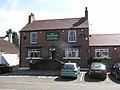 The Fox And Hounds , Neasham. - geograph.org.uk - 157600.jpg 640 × 479 ; 90 kio
-
 The Fox and Hounds Neasham - geograph.org.uk - 4467250.jpg 4 000 × 2 250 ; 1,99 Mio
-
 Thin Strip of Trees attached to Black Wood - geograph.org.uk - 1957553.jpg 2 816 × 2 112 ; 1,68 Mio
-
 Track to Hunger Hill Farm - geograph.org.uk - 3283654.jpg 640 × 480 ; 43 kio
-
 Tree pruning at Old Fish Locks drive - geograph.org.uk - 2231753.jpg 4 320 × 3 240 ; 5,7 Mio
-
 Trees beside the A66 - geograph.org.uk - 3283712.jpg 640 × 480 ; 84 kio
-
 View towards the River Tees, Neasham - geograph.org.uk - 3238519.jpg 640 × 480 ; 28 kio
-
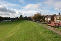
 Village Seat, Neasham - geograph.org.uk - 114291.jpg 640 × 482 ; 52 kio
-
 Weir, River Tees - geograph.org.uk - 2364178.jpg 640 × 427 ; 296 kio
-
 Woodland path on the banks of the River Tees - geograph.org.uk - 2972042.jpg 3 648 × 2 736 ; 3,05 Mio
-
 Dinsdale Spa Golf Club. - geograph.org.uk - 140707.jpg 640 × 479 ; 71 kio
-
 Dinsdale Spa. - geograph.org.uk - 157592.jpg 640 × 479 ; 135 kio
-

-
 Neasham flood defence - geograph.org.uk - 598212.jpg 640 × 426 ; 74 kio
-
 Neasham Hall Gatehouse and driveway - geograph.org.uk - 598216.jpg 640 × 426 ; 111 kio
-
 Neasham Hill - geograph.org.uk - 598253.jpg 640 × 426 ; 42 kio
-
 Thorny Close, leading to Morton Farm. - geograph.org.uk - 140701.jpg 640 × 479 ; 159 kio
_Ringroad_-_geograph.org.uk_-_195585.jpg)


