Category:Borough of Darlington
Jump to navigation
Jump to search
unitary authority in County Durham, United Kingdom    | |||||
| Upload media | |||||
| Instance of | |||||
|---|---|---|---|---|---|
| Location | County Durham, North East England, England | ||||
| Capital | |||||
| Legislative body |
| ||||
| Inception |
| ||||
| Population |
| ||||
| Area |
| ||||
| official website | |||||
 | |||||
Subcategories
This category has the following 26 subcategories, out of 26 total.
A
- Archdeacon Newton (34 F)
B
- Brafferton, County Durham (91 F)
C
D
- Denton, County Durham (42 F)
E
- East and West Newbiggin (6 F)
G
H
K
- Killerby, County Durham (25 F)
L
- Little Stainton (18 F)
M
N
P
S
- Sadberge (37 F)
- Summerhouse (33 F)
W
Media in category "Borough of Darlington"
The following 200 files are in this category, out of 327 total.
(previous page) (next page)-

-
 A flooded Newton Lane - geograph.org.uk - 4805060.jpg 640 × 480; 54 KB
-
 Albert Road Post Office and stores - geograph.org.uk - 4794875.jpg 640 × 480; 68 KB
-
 Apartment buildings across grassed space - geograph.org.uk - 4744658.jpg 1,500 × 1,125; 2.11 MB
-
 Asda etc, Darlington - geograph.org.uk - 3889990.jpg 640 × 480; 53 KB
-
 Aviary in South Park - geograph.org.uk - 5132001.jpg 1,024 × 662; 194 KB
-
 B6279 heading east - geograph.org.uk - 3283757.jpg 640 × 480; 51 KB
-
 Back Alley - geograph.org.uk - 2611492.jpg 640 × 480; 125 KB
-
 Back Alley - geograph.org.uk - 2611495.jpg 640 × 480; 107 KB
-
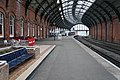
 Bank Top Railway Station, Platform 4 - geograph.org.uk - 6060016.jpg 5,184 × 3,888; 3.61 MB
-
 Barmpton Lane - geograph.org.uk - 3227792.jpg 640 × 480; 81 KB
-

-

-
 Benchmark on Neasham Road wall - geograph.org.uk - 5324297.jpg 663 × 1,024; 212 KB
-
 Benchmark on Railway Bridge DSN1-1 - geograph.org.uk - 5148186.jpg 1,024 × 668; 250 KB
-
 Benchmark on railway station clock tower - geograph.org.uk - 5324246.jpg 683 × 1,024; 276 KB
-
 Benchmark on the Darlington Railway Works - geograph.org.uk - 5282474.jpg 674 × 1,024; 268 KB
-
 Benchmark on wall of Hopetown Lane - geograph.org.uk - 5282063.jpg 668 × 1,024; 294 KB
-
 Benchmark on ^106 Clifton Road - geograph.org.uk - 5148382.jpg 683 × 1,024; 302 KB
-
 Benchmark on ^107 Park Lane - geograph.org.uk - 5148211.jpg 1,024 × 683; 297 KB
-
 Benchmark on ^129 Hammond Drive - geograph.org.uk - 5148017.jpg 683 × 1,024; 250 KB
-
 Benchmark on ^132 Parkside - geograph.org.uk - 5148103.jpg 683 × 1,024; 209 KB
-
 Benchmark on ^141 Clifton Road - geograph.org.uk - 5148231.jpg 683 × 1,024; 223 KB
-
 Benchmark on ^24 Waverley Terrace - geograph.org.uk - 5132019.jpg 683 × 1,024; 345 KB
-
 Benchmark on ^44 Park Lane - geograph.org.uk - 5148619.jpg 683 × 1,024; 107 KB
-
 Benchmark on ^52B Clifton Road - geograph.org.uk - 5148475.jpg 661 × 1,024; 204 KB
-
 Booking Office, North Road Station - geograph.org.uk - 2479497.jpg 640 × 480; 195 KB
-
 Bridleway from Staindrop Road in Darlington - geograph.org.uk - 2799568.jpg 3,648 × 2,736; 1.96 MB
-
 Broken Scar dam in flood - geograph.org.uk - 2126288.jpg 640 × 480; 88 KB
-
 Brompton Walk - geograph.org.uk - 4733319.jpg 640 × 480; 59 KB
-

-

-
 Bus stop on Baydale Road - geograph.org.uk - 4732844.jpg 640 × 480; 90 KB
-
 Bus stop on Newton Lane - geograph.org.uk - 4805056.jpg 640 × 480; 82 KB
-
 Bus stop on North Road (A167) - geograph.org.uk - 4794889.jpg 640 × 480; 67 KB
-

-
 Cattle pens at Darlington Mart - geograph.org.uk - 2135867.jpg 2,048 × 1,536; 668 KB
-
 Cemetery Chapel, North Cemetery - geograph.org.uk - 4794897.jpg 480 × 640; 95 KB
-
 Cemetery gates, North Cemetery - geograph.org.uk - 4794885.jpg 640 × 480; 96 KB
-
 Cemetery Lane leading to Carmel Road North - geograph.org.uk - 3272861.jpg 3,528 × 2,574; 3.67 MB
-
 Church of St. John the Evangelist - geograph.org.uk - 5423456.jpg 640 × 391; 164 KB
-
 Clock tower at Bank Top railway station - geograph.org.uk - 5324268.jpg 643 × 1,024; 101 KB
-

-

-

-
 Clock tower, Bank Top Station - geograph.org.uk - 2017472.jpg 2,592 × 1,944; 739 KB
-
 Clock Tower, Darlington Bank Top Station - geograph.org.uk - 2017484.jpg 972 × 1,296; 184 KB
-

-
 Co-operative food store - geograph.org.uk - 4794893.jpg 640 × 440; 64 KB
-
 Comet's Garth, West Park Village - geograph.org.uk - 3179681.jpg 640 × 480; 79 KB
-
 Coniscliffe Road (A67) - geograph.org.uk - 4732840.jpg 640 × 480; 111 KB
-
 Coniscliffe Road's autumn colours - geograph.org.uk - 5963021.jpg 2,000 × 1,254; 3.4 MB
-
 Cranes in the Head Of Steam Museum - geograph.org.uk - 2839452.jpg 1,000 × 1,500; 181 KB
-
 Cumberland Street Darlington - geograph.org.uk - 2468454.jpg 3,648 × 2,736; 2.09 MB
-
 Cycle path beside the B6279 - geograph.org.uk - 3283755.jpg 640 × 480; 57 KB
-
 Cycle path on disused railway - geograph.org.uk - 4805054.jpg 640 × 480; 84 KB
-

-

-

-
 Darlington Autocentre - geograph.org.uk - 3227743.jpg 640 × 480; 45 KB
-
 Darlington Bank Top - geograph.org.uk - 5867987.jpg 683 × 1,024; 280 KB
-
 Darlington Bank Top railway station - geograph.org.uk - 2654371.jpg 1,024 × 779; 143 KB
-
 Darlington Bank Top Railway Station - geograph.org.uk - 5867990.jpg 1,024 × 768; 273 KB
-
-
 Darlington Business Central - geograph.org.uk - 5324720.jpg 1,024 × 683; 173 KB
-
 Darlington Council composition.svg 360 × 185; 3 KB
-

-
 Darlington Farmers Auction Mart - geograph.org.uk - 5103137.jpg 640 × 331; 86 KB
-
 Darlington Farmers Auction Mart - geograph.org.uk - 5103151.jpg 640 × 394; 123 KB
-
 Darlington Farmers Auction Mart - geograph.org.uk - 5103757.jpg 566 × 640; 199 KB
-
 Darlington FC Stadium - geograph.org.uk - 3238565.jpg 640 × 406; 28 KB
-
 Darlington North Road, exterior 1981 - geograph.org.uk - 5327370.jpg 2,397 × 1,240; 2.7 MB
-
 Darlington Railway Station - geograph.org.uk - 4266367.jpg 480 × 640; 81 KB
-
 Darlington railway station - geograph.org.uk - 5103149.jpg 640 × 447; 111 KB
-
 Darlington railway station - geograph.org.uk - 5103154.jpg 640 × 480; 131 KB
-
 Darlington railway station - geograph.org.uk - 5103156.jpg 640 × 398; 136 KB
-
 Darlington railway station - geograph.org.uk - 5103158.jpg 640 × 371; 105 KB
-
 Darlington railway station - geograph.org.uk - 5103160.jpg 640 × 449; 102 KB
-
 Darlington railway station - geograph.org.uk - 5103161.jpg 640 × 480; 144 KB
-
 Darlington railway station - geograph.org.uk - 5103164.jpg 640 × 480; 150 KB
-
 Darlington railway station - geograph.org.uk - 5103166.jpg 640 × 480; 126 KB
-
 Darlington railway station - geograph.org.uk - 5103169.jpg 640 × 480; 175 KB
-
 Darlington railway station - geograph.org.uk - 5103170.jpg 640 × 480; 132 KB
-
 Darlington railway station - geograph.org.uk - 5103174.jpg 480 × 640; 202 KB
-
 Darlington railway station - geograph.org.uk - 5103179.jpg 640 × 415; 142 KB
-
 Darlington railway station - geograph.org.uk - 5103758.jpg 640 × 480; 121 KB
-
 Darlington railway station - geograph.org.uk - 5103904.jpg 640 × 480; 134 KB
-
 Darlington railway station - geograph.org.uk - 5103907.jpg 640 × 445; 178 KB
-
 Darlington railway station - geograph.org.uk - 5103912.jpg 640 × 455; 177 KB
-
 Darlington railway station - geograph.org.uk - 5103923.jpg 640 × 474; 138 KB
-
 Darlington railway station - geograph.org.uk - 5103927.jpg 640 × 442; 155 KB
-
 Darlington railway station - geograph.org.uk - 5103931.jpg 640 × 480; 156 KB
-
 Darlington railway station - geograph.org.uk - 5103938.jpg 640 × 274; 75 KB
-
 Darlington railway station - geograph.org.uk - 5104000.jpg 640 × 480; 141 KB
-
 Darlington railway station - geograph.org.uk - 5104009.jpg 640 × 480; 152 KB
-
 Darlington railway station - geograph.org.uk - 5140767.jpg 640 × 480; 164 KB
-
 Darlington railway station - geograph.org.uk - 5140770.jpg 640 × 480; 172 KB
-
 Darlington railway station - geograph.org.uk - 5419982.jpg 640 × 480; 124 KB
-
 Darlington railway station - geograph.org.uk - 5419994.jpg 640 × 511; 162 KB
-
 Darlington railway station - geograph.org.uk - 5420004.jpg 640 × 398; 130 KB
-
 Darlington railway station - geograph.org.uk - 5420006.jpg 640 × 480; 146 KB
-
 Darlington railway station - geograph.org.uk - 5420013.jpg 640 × 480; 142 KB
-
 Darlington railway station - geograph.org.uk - 5420020.jpg 640 × 480; 168 KB
-
 Darlington railway station - geograph.org.uk - 5420026.jpg 640 × 400; 136 KB
-
 Darlington railway station - geograph.org.uk - 5420053.jpg 640 × 480; 156 KB
-
 Darlington railway station - geograph.org.uk - 5420057.jpg 640 × 480; 202 KB
-
 Darlington railway station - geograph.org.uk - 5420182.jpg 640 × 480; 145 KB
-
 Darlington railway station - geograph.org.uk - 5420183.jpg 640 × 480; 145 KB
-
 Darlington railway station - geograph.org.uk - 5420186.jpg 640 × 480; 183 KB
-
 Darlington railway station - geograph.org.uk - 5420190.jpg 494 × 640; 169 KB
-
 Darlington railway station - geograph.org.uk - 5420191.jpg 480 × 640; 173 KB
-
 Darlington railway station - geograph.org.uk - 5420193.jpg 640 × 480; 188 KB
-
 Darlington railway station - geograph.org.uk - 5420198.jpg 640 × 480; 162 KB
-
 Darlington railway station - geograph.org.uk - 5420202.jpg 480 × 640; 152 KB
-
 Darlington railway station - geograph.org.uk - 5423469.jpg 640 × 480; 162 KB
-
 Darlington railway station - geograph.org.uk - 5423470.jpg 640 × 480; 159 KB
-
 Darlington railway station - geograph.org.uk - 5423473.jpg 640 × 480; 159 KB
-
 Darlington railway station - geograph.org.uk - 5423474.jpg 640 × 480; 165 KB
-
 Darlington railway station - geograph.org.uk - 5424343.jpg 640 × 480; 137 KB
-
 Darlington Railway Station - geograph.org.uk - 5519720.jpg 640 × 480; 94 KB
-
 Darlington Railway Station - geograph.org.uk - 5909899.jpg 640 × 480; 86 KB
-
-
 Darlington Railway Works - geograph.org.uk - 5282494.jpg 1,024 × 676; 129 KB
-
 Darlington South Junction - geograph.org.uk - 2332499.jpg 640 × 430; 55 KB
-
 Darlington South Junction - geograph.org.uk - 2416585.jpg 640 × 316; 34 KB
-
 Darlington South Junction - geograph.org.uk - 2416589.jpg 640 × 557; 51 KB
-
 Darlington South Junction sign - geograph.org.uk - 2332492.jpg 640 × 430; 58 KB
-
 Darlington South Junction, East Coast Mainline - geograph.org.uk - 6325060.jpg 3,264 × 2,448; 2.47 MB
-
 Darlington station - geograph.org.uk - 5651203.jpg 5,376 × 3,024; 4.81 MB
-
 Darlington station - geograph.org.uk - 6084279.jpg 1,024 × 768; 141 KB
-
 Darlington station platform 4 looking northwards - geograph.org.uk - 5467153.jpg 5,202 × 3,465; 3.69 MB
-
 Darlington station south end - geograph.org.uk - 5467150.jpg 5,202 × 3,465; 2.92 MB
-
 Darlington Train Station - geograph.org.uk - 4021133.jpg 1,600 × 1,064; 690 KB
-
 Darlington Train Station - geograph.org.uk - 4021136.jpg 1,600 × 1,064; 670 KB
-
 Disused turntable south of Darlington station - geograph.org.uk - 4144207.jpg 1,600 × 927; 272 KB
-
 Drinking fountain at Tees Cottage - geograph.org.uk - 5494655.jpg 480 × 640; 325 KB
-

-
 Elm Tree House Farm - geograph.org.uk - 2737807.jpg 3,648 × 2,736; 1.9 MB
-
 Empties Through Darlington - geograph.org.uk - 2182916.jpg 1,548 × 1,007; 711 KB
-
 End of Belvedere Road, Darlington - geograph.org.uk - 4285922.jpg 1,280 × 851; 370 KB
-
 Entrance to the Head Of Steam Museum - geograph.org.uk - 2839443.jpg 1,500 × 1,000; 344 KB
-
 Entry road for Broken Scar Picnic Site car park - geograph.org.uk - 5963040.jpg 2,000 × 1,333; 3.52 MB
-
 Estoril Road South, Firth Moor - geograph.org.uk - 1948782.jpg 640 × 427; 275 KB
-
 Estoril Road South, Firth Moor - geograph.org.uk - 3179663.jpg 640 × 480; 102 KB
-
 Every picture tells a story - geograph.org.uk - 5097427.jpg 640 × 453; 213 KB
-
 Farmhouse at Bottom House Farm - geograph.org.uk - 3112024.jpg 3,648 × 2,736; 1.94 MB
-
 Farmland, Ely Hill - geograph.org.uk - 3227791.jpg 640 × 480; 42 KB
-
 Filter bed at Tees Cottage pumping station - geograph.org.uk - 5821698.jpg 3,239 × 4,319; 3.7 MB
-
 Fletcher Joinery premises in Whessoe Road Darlington - geograph.org.uk - 2468474.jpg 3,648 × 2,736; 2.37 MB
-
 Football pitch in North End Recreation Ground Darlington - geograph.org.uk - 2468471.jpg 3,648 × 2,736; 2.5 MB
-

-

-

-
 Footpath in North End Recreation Ground Darlington - geograph.org.uk - 2468426.jpg 3,648 × 2,736; 2.36 MB
-
 Former Church on Victoria Road, Darlington - geograph.org.uk - 4021111.jpg 1,600 × 1,064; 412 KB
-

-

-

-
-
 Former Rise Carr Rolling Mills building - geograph.org.uk - 5423442.jpg 640 × 396; 126 KB
-
 Former Rise Carr Rolling Mills building - geograph.org.uk - 5423444.jpg 640 × 541; 171 KB
-
 Geneva Road, Darlington - geograph.org.uk - 3238575.jpg 640 × 480; 68 KB
-
 Grassed area with trees - geograph.org.uk - 4009438.jpg 1,500 × 1,125; 2.07 MB
-
 Grazing near Stag House - geograph.org.uk - 4805063.jpg 640 × 480; 71 KB
-
 Green Lane bridleway in Darlington - geograph.org.uk - 2737802.jpg 3,648 × 2,736; 3.52 MB
-
 Haughton Road - geograph.org.uk - 3227769.jpg 640 × 480; 63 KB
-
 Head of Steam Museum - geograph.org.uk - 6282757.jpg 640 × 427; 78 KB
-
 Head of Steam Railway Museum, Darlington - geograph.org.uk - 2479495.jpg 1,280 × 960; 627 KB
-
 Hellkettles.jpg 3,007 × 2,254; 3.04 MB
-
 Henderson Street - geograph.org.uk - 5843155.jpg 640 × 449; 101 KB
-
 Hogans on Victoria Road, Darlington - geograph.org.uk - 4021010.jpg 1,600 × 1,064; 515 KB
-
 Hogans public house - geograph.org.uk - 5103708.jpg 640 × 308; 80 KB
-
 Hogans, Darlington - geograph.org.uk - 4818844.jpg 640 × 480; 65 KB
-
 Holly House Farm beyond field - geograph.org.uk - 5384996.jpg 1,500 × 1,125; 1.62 MB
-

-
 Houghton Road - geograph.org.uk - 4128715.jpg 2,560 × 1,920; 2.82 MB
-
 House on Coniscliffe Road - geograph.org.uk - 4732839.jpg 640 × 423; 90 KB
-
 Houses on Barmpton Lane - geograph.org.uk - 3227790.jpg 640 × 469; 63 KB
-
 Houses on Baydale Road - geograph.org.uk - 4732841.jpg 640 × 385; 67 KB
-
 Houses on Berwick Road - geograph.org.uk - 4805052.jpg 640 × 480; 59 KB
-
 Houses on Coombe Drive, Red Hall - geograph.org.uk - 3283753.jpg 1,200 × 900; 274 KB
-
 Houses on Geneva Road - geograph.org.uk - 3238573.jpg 640 × 480; 54 KB
-
 Houses on Haughton Road - geograph.org.uk - 3227766.jpg 640 × 427; 60 KB
-
 Houses on Kilmarnock Road - geograph.org.uk - 3227782.jpg 640 × 480; 74 KB
-
 Houses on Neasham Road - geograph.org.uk - 3238569.jpg 640 × 480; 54 KB
-
 Houses on North Road (A167) - geograph.org.uk - 4794881.jpg 640 × 487; 65 KB
-
 Houses on Spruce Grove - geograph.org.uk - 4818836.jpg 640 × 480; 99 KB
-

-
 Housing on North Road - geograph.org.uk - 4744679.jpg 1,500 × 1,125; 1.39 MB
-
 Inside Darlington Station - geograph.org.uk - 5231510.jpg 2,000 × 1,500; 443 KB
-
 Interior of beam engine house at Tees Cottage - geograph.org.uk - 5821695.jpg 3,239 × 4,319; 2.76 MB
-
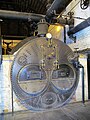 Interior view of the boiler house at Tees Cottage - geograph.org.uk - 5821711.jpg 3,239 × 4,319; 2.85 MB
-
 Interior view, Tees Cottage engine house - geograph.org.uk - 5821679.jpg 3,240 × 4,320; 2.45 MB
-
 Jubilee Cottages - geograph.org.uk - 4732848.jpg 640 × 421; 98 KB
-
 Junction of Clifton Road and Henderson Street - geograph.org.uk - 5148245.jpg 1,024 × 683; 165 KB
-
 Junction of Clifton Road and Milner Road - geograph.org.uk - 5148451.jpg 1,024 × 683; 154 KB
-
 Junction of Clifton Road and Waverley Terrace - geograph.org.uk - 5132137.jpg 1,024 × 669; 152 KB
-
 Junction of Park Lane and Leafield Road - geograph.org.uk - 5148654.jpg 1,024 × 683; 178 KB
-
 Junction of Park Lane and Smithfield Road - geograph.org.uk - 5148225.jpg 1,024 × 662; 183 KB
-
 Kielder Drive, Haughton-le-Skerne - geograph.org.uk - 3227779.jpg 640 × 480; 52 KB


_-_geograph.org.uk_-_4794889.jpg)


_-_geograph.org.uk_-_4732840.jpg)


_railway_station,_County_Durham_-_geograph.org.uk_-_3272214.jpg)
_railway_station,_County_Durham_-_geograph.org.uk_-_3272217.jpg)


_signal_box_-_geograph.org.uk_-_3725866.jpg)


_-_geograph.org.uk_-_4794881.jpg)


