Category:Nemaničky
Jump to navigation
Jump to search
| Object location | | View all coordinates using: OpenStreetMap |
|---|
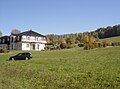
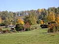
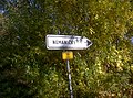
village in Domažlice District of Plzeň region  | |||||
| Upload media | |||||
| Instance of | |||||
|---|---|---|---|---|---|
| Location | Nemanice, Domažlice District, Plzeň Region, Czechia | ||||
| Population |
| ||||
| Area |
| ||||
| Elevation above sea level |
| ||||
 | |||||
Media in category "Nemaničky"
The following 6 files are in this category, out of 6 total.
-
 Nemanicky 01.jpg 2,304 × 1,704; 868 KB
-
 Nemanicky 02.jpg 2,304 × 1,704; 892 KB
-
 Nemanicky 03.jpg 2,304 × 1,704; 894 KB
-
 Nemanicky 04.jpg 2,304 × 1,704; 917 KB
-
 Nemanicky 05.jpg 2,304 × 1,704; 912 KB
-
 Nemanicky 06.jpg 2,304 × 1,704; 901 KB


