Category:Nether Stowey
Vai alla navigazione
Vai alla ricerca
village in the United Kingdom  | |||||
| Carica un file multimediale | |||||
| Istanza di | |||||
|---|---|---|---|---|---|
| Luogo | Sedgemoor, Somerset, Sud Ovest dell'Inghilterra, Inghilterra | ||||
 | |||||
Sottocategorie
Questa categoria contiene le 5 sottocategorie indicate di seguito, su un totale di 5.
File nella categoria "Nether Stowey"
Questa categoria contiene 187 file, indicati di seguito, su un totale di 187.
-
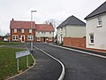
 "Hartley Meadow" housing development - geograph.org.uk - 172564.jpg 640 × 420; 65 KB
-
 A39 at The Cottage Inn - geograph.org.uk - 3956478.jpg 1 920 × 1 296; 424 KB
-
 A39 junctions near Stowey Rocks - geograph.org.uk - 5777318.jpg 1 600 × 1 067; 634 KB
-
 At Hamlands Corner - geograph.org.uk - 3961697.jpg 1 920 × 1 457; 592 KB
-
 At the brow of Castle Hill looking west - geograph.org.uk - 5118124.jpg 3 648 × 2 432; 4,13 MB
-
 Barn at Budley Farm - geograph.org.uk - 4409389.jpg 1 024 × 768; 197 KB
-
 Bell Tower and Lock-up - geograph.org.uk - 5118121.jpg 3 648 × 2 432; 4,02 MB
-
 Buildings on Castle Hill, Nether Stowey - geograph.org.uk - 5379454.jpg 1 899 × 3 016; 1,06 MB
-
 Buildings on Castle Street, Nether Stowey - geograph.org.uk - 5379642.jpg 2 047 × 2 907; 867 KB
-
 Butchers Lane off Castle Hill - geograph.org.uk - 5118123.jpg 3 648 × 2 432; 4,61 MB
-
 Castle Hill House, Nether Stowey - geograph.org.uk - 5248554.jpg 3 049 × 1 943; 945 KB
-
 Castle Hill, Nether Stowey - geograph.org.uk - 5379390.jpg 3 072 × 2 048; 1,02 MB
-
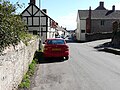
 Castle Street, Nether Stowey - geograph.org.uk - 1766840.jpg 640 × 480; 222 KB
-
 Castle Street, Nether Stowey - geograph.org.uk - 2512328.jpg 1 024 × 768; 181 KB
-
 Castle Street, Nether Stowey - geograph.org.uk - 2824986.jpg 640 × 423; 68 KB
-
 Castle Street, Nether Stowey - geograph.org.uk - 5248390.jpg 2 646 × 1 693; 670 KB
-
 Castle Street, Nether Stowey - geograph.org.uk - 5248562.jpg 1 388 × 1 035; 387 KB
-
 Castle Street, with its stream, Nether Stowey - geograph.org.uk - 5778772.jpg 1 600 × 1 200; 813 KB
-
 Cereal crop by the A39 - geograph.org.uk - 3956504.jpg 1 920 × 1 149; 526 KB
-
 Coleridge Cottage, Nether Stowey - geograph.org.uk - 5777330.jpg 1 600 × 1 200; 730 KB
-
 Cottage on Castle Hill - geograph.org.uk - 5762991.jpg 1 024 × 768; 229 KB
-

-
 Descending Castle Hill - geograph.org.uk - 5118131.jpg 3 648 × 2 432; 4 MB
-
 Farm track, east of Stogursey Lane - geograph.org.uk - 4230454.jpg 1 024 × 768; 244 KB
-
 Farmland around Inwood Farm - geograph.org.uk - 3962080.jpg 1 920 × 1 310; 683 KB
-
 Farmland near Nether Stowey - geograph.org.uk - 3962104.jpg 1 920 × 1 440; 704 KB
-
 Field access track at Hamlands Corner - geograph.org.uk - 3961674.jpg 1 920 × 1 371; 480 KB
-
 Field access track, Pinnacle Hill - geograph.org.uk - 3960322.jpg 1 920 × 1 112; 376 KB
-
 Field access track, Pinnacle Hill - geograph.org.uk - 3961733.jpg 1 920 × 1 323; 531 KB
-
 Field boundary north of Pinnacle Hill - geograph.org.uk - 3961251.jpg 1 920 × 1 440; 557 KB
-
 Field near Hamlands Corner - geograph.org.uk - 3960343.jpg 1 920 × 1 284; 750 KB
-
 Field near Nether Stowey - geograph.org.uk - 3962154.jpg 1 920 × 1 440; 468 KB
-
 Field on Pinnacle Hill - geograph.org.uk - 3960316.jpg 1 920 × 1 217; 387 KB
-
 Field, Hamlands Corner - geograph.org.uk - 3960488.jpg 1 920 × 1 105; 512 KB
-
 Fields near Inwood Farm - geograph.org.uk - 3010225.jpg 2 288 × 1 712; 791 KB
-
 Fields north of Nether Stowey - geograph.org.uk - 1766829.jpg 640 × 480; 340 KB
-
 Fields north of Nether Stowey - geograph.org.uk - 1941054.jpg 1 776 × 1 111; 412 KB
-
 Footpath from Castle Hill brow - geograph.org.uk - 5118125.jpg 3 648 × 2 432; 4,26 MB
-
 Footpath north of Nether Stowey - geograph.org.uk - 3960292.jpg 1 920 × 2 140; 832 KB
-
 Footpath past Budley Farm - geograph.org.uk - 3962186.jpg 1 920 × 1 338; 680 KB
-
 Footpath, Nether Stowey - geograph.org.uk - 3960238.jpg 1 920 × 1 440; 424 KB
-
 Footpath, Nether Stowey - geograph.org.uk - 3960253.jpg 1 920 × 1 483; 518 KB
-
 Former Quantock Savings Bank, Nether Stowey - geograph.org.uk - 5379968.jpg 2 445 × 1 657; 550 KB
-
 Former Quantock Savings Bank, Nether Stowey - geograph.org.uk - 5777363.jpg 1 600 × 1 200; 909 KB
-
 Fox Way, Nether Stowey - geograph.org.uk - 5778761.jpg 1 600 × 1 200; 686 KB
-
 Gazebo at Stowey Court (geograph 4409351).jpg 1 024 × 770; 177 KB
-
 Geograph 3010230 Gazebo, Stowey Court.jpg 1 712 × 2 288; 803 KB
-
 Gulliford's Garage, Nether Stowey - geograph.org.uk - 1766803.jpg 640 × 480; 209 KB
-
 Gulliford's Garage, Nether Stowey - geograph.org.uk - 2882481.jpg 1 280 × 856; 112 KB
-
 Gullifords Garage - geograph.org.uk - 4410213.jpg 1 024 × 768; 134 KB
-
 Halsey Cross - geograph.org.uk - 3813399.jpg 1 024 × 768; 159 KB
-
 Hamlands Corner - geograph.org.uk - 3960480.jpg 1 920 × 1 440; 699 KB
-
 Hamlands Corner - geograph.org.uk - 3960491.jpg 1 920 × 1 440; 705 KB
-
 Harry Prowse Close - geograph.org.uk - 4410173.jpg 1 024 × 768; 126 KB
-
 Highbeer Close, Nether Stowey - geograph.org.uk - 5778771.jpg 1 600 × 1 200; 747 KB
-
 Houses in Nether Stowey - geograph.org.uk - 3959930.jpg 1 920 × 2 451; 655 KB
-
 Houses on Lime Street, Nether Stowey - geograph.org.uk - 1766835.jpg 640 × 480; 276 KB
-
 Houses on the hillside, Nether Stowey - geograph.org.uk - 1766846.jpg 640 × 480; 272 KB
-
 In the garden at Coleridge Cottage - geograph.org.uk - 5409302.jpg 640 × 427; 112 KB
-
 Lime Street - geograph.org.uk - 4410182.jpg 1 024 × 768; 168 KB
-
 Lime Street, Nether Stowey (geograph 2882519).jpg 1 280 × 856; 131 KB
-
 Lime Street, Nether Stowey - geograph.org.uk - 1766818.jpg 640 × 480; 180 KB
-
 Lime Street, Nether Stowey - geograph.org.uk - 3959837.jpg 1 920 × 1 380; 397 KB
-
 Lime Street, Nether Stowey - geograph.org.uk - 5118119.jpg 3 648 × 2 432; 2,98 MB
-
 Lime Street, Nether Stowey - geograph.org.uk - 5248418.jpg 2 730 × 1 793; 746 KB
-
 Lime Street, Nether Stowey - geograph.org.uk - 5248460.jpg 2 621 × 1 793; 651 KB
-
 Looking southeast down Lime Street - geograph.org.uk - 4943108.jpg 3 264 × 2 448; 2,1 MB
-
 Looking southeast down St Mary Street - geograph.org.uk - 4943140.jpg 3 101 × 2 383; 1,53 MB
-
 Mill Lane, Nether Stowey - geograph.org.uk - 5409312.jpg 640 × 427; 99 KB
-
 Nether Stowey - geograph.org.uk - 3432412.jpg 1 024 × 954; 169 KB
-
 Nether Stowey ... Post Office & Stores with postbox TA5 209. (6008003518) (2).jpg 3 587 × 3 101; 5,88 MB
-
 Nether Stowey Church Centre - geograph.org.uk - 3960105.jpg 1 920 × 1 261; 364 KB
-
 Nether Stowey Hoard.jpg 1 024 × 698; 353 KB
-
 Nether Stowey Telephone Exchange (1) - geograph.org.uk - 4545283.jpg 3 072 × 2 304; 1,79 MB
-
 Nether Stowey Telephone Exchange (2) - geograph.org.uk - 4545290.jpg 3 072 × 2 304; 1,81 MB
-
 Nether Stowey war memorial and clock tower - geograph.org.uk - 5777369.jpg 1 200 × 1 600; 811 KB
-
 Nether Stowey, Coleridge Cottage - geograph.org.uk - 6282796.jpg 6 216 × 4 144; 5,64 MB
-
 Nether Stowey, Coleridge Cottage - geograph.org.uk - 6282802.jpg 7 328 × 4 885; 5,98 MB
-
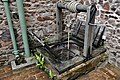 Nether Stowey, Coleridge Cottage, c17th well - geograph.org.uk - 6282852.jpg 6 633 × 4 423; 7,66 MB
-
 Nether Stowey, Coleridge Cottage, c17th well - geograph.org.uk - 6282855.jpg 7 160 × 4 773; 7,68 MB
-
-
 Nether Stowey, Coleridge Cottage, First Floor Bedroom - geograph.org.uk - 6282832.jpg 6 618 × 4 412; 5,92 MB
-
 Nether Stowey, Coleridge Cottage, Flower border - geograph.org.uk - 6282895.jpg 6 187 × 4 125; 7,8 MB
-
 Nether Stowey, Coleridge Cottage, Flower border - geograph.org.uk - 6282897.jpg 6 145 × 4 096; 6,69 MB
-
 Nether Stowey, Coleridge Cottage, Inscribed flat seat - geograph.org.uk - 6282884.jpg 6 216 × 4 143; 6,9 MB
-

-
 Nether Stowey, Coleridge Cottage, Sara's Kitchen - geograph.org.uk - 6282816.jpg 6 818 × 4 545; 6,11 MB
-
 Nether Stowey, Coleridge Cottage, Small vegetable patch - geograph.org.uk - 6282878.jpg 5 737 × 3 825; 6,36 MB
-
 Nether Stowey, Coleridge Cottage, The Exhibition Room - geograph.org.uk - 6282827.jpg 7 475 × 4 983; 5,44 MB
-
 Nether Stowey, Coleridge Cottage, The Second Parlour - geograph.org.uk - 6282807.jpg 6 741 × 4 494; 4,6 MB
-

-
 Nether Stowey, Coleridge Cottage, The Tearoom - geograph.org.uk - 6282843.jpg 6 671 × 4 447; 6,06 MB
-
 Nether Stowey, Coleridge Cottage, The Welcome Parlour - geograph.org.uk - 6282812.jpg 6 950 × 4 633; 5,61 MB
-
 Nether Stowey, Coleridge Cottage, Wild flower meadow - geograph.org.uk - 6282862.jpg 6 434 × 4 290; 7,48 MB
-
 Nether Stowey, Coleridge Cottage, Wild flower meadow - geograph.org.uk - 6282873.jpg 5 541 × 3 694; 7,16 MB
-
 NetherStowey2.jpg 4 722 × 3 360; 12,2 MB
-
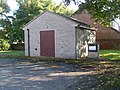
 Netherstoweyfirestation.jpg 640 × 426; 251 KB
-

-
 New housing at Nether Stowey - geograph.org.uk - 5409310.jpg 640 × 427; 75 KB
-
 Oak by the track junction - geograph.org.uk - 3960337.jpg 1 920 × 1 440; 583 KB
-
 Oak by the track junction - geograph.org.uk - 3961715.jpg 1 920 × 1 287; 488 KB
-
 Oak Road, Nether Stowey - geograph.org.uk - 5778748.jpg 1 600 × 1 200; 790 KB
-
 Oak trees near Peadon Farm - geograph.org.uk - 4409901.jpg 1 024 × 768; 220 KB
-

-

-
 Old Farm Road, Nether Stowey - geograph.org.uk - 5778751.jpg 1 600 × 941; 617 KB
-
 Old Gaol, St Marys St, Nether Stowey (geograph 1907682).jpg 2 304 × 1 704; 907 KB
-
 Old Toll House, Nether Stowey - geograph.org.uk - 6114617.jpg 640 × 479; 135 KB
-
 Ordnance Survey 1GL Bolt - geograph.org.uk - 4708196.jpg 640 × 480; 125 KB
-
 Path near Budley Farm - geograph.org.uk - 3962148.jpg 1 920 × 1 440; 637 KB
-
 Path to Nether Stowey - geograph.org.uk - 4410154.jpg 1 024 × 768; 226 KB
-
 Path to Pinnacle Hill - geograph.org.uk - 3962120.jpg 1 920 × 1 186; 463 KB
-
 Path to Pinnacle Hill - geograph.org.uk - 4409420.jpg 1 024 × 768; 234 KB
-
 Pines, Stowey Castle - geograph.org.uk - 5379619.jpg 2 036 × 2 625; 1,29 MB
-
 Pinnacle Hill - geograph.org.uk - 4409869.jpg 1 024 × 768; 180 KB
-
 Poole House, Nether Stowey - geograph.org.uk - 5379646.jpg 1 842 × 1 410; 486 KB
-
 Pooles Close, Nether Stowey - geograph.org.uk - 5379497.jpg 3 072 × 1 908; 1,68 MB
-

-
 Quantock Post Office, Nether Stowey - geograph.org.uk - 1766812.jpg 640 × 480; 210 KB
-
 Quantock Savings Bank - geograph.org.uk - 4410199.jpg 1 024 × 768; 152 KB
-
 Remains of Stowey Mill - geograph.org.uk - 2608754.jpg 2 288 × 1 712; 905 KB
-
 Road junction east of Keenthorne - geograph.org.uk - 5777195.jpg 1 600 × 997; 575 KB
-
 Road to Aley - geograph.org.uk - 3956488.jpg 1 920 × 1 440; 521 KB
-
 Road to Aley - geograph.org.uk - 3956580.jpg 1 920 × 1 156; 844 KB
-
 Semis on Hack Lane, Nether Stowey - geograph.org.uk - 5379624.jpg 3 072 × 2 048; 1,45 MB
-
 Sign describing Nether Stowey castle - geograph.org.uk - 2039515.jpg 2 304 × 1 704; 772 KB
-
 SOM-849CA3, Post-Medieval sileverware hoard (FindID 237552).jpg 3 637 × 2 480; 941 KB
-
 South Lane, Nether Stowey - geograph.org.uk - 5379955.jpg 3 072 × 2 048; 840 KB
-
 Springfield, Nether Stowey - geograph.org.uk - 2512290.jpg 1 024 × 768; 213 KB
-
 St Mary's Street meets the A39 - geograph.org.uk - 3960230.jpg 1 920 × 1 259; 316 KB
-
 St Mary's Street, Nether Stowey - geograph.org.uk - 3959847.jpg 1 920 × 1 265; 377 KB
-
 St Mary's Street, Nether Stowey - geograph.org.uk - 3959920.jpg 1 920 × 1 340; 412 KB
-
 Stogursey Lane closed at Nether Stowey - geograph.org.uk - 3958602.jpg 1 920 × 1 300; 522 KB
-
 Stowey Castle - geograph.org.uk - 2824801.jpg 640 × 419; 66 KB
-
 Stowey Castle - geograph.org.uk - 2824968.jpg 640 × 419; 87 KB
-
 Stowey Castle - geograph.org.uk - 5248538.jpg 2 911 × 1 858; 1,27 MB
-
 Stowey Castle - geograph.org.uk - 5379470.jpg 3 056 × 1 750; 1,03 MB
-
 Stowey Castle - geograph.org.uk - 5379472.jpg 3 072 × 1 839; 1,41 MB
-
 Stowey Castle - geograph.org.uk - 5379481.jpg 2 984 × 1 984; 1,47 MB
-
 Stowey Castle - geograph.org.uk - 5379615.jpg 3 072 × 2 048; 1,22 MB
-
 Stowey Castle - geograph.org.uk - 5763876.jpg 1 024 × 768; 174 KB
-
 Stowey Court (geograph 4409377).jpg 1 024 × 768; 134 KB
-
 Stowey Court. Gazebo - geograph.org.uk - 879375.jpg 640 × 428; 46 KB
-

-
 The A39 at Nether Stowey - geograph.org.uk - 3432414.jpg 1 600 × 1 035; 394 KB
-
 The A39 at Nether Stoweyr - geograph.org.uk - 1766825.jpg 640 × 480; 208 KB
-
 The A39 near Stowey Rocks - geograph.org.uk - 3813404.jpg 1 024 × 768; 141 KB
-
 The Castle mound - geograph.org.uk - 4481423.jpg 1 920 × 1 440; 373 KB
-
 The garden of Coleridge Cottage, Nether Stowey (2) - geograph.org.uk - 5777356.jpg 1 600 × 1 200; 915 KB
-
 The garden of Coleridge Cottage, Nether Stowey - geograph.org.uk - 5777338.jpg 1 600 × 1 200; 795 KB
-
 The gazebo at Stowey Court by A39 - geograph.org.uk - 5777322.jpg 1 600 × 1 199; 605 KB
-
 The George Inn and the Rose and Crown, Nether Stowey - geograph.org.uk - 5777364.jpg 1 600 × 1 200; 772 KB
-
 The old toll house, Nether Stowey - geograph.org.uk - 4410221.jpg 1 024 × 768; 167 KB
-
 Toll house, Nether Stowey - geograph.org.uk - 5777371.jpg 1 600 × 1 200; 797 KB
-

-
 Track near Hamlands Corner - geograph.org.uk - 3961647.jpg 1 920 × 1 460; 663 KB
-
 Track near Nether Stowey - geograph.org.uk - 3960283.jpg 1 920 × 1 381; 392 KB
-
 Track near Pinnacle Hill - geograph.org.uk - 3960327.jpg 3 093 × 1 865; 1,01 MB
-
 Track north of Nether Stowey - geograph.org.uk - 3960308.jpg 1 920 × 1 239; 490 KB
-
 Track on Pinnacle Hill - geograph.org.uk - 3962059.jpg 1 920 × 1 387; 504 KB
-
 Track to Budley Farm - geograph.org.uk - 3962200.jpg 1 920 × 1 270; 402 KB
-
 Track to Budley Farm - geograph.org.uk - 4409395.jpg 1 024 × 768; 244 KB
-
 Track to Hamlands Corner - geograph.org.uk - 3960361.jpg 1 920 × 1 394; 574 KB
-
 Track to Peadon - geograph.org.uk - 3961226.jpg 1 920 × 1 440; 390 KB
-
 Track to Peadon - geograph.org.uk - 3961613.jpg 1 920 × 2 548; 1,25 MB
-
 Track to Peadon Farm - geograph.org.uk - 4409877.jpg 1 024 × 768; 228 KB
-
 Track to Pinnacle Hill - geograph.org.uk - 3961602.jpg 1 771 × 2 285; 788 KB
-
 Track up Pinnacle Hill - geograph.org.uk - 3960357.jpg 1 920 × 1 214; 634 KB
-
 Trees by Nether Stowey Castle - geograph.org.uk - 648336.jpg 640 × 427; 76 KB
-
 Trig Point on Pinnacle Hill - geograph.org.uk - 4409855.jpg 1 024 × 768; 259 KB
-
 View across Nether Stowey - geograph.org.uk - 5763889.jpg 1 024 × 797; 198 KB
-
 View towards housing estate on Hack Lane - geograph.org.uk - 5763892.jpg 1 024 × 789; 184 KB
-
 Crowcombe, Crowcombe Common - geograph.org.uk - 60025.jpg 640 × 427; 138 KB
-
 Crowcombe, near Crowcombe Park Gate - geograph.org.uk - 60034.jpg 640 × 427; 169 KB
-
 Durborough Farm - geograph.org.uk - 172401.jpg 640 × 397; 75 KB
-
 Houses opposite the church, Over Stowey - geograph.org.uk - 95625.jpg 568 × 425; 108 KB
-
 Industrial Unit near Whitnell - geograph.org.uk - 124952.jpg 640 × 426; 120 KB
-
 Inwood Farm - geograph.org.uk - 146276.jpg 640 × 480; 97 KB
-
 Kidner's Cottage, Over Stowey - geograph.org.uk - 145143.jpg 328 × 425; 73 KB
-
 Little Halseycross Farm - geograph.org.uk - 145146.jpg 640 × 419; 114 KB
-

-
 Rams Combe - geograph.org.uk - 7099.jpg 640 × 412; 83 KB
-
 Stogursey Lane, near Durborough Farm - geograph.org.uk - 172394.jpg 640 × 425; 59 KB
-
 The A39 Nether Stowey bypass - geograph.org.uk - 172390.jpg 640 × 425; 61 KB
-
 The Ancient Mariner - geograph.org.uk - 694671.jpg 640 × 480; 113 KB
-
 The Old Toll House, Nether Stowey - geograph.org.uk - 7214.jpg 640 × 480; 227 KB
-
 Track to Peadon Farm - geograph.org.uk - 124909.jpg 640 × 426; 121 KB


.jpg)


.jpg)


_(2).jpg)


_-_geograph.org.uk_-_4545283.jpg)
_-_geograph.org.uk_-_4545290.jpg)


.jpg)


.jpg)


.jpg)


_-_geograph.org.uk_-_5777356.jpg)


