Category:Nettlestead, Kent
Jump to navigation
Jump to search
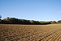
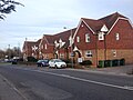
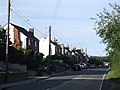
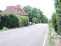
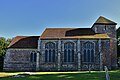
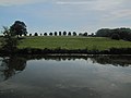
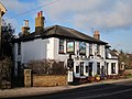
English: Nettlestead is a village and civil parish on the road SW of, and part of the borough of Maidstone. More than 800 people live in the parish. The parish church of St Mary the Virgin has links with William the Conqueror's half brother, Odo.
village and civil parish in Kent, United Kingdom .jpg) Eglwys Santes Fair y Forwyn, Nettlestead | |||||
| Upload media | |||||
| Instance of | |||||
|---|---|---|---|---|---|
| Location | Maidstone, Kent, South East England, England | ||||
 | |||||
Subcategories
This category has the following 3 subcategories, out of 3 total.
Media in category "Nettlestead, Kent"
The following 200 files are in this category, out of 217 total.
(previous page) (next page)-
 'WATERINGBURY WELCOMES CONSIDERATE DRIVERS' - geograph.org.uk - 3790478.jpg 4,000 × 3,000; 3.95 MB
-
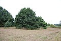
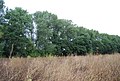 A belt of trees - geograph.org.uk - 2756505.jpg 640 × 430; 95 KB
-
 A couple of sheds near Nettlestead Green - geograph.org.uk - 1568511.jpg 640 × 583; 114 KB
-
-
 Bishops Close, Nettlestead - geograph.org.uk - 5000472.jpg 3,264 × 2,448; 1.73 MB
-
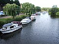
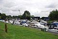 Boats at Wateringbury - geograph.org.uk - 2758960.jpg 640 × 430; 70 KB
-
 Boats moored at Wateringbury - geograph.org.uk - 2758957.jpg 640 × 430; 74 KB
-
 Boats moored on the Medway, Yalding - geograph.org.uk - 2751822.jpg 640 × 430; 95 KB
-
 Boats on the River Medway - geograph.org.uk - 2756448.jpg 640 × 430; 119 KB
-
 Boats on the River Medway, Wateringbury - geograph.org.uk - 3584889.jpg 3,488 × 2,616; 2.16 MB
-
 Boats on the River Medway, Wateringbury - geograph.org.uk - 3599448.jpg 3,488 × 2,616; 2.21 MB
-
 Bow Bridge - geograph.org.uk - 2758964.jpg 640 × 430; 82 KB
-
 Bow Bridge - geograph.org.uk - 4916215.jpg 1,600 × 904; 310 KB
-
 Bow Bridge at Wateringbury on Christmas Day - geograph.org.uk - 3789768.jpg 3,333 × 2,658; 1.02 MB
-
 Bow Road, Wateringbury - geograph.org.uk - 4890884.jpg 3,264 × 2,448; 1.61 MB
-
 Building by The Medway - geograph.org.uk - 2241246.jpg 640 × 480; 98 KB
-
 Bushes by the River Medway - geograph.org.uk - 2756468.jpg 640 × 430; 80 KB
-
 By the River Medway, Nettlestead - geograph.org.uk - 3599445.jpg 3,488 × 2,616; 2.28 MB
-
 Caravan Park by the River Medway, Wateringbury - geograph.org.uk - 3599452.jpg 3,488 × 2,616; 2.25 MB
-
 Cat at Wateringbury - geograph.org.uk - 6000700.jpg 4,000 × 3,000; 4.58 MB
-
 Conifers by the Greensand Way - geograph.org.uk - 1568656.jpg 640 × 430; 171 KB
-
 Conifers, Moat Wood - geograph.org.uk - 1568617.jpg 640 × 430; 202 KB
-
 Converted Cowl at Cronks Farm - geograph.org.uk - 1533850.jpg 480 × 640; 117 KB
-
 Coppiced tree - geograph.org.uk - 2758929.jpg 640 × 430; 152 KB
-
 Coppiced trees, Moat Wood - geograph.org.uk - 1568600.jpg 640 × 430; 211 KB
-
 Coppiced trees, Moat Wood - geograph.org.uk - 1568607.jpg 640 × 430; 219 KB
-
 Cronks Farm Barn - geograph.org.uk - 1212145.jpg 640 × 480; 108 KB
-

-
 Donkey near Nettlstead Green - geograph.org.uk - 1568503.jpg 640 × 523; 119 KB
-
 Field alongside the Greensand Way - geograph.org.uk - 4911925.jpg 4,608 × 3,456; 3.43 MB
-
 Field by the River Medway - geograph.org.uk - 2756513.jpg 640 × 430; 68 KB
-
 Field by the River Medway - geograph.org.uk - 2758883.jpg 640 × 430; 66 KB
-
 Fields behind Rose Cottages - geograph.org.uk - 4911922.jpg 4,608 × 3,456; 3.54 MB
-

-
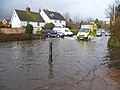
 Flooding at Wateringbury - geograph.org.uk - 3789766.jpg 4,000 × 3,000; 4.07 MB
-
 Foot crossing over the Medway Valley Line - geograph.org.uk - 6000643.jpg 4,000 × 3,000; 4.87 MB
-
 Footbridge, Medway Valley Walk (MVW) - geograph.org.uk - 2758953.jpg 640 × 430; 97 KB
-
 Footbridge, MVW - geograph.org.uk - 2758916.jpg 640 × 430; 130 KB
-
 Footpath across field - geograph.org.uk - 4173079.jpg 640 × 427; 78 KB
-
 Footpath across field - geograph.org.uk - 4173083.jpg 640 × 427; 100 KB
-
 Footpath Level Crossing - geograph.org.uk - 4916231.jpg 1,600 × 1,200; 629 KB
-
 Footpath towards Hale Park Woods - geograph.org.uk - 4173085.jpg 640 × 427; 93 KB
-
 Gate on the MVW - geograph.org.uk - 2758911.jpg 640 × 430; 146 KB
-
 Gibbs Hill towards the B2015 - geograph.org.uk - 3837121.jpg 3,696 × 2,448; 3.53 MB
-
 Gibbs Hill, Nettlestead - geograph.org.uk - 5000465.jpg 3,264 × 2,448; 2.17 MB
-
 Gibbs Hill, Nettlestead - geograph.org.uk - 5000468.jpg 3,264 × 2,448; 2.14 MB
-
 Gibbs Hill, Nettlestead - geograph.org.uk - 5000469.jpg 3,264 × 2,448; 1.94 MB
-
 Green Farm, Nettlestead Green - geograph.org.uk - 1506653.jpg 640 × 451; 53 KB
-
 Greensand Way crosses a ploughed field - geograph.org.uk - 1568533.jpg 640 × 430; 149 KB
-

-
 Greensand Way heads to Moat Wood - geograph.org.uk - 1212113.jpg 640 × 480; 82 KB
-
 Greensand Way in Moat Wood - geograph.org.uk - 3829116.jpg 428 × 640; 164 KB
-
 Greensand Way marker in Moat Wood - geograph.org.uk - 1212131.jpg 480 × 640; 150 KB
-
 Greensand Way through Moat Wood - geograph.org.uk - 1568612.jpg 640 × 430; 212 KB
-
 Greensand Way through Moat Wood - geograph.org.uk - 1568624.jpg 640 × 430; 180 KB
-
 Greensand Way through Moat Wood - geograph.org.uk - 1568631.jpg 640 × 430; 199 KB
-
 Hale Park Wood - geograph.org.uk - 1568569.jpg 640 × 430; 203 KB
-
 Hale Park Wood - geograph.org.uk - 1568580.jpg 640 × 430; 144 KB
-
 Hale Park Wood and Moat Wood - geograph.org.uk - 1568584.jpg 640 × 430; 137 KB
-
 Hampstead Lane, Nettlestead Green - geograph.org.uk - 3599426.jpg 3,488 × 2,616; 2.28 MB
-
 Hedgerow by the Greensand Way - geograph.org.uk - 1568650.jpg 640 × 430; 188 KB
-
 Highgrove Cottages, Bow Road, Wateringbury - geograph.org.uk - 4890894.jpg 3,264 × 2,448; 1.82 MB
-
 LEAF sign on the edge of Hale Park Wood - geograph.org.uk - 1568544.jpg 640 × 430; 191 KB
-
 Level crossing at Wateringbury - geograph.org.uk - 3706986.jpg 4,000 × 3,000; 4 MB
-
 Level crossing, Medway Valley Line - geograph.org.uk - 2756463.jpg 640 × 430; 98 KB
-
 Level crossing, Wateringbury - geograph.org.uk - 3584877.jpg 3,488 × 2,616; 2.23 MB
-
 Looking across Bow Bridge - geograph.org.uk - 2760604.jpg 640 × 430; 79 KB
-
 Looking towards the Greensand Way - geograph.org.uk - 4911926.jpg 4,608 × 3,456; 3.32 MB
-
 Lych Gate ^ War Memorial - geograph.org.uk - 4916240.jpg 1,600 × 904; 383 KB
-
 Maidstone Road (B2015) - geograph.org.uk - 4911915.jpg 4,608 × 3,456; 3.31 MB
-
 Maidstone Road - geograph.org.uk - 4911913.jpg 4,608 × 3,456; 3.44 MB
-
 Maidstone Road, Nettlestead - geograph.org.uk - 1621039.jpg 640 × 480; 49 KB
-
 Maidstone Road, Nettlestead - geograph.org.uk - 3584903.jpg 3,488 × 2,616; 2.21 MB
-
 Maidstone Road, Nettlestead Green - geograph.org.uk - 3599431.jpg 3,488 × 2,616; 2.26 MB
-
 Maidstone Road, Nettlestead Green - geograph.org.uk - 3599434.jpg 3,488 × 2,616; 2.18 MB
-
 Maidstone Road, Nettlestead Green - geograph.org.uk - 3599438.jpg 3,488 × 2,616; 2.15 MB
-
 Medway Towpath at Yalding - geograph.org.uk - 3846661.jpg 574 × 383; 42 KB
-
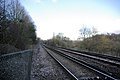
 Medway Valley Line - geograph.org.uk - 2758907.jpg 640 × 430; 95 KB
-
 Medway Valley Walk - geograph.org.uk - 2756461.jpg 640 × 430; 75 KB
-
 Medway Valley Walk - geograph.org.uk - 2756494.jpg 640 × 430; 64 KB
-
 Medway Valley Walk - geograph.org.uk - 2756503.jpg 640 × 430; 101 KB
-
 Medway Valley Walk - geograph.org.uk - 2758898.jpg 640 × 430; 84 KB
-
 Medway Valley Walk - geograph.org.uk - 4333974.jpg 640 × 480; 98 KB
-
 Medway Valley walk in the woods - geograph.org.uk - 2756466.jpg 640 × 430; 134 KB
-
 Medway Valley Way - geograph.org.uk - 2756456.jpg 640 × 430; 78 KB
-
 Mistletoe near Roydon Hall - geograph.org.uk - 5544613.jpg 640 × 428; 206 KB
-
 Moat Wood - geograph.org.uk - 1568603.jpg 640 × 430; 218 KB
-
 Moat Wood - geograph.org.uk - 1568609.jpg 640 × 430; 200 KB
-
 Moat Wood - geograph.org.uk - 1568627.jpg 640 × 430; 207 KB
-
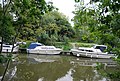
 Moored on the Medway - geograph.org.uk - 2756452.jpg 640 × 430; 116 KB
-
 Narrowboat, River Medway - geograph.org.uk - 2758945.jpg 640 × 430; 73 KB
-
 Nettlestead Place (geograph 2758922).jpg 640 × 430; 89 KB
-
 Nettlestead Place - geograph.org.uk - 2434710.jpg 1,280 × 960; 611 KB
-
 Nettlestead Village Hall - geograph.org.uk - 3584899.jpg 3,488 × 2,616; 2.15 MB
-
 Nettlestead, St. Mary's Church - geograph.org.uk - 5078350.jpg 3,678 × 2,456; 5.29 MB
-
 Nettlestead, St. Mary's Church south eastern aspect - geograph.org.uk - 5078356.jpg 3,678 × 2,456; 6.39 MB
-
 Nettlestead, St. Mary's Church southern aspect - geograph.org.uk - 5078352.jpg 3,042 × 1,994; 4.65 MB
-
 Nettlestead, St. Mary's Church, Benefaction board - geograph.org.uk - 5078473.jpg 3,858 × 3,120; 5.32 MB
-

-
-

-

-

-

-

-

-

-
 Nettlestead, St. Mary's Church, Medieval glass, St. Simon - geograph.org.uk - 5078467.jpg 2,406 × 5,065; 6.94 MB
-

-
-
 Nettlestead, St. Mary's Church, Medieval glass, St. Thomas - geograph.org.uk - 5078469.jpg 1,831 × 4,698; 5.15 MB
-

-

-
 Nettlestead, St. Mary's Church, St. Barnabas - geograph.org.uk - 5078463.jpg 3,669 × 2,439; 5.16 MB
-
 Nettlestead, St. Mary's Church, St. Paul - geograph.org.uk - 5078464.jpg 3,678 × 2,456; 5.33 MB
-
 Nettlestead, St. Mary's Church, The font - geograph.org.uk - 5078454.jpg 2,429 × 3,661; 4.51 MB
-

-

-
 Nettlestead, St. Mary's Church, The nave - geograph.org.uk - 5078370.jpg 3,679 × 2,455; 4.56 MB
-

-
 New houses in Hampstead Lane Yalding - geograph.org.uk - 5779907.jpg 640 × 480; 82 KB
-
 Oast House - geograph.org.uk - 5455836.jpg 4,000 × 3,000; 4.39 MB
-
 Oast House - geograph.org.uk - 5455901.jpg 3,591 × 2,394; 3.82 MB
-
 Old "Drive on Left" sign, near Yalding - geograph.org.uk - 3599419.jpg 2,616 × 3,488; 1.95 MB
-
 Path alongside an old orchard - geograph.org.uk - 3064299.jpg 4,000 × 3,000; 4.23 MB
-
 Path of a grubbed up hedge - geograph.org.uk - 1568524.jpg 640 × 430; 135 KB
-
 Pedestrian Level Crossing, Nettlestead - geograph.org.uk - 3599444.jpg 3,488 × 2,616; 2.19 MB
-
 Phoenix Cottages - geograph.org.uk - 2241985.jpg 640 × 480; 75 KB
-
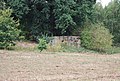 Pillbox by the River Medway - geograph.org.uk - 2756454.jpg 640 × 430; 116 KB
-
 Pillbox in Nettlestead Place Grounds - geograph.org.uk - 1200435.jpg 640 × 481; 129 KB
-
 Ploughed field by the Greensand Way - geograph.org.uk - 1568528.jpg 640 × 430; 147 KB
-

-
 Railway Crossing - geograph.org.uk - 2239620.jpg 640 × 427; 74 KB
-
 Railway near Nettlestead Church - geograph.org.uk - 331644.jpg 640 × 428; 105 KB
-
 Reflections in the River Medway near Wateringbury - geograph.org.uk - 6330607.jpg 4,000 × 3,000; 4.62 MB
-
 Resting Land Rover - geograph.org.uk - 1737420.jpg 640 × 480; 113 KB
-
 River Medway - geograph.org.uk - 2241968.jpg 640 × 320; 47 KB
-
 River Medway - geograph.org.uk - 2756507.jpg 640 × 430; 78 KB
-
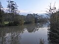
 River Medway - geograph.org.uk - 2758892.jpg 640 × 430; 108 KB
-
 River Medway - geograph.org.uk - 2758937.jpg 640 × 430; 108 KB
-
 River Medway - geograph.org.uk - 2758942.jpg 640 × 430; 87 KB
-
 River Medway - geograph.org.uk - 4333979.jpg 640 × 480; 40 KB
-
 River Medway near Wateringbury - geograph.org.uk - 6330601.jpg 4,000 × 3,000; 4.63 MB
-
 Riverside Cottage - geograph.org.uk - 2758969.jpg 640 × 430; 73 KB
-

-

-
 Security cat at Wateringbury - geograph.org.uk - 6000699.jpg 4,000 × 3,000; 4.97 MB
-
 Signal Box at Wateringbury Station - geograph.org.uk - 2239644.jpg 640 × 480; 87 KB
-
 Signalbox, Wateringbury Station - geograph.org.uk - 2760607.jpg 640 × 430; 81 KB
-
 Slipway, Yalding Marina - geograph.org.uk - 2751820.jpg 640 × 430; 96 KB
-
 St Mary's church. Nettlestead - geograph.org.uk - 3839244.jpg 3,696 × 2,448; 2.3 MB
-
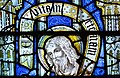
 Stained glass window, St Mary's, Nettlestead - geograph.org.uk - 3847958.jpg 2,116 × 2,712; 6.02 MB
-
 Station Road, Nettlestead Green - geograph.org.uk - 3599427.jpg 3,488 × 2,616; 2.24 MB
-
 Stile near Nettlestead Place - geograph.org.uk - 2758925.jpg 640 × 430; 141 KB
-
-
 Stile, Greensand way enters Moat Wood - geograph.org.uk - 1568593.jpg 640 × 430; 222 KB
-
 Stile, Greensand way enters Moat Wood - geograph.org.uk - 1568635.jpg 640 × 430; 207 KB
-
 Swans at Wateringbury Bridge - geograph.org.uk - 4387480.jpg 4,000 × 3,000; 4.37 MB
-
 Swans near Wateringbury Bridge - geograph.org.uk - 4387489.jpg 4,000 × 3,000; 4.42 MB
-
 The edge of Hale Park Wood - geograph.org.uk - 1568564.jpg 640 × 430; 164 KB
-
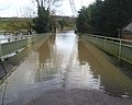
 The flooded River Medway on Christmas Day - geograph.org.uk - 3789769.jpg 4,000 × 3,000; 3.99 MB
-
 The flooded River Medway on Christmas Day - geograph.org.uk - 3789770.jpg 4,000 × 3,000; 4.09 MB
-
 The Greensand Way - geograph.org.uk - 1568646.jpg 640 × 430; 166 KB
-
 The Greensand Way - geograph.org.uk - 1737398.jpg 640 × 480; 88 KB
-
 The Greensand Way approaching Nettlestead Green - geograph.org.uk - 4911918.jpg 4,608 × 3,456; 3.4 MB
-
 The Greensand Way approaching Nettlestead Green - geograph.org.uk - 4911935.jpg 4,608 × 3,456; 3.36 MB
-

-
 The Hop Pole, Nettlestead Green - geograph.org.uk - 3599428.jpg 3,488 × 2,616; 2.23 MB
-
 The level crossing at Wateringbury station - geograph.org.uk - 5688816.jpg 3,874 × 2,905; 1.78 MB
-
 The Medway Valley Walk near Nettlestead - geograph.org.uk - 6000626.jpg 4,000 × 3,000; 4.97 MB
-
 The Medway Valley Walk near Wateringbury - geograph.org.uk - 6000615.jpg 4,000 × 3,000; 5.04 MB
-
 The Medway Valley Walk near Wateringbury - geograph.org.uk - 6000619.jpg 4,000 × 3,000; 4.64 MB
-
 The Medway Valley Walk near Wateringbury - geograph.org.uk - 6000628.jpg 4,000 × 3,000; 4.86 MB
-
 The Medway Valley Walk near Wateringbury - geograph.org.uk - 6330603.jpg 4,000 × 3,000; 4.68 MB
-
 The Medway Valley Walk near Wateringbury - geograph.org.uk - 6330605.jpg 4,000 × 3,000; 5.01 MB
-
 The Railway - geograph.org.uk - 2760603.jpg 640 × 430; 83 KB
-
 The Railway sign - geograph.org.uk - 2239632.jpg 480 × 640; 82 KB
-
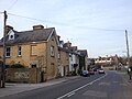
 The Railway, Wateringbury - geograph.org.uk - 2239626.jpg 640 × 480; 79 KB
-
 The Railway, Wateringbury - geograph.org.uk - 4890895.jpg 3,264 × 2,448; 1.33 MB
-
 The River Medway near Wateringbury - geograph.org.uk - 6000629.jpg 4,000 × 3,000; 4.65 MB
-
 Track to the Medway Valley Line - geograph.org.uk - 4911924.jpg 4,608 × 3,456; 3.95 MB
-
 Train on the Medway Valley Line - geograph.org.uk - 2756472.jpg 640 × 430; 76 KB
-
 Train on the Medway Valley Line - geograph.org.uk - 2756496.jpg 640 × 430; 64 KB
-
 Train on the Medway Valley Line - geograph.org.uk - 2758934.jpg 640 × 430; 115 KB
-
 Tree by the Greensand Way - geograph.org.uk - 1568669.jpg 640 × 430; 138 KB
-
-
 Trees along the River Medway - geograph.org.uk - 1515397.jpg 640 × 416; 89 KB
-
 Trees by the Medway - geograph.org.uk - 2756514.jpg 640 × 430; 90 KB
-
 Trees lining the River - geograph.org.uk - 2756500.jpg 640 × 430; 116 KB
-
 Trees lining the River Medway - geograph.org.uk - 2756460.jpg 640 × 430; 125 KB
-
 Trees lining the River Medway - geograph.org.uk - 2756474.jpg 640 × 430; 102 KB
-
 Tunnel of trees, MVW - geograph.org.uk - 2758888.jpg 640 × 430; 135 KB
-
 Two Woods - geograph.org.uk - 1212126.jpg 640 × 480; 64 KB
-
 View from Bow Bridge at Wateringbury - geograph.org.uk - 3819532.jpg 4,000 × 3,000; 4.12 MB
-
 View from Bow Bridge at Wateringbury on Christmas Day - geograph.org.uk - 3790469.jpg 4,000 × 3,000; 4.11 MB
-
 View of the River Medway from Bow Bridge at Wateringbury - geograph.org.uk - 3819603.jpg 4,000 × 3,000; 4.06 MB
-
 View to Green Farm Oast - geograph.org.uk - 2756471.jpg 640 × 430; 78 KB
-
 View to Nettlestead caravan parks - geograph.org.uk - 4655655.jpg 4,000 × 2,667; 3.73 MB
-
 View to Rock Farm - geograph.org.uk - 4655651.jpg 4,000 × 3,000; 3.01 MB
-
 Wateringbury Level Crossing - geograph.org.uk - 4890890.jpg 3,264 × 2,448; 1.79 MB


_-_geograph.org.uk_-_2758953.jpg)


_-_geograph.org.uk_-_4911915.jpg)


.jpg)


