Category:Nettlestone and Seaview
Jump to navigation
Jump to search
civil parish in Isle of Wight, England | |||||
| Upload media | |||||
| Instance of | |||||
|---|---|---|---|---|---|
| Location | Isle of Wight, South East England, England | ||||
| Area |
| ||||
| official website | |||||
 | |||||
Subcategories
This category has the following 4 subcategories, out of 4 total.
Media in category "Nettlestone and Seaview"
The following 149 files are in this category, out of 149 total.
-
 A command to "Ryde a bicycle" - geograph.org.uk - 2128382.jpg 480 × 640; 212 KB
-
 A glimpse of St. Helens church - geograph.org.uk - 5149763.jpg 640 × 480; 168 KB
-
 A path heading to St Helens - geograph.org.uk - 2652093.jpg 800 × 600; 228 KB
-
 Apartments overlooking Seagrove Bay, Seaview - geograph.org.uk - 6161002.jpg 1,024 × 768; 1.24 MB
-

-

-

-
 Attrill's Lane, near Nettlestone, Isle of Wight - geograph.org.uk - 5497514.jpg 3,733 × 2,507; 2.54 MB
-
 B3330 junction with Oakhill Road - geograph.org.uk - 4130438.jpg 2,774 × 2,375; 1.04 MB
-
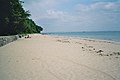
 Beach at Horestone Point - geograph.org.uk - 2128215.jpg 640 × 480; 211 KB
-

-
 Beach at Seagrove Bay - geograph.org.uk - 6291727.jpg 1,024 × 683; 124 KB
-

-
 Beach East of Ryde - geograph.org.uk - 4072058.jpg 640 × 413; 426 KB
-
 Beach near Puckpool Point - geograph.org.uk - 4072046.jpg 640 × 426; 354 KB
-
 Beach on a falling tide - geograph.org.uk - 5149880.jpg 640 × 480; 197 KB
-
 Beach, Seagrove Bay - geograph.org.uk - 5149784.jpg 640 × 480; 152 KB
-
 Beaches at Puckpool Point - geograph.org.uk - 3122092.jpg 1,600 × 1,200; 395 KB
-
 Beaches at Seaview - geograph.org.uk - 3122043.jpg 1,600 × 1,200; 407 KB
-
 Ben And Steve Navigate (6205098014).jpg 3,776 × 2,520; 3.05 MB
-
 Bookworm, Pier Road - geograph.org.uk - 3344979.jpg 640 × 480; 93 KB
-
 Bullen Cross - geograph.org.uk - 1047897.jpg 640 × 480; 58 KB
-
 Bullen Road - geograph.org.uk - 1047910.jpg 640 × 480; 115 KB
-

-
 Chemists in Pier Road - geograph.org.uk - 3344940.jpg 480 × 640; 72 KB
-
 Coastal footpath at Puckpool Point - geograph.org.uk - 2128388.jpg 640 × 480; 195 KB
-
 Coastal Path - Puckpool Point - geograph.org.uk - 3122081.jpg 1,600 × 1,200; 300 KB
-

-
 Dinghies on slipway at Nettlestone - geograph.org.uk - 6291723.jpg 683 × 1,024; 198 KB
-
 Duver Coast Nature Reserve, Isle of Wight - geograph.org.uk - 1999988.jpg 1,024 × 681; 308 KB
-
 Duver Coast Nature Reserve, Isle of Wight - geograph.org.uk - 2000009.jpg 1,024 × 681; 210 KB
-
 Duver Road towards Seaview - geograph.org.uk - 2653655.jpg 800 × 600; 222 KB
-
 Empty seats in The Esplanade - geograph.org.uk - 3345075.jpg 640 × 480; 39 KB
-
 Entrance to Puckpool Park - geograph.org.uk - 3381295.jpg 1,600 × 1,185; 297 KB
-
 Esplanade towards Horestone point - geograph.org.uk - 1038372.jpg 640 × 480; 84 KB
-
 Estate agents in the High Street - geograph.org.uk - 3345050.jpg 480 × 640; 64 KB
-
 Flagpole in St Peter's Churchyard - geograph.org.uk - 3344963.jpg 640 × 480; 85 KB
-
-
 Flood Defence, Sea Vale, Isle of Wight - geograph.org.uk - 2000024.jpg 1,024 × 681; 234 KB
-
 Flowers in Puckpool Park - geograph.org.uk - 3122015.jpg 1,600 × 1,200; 748 KB
-
 Formerly Spring Vale Hotel - geograph.org.uk - 5149908.jpg 640 × 428; 129 KB
-
 Haven House (geograph 6575881).jpg 1,024 × 684; 126 KB
-
 Hedgerow across a field - geograph.org.uk - 5149772.jpg 640 × 480; 158 KB
-
 High Street in Seaview - geograph.org.uk - 5664925.jpg 2,700 × 1,996; 449 KB
-
 Horestone Point - geograph.org.uk - 2128228.jpg 640 × 480; 242 KB
-
 Hotel in the High Street - geograph.org.uk - 3345104.jpg 480 × 640; 74 KB
-
 Houses on Pier Road, Nettlestone - geograph.org.uk - 5149800.jpg 640 × 480; 158 KB
-
 Houses on the shore at Seagrove Bay - geograph.org.uk - 6291725.jpg 1,024 × 683; 231 KB
-
 Houses overlooking Seagrove Bay, Seaview - geograph.org.uk - 6160988.jpg 1,024 × 768; 1.22 MB
-

-

-

-

-

-

-

-

-

-

-

-
-
 Looking north-west in The Esplanade - geograph.org.uk - 3345043.jpg 640 × 480; 43 KB
-
 Looking south-east in The Esplanade - geograph.org.uk - 3345035.jpg 640 × 480; 55 KB
-

-
 Low tide off Puckpool - geograph.org.uk - 6179999.jpg 3,404 × 2,956; 1.27 MB
-
 LPSV, High Street - geograph.org.uk - 3345097.jpg 480 × 640; 58 KB
-
 Medina , Callthorpe Road - geograph.org.uk - 2885389.jpg 4,288 × 2,848; 6.27 MB
-
 Medina , Callthorpe Road ^ Woodlands Vale Lodge - geograph.org.uk - 2885408.jpg 4,268 × 2,820; 6.11 MB
-
 Mid section of the High Street - geograph.org.uk - 3345122.jpg 640 × 480; 70 KB
-
 Mid section of west Street - geograph.org.uk - 3345126.jpg 640 × 480; 68 KB
-
 Mild October morning at Nettlestone - geograph.org.uk - 6291728.jpg 1,024 × 683; 197 KB
-
-
 Nettlestone point from Seaview IOW - geograph.org.uk - 5489606.jpg 1,015 × 645; 202 KB
-
 Nissan Dealership, Brading Road - geograph.org.uk - 3764635.jpg 640 × 480; 245 KB
-
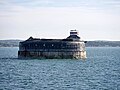
 No Man's Land Fort - "The Street" - geograph.org.uk - 4943954.jpg 1,501 × 1,000; 1.25 MB
-
 No Man's Land Fort - A lounge - geograph.org.uk - 4943974.jpg 1,454 × 1,000; 1.08 MB
-
 No Man's Land Fort - A lower level room - geograph.org.uk - 4944009.jpg 1,547 × 1,000; 1.53 MB
-
 No Man's Land Fort - Access to the sea^ - geograph.org.uk - 4944014.jpg 1,500 × 1,000; 1.15 MB
-
 No Man's Land Fort - Central atrium - geograph.org.uk - 4942900.jpg 1,480 × 1,000; 1.25 MB
-
 No Man's Land fort - Fire pit area - geograph.org.uk - 4943994.jpg 1,333 × 1,000; 1.02 MB
-
 No Man's Land Fort - geograph.org.uk - 6261380.jpg 1,024 × 576; 310 KB
-
 No Man's Land Fort - Gun - geograph.org.uk - 4944051.jpg 1,500 × 1,000; 1,021 KB
-
-
 No Man's Land Fort - lower level corridor - geograph.org.uk - 4944005.jpg 1,000 × 1,520; 1.16 MB
-
 No Man's Land Fort - Roof level - geograph.org.uk - 4943984.jpg 1,333 × 1,000; 857 KB
-
 No Man's Land Fort - The Palmerston Bar - geograph.org.uk - 4943978.jpg 1,500 × 1,000; 1.28 MB
-
 No Man's Land Fort near Ryde - geograph.org.uk - 5016572.jpg 1,280 × 720; 79 KB
-
 No Man's Land Lighthouse and dark clouds - geograph.org.uk - 4943088.jpg 1,397 × 1,000; 756 KB
-
-
 Old Seaview Lane - geograph.org.uk - 2009996.jpg 640 × 427; 159 KB
-

-
 Outfall, Seaview - geograph.org.uk - 5149823.jpg 640 × 480; 125 KB
-
 Palmerston Fort near The Isle of Wight - geograph.org.uk - 5421939.jpg 640 × 481; 346 KB
-
 Parked car in Church Street - geograph.org.uk - 3345087.jpg 640 × 480; 56 KB
-
 Pedestrian crossing Church Street - geograph.org.uk - 3345130.jpg 640 × 480; 54 KB
-
 Phone mast or tree^ - geograph.org.uk - 1897026.jpg 427 × 640; 193 KB
-
 Phonebox in Pier Road - geograph.org.uk - 3344956.jpg 640 × 480; 72 KB
-
 Portsmouth from No Man's Land Fort - geograph.org.uk - 4944082.jpg 1,585 × 1,000; 1.12 MB
-
 Priory Bay - geograph.org.uk - 1869606.jpg 1,909 × 1,273; 820 KB
-
 Priory Bay - Isle of Wight - geograph.org.uk - 2004720.jpg 4,000 × 2,664; 1.35 MB
-
 Public Bridleway R63 towards Nettlestone, Isle of Wight - geograph.org.uk - 5497450.jpg 3,827 × 2,836; 3.73 MB
-
 Public toilets, Fernclose Road - geograph.org.uk - 2128277.jpg 640 × 480; 275 KB
-
 Puckpool Park - geograph.org.uk - 3121996.jpg 1,600 × 1,200; 469 KB
-
 Raised Boardwalk - Horestone Point - Isle of Wight - geograph.org.uk - 2005123.jpg 4,000 × 2,664; 3.08 MB
-
 Roof and lighthouse, No Man's Land fort - geograph.org.uk - 4943106.jpg 1,333 × 1,000; 923 KB
-
 Ryde , MS Ventura in The Solent - geograph.org.uk - 2884930.jpg 4,214 × 2,730; 3.38 MB
-
 Ryde , Puckpool Point - geograph.org.uk - 2884903.jpg 4,288 × 2,848; 6.78 MB
-
 Ryde , The Solent - geograph.org.uk - 2885082.jpg 2,861 × 1,899; 1.45 MB
-
 Ryde , The Solent - geograph.org.uk - 2885099.jpg 4,288 × 2,848; 4.68 MB
-
 Ryde Sands - geograph.org.uk - 1115957.jpg 640 × 428; 23 KB
-
 Ryde Sands - geograph.org.uk - 1115968.jpg 640 × 428; 32 KB
-
 Sailing Lesson - Priory Bay - geograph.org.uk - 2005135.jpg 4,000 × 2,664; 1.63 MB
-
 Sale at Shipmates - geograph.org.uk - 3344928.jpg 640 × 480; 89 KB
-
 Sea Defences - geograph.org.uk - 4072068.jpg 640 × 413; 374 KB
-
 Sea View Yacht Club - geograph.org.uk - 6291722.jpg 1,024 × 683; 150 KB
-
 Seafield Road and slipway - geograph.org.uk - 2128344.jpg 480 × 640; 224 KB
-
 Seaview - esplanade - geograph.org.uk - 5836536.jpg 640 × 480; 72 KB
-
 Shipping and a fort, Spithead - geograph.org.uk - 6161343.jpg 1,024 × 512; 785 KB
-

-
 Shops in the High Street - geograph.org.uk - 3345040.jpg 640 × 480; 78 KB
-
 Skip in Pier Road - geograph.org.uk - 3344969.jpg 640 × 480; 87 KB
-
 Slipway at Seagrove Bay - geograph.org.uk - 1897007.jpg 640 × 427; 146 KB
-
 Slipway off Pier road - geograph.org.uk - 1038389.jpg 640 × 480; 74 KB
-
-
 Solent View Road - geograph.org.uk - 2652075.jpg 800 × 600; 261 KB
-
 Spithead, The Solent - geograph.org.uk - 2596295.jpg 3,748 × 2,811; 6.81 MB
-
 St Helen's Fort - geograph.org.uk - 4942890.jpg 1,755 × 1,000; 1.15 MB
-
 Still open^ - geograph.org.uk - 3345108.jpg 480 × 640; 65 KB
-
 Tesco filling station, Ryde - geograph.org.uk - 5504471.jpg 640 × 480; 111 KB
-
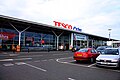 Tesco store near Ryde - geograph.org.uk - 2010182.jpg 1,500 × 1,000; 164 KB
-
 The beach at Seagrove Bay - geograph.org.uk - 2652083.jpg 800 × 600; 231 KB
-
 The beach in Priory Bay - geograph.org.uk - 5793900.jpg 2,700 × 2,025; 388 KB
-
 The beach towards Puckpool Point - geograph.org.uk - 1943702.jpg 1,500 × 1,000; 171 KB
-
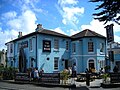 The Boat House pub - geograph.org.uk - 4877807.jpg 2,048 × 1,536; 469 KB
-
 The coastal path at Puck Pool Point - geograph.org.uk - 2652007.jpg 800 × 600; 225 KB
-
 The Duver, Seaview - geograph.org.uk - 3122065.jpg 1,600 × 1,200; 461 KB
-
 The foreshore by Nettlestone Point - geograph.org.uk - 5664927.jpg 2,700 × 1,992; 462 KB
-
 The foreshore by Nettlestone Point - geograph.org.uk - 5664928.jpg 2,700 × 2,025; 636 KB
-
 The Isle of Wight - geograph.org.uk - 4937218.jpg 2,888 × 2,166; 2.14 MB
-
 The Isle of Wight - geograph.org.uk - 4939784.jpg 2,789 × 2,090; 2.6 MB
-
 The Old Boathouse (geograph 6581868).jpg 1,024 × 684; 271 KB
-
 The old boathouse - geograph.org.uk - 1896995.jpg 640 × 427; 209 KB
-
 The Solent and Isle of Wight - geograph.org.uk - 4677074.jpg 3,170 × 2,377; 3.61 MB
-
 Walking the dogs - geograph.org.uk - 5149915.jpg 640 × 480; 200 KB
-
 Waltzing Waters - geograph.org.uk - 1047848.jpg 640 × 480; 80 KB
-
 Waltzing Waters Aqua Theatre - geograph.org.uk - 1943666.jpg 1,500 × 985; 181 KB
-
 White Cottage and Spring Vale House (geograph 6575878).jpg 1,024 × 684; 117 KB
-

-
 Woollen seagull by Nettlestone Point - geograph.org.uk - 5664926.jpg 2,700 × 2,025; 317 KB


.jpg)


.jpg)


.jpg)


.jpg)


.jpg)