Category:Nettleton, Wiltshire
Jump to navigation
Jump to search
village and civil parish in Wiltshire, England | |||||
| Upload media | |||||
| Instance of | |||||
|---|---|---|---|---|---|
| Location | Wiltshire, South West England, England | ||||
 | |||||
Nettleton is a village and civil parish about 6.5 miles (10.5 km) northwest of Chippenham in Wiltshire, England. The parish includes the villages of Burton and West Kington, and the hamlets of Horsedown, Nettleton Shrub and West Kington Wick. The northern section of Nettleton village is known as Nettleton Green.
Media in category "Nettleton, Wiltshire"
The following 200 files are in this category, out of 208 total.
(previous page) (next page)-
 2010 , Approach to Manor Farm - geograph.org.uk - 2053471.jpg 800 × 482; 159 KB
-
 2010 , B4039 at Burton - geograph.org.uk - 1958262.jpg 800 × 599; 125 KB
-

-
-
 2010 , B4039 heading west from New Town - geograph.org.uk - 1958252.jpg 800 × 612; 137 KB
-

-
 2010 , Fosse Farmhouse - geograph.org.uk - 2042010.jpg 800 × 609; 244 KB
-
 2010 , Fosse Way near Lugbury Farm - geograph.org.uk - 2042067.jpg 800 × 657; 258 KB
-
 2010 , Fosse Way near Nettleton Shrub - geograph.org.uk - 2053393.jpg 800 × 551; 180 KB
-
 2010 , Fosse Way passing Lugbury Farm - geograph.org.uk - 2053414.jpg 800 × 599; 208 KB
-

-
 2010 , Lane heading west from Burton - geograph.org.uk - 1959557.jpg 800 × 568; 215 KB
-
 2010 , Lane to Nettleton Green - geograph.org.uk - 2053386.jpg 800 × 623; 226 KB
-

-
 2010 , Manor Farm, Nettleton Green - geograph.org.uk - 2042023.jpg 800 × 663; 165 KB
-

-

-

-

-
 2010 , On the road to Nettleton - geograph.org.uk - 2053452.jpg 800 × 695; 237 KB
-
 2010 , Quiet lane to Burton - geograph.org.uk - 1959560.jpg 800 × 647; 257 KB
-
 2010 , The lane to Nettleton Mill - geograph.org.uk - 2047707.jpg 800 × 533; 246 KB
-

-
 A leaky old mill leat in the Broadmead Brook - geograph.org.uk - 5137059.jpg 3,648 × 2,048; 2.65 MB
-
 A steep grazing meadow beside Gunning's Wood - geograph.org.uk - 3486428.jpg 2,592 × 1,944; 915 KB
-
 An old kissing gate - geograph.org.uk - 5454582.jpg 480 × 640; 347 KB
-

-
 Arable field with pylon and nettles - geograph.org.uk - 5137044.jpg 3,648 × 2,048; 2.5 MB
-
 B 4039 through Burton, Wiltshire 2011 - geograph.org.uk - 5776475.jpg 2,037 × 1,281; 634 KB
-
 B4039 through Burton, Wiltshire 2011 - geograph.org.uk - 5776480.jpg 2,192 × 1,379; 620 KB
-
 Baptist Chapel, Nettleton, Wiltshire 2016 - geograph.org.uk - 5781461.jpg 2,774 × 1,822; 1.48 MB
-
 Bare field in Burton - geograph.org.uk - 3763150.jpg 800 × 600; 161 KB
-

-
 Bridleway above Broadmead Brook - geograph.org.uk - 3389334.jpg 1,280 × 853; 1.27 MB
-
 Bridleway above Broadmead Brook - geograph.org.uk - 3389401.jpg 1,920 × 1,204; 2.17 MB
-
 Bridleway near Nettleton - geograph.org.uk - 3132495.jpg 640 × 480; 76 KB
-
 Bridleway to Nettleton Shrub - geograph.org.uk - 3389542.jpg 1,280 × 851; 1.66 MB
-
 Bridleway to Nettleton Shrub - geograph.org.uk - 3389551.jpg 1,280 × 853; 1.66 MB
-
 Broadmead Brook - geograph.org.uk - 3389305.jpg 1,920 × 1,280; 2.79 MB
-
 Broadmead Brook - geograph.org.uk - 3389433.jpg 1,280 × 853; 1.62 MB
-
 Broadmead Brook - geograph.org.uk - 5451835.jpg 640 × 480; 408 KB
-
 Broadmead Brook Bridge - geograph.org.uk - 2412662.jpg 3,648 × 2,736; 2.97 MB
-

-

-
 Broadmead Brook, Shire Hill, nr West Kington, Wiltshire 2014 - geograph.org.uk - 5740361.jpg 3,872 × 2,592; 2.28 MB
-
 Broadmead Brook, Shire Hill, nr West Kington, Wiltshire 2014 - geograph.org.uk - 5740366.jpg 3,872 × 2,592; 2.24 MB
-
 Broadmead Brook, Shire Hill, nr West Kington, Wiltshire 2014 - geograph.org.uk - 5740371.jpg 3,872 × 2,592; 2.25 MB
-
 Broadmead Brook, Shire Hill, nr West Kington, Wiltshire 2014 - geograph.org.uk - 5740373.jpg 3,872 × 2,592; 2.29 MB
-
 Broadmead Brook, Shire Hill, nr West Kington, Wiltshire 2014 - geograph.org.uk - 5740375.jpg 3,872 × 2,592; 2.45 MB
-

-
 Broadmead Brook, West Kington, Wiltshire 2014 - geograph.org.uk - 5740379.jpg 3,872 × 2,592; 2.28 MB
-
 Broadmead Brook, West Kington, Wiltshire 2014 - geograph.org.uk - 5743358.jpg 3,872 × 2,592; 1.88 MB
-
 Brotton Hill Wood - geograph.org.uk - 2506685.jpg 2,592 × 1,944; 1.69 MB
-

-
 Church Hill, Burton, Wiltshire 2011 - geograph.org.uk - 5776500.jpg 1,885 × 1,203; 459 KB
-
 Church noticeboard in Burton - geograph.org.uk - 3877862.jpg 800 × 682; 175 KB
-
 Clapper bridge over Broadmead Brook - geograph.org.uk - 5451836.jpg 640 × 480; 404 KB
-
 Converted Farm Building, West Kington, Wiltshire 2014 - geograph.org.uk - 5743353.jpg 3,872 × 2,592; 2.23 MB
-
 Converted Farm Building, West Kington, Wiltshire 2014 - geograph.org.uk - 5743354.jpg 3,872 × 2,592; 2.32 MB
-
 Converted farmhouse in Nettleton - geograph.org.uk - 3163884.jpg 640 × 480; 55 KB
-
 Cottage, Nettleton, Wiltshire 2016 - geograph.org.uk - 5781450.jpg 2,317 × 1,526; 1.12 MB
-
 Derelict farm buildings - geograph.org.uk - 5609945.jpg 3,264 × 2,448; 1.87 MB
-
 Drifton Hill, West Kington, Wiltshire 2014 - geograph.org.uk - 5742438.jpg 3,872 × 2,592; 2.21 MB
-
 Drifton Hill, West Kington, Wiltshire 2014 - geograph.org.uk - 5742440.jpg 3,872 × 2,592; 1.94 MB
-
 Drifton Hill, West Kington, Wiltshire 2014 - geograph.org.uk - 5742443.jpg 3,872 × 2,592; 2.3 MB
-
 Drifton Hill, West Kington, Wiltshire 2014 - geograph.org.uk - 5742446.jpg 3,872 × 2,592; 2.26 MB
-
 Drifton Hill, West Kington, Wiltshire 2014 - geograph.org.uk - 5743348.jpg 3,872 × 2,592; 2.06 MB
-
 Drifton Hill, West Kington, Wiltshire 2014 - geograph.org.uk - 5743349.jpg 3,872 × 2,592; 1.99 MB
-
 Dry drainage channel, Burton - geograph.org.uk - 3763151.jpg 800 × 800; 270 KB
-
 Dry stone wall beside the road - geograph.org.uk - 3389443.jpg 1,280 × 853; 1.61 MB
-

-
 Entering Burton, Wiltshire on B4039 - 2011 - geograph.org.uk - 5776517.jpg 2,159 × 1,403; 831 KB
-
 Fallen tree in Deverell's Plantation - geograph.org.uk - 3389565.jpg 853 × 1,280; 1.73 MB
-
 Farmland at Down Farm - geograph.org.uk - 3662201.jpg 2,592 × 1,944; 1.62 MB
-
 Fenced old oak tree seen over a limestone wall - geograph.org.uk - 5137053.jpg 3,648 × 2,048; 2.31 MB
-
 Fields near Lugbury Farm - geograph.org.uk - 3132269.jpg 640 × 480; 74 KB
-
 Foliage-Clad House, Burton, Wiltshire 2011 - geograph.org.uk - 5778061.jpg 2,168 × 1,367; 752 KB
-
 Footbridge across the Broadmead Brook into Gunning's Wood - geograph.org.uk - 3486436.jpg 2,592 × 1,944; 1.16 MB
-
 Footbridge over Broadmead Brook - geograph.org.uk - 3389552.jpg 1,280 × 853; 1.52 MB
-
 Footbridge over Broadmead Brook - geograph.org.uk - 3389558.jpg 853 × 1,280; 1.45 MB
-
 Footbridge over the Broadmead Brook - geograph.org.uk - 3389429.jpg 1,920 × 1,278; 3.35 MB
-
 Former Pump House - geograph.org.uk - 3486440.jpg 2,592 × 1,944; 987 KB
-
 Former water supply installation^ - geograph.org.uk - 3486435.jpg 2,592 × 1,944; 983 KB
-
 Fosse Way near West Kington Wick - geograph.org.uk - 3162170.jpg 640 × 480; 68 KB
-
 Garage on the B4039 - geograph.org.uk - 5021517.jpg 1,600 × 1,065; 900 KB
-
 Garage, Burton, Wiltshire 2011 - geograph.org.uk - 5776469.jpg 2,183 × 1,385; 566 KB
-
 Garage, Burton, Wiltshire 2011 - geograph.org.uk - 5776483.jpg 2,153 × 1,388; 675 KB
-
 Garage, The Gibb, nr Castle Combe, Wiltshire 2013 - geograph.org.uk - 5776762.jpg 2,159 × 1,388; 646 KB
-
 Goulters Mill Farmhouse, nr Castle Combe, Wiltshire 2016 - geograph.org.uk - 5775395.jpg 2,797 × 1,830; 1.35 MB
-
 Goulters Mill, nr Castle Combe, Wiltshire 2016 - geograph.org.uk - 5775363.jpg 2,821 × 1,841; 1.19 MB
-
 Goulters Mill, nr Castle Combe, Wiltshire 2016 - geograph.org.uk - 5775365.jpg 2,833 × 1,830; 1.57 MB
-
 Goulters Mill, nr Castle Combe, Wiltshire 2016 - geograph.org.uk - 5775367.jpg 2,833 × 1,834; 1.32 MB
-
 Goulters Mill, nr Castle Combe, Wiltshire 2016 - geograph.org.uk - 5775370.jpg 2,798 × 1,822; 1.93 MB
-
 Goulters Mill, nr Castle Combe, Wiltshire 2016 - geograph.org.uk - 5775372.jpg 2,864 × 1,818; 1.39 MB
-
 Goulters Mill, nr Castle Combe, Wiltshire 2016 - geograph.org.uk - 5775373.jpg 2,845 × 1,830; 1.8 MB
-
 Goulters Mill, nr Castle Combe, Wiltshire 2016 - geograph.org.uk - 5775378.jpg 2,821 × 1,845; 1.67 MB
-
 Goulters Mill, nr Castle Combe, Wiltshire 2016 - geograph.org.uk - 5775381.jpg 2,712 × 1,742; 1.56 MB
-
 Goulters Mill, nr Castle Combe, Wiltshire 2016 - geograph.org.uk - 5775386.jpg 2,793 × 1,841; 1.64 MB
-
 Goulters Mill, nr Castle Combe, Wiltshire 2016 - geograph.org.uk - 5775397.jpg 2,864 × 1,818; 1.29 MB
-
 Green Cottage, Nettleton, Wiltshire 2016 - geograph.org.uk - 5781439.jpg 2,762 × 1,814; 1.72 MB
-
 Green Farm, Nettleton, Wiltshire 2016 - geograph.org.uk - 5781442.jpg 2,778 × 1,798; 1.23 MB
-
 Green Triangle at Nettleton Green - geograph.org.uk - 3168543.jpg 640 × 480; 60 KB
-
 Hillside garage, Burton - geograph.org.uk - 3763114.jpg 800 × 575; 134 KB
-
 Hillside, Burton - geograph.org.uk - 3758732.jpg 800 × 777; 196 KB
-
 Holloway Hill, West Kington, Wiltshire 2014 - geograph.org.uk - 5743341.jpg 3,872 × 2,592; 2.32 MB
-
 Holloway Hill, West Kington, Wiltshire 2014 - geograph.org.uk - 5743343.jpg 3,872 × 2,592; 1.9 MB
-
 Horse ^ Pony, Nettleton, Wiltshire 2016 - geograph.org.uk - 5781445.jpg 2,758 × 1,834; 1.32 MB
-
 House at Lugbury Farm - geograph.org.uk - 3132353.jpg 640 × 480; 90 KB
-
 House at Nettleton Shrub - geograph.org.uk - 3163877.jpg 640 × 480; 74 KB
-
 Houses, Burton, Wiltshire 2011 - geograph.org.uk - 5776512.jpg 2,153 × 1,403; 704 KB
-
 Houses, Drifton Hill, West Kington, Wiltshire 2014 - geograph.org.uk - 5743355.jpg 3,872 × 2,592; 2.35 MB
-
 Houses, Drifton Hill, West Kington, Wiltshire 2014 - geograph.org.uk - 5743360.jpg 3,872 × 2,592; 1.9 MB
-
 Houses, Drifton Hill, West Kington, Wiltshire 2014 - geograph.org.uk - 5743361.jpg 3,872 × 2,592; 2.01 MB
-
 Little Fosse Farm - geograph.org.uk - 2412765.jpg 2,753 × 2,144; 831 KB
-
 Looking downstream over the Broadmead Brook - geograph.org.uk - 5137070.jpg 3,648 × 2,048; 3.35 MB
-
 Looking upstream on the Broadmead Brook - geograph.org.uk - 5137064.jpg 3,648 × 2,048; 3.18 MB
-
 Lugbury long barrow, Nettleton - geograph.org.uk - 2312518.jpg 1,664 × 1,043; 226 KB
-
 M4 Motorway east of Burton - geograph.org.uk - 2085356.jpg 640 × 480; 52 KB
-
 M4 Motorway north of Burton - geograph.org.uk - 2085353.jpg 640 × 480; 48 KB
-
 M4 Motorway, nr Littleton Drew, Wiltshire 2011 - geograph.org.uk - 5729760.jpg 2,176 × 1,389; 712 KB
-
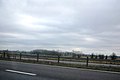
 M4 near Burton - geograph.org.uk - 1997251.jpg 1,024 × 672; 191 KB
-
 Manor Farm - geograph.org.uk - 3168556.jpg 640 × 480; 68 KB
-
 Marsh Lane bridge over M4 eastbound - geograph.org.uk - 5430615.jpg 1,600 × 960; 501 KB
-
 Marsh Lane Bridge, M4 - geograph.org.uk - 3661014.jpg 640 × 430; 36 KB
-
 National Speed Limit signs, Burton - geograph.org.uk - 3877681.jpg 800 × 667; 156 KB
-
 A timeless scene - geograph.org.uk - 327138.jpg 640 × 480; 54 KB
-
 Nettleton Green - geograph.org.uk - 1437660.jpg 640 × 477; 153 KB
-

-
 Nettleton, Wiltshire 2016 - geograph.org.uk - 5781396.jpg 2,318 × 1,492; 947 KB
-
 Nettleton, Wiltshire 2016 - geograph.org.uk - 5781405.jpg 2,794 × 1,849; 1.38 MB
-
 Nettleton, Wiltshire 2016 - geograph.org.uk - 5781456.jpg 2,802 × 1,822; 1.75 MB
-
 Nettleton, Wiltshire 2016 - geograph.org.uk - 5781458.jpg 2,355 × 1,550; 1.19 MB
-
 Nettleton, Wiltshire 2016 - geograph.org.uk - 5781459.jpg 2,814 × 1,826; 1.86 MB
-
 Nettleton, Wiltshire 2016 - geograph.org.uk - 5781463.jpg 2,658 × 1,690; 1.21 MB
-
 Old Cottage, West Kington, Wiltshire 2014 - geograph.org.uk - 5742434.jpg 3,872 × 2,592; 2.27 MB
-

-
 Old Farm Sheds, West Kington, Wiltshire 2014 - geograph.org.uk - 5742431.jpg 3,872 × 2,592; 2.32 MB
-
 Old Farm Sheds, West Kington, Wiltshire 2014 - geograph.org.uk - 5742433.jpg 3,872 × 2,592; 1.96 MB
-
 Old Farmhouse, Burton, Wiltshire 2011 - geograph.org.uk - 5776508.jpg 2,156 × 1,379; 744 KB
-

-

-
 Plough Farm crossroads - geograph.org.uk - 2412145.jpg 3,626 × 2,380; 1.32 MB
-
 Ploughed field near Plough Farm - geograph.org.uk - 1228866.jpg 640 × 491; 133 KB
-
 Pollution at Fosse Bridge - geograph.org.uk - 3110228.jpg 640 × 480; 119 KB
-
 Postbox ^ Notice Board, Nettleton, Wiltshire 2016 - geograph.org.uk - 5781449.jpg 1,852 × 1,197; 920 KB
-
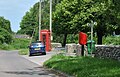 Postbox ^ Telephone Kiosk, Nettleton, Wiltshire 2016 - geograph.org.uk - 5781414.jpg 1,751 × 1,122; 661 KB
-
 Postbox, Drifton Hill, West Kington, Wiltshire 2014 - geograph.org.uk - 5743356.jpg 3,872 × 2,592; 2.3 MB
-
 Powerlines Near Nettleton - geograph.org.uk - 3132817.jpg 640 × 480; 66 KB
-
 Public footpath heading East beside the Broadmead Brook - geograph.org.uk - 3486423.jpg 2,592 × 1,944; 860 KB
-
 Pylon by the M4 - geograph.org.uk - 3331958.jpg 640 × 430; 37 KB
-
 Pylon by the M4 - geograph.org.uk - 3661010.jpg 640 × 430; 39 KB
-
 Ridleys Cheer wildflower meadow - geograph.org.uk - 4036166.jpg 3,072 × 2,048; 3.36 MB
-
 Ripening barley, Nettleton Green - geograph.org.uk - 1447593.jpg 640 × 487; 156 KB
-

-
 Road from Burton to Hinton - geograph.org.uk - 3763143.jpg 800 × 635; 159 KB
-
 Road into Nettleton Green - geograph.org.uk - 1447589.jpg 640 × 483; 209 KB
-
 Road junction west of Burton - geograph.org.uk - 2446913.jpg 640 × 480; 77 KB
-
 Sheep, Goulters Mill, nr Castle Combe, Wiltshire 2016 - geograph.org.uk - 5775392.jpg 2,782 × 1,841; 1.48 MB
-
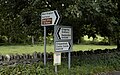 Signpost, Burton, Wiltshire 2011 - geograph.org.uk - 5776519.jpg 2,180 × 1,370; 901 KB
-

-
 Signpost, Village Green, Nettleton, Wiltshire 2016 - geograph.org.uk - 5781400.jpg 2,734 × 1,822; 1.27 MB
-
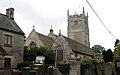
 St Mary's Church, Burton, Wiltshire 2011 - geograph.org.uk - 5776466.jpg 2,159 × 1,370; 554 KB
-
 St Mary's Church, Burton, Wiltshire 2011 - geograph.org.uk - 5776472.jpg 2,198 × 1,382; 634 KB
-
 St Mary's Church, Burton, Wiltshire 2011 - geograph.org.uk - 5776499.jpg 2,174 × 1,388; 665 KB
-

-
 St Mary's Churchgate, Burton, Wiltshire 2011 - geograph.org.uk - 5776497.jpg 2,135 × 1,394; 906 KB
-
 Stepping out near Down Farm - geograph.org.uk - 1447500.jpg 640 × 537; 153 KB
-

-

-
 Stream, bridge and repair crew at work - geograph.org.uk - 5137083.jpg 3,648 × 2,048; 2.32 MB
-
 Telephone Kiosk (now Library), Nettleton, Wiltshire 2016 - geograph.org.uk - 5781438.jpg 1,826 × 2,601; 1.38 MB
-
 Thatched Cottage, Nettleton, Wiltshire 2016 - geograph.org.uk - 5781402.jpg 2,735 × 1,810; 1.2 MB
-
 Thatched Cottage, Nettleton, Wiltshire 2016 - geograph.org.uk - 5781447.jpg 2,449 × 1,569; 857 KB
-
 Thatched Cottage, West Kington, Wiltshire 2014 - geograph.org.uk - 5740381.jpg 3,872 × 2,592; 2.35 MB
-
 Thatched Cottage, West Kington, Wiltshire 2014 - geograph.org.uk - 5740397.jpg 3,872 × 2,592; 2.3 MB
-
 Thatched Cottage, West Kington, Wiltshire 2014 - geograph.org.uk - 5742448.jpg 3,618 × 2,406; 1.83 MB
-
 Thatched Cottage, West Kington, Wiltshire 2014 - geograph.org.uk - 5742453.jpg 3,872 × 2,592; 2.22 MB
-
 Thatched Cottage, West Kington, Wiltshire 2014 - geograph.org.uk - 5743344.jpg 3,872 × 2,592; 2.29 MB
-
 Thatched Cottage, West Kington, Wiltshire 2014 - geograph.org.uk - 5743347.jpg 3,872 × 2,592; 2.21 MB
-
 The Broadmead Brook executes a small oxbow - geograph.org.uk - 3486425.jpg 2,592 × 1,944; 1.04 MB
-
 The drive to Kington Down Farm - geograph.org.uk - 3855076.jpg 2,592 × 1,944; 1.13 MB
-
 The Fosse Way - geograph.org.uk - 3389320.jpg 1,280 × 853; 1.7 MB
-
 The lane leading from Tormarton to Burton - geograph.org.uk - 2506714.jpg 2,592 × 1,944; 1.55 MB
-
 The lane to Burton - geograph.org.uk - 3662206.jpg 2,592 × 1,944; 1.31 MB
-
 The M4 - geograph.org.uk - 3331954.jpg 640 × 427; 31 KB
-
 The Old House at Home, Burton, Wiltshire 2011 - geograph.org.uk - 5776492.jpg 2,122 × 1,304; 707 KB
-
 The Old House at Home, Burton, Wiltshire 2011 - geograph.org.uk - 5776494.jpg 2,073 × 1,284; 662 KB
-
 The Old Schoolhouse, West Kington, Wiltshire 2014 - geograph.org.uk - 5740389.jpg 3,872 × 2,592; 1.96 MB
-
 The Old Schoolhouse, West Kington, Wiltshire 2014 - geograph.org.uk - 5740393.jpg 3,872 × 2,592; 2.3 MB
-
 The way to Down Farm - geograph.org.uk - 4948366.jpg 1,936 × 2,554; 1.74 MB
-
 The White Cottage, Nettleton, Wiltshire 2016 - geograph.org.uk - 5781467.jpg 2,817 × 1,834; 1.3 MB
-

-

-

-
 Tree beside Broadmead Brook - geograph.org.uk - 3389376.jpg 1,280 × 853; 1.45 MB
-
 Trees along field boundaries near Littleton Drew - geograph.org.uk - 5660084.jpg 2,187 × 850; 165 KB
-
 Turning to Littleton Drew - geograph.org.uk - 2446905.jpg 640 × 480; 51 KB
-
 Village Green, Nettleton, Wiltshire 2016 - geograph.org.uk - 5781401.jpg 2,802 × 1,806; 1.52 MB
-
 Village Shop ^ Post Office, Nettleton, Wiltshire 2016 - geograph.org.uk - 5781443.jpg 2,735 × 1,826; 1.11 MB
-
 Wall Leaze Wood - geograph.org.uk - 2506698.jpg 2,592 × 1,944; 1.76 MB


,_Nettleton,_Wiltshire_2016_-_geograph.org.uk_-_5781438.jpg)


