Category:Newry, Mourne and Down
Vai alla navigazione
Vai alla ricerca
Distretti dell’Irlanda del Nord: Antrim and Newtownabbey · Ards and North Down · Armagh, Banbridge and Craigavon · Belfast · Causeway Coast and Glens · Derry and Strabane · Fermanagh and Omagh · Lisburn and Castlereagh · Mid and East Antrim · Mid Ulster · Newry, Mourne and Down
one of the 11 local government districts of Northern Ireland established 2015  | |||||
| Carica un file multimediale | |||||
| Istanza di | |||||
|---|---|---|---|---|---|
| Luogo | Irlanda del Nord | ||||
| Capitale | |||||
| Popolazione |
| ||||
| Superficie |
| ||||
| sito web ufficiale | |||||
 | |||||
Sottocategorie
Questa categoria contiene le 5 sottocategorie indicate di seguito, su un totale di 5.
D
H
N
File nella categoria "Newry, Mourne and Down"
Questa categoria contiene 200 file, indicati di seguito, su un totale di 3 525.
(pagina precedente) (pagina successiva)-
 "Across the Sun and The Moon" - geograph.org.uk - 6624615.jpg 4 000 × 3 000; 2,36 MB
-
 'Clean' granite at Thomas's Mountain Quarry - geograph.org.uk - 5591145.jpg 3 429 × 1 730; 4,04 MB
-

-
 'Ladder' farms on the slopes below Ballymagreehan Wood - geograph.org.uk - 6346867.jpg 2 380 × 1 501; 2,32 MB
-
 'The Biodegradablity Waste at Sea' Chart - geograph.org.uk - 6107855.jpg 2 608 × 2 787; 3,71 MB
-
 11kV power lines approaching Cabra Road from the West - geograph.org.uk - 5990821.jpg 3 106 × 2 274; 3,35 MB
-

-
 11kV power lines crossing the Ballynahinch Road - geograph.org.uk - 6321282.jpg 2 669 × 1 690; 3,36 MB
-
 11kV power lines crossing the Carnreagh Road - geograph.org.uk - 6319128.jpg 3 000 × 4 000; 6,39 MB
-
 11kV power lines crossing the Drumanaghan Road - geograph.org.uk - 6324505.jpg 4 000 × 3 000; 5,43 MB
-
 11kV power lines crossing the New Line Road - geograph.org.uk - 6321983.jpg 2 654 × 3 764; 4,76 MB
-

-
 11kV power lines east of Aghlisnafin - geograph.org.uk - 5604145.jpg 1 682 × 773; 660 KB
-
 11kV power lines running parallel with the Kinghill Road - geograph.org.uk - 5940854.jpg 3 315 × 1 759; 3,08 MB
-

-
 1st Newcastle Scouts' Camp Site in Tipperary Lane - geograph.org.uk - 6588735.jpg 4 000 × 3 000; 2,9 MB
-

-
 63 King Street, Newcastle - geograph.org.uk - 6689945.jpg 1 303 × 1 437; 353 KB
-
 A "Not In Service" Ulster Bus on the Newcastle Road - geograph.org.uk - 5701348.jpg 2 306 × 1 304; 1,15 MB
-
 A 11kV line feeding a local line above the Cavan Road - geograph.org.uk - 5939826.jpg 2 726 × 3 808; 4,85 MB
-

-

-

-
 A bend in the Woodgrange Road leading to Lake House - geograph.org.uk - 5980757.jpg 4 000 × 3 000; 2,87 MB
-
 A bleak day on the Central Promenade at Newcastle - geograph.org.uk - 5656315.jpg 3 054 × 1 842; 2,55 MB
-
 A boarded up cottage in the grounds of Dromantine House - geograph.org.uk - 6120286.jpg 4 000 × 3 000; 2,87 MB
-
-
 A casualty of Ex-Hurricane Ophelia - geograph.org.uk - 5572689.jpg 3 991 × 2 311; 3,45 MB
-
-
 A complex of hospitality venues facing the Central Promenade - geograph.org.uk - 5657188.jpg 2 636 × 1 960; 1,79 MB
-
 A cormorant on a gravel bank in Castle Lake, Newcastle - geograph.org.uk - 5607556.jpg 1 659 × 2 000; 2,74 MB
-

-

-
 A cut-over section of Drumkeeragh Forest - geograph.org.uk - 6327189.jpg 4 000 × 3 000; 7,2 MB
-

-
 A depleted Clanrye River emerges below Newry's City Hall - geograph.org.uk - 5816695.jpg 4 000 × 3 000; 2,83 MB
-
 A depleted waterfall at Lindsay's Leap - geograph.org.uk - 6144031.jpg 3 602 × 2 327; 4,69 MB
-
 A deserted Donard Park on Easter Saturday, 2020 - geograph.org.uk - 6439683.jpg 3 664 × 2 347; 3,26 MB
-
 A disused homestead on the Cavan Road - geograph.org.uk - 5939338.jpg 4 000 × 3 000; 2,93 MB
-
 A dredger on the Newry Canal viewed from the Merchant's Quay - geograph.org.uk - 5848807.jpg 4 000 × 3 000; 2,57 MB
-

-

-
 A flock of crows above ploughed drumlin land near Tullymurry - geograph.org.uk - 5605435.jpg 3 725 × 1 942; 2,92 MB
-
-
 A group of bungalows on a private road off Tannaghmore Road - geograph.org.uk - 6324939.jpg 4 000 × 3 000; 2,88 MB
-

-
 A grove of trees on the seaward margin of pasture land - geograph.org.uk - 6303729.jpg 3 846 × 2 784; 5,55 MB
-
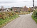
 A hamlet on the A 25 (Castlewellan Road) in Moneygore TD - geograph.org.uk - 5763714.jpg 2 669 × 2 000; 2,79 MB
-
 A hazy evening on the South Promenade, Newcastle - geograph.org.uk - 5793577.jpg 3 416 × 2 516; 5,59 MB
-
 A heavy wintery shower over the Clanrye River - geograph.org.uk - 5680653.jpg 3 584 × 2 386; 4,08 MB
-
 A hole in the B8 in the centre of Hilltown - geograph.org.uk - 5676373.jpg 4 000 × 3 000; 2,3 MB
-
 A Honda Goldwing Trike outside the Newcastle Centre - geograph.org.uk - 5850652.jpg 3 540 × 2 517; 5,39 MB
-
 A meander in the Upper Bann - geograph.org.uk - 5934733.jpg 4 000 × 3 000; 2,89 MB
-
 A muddy Islands Park car park on the following day - geograph.org.uk - 6581631.jpg 3 975 × 2 350; 2,77 MB
-
 A Mute Swan on the banks of the Duckweed covered Newry Canal - geograph.org.uk - 5848821.jpg 3 932 × 2 906; 5,96 MB
-

-
 A pair of singularly tall topiary trees on Drumgavlin Road - geograph.org.uk - 6318142.jpg 2 810 × 3 864; 6,55 MB
-
 A pair of Ulster cottage style bungalows at Lisnacee - geograph.org.uk - 6304791.jpg 4 000 × 3 000; 2,38 MB
-
 A placid Boating Lake in Castle Park - geograph.org.uk - 6579491.jpg 3 636 × 2 741; 2,5 MB
-

-

-

-
-
 A run of shops in The Square East, Warrenpoint - geograph.org.uk - 6299909.jpg 3 810 × 1 928; 3,62 MB
-

-

-

-
 A small holding for sale at 104 Drumnaquoile Road - geograph.org.uk - 6318927.jpg 3 888 × 2 844; 7,87 MB
-
 A staggered crossroads on the A25 east of McComb's Bridge - geograph.org.uk - 5988262.jpg 2 668 × 2 000; 3,33 MB
-
 A staggered terrace of houses in Dunwellan Park - geograph.org.uk - 5679498.jpg 3 029 × 2 180; 2,95 MB
-
 A stream flowing parallel with School Road - geograph.org.uk - 5749836.jpg 4 000 × 3 000; 2,88 MB
-
 A traffic free Castle Bridge at Newcastle - geograph.org.uk - 6433635.jpg 4 000 × 2 503; 2,11 MB
-

-
 A victim of Ex-Hurricane Ophelia straddles the Glen River - geograph.org.uk - 5574278.jpg 4 000 × 3 000; 2,88 MB
-

-

-
 A wee bit crowded on Castle Bridge, Newcastle - geograph.org.uk - 5842774.jpg 2 233 × 1 130; 1,67 MB
-
 A wild start to 2018 on Newcastle's Promenade - geograph.org.uk - 5641377.jpg 4 000 × 3 000; 2,49 MB
-
 A winding section of the Bucks Road - geograph.org.uk - 5979132.jpg 3 902 × 2 864; 6,04 MB
-

-
 Abandoned forestry road east of Amy's River - geograph.org.uk - 6031014.jpg 4 000 × 3 000; 2,86 MB
-
 Abandoned homesteads west of the Convent Road - geograph.org.uk - 6219777.jpg 2 030 × 1 166; 1,29 MB
-
 Abandoned work face of Millstone Quarry - geograph.org.uk - 6534074.jpg 4 000 × 3 000; 4,01 MB
-
 About to cross West of the Bann - geograph.org.uk - 5735354.jpg 3 998 × 2 998; 5,81 MB
-
 Above The Silent Valley - geograph.org.uk - 5775265.jpg 1 280 × 720; 832 KB
-
 Access walkway from the Central Promenade to the beach - geograph.org.uk - 6026568.jpg 3 972 × 2 960; 5,18 MB
-
 Adams Hill drumlin from the Bannfield Road - geograph.org.uk - 5990838.jpg 3 765 × 2 296; 5,81 MB
-

-

-
 Aggregate quarry at Narrow Water, Co Down - geograph.org.uk - 5717618.jpg 1 596 × 1 038; 1,02 MB
-
 Aghlisnafin Community Centre - geograph.org.uk - 5745136.jpg 4 000 × 3 000; 2,89 MB
-
 Aghlisnafin Road at its junction with Castlewellan Road - geograph.org.uk - 5602894.jpg 3 300 × 1 978; 2,71 MB
-
 Aghlisnafin Water Treatment Works - geograph.org.uk - 5746342.jpg 4 000 × 3 000; 2,87 MB
-
 Agricultural land between the B8 and Crobane Road - geograph.org.uk - 5804767.jpg 2 566 × 1 334; 1,98 MB
-
 Agricultural traffic on the Bannfield Road - geograph.org.uk - 5937864.jpg 2 871 × 2 088; 4,01 MB
-
 Agricultural traffic on the Rathfriland Road - geograph.org.uk - 5732955.jpg 1 780 × 1 231; 1,54 MB
-
 Agricultural traffic on the Rathfriland Road - geograph.org.uk - 5737491.jpg 2 668 × 2 000; 2,52 MB
-
 Aircraft contrails above the Downshire Civic Centre - geograph.org.uk - 6377215.jpg 4 000 × 3 000; 2,57 MB
-
 All Children's Integrated Primary School, Newcastle - geograph.org.uk - 6423091.jpg 4 000 × 3 000; 2,76 MB
-
 Allium ursinum in Tipperary Wood - geograph.org.uk - 6473211.jpg 4 000 × 3 000; 3,72 MB
-
 Alpha Quarries block yard on the A2 (Dundrum Road) - geograph.org.uk - 6626522.jpg 3 499 × 2 288; 1,63 MB
-
 Altnadua Lake viewed from the Dublin Road - geograph.org.uk - 6119511.jpg 3 207 × 1 412; 2,26 MB
-
 Altnadua Lough viewed from the A25 (Dublin Road) - geograph.org.uk - 5689987.jpg 3 100 × 1 747; 2,79 MB
-
 Altnadua Road at its junction with the Dublin Road - geograph.org.uk - 6119476.jpg 2 601 × 1 328; 2,24 MB
-
 Altocumulus Castellanus clouds over the Hilltown district - geograph.org.uk - 6346671.jpg 2 568 × 1 660; 1,78 MB
-
 Amy's River descending through Donard Wood - geograph.org.uk - 6031023.jpg 3 000 × 4 000; 7,67 MB
-
 Amy's River in Donard Wood - geograph.org.uk - 6246658.jpg 2 556 × 3 559; 7,06 MB
-

-
 Amy's River reduced to trickle at Lindsay's Leap - geograph.org.uk - 6525051.jpg 3 000 × 4 000; 2,39 MB
-
 Amy's River stilled by the Wee Beast from the East - geograph.org.uk - 5711456.jpg 4 000 × 3 000; 2,9 MB
-
 An abandoned section of the old A50 - geograph.org.uk - 6114336.jpg 4 000 × 3 000; 2,86 MB
-

-
 An almost deserted North Promenade at Newcastle - geograph.org.uk - 6443438.jpg 3 779 × 2 489; 2,16 MB
-
 An April evening at Newcastle Harbour - geograph.org.uk - 6138550.jpg 2 669 × 2 658; 4,13 MB
-
 An early April crop of silage on Barr Hill - geograph.org.uk - 6136818.jpg 3 087 × 2 000; 4,21 MB
-
 An empty Central Promenade on Easter Sunday, 2018 - geograph.org.uk - 5723601.jpg 3 628 × 2 000; 3,62 MB
-

-
 Angler fishing in the Newry Canal opposite Clady Quarries - geograph.org.uk - 6363953.jpg 1 780 × 1 334; 1,88 MB
-
 Angling platforms above the Clanrye River - geograph.org.uk - 5736947.jpg 3 918 × 2 886; 5,36 MB
-
 Annalong from the air - geograph.org.uk - 5987674.jpg 1 024 × 768; 378 KB
-
 Annalong Road, Ballymartin - geograph.org.uk - 5927100.jpg 3 928 × 2 902; 3,81 MB
-
 Annesley Hall and the Seaweed Bath House - geograph.org.uk - 5794292.jpg 4 000 × 3 000; 2,28 MB
-
 Annesley Hall on Newcastles' South Promenade - geograph.org.uk - 5794308.jpg 2 689 × 2 476; 3,32 MB
-
 Annesley Hall, Newcastle - geograph.org.uk - 6605264.jpg 4 000 × 3 000; 2,31 MB
-
 Anti-Wind Farm Poster in Donald Park - geograph.org.uk - 6631291.jpg 2 932 × 3 597; 3,21 MB
-
 Apartment block in Havelock Place, Warrenpoint - geograph.org.uk - 6299870.jpg 3 443 × 2 201; 4,47 MB
-

-
 Apartments at Leeward Court, Annalong - geograph.org.uk - 6302565.jpg 3 890 × 2 848; 5,37 MB
-
 Apartments at the Bryansford Road entrance to Donard Park - geograph.org.uk - 5618428.jpg 3 582 × 2 187; 2,76 MB
-

-
 Apartments in Boulevard Park, Newcastle - geograph.org.uk - 6626440.jpg 3 747 × 2 510; 1,72 MB
-
 Apartments in Sandys Street with offices at street level - geograph.org.uk - 5818101.jpg 3 729 × 2 309; 5,66 MB
-

-

-
 Apartments on the Shimna Mile, Newcastle - geograph.org.uk - 6605960.jpg 4 000 × 3 000; 2,69 MB
-
 Apartments overlooking Castle Lake, Newcastle - geograph.org.uk - 5573186.jpg 4 000 × 3 000; 2,24 MB
-
 Apartments overlooking the Albert Basin, Newry - geograph.org.uk - 5775963.jpg 2 921 × 2 141; 4,72 MB
-
 Apartments overlooking the Newry Canal - geograph.org.uk - 6363155.jpg 4 000 × 3 000; 2,87 MB
-
 Apartments overlooking the Shimna River - geograph.org.uk - 5680027.jpg 3 950 × 2 932; 6,02 MB
-

-

-
 Apartments under construction on the former SERC campus - geograph.org.uk - 5615396.jpg 3 000 × 1 990; 2,34 MB
-

-
 Approaching a 90 degree turn in the Ulster Way - geograph.org.uk - 6578232.jpg 4 000 × 3 000; 2,91 MB
-
 Approaching Bonecastle Cross Roads along Bonecastle Road - geograph.org.uk - 5980062.jpg 2 668 × 2 000; 3,07 MB
-
 Approaching Bonney's Caravan Park on Tullybrannigan Road - geograph.org.uk - 5607525.jpg 3 909 × 2 933; 2,69 MB
-

-
 Approaching Dromantine House along the visitors' drive - geograph.org.uk - 6120297.jpg 3 331 × 2 004; 5,02 MB
-

-

-
 Approaching George's Quay from the South along the A2 - geograph.org.uk - 5729594.jpg 2 753 × 2 024; 3,06 MB
-
 Approaching Hilltown on the Rathfriland Road - geograph.org.uk - 5737486.jpg 2 584 × 1 884; 1,76 MB
-
 Approaching houses on the North side of Drumulcaw Road - geograph.org.uk - 6323759.jpg 4 000 × 3 000; 2,82 MB
-
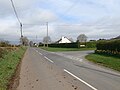
 Approaching Kilcoo from the West along the A25 (Dublin Road) - geograph.org.uk - 5734707.jpg 2 668 × 2 000; 3,29 MB
-
 Approaching Low Water at Newcastle, Co Down - geograph.org.uk - 6041477.jpg 4 000 × 3 000; 2,5 MB
-

-
 Approaching McCombs Bridge from the Rathfriland direction - geograph.org.uk - 5889661.jpg 3 062 × 2 000; 3,86 MB
-
 Approaching Meelmore Lodge - geograph.org.uk - 5717153.jpg 1 280 × 720; 1,14 MB
-
 Approaching road works on the Hilltown Road above Mayobridge - geograph.org.uk - 5737723.jpg 3 204 × 2 602; 2,91 MB
-

-
 Approaching the big bend in the Manse Road, Seaforde - geograph.org.uk - 5752831.jpg 2 668 × 2 000; 3,72 MB
-

-
 Approaching the Burren Roundabout on the A2 - geograph.org.uk - 6287119.jpg 3 506 × 2 050; 3,95 MB
-

-

-

-

-

-
 Approaching the Hollymount Forest exit gate - geograph.org.uk - 5985181.jpg 4 000 × 3 000; 2,87 MB
-

-

-

-
-
 Approaching the NW end of Ballymoney Road, Kilcoo - geograph.org.uk - 5937762.jpg 3 890 × 2 850; 6,45 MB
-

-

-

-
-
 Approaching Trassey Bridge from the West - geograph.org.uk - 5530615.jpg 4 000 × 3 000; 5,08 MB
-

-
 Arable land between Kilkeel and Ballymartin - geograph.org.uk - 5729713.jpg 3 000 × 2 058; 2,63 MB
-

-
 Araucaria araucana at Glasdrumman - geograph.org.uk - 5702537.jpg 2 668 × 2 000; 2,9 MB
-
 Arched footbridge over the Newry Canal - geograph.org.uk - 5736832.jpg 3 908 × 2 872; 5,67 MB
-
 Arched pedestrian bridge over the Newry Canal - geograph.org.uk - 5736806.jpg 4 000 × 3 000; 2,85 MB
-
 Ardiente Grill Bar on Newcastle's Central Promenade - geograph.org.uk - 5538748.jpg 3 861 × 2 169; 1,74 MB
-

-
 Around A Pound Store on Newcastle's Main Street - geograph.org.uk - 5683694.jpg 2 818 × 2 383; 3,07 MB
-
 Ascending forestry track in Tollymore Forest - geograph.org.uk - 5528677.jpg 4 000 × 3 000; 4,41 MB
-
 Ascending Trassey Road in a WSW direction - geograph.org.uk - 5531810.jpg 4 000 × 3 000; 3,35 MB
-
 At the end of the rainbow - geograph.org.uk - 5572795.jpg 3 353 × 2 835; 1,53 MB
-

-
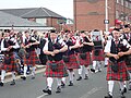 Aughnahoory Heroes Pipe Band - geograph.org.uk - 5842812.jpg 3 994 × 2 994; 6,6 MB
-
 Aughrim or Little Kilkeel River below the A2 Bridge - geograph.org.uk - 5682882.jpg 3 712 × 2 562; 5,78 MB
-

-
 Autumn colours in the undergrowth in Donard Wood - geograph.org.uk - 5590659.jpg 3 920 × 2 890; 7,97 MB
-
 Autumn colours in the woodlands of the Seaforde Demesne - geograph.org.uk - 6324300.jpg 3 950 × 2 203; 4,37 MB
-
 Autumn colours on Castlewellan Road, Newcastle - geograph.org.uk - 6317939.jpg 4 000 × 2 384; 4,28 MB
-
 Autumn in Donard Park - geograph.org.uk - 5589900.jpg 4 000 × 3 000; 2,92 MB
-
 Autumn leaves carpet the floor of Donard Wood - geograph.org.uk - 5574294.jpg 3 000 × 4 000; 2,58 MB


_in_Moneygore_TD_-_geograph.org.uk_-_5763714.jpg)


_-_geograph.org.uk_-_6368975.jpg)


_-_geograph.org.uk_-_6626522.jpg)

_-_geograph.org.uk_-_5689987.jpg)


_in_the_centre_of_Warrenpoint_-_geograph.org.uk_-_6299885.jpg)


_-_geograph.org.uk_-_5734707.jpg)


_-_geograph.org.uk_-_5763710.jpg)


