Category:Nieuwe Kerk (Groningen)
Jump to navigation
Jump to search
| Object location | | View all coordinates using: OpenStreetMap |
|---|
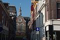
church building in Groningen, Netherlands  | |||||
| Upload media | |||||
| Instance of | |||||
|---|---|---|---|---|---|
| Location | Groningen, Netherlands | ||||
| Street address |
| ||||
| Located on street |
| ||||
| Heritage designation |
| ||||
| Inception |
| ||||
| official website | |||||
 | |||||
|
This is a category about rijksmonument number 18583
|
| Address |
|
Subcategories
This category has the following 2 subcategories, out of 2 total.
I
P
Media in category "Nieuwe Kerk (Groningen)"
The following 24 files are in this category, out of 24 total.
-
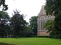
 20100418 Nieuwe Kerk Groningen NL.jpg 3,000 × 2,400; 4.95 MB
-
 20130709 Torenspits Nieuwe Kerk Groningen.jpg 3,572 × 4,762; 599 KB
-
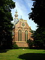
 517 Groningen Nieuwe Kerk.JPG 4,000 × 3,000; 5.17 MB
-
 56, Groninger Museum - Groningen - 20093164 - RCE.jpg 1,200 × 803; 218 KB
-
 Cibogaterrein met het groen van Open Lab Ebbinge.jpg 3,008 × 2,000; 3.21 MB
-

-

-
 Groningen - Nieuwe Kerk en Nieuwe Kazerne.jpg 5,134 × 4,272; 8.63 MB
-
 Groningen, de Nieuwe Kerk RM18563 foto8 2015-03-22 13.58.jpg 4,352 × 3,264; 14.62 MB
-
 Groningen, de Nieuwe Kerk RM18583 IMG 0085 2018-01-07 14.59.jpg 4,773 × 3,460; 15.07 MB
-
-
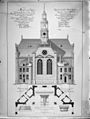
 Naar tekening XIXA in het Museum Groningen - Groningen - 20093157 - RCE.jpg 1,200 × 896; 325 KB
-
 Nieuwe Kerk Groningen.jpg 389 × 518; 44 KB
-
 Nieuwe Kerk, Groningen 2022.jpg 4,032 × 3,024; 5.85 MB
-
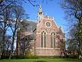
 Nieuwe Kerk, Groningen.jpg 1,944 × 2,592; 2.26 MB
-
 Nieuwe Kerk.JPG 2,816 × 2,112; 2.64 MB
-
 NieuweKerk.jpg 2,560 × 1,920; 989 KB
-
 Overzicht - Groningen - 20093163 - RCE.jpg 894 × 1,200; 292 KB
-
 Overzicht hervormde kerk, centraalbouw - Groningen - 20319041 - RCE.jpg 1,200 × 871; 245 KB
-
 Overzicht hervormde kerk, centraalbouw - Groningen - 20319042 - RCE.jpg 899 × 1,200; 275 KB
-
 Overzicht zuidoostgevel - Groningen - 20365263 - RCE.jpg 1,200 × 953; 304 KB
-
 Overzicht zuidoostgevel - Groningen - 20365264 - RCE.jpg 1,200 × 945; 315 KB
-
 Roeleffs - Nieuwe Kerk.jpg 7,226 × 10,227; 17.97 MB
-
 Rotterdammerstraatje met zicht op de Nieuwe Kerk.jpg 3,008 × 2,000; 3.27 MB


