Category:Nieuwe Markt 37, Deventer
Jump to navigation
Jump to search
| Object location | | View all coordinates using: OpenStreetMap |
|---|
 | |||||
| Upload media | |||||
| Instance of |
| ||||
|---|---|---|---|---|---|
| Location | Deventer, Overijssel, Netherlands | ||||
| Street address |
| ||||
| Located on street |
| ||||
| Heritage designation |
| ||||
 | |||||
|
This is a category about rijksmonument number 12701
|
| Address |
|
Media in category "Nieuwe Markt 37, Deventer"
The following 30 files are in this category, out of 30 total.
-
 Exterieur DAK VAN ZOLDER - Deventer - 20309443 - RCE.jpg 1,190 × 1,200; 305 KB
-
 Exterieur OVERZICHT - Deventer - 20309439 - RCE.jpg 1,190 × 1,200; 342 KB
-
 Exterieur OVERZICHT - Deventer - 20309440 - RCE.jpg 1,188 × 1,200; 330 KB
-
 Exterieur OVERZICHT - Deventer - 20309442 - RCE.jpg 1,197 × 1,200; 354 KB
-
 Exterieur OVERZICHT VANAF DAK - Deventer - 20309444 - RCE.jpg 1,190 × 1,200; 252 KB
-
 Exterieur OVERZICHT VOORGEVELS - Deventer - 20284417 - RCE.jpg 1,200 × 1,188; 356 KB
-
 Exterieur OVERZICHT VOORGEVELS - Deventer - 20309441 - RCE.jpg 1,190 × 1,200; 340 KB
-
 INT. BEGANE GROND, OVERZICHT RUIMTE - Deventer - 20309447 - RCE.jpg 1,193 × 1,200; 352 KB
-
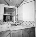 INT. EERSTE VERDIEPING, KEUKEN - Deventer - 20309453 - RCE.jpg 1,185 × 1,200; 260 KB
-
 INT. EERSTE VERDIEPING, OVERZICHT KAMER - Deventer - 20309452 - RCE.jpg 1,186 × 1,200; 257 KB
-
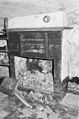
 INT. EERSTE VERDIEPING, OVERZICHT KAMER, SCHOUW - Deventer - 20309451 - RCE.jpg 1,195 × 1,200; 261 KB
-
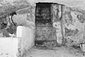
 INT. KELDER - Deventer - 20309448 - RCE.jpg 795 × 1,200; 253 KB
-
 INT. KELDER, STENEN TRAP - Deventer - 20309450 - RCE.jpg 1,200 × 795; 244 KB
-
 INT. KELDER, TRAP - Deventer - 20309449 - RCE.jpg 795 × 1,200; 217 KB
-
 INT. OVERZICHT BEGANE GROND - Deventer - 20309445 - RCE.jpg 1,195 × 1,200; 331 KB
-
 INT. OVERZICHT BEGANE GROND - Deventer - 20309446 - RCE.jpg 1,188 × 1,200; 311 KB
-
 INT. TWEEDE VERDIEPING, OVERZICHT KAMER - Deventer - 20309454 - RCE.jpg 1,185 × 1,200; 278 KB
-
 INT. TWEEDE VERDIEPING, OVERZICHT VOORKAMER - Deventer - 20309455 - RCE.jpg 1,197 × 1,200; 269 KB
-
 INT. TWEEDE VERDIEPING, OVERZICHT VOORKAMER - Deventer - 20309456 - RCE.jpg 1,200 × 1,200; 285 KB
-
 INT. TWEEDE VERDIEPING, VOORKAMER, MUURKASTEN - Deventer - 20309457 - RCE.jpg 1,188 × 1,200; 296 KB
-
 INT. TWEEDE VERDIEPING, VOORKAMER, TRAP - Deventer - 20309458 - RCE.jpg 1,200 × 1,197; 292 KB
-
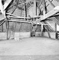 INT. ZOLDER, OVERZICHT KAPCONSTRUCTIE - Deventer - 20309459 - RCE.jpg 1,185 × 1,200; 313 KB
-
 INT. ZOLDER, OVERZICHT KAPCONSTRUCTIE - Deventer - 20309460 - RCE.jpg 1,183 × 1,200; 364 KB
-
 INT. ZOLDER, OVERZICHT KAPCONSTRUCTIE - Deventer - 20309461 - RCE.jpg 1,197 × 1,200; 337 KB
-
 INTERIEUR, OVERZICHT WINKEL - Deventer - 20284418 - RCE.jpg 1,195 × 1,200; 250 KB
-
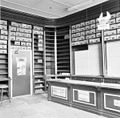 INTERIEUR, OVERZICHT WINKEL - Deventer - 20284419 - RCE.jpg 1,200 × 1,176; 279 KB
-
 INTERIEUR, WINKEL, KROONLIJST, DETAIL - Deventer - 20284421 - RCE.jpg 1,200 × 1,188; 170 KB
-
 INTERIEUR, WINKEL, TRAPPENKAST - Deventer - 20284420 - RCE.jpg 1,195 × 1,200; 222 KB
-
 Nieuwe Markt 37 Deventer.jpg 1,712 × 2,560; 1.19 MB
-
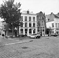
 Straatwand - Deventer - 20056121 - RCE.jpg 1,200 × 804; 189 KB


