Category:Nitzow
Jump to navigation
Jump to search
| Object location | | View all coordinates using: OpenStreetMap |
|---|
district of Havelberg | |||||
| Upload media | |||||
| Instance of |
| ||||
|---|---|---|---|---|---|
| Location | Havelberg, Stendal District, Saxony-Anhalt, Germany | ||||
| Area |
| ||||
| Elevation above sea level |
| ||||
 | |||||
Subcategories
This category has the following 2 subcategories, out of 2 total.
B
- Bahnhof Nitzow (3 F)
D
- Dorfkirche (Nitzow) (3 F)
Media in category "Nitzow"
The following 10 files are in this category, out of 10 total.
-
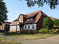
 Nitzow Dorfstraße 54.jpg 4,896 × 3,672; 8.88 MB
-
 Nitzow Freiwillige Feuerwehr.JPG 4,000 × 3,000; 3.09 MB
-
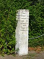
 Nitzow Wegestein-01.jpg 2,832 × 3,776; 8.17 MB
-
 Nitzow Wegestein.jpg 2,832 × 4,240; 9.02 MB
-
 NitzowDorfstr1516.jpg 2,592 × 1,944; 2.4 MB
-
 NitzowDorfstr20.jpg 2,511 × 1,868; 2.5 MB
-
 NitzowDorfstr24.jpg 2,592 × 1,944; 2.26 MB
-
 NitzowDorfstr26.jpg 2,592 × 1,944; 2.86 MB
-
 NitzowDorfstr86.jpg 2,520 × 1,885; 2.24 MB
-
 NitzowWegweiser.jpg 1,587 × 2,137; 2.58 MB


