Category:Noordeinde 12, The Hague
Jump to navigation
Jump to search
| Object location | | View all coordinates using: OpenStreetMap |
|---|
house in The Hague, Netherlands  | |||||
| Upload media | |||||
| Instance of | |||||
|---|---|---|---|---|---|
| Location | The Hague, South Holland, Netherlands | ||||
| Street address |
| ||||
| Architectural style | |||||
| Heritage designation |
| ||||
 | |||||
|
This is a category about rijksmonument number 459756
|
| Address |
|
Media in category "Noordeinde 12, The Hague"
The following 5 files are in this category, out of 5 total.
-
 Kortenbos, Den Haag, Netherlands - panoramio (25).jpg 1,148 × 2,048; 389 KB
-
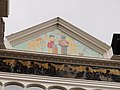 Rm459756 top.JPG 3,648 × 2,736; 1.97 MB
-
 Rm459756-2.JPG 2,736 × 3,648; 2.03 MB
-
 Rm459756-onder.JPG 2,736 × 3,648; 1.99 MB
-
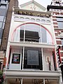 Rm459756.JPG 2,736 × 3,648; 2.05 MB
.jpg)


