Category:North Downs Way
Jump to navigation
Jump to search

long distance footpath in England  | |||||
| Upload media | |||||
| Instance of |
| ||||
|---|---|---|---|---|---|
| Location |
| ||||
| Highest point |
| ||||
| Terminus | |||||
 | |||||
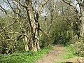
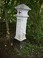
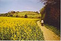
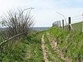
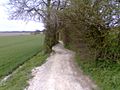
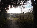
English: The North Downs Way is a long-distance path in southern England. It runs from Farnham to Dover, past Godalming, Guildford, Dorking, Merstham, Otford and Rochester, along the Surrey Hills Area of Outstanding Natural Beauty (AONB) and Kent Downs AONB.
Subcategories
This category has the following 20 subcategories, out of 20 total.
A
B
- Bigbury Camp (14 F)
- Blatchford Down (4 F)
- Box Hill, Stepping Stones (15 F)
- Brockham Lime Works (5 F)
C
D
- Denbies Wine Estate (75 F)
G
I
- Inglis Memorial (42 F)
K
M
O
- Optohedron (6 F)
P
R
- Reigate Fort (12 F)
- Reigate Hill Footbridge (27 F)
S
W
- White Down (2 F)
- Whitehill Tower (7 F)
Media in category "North Downs Way"
The following 200 files are in this category, out of 242 total.
(previous page) (next page)-
 A claggy bit of the Pilgrim's Way - geograph.org.uk - 137030.jpg 640 × 480; 155 KB
-
 A crossing of the ways - geograph.org.uk - 141623.jpg 640 × 480; 141 KB
-
 A view along the North Downs Way - geograph.org.uk - 1654868.jpg 480 × 640; 566 KB
-
 A warning I did well to heed - geograph.org.uk - 1082819.jpg 480 × 640; 89 KB
-
 Allington Farm from the North - geograph.org.uk - 778318.jpg 640 × 425; 51 KB
-
 Birch Cross Road - geograph.org.uk - 1706216.jpg 2,048 × 1,536; 1.24 MB
-
 Bluebells on the North Downs Way - geograph.org.uk - 167791.jpg 640 × 480; 171 KB
-
 Bluebells on the North Downs Way - geograph.org.uk - 778232.jpg 640 × 480; 132 KB
-
 Box Hill Salomons Memorial.jpg 640 × 425; 88 KB
-
 Caterham, North Downs Way near the viewpoint.jpg 2,668 × 4,000; 4.14 MB
-
 Close-up of the Path Marker on the North Downs - geograph.org.uk - 2108146.jpg 2,304 × 3,072; 3.27 MB
-
 Clump of trees, North Downs Way - geograph.org.uk - 235506.jpg 640 × 461; 56 KB
-
 Coal Tax Post, Colley Hill, by Swiss Cottage.jpg 1,333 × 2,000; 551 KB
-
 Coal Tax Post, Queens Park, Reigate 02.jpg 2,112 × 2,816; 1.47 MB
-
 Colley Hill, view.jpg 3,500 × 2,327; 2.13 MB
-

-
 Denbies Wine Estate, autumn colours.jpg 4,000 × 2,666; 5.22 MB
-
 Denbies, view over Box Hill.jpg 6,500 × 1,880; 4.39 MB
-
 Derelict shepherd's hut, Guildford.jpg 4,000 × 3,000; 2.77 MB
-
 Dew pond on the North Downs Way.jpg 3,264 × 2,448; 4.69 MB
-

-
 Entrance to Shoulder of Mutton Wood - geograph.org.uk - 1062101.jpg 640 × 481; 153 KB
-
 Fly tipping, The Avenue, Tatsfield.jpg 5,152 × 3,864; 4.43 MB
-
 Footpath junction on the North Downs Way (geograph 3253398).jpg 800 × 600; 210 KB
-
 Heading Up Hollingbourne Down. - geograph.org.uk - 170954.jpg 640 × 436; 148 KB
-

-

-
 Kissing Gate on North Downs Way near Cold Blow Farm - geograph.org.uk - 1772021.jpg 3,072 × 2,304; 2.71 MB
-

-
 Little Kings Wood Viewpoint on North Downs Way.jpg 3,000 × 2,001; 1.79 MB
-
 Looking N along the North Downs Way - geograph.org.uk - 1654847.jpg 480 × 640; 474 KB
-
 Millenium signpost, National Cycle Network route 17 at Blue Bell Hill.jpg 3,864 × 5,152; 4.49 MB
-
 Mouse seat, Steers Field, Ranmore.jpg 2,500 × 1,666; 941 KB
-
 NashendenValley5508.JPG 2,048 × 1,536; 746 KB
-

-
 North Downs (this) Way - geograph.org.uk - 1656752.jpg 3,872 × 2,592; 5.77 MB
-
 North Downs near Hawley's corner.jpg 4,000 × 3,000; 4.54 MB
-
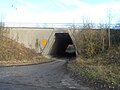
 North Downs Way - Bridge under B3000.JPG 3,072 × 2,304; 3.54 MB
-
 North Downs Way - fairy tree.jpg 2,322 × 4,128; 6.57 MB
-
 North Downs Way - Farnham terminus - marker.jpg 4,128 × 2,322; 8 MB
-
 North Downs Way - Farnham terminus - sculpture.jpg 4,128 × 2,322; 6.87 MB
-
 North Downs Way - geograph.org.uk - 1050316.jpg 480 × 640; 154 KB
-
 North Downs Way - geograph.org.uk - 1316662.jpg 640 × 480; 143 KB
-
 North Downs Way - geograph.org.uk - 1316912.jpg 640 × 480; 155 KB
-
 North Downs Way - geograph.org.uk - 1383197.jpg 640 × 480; 103 KB
-
 North Downs Way - geograph.org.uk - 1383218.jpg 640 × 480; 149 KB
-
 North Downs Way - geograph.org.uk - 1383225.jpg 640 × 480; 155 KB
-
 North Downs Way - geograph.org.uk - 1424952.jpg 640 × 480; 142 KB
-
 North Downs Way - geograph.org.uk - 1424957.jpg 640 × 480; 136 KB
-
 North Downs Way - geograph.org.uk - 1425054.jpg 640 × 480; 154 KB
-
 North Downs Way - geograph.org.uk - 1425063.jpg 640 × 480; 119 KB
-
 North Downs Way - geograph.org.uk - 1426785.jpg 640 × 480; 196 KB
-
 North Downs Way - geograph.org.uk - 1426807.jpg 640 × 480; 165 KB
-
 North Downs Way - geograph.org.uk - 1706214.jpg 2,048 × 1,536; 1.2 MB
-
 North Downs Way - geograph.org.uk - 340814.jpg 640 × 426; 149 KB
-
 North Downs Way - geograph.org.uk - 364142.jpg 640 × 479; 136 KB
-
 North Downs Way - geograph.org.uk - 778262.jpg 640 × 480; 85 KB
-
 North Downs Way - geograph.org.uk - 791037.jpg 640 × 426; 88 KB
-
 North Downs Way - geograph.org.uk - 794595.jpg 640 × 426; 108 KB
-
 North Downs Way - geograph.org.uk - 81609.jpg 640 × 428; 39 KB
-
 North Downs Way - geograph.org.uk - 856315.jpg 640 × 480; 127 KB
-
 North Downs Way - geograph.org.uk - 869972.jpg 640 × 426; 83 KB
-
 North Downs Way - pillbox.jpg 4,128 × 2,322; 5.95 MB
-
 North Downs Way above Otford - geograph.org.uk - 228071.jpg 640 × 480; 144 KB
-
 North Downs Way across The Spains - geograph.org.uk - 788633.jpg 426 × 640; 137 KB
-

-

-
 North Downs Way approach to Colley Hill - geograph.org.uk - 370220.jpg 640 × 481; 130 KB
-
 North Downs Way at Colley Hill - geograph.org.uk - 370228.jpg 640 × 481; 81 KB
-
 North Downs Way below Holly Hill - geograph.org.uk - 228159.jpg 640 × 480; 125 KB
-
 North Downs Way below Pebble Coombe - geograph.org.uk - 866476.jpg 479 × 640; 148 KB
-

-
 North Downs Way crosses bridleway - geograph.org.uk - 1254161.jpg 640 × 480; 118 KB
-

-
 North Downs Way crosses road - geograph.org.uk - 1178090.jpg 640 × 481; 80 KB
-
 North Downs Way east of Etchinghill - geograph.org.uk - 351491.jpg 640 × 467; 53 KB
-
 North Downs Way facing Brabourne Lane - geograph.org.uk - 392870.jpg 480 × 640; 147 KB
-

-
 North Downs Way footbridge over River Wey - geograph.org.uk - 84319.jpg 640 × 480; 104 KB
-

-
 North Downs Way from Brabourne Lane - geograph.org.uk - 392048.jpg 480 × 640; 127 KB
-

-
 North Downs Way goes on byway - geograph.org.uk - 1118356.jpg 640 × 481; 106 KB
-
 North Downs Way heads downhill - geograph.org.uk - 1456237.jpg 640 × 480; 144 KB
-
 North Downs Way in Birches Wood - geograph.org.uk - 1254151.jpg 640 × 480; 136 KB
-
 North Downs Way in Birches Wood - geograph.org.uk - 1254186.jpg 640 × 480; 160 KB
-
 North Downs Way in Great Park Wood - geograph.org.uk - 1118362.jpg 481 × 640; 116 KB
-
 North Downs Way in No Man's Orchard - geograph.org.uk - 1588163.jpg 640 × 427; 78 KB
-
 North Downs Way in Old Wives Lees - geograph.org.uk - 1490218.jpg 640 × 427; 88 KB
-
 North Downs Way in Trosley Country Park - geograph.org.uk - 1177069.jpg 640 × 481; 128 KB
-
 North Downs Way in Westfield Wood - geograph.org.uk - 1639216.jpg 640 × 479; 114 KB
-
 North Downs Way Information Board - geograph.org.uk - 1588179.jpg 640 × 427; 78 KB
-

-
 North Downs Way left, Pilgrim's way right - geograph.org.uk - 491391.jpg 640 × 480; 144 KB
-
 North Downs Way looking west 2737638 2b90a3d6.jpg 782 × 586; 155 KB
-
 North Downs Way Marker - geograph.org.uk - 1254156.jpg 640 × 480; 118 KB
-

-
 North Downs Way marker, King's Wood, Kent.JPG 2,112 × 2,816; 3.72 MB
-
 North Downs Way meets Birchin Cross Road - geograph.org.uk - 25203.jpg 640 × 480; 110 KB
-
 North Downs Way near Boughton Lees - geograph.org.uk - 385459.jpg 640 × 480; 119 KB
-
 North Downs Way near Brabourne - geograph.org.uk - 392053.jpg 640 × 480; 122 KB
-
 North Downs Way near Eastwell Park - geograph.org.uk - 1409491.jpg 640 × 480; 225 KB
-
 North Downs Way near Hollingbourne 1.JPG 3,008 × 2,000; 1.52 MB
-
 North Downs Way near Holly Hill House - geograph.org.uk - 1118372.jpg 640 × 481; 126 KB
-
 North Downs Way on ancient Trackway - geograph.org.uk - 1588302.jpg 640 × 427; 127 KB
-
 North Downs Way on Birch Cross Road - geograph.org.uk - 1256087.jpg 640 × 480; 135 KB
-
 North Downs Way on Golden Hill - geograph.org.uk - 1588317.jpg 640 × 427; 129 KB
-
 North Downs Way on Woods Hill Lane - geograph.org.uk - 1435895.jpg 640 × 480; 80 KB
-
 North Downs Way past Perry Court Farm - geograph.org.uk - 1456407.jpg 640 × 480; 144 KB
-
 North Downs Way past Squintels Wood - geograph.org.uk - 1325969.jpg 640 × 480; 84 KB
-
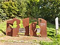 North Downs Way sculpture at Farnham (1).jpg 3,264 × 2,448; 4.16 MB
-
 North Downs Way sculpture at Farnham (2).jpg 3,264 × 2,448; 4.07 MB
-
 North Downs Way seat sculpture - geograph.org.uk - 2092178.jpg 2,092 × 1,569; 1.1 MB
-
 North downs way seen from puttenham.jpg 3,072 × 2,304; 2.99 MB
-
 North downs way sign 1.jpg 3,072 × 2,304; 3.01 MB
-
 North Downs Way Sign in Kemsing Downs Nature Reserve.jpg 4,592 × 3,448; 14.02 MB
-
 North Downs Way starting point at Farnham.jpg 4,032 × 3,024; 5.2 MB
-
 North Downs Way to Brasted Hill - geograph.org.uk - 1578067.jpg 640 × 427; 99 KB
-
 North Downs Way to Cobham Farm - geograph.org.uk - 1301386.jpg 640 × 480; 97 KB
-
 North Downs Way West of Colley Hill - geograph.org.uk - 370241.jpg 640 × 481; 136 KB
-
 North Downs Way, Compton - geograph.org.uk - 858285.jpg 640 × 480; 132 KB
-
 North Downs Way, Compton - geograph.org.uk - 858294.jpg 640 × 480; 156 KB
-
 North Downs Way, crosses on A3 slip road.jpg 1,665 × 2,500; 1.02 MB
-
 North Downs Way, Cuxton - geograph.org.uk - 145791.jpg 427 × 640; 144 KB
-
 North Downs Way, Kent - geograph.org.uk - 10633.jpg 640 × 475; 102 KB
-
 North Downs Way, near Cuxton - geograph.org.uk - 146192.jpg 640 × 427; 137 KB
-
 North Downs Way, near Halling - geograph.org.uk - 177504.jpg 640 × 480; 70 KB
-
 North Downs Way, north of Hollingbourne - geograph.org.uk - 778330.jpg 640 × 480; 153 KB
-
 North Downs Way, Orchid Seat near Snailslynch Farm, Farnham.jpg 2,500 × 1,899; 1.79 MB
-
 North Downs Way, Reigate Hill - geograph.org.uk - 1319695.jpg 640 × 360; 86 KB
-
 North Downs Way, Runfold Wood.jpg 3,000 × 2,250; 2.37 MB
-
 North Downs Way, Wrotham - geograph.org.uk - 1383204.jpg 640 × 480; 138 KB
-
 North Downs Way.jpg 640 × 480; 42 KB
-
 North Downs Way^ - geograph.org.uk - 1657392.jpg 2,592 × 3,872; 3.45 MB
-
 North of Polsted - geograph.org.uk - 856616.jpg 640 × 480; 72 KB
-
 NorthDownsWayTrail.jpg 640 × 480; 57 KB
-
 Orchard on the North Downs way - geograph.org.uk - 48149.jpg 640 × 480; 196 KB
-
 Part of the North Downs Way - geograph.org.uk - 1217411.jpg 480 × 640; 134 KB
-
 Part of the North Downs Way - geograph.org.uk - 1217432.jpg 640 × 480; 125 KB
-
 Path through natural trellis - geograph.org.uk - 411537.jpg 427 × 640; 150 KB
-
 Pilgrims Way near Trottiscliffe - geograph.org.uk - 177555.jpg 640 × 480; 121 KB
-
 Pill Box on the North Downs Way - geograph.org.uk - 364159.jpg 640 × 467; 157 KB
-
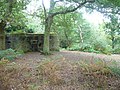 Pillbox on North Downs Way - geograph.org.uk - 963751.jpg 640 × 480; 139 KB
-
 Pillbox on the North Downs Way.jpg 3,264 × 2,448; 3.97 MB
-
 Pillbox, Blatchford Down 1.JPG 2,816 × 2,112; 1.46 MB
-
 Pillbox, Blatchford Down 2.JPG 2,816 × 2,112; 1.47 MB
-
 Pillbox, Blatchford Down 3.JPG 2,816 × 2,112; 1.46 MB
-
 Pillbox, White Down 1.JPG 2,816 × 2,112; 1.48 MB
-
 Pillbox, White Down 2.JPG 2,816 × 2,112; 1.48 MB
-
 Puttenham Common from the North Downs Way.JPG 3,072 × 2,304; 3.54 MB
-
 Puttenham sign.jpg 1,662 × 2,500; 1.64 MB
-
 Quick's grave, Box Hill.jpg 1,384 × 2,000; 1.5 MB
-
 Railway bridge and North Downs Way, near White Horse Stone.jpg 5,152 × 3,864; 4.32 MB
-
 Railway bridge over Channel Tunnel Rail Link, Blue Bell Hill.jpg 5,152 × 3,864; 4.27 MB
-
 Railway Bridge, North Downs Way - geograph.org.uk - 1526567.jpg 480 × 640; 142 KB
-
 Ranmore Common, North Downs Way.jpg 2,660 × 4,000; 5.34 MB
-
 Ranmore Common, woods along the North Downs Way.jpg 4,000 × 2,669; 5.5 MB
-
 Reigate Hill, War Department Boundary Marker.jpg 2,667 × 4,000; 2.51 MB
-
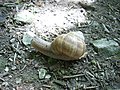 Roman Snail (Helix pomatia) on the North Downs Way at Lenham.JPG 2,816 × 2,112; 1.48 MB
-
 Seat on the North Downs Way - geograph.org.uk - 1526245.jpg 480 × 640; 159 KB
-
 Shalford House Parkland marker.jpg 2,171 × 3,000; 3.66 MB
-
 Shere Woodlands, NDW in West Hanger.jpg 3,000 × 2,250; 2.57 MB
-
 Signage in Kemsing Downs Nature Reserve.jpg 3,448 × 4,592; 10.45 MB
-
 Slow worm in King's Wood, Kent.JPG 2,816 × 2,112; 1.46 MB
-
 South of Sandy Cross - geograph.org.uk - 1316655.jpg 640 × 480; 131 KB
-
 Stepping Stones over the River Mole, Box Hill, Dorking.jpg 800 × 532; 430 KB
-
 Stile, North Downs Way and View - geograph.org.uk - 1399439.jpg 640 × 360; 45 KB
-
 Subway under the A229 at Blue Bell Hill 01.jpg 5,152 × 3,864; 4.42 MB
-
 Subway under the A229 at Blue Bell Hill 02.jpg 5,152 × 3,864; 4.34 MB
-
 Subway under the A229 at Blue Bell Hill 03.jpg 5,152 × 3,864; 4.5 MB
-
 Subway under the A229 at Blue Bell Hill 04.jpg 5,152 × 3,864; 4.35 MB
-
 Subway under the A229 at Blue Bell Hill 05.jpg 5,152 × 3,864; 4.36 MB
-
 Subway under the A229 at Blue Bell Hill 06.jpg 5,152 × 3,864; 4.44 MB
-
 Subway under the A229 at Blue Bell Hill 07.jpg 5,152 × 3,864; 9.17 MB
-
 The Fairy Tree, near Seale, North Downs Way.jpg 1,139 × 2,000; 820 KB
-
 The Fox Way, Clandon Downs - geograph.org.uk - 992340.jpg 640 × 480; 122 KB
-

-
 The North Downs Way - geograph.org.uk - 1194271.jpg 640 × 429; 105 KB
-
 The North Downs Way - geograph.org.uk - 167796.jpg 640 × 480; 148 KB
-
 The North Downs Way - geograph.org.uk - 64473.jpg 640 × 480; 160 KB
-
 The North Downs Way at Albury Downs - geograph.org.uk - 1288664.jpg 640 × 427; 79 KB
-

-
 The North Downs Way crosses Brabourne Lane - geograph.org.uk - 1771857.jpg 3,072 × 2,304; 3.14 MB
-

-
 The North Downs Way crossing the River Wey near Shalford in Surrey (geograph 5744682).jpg 3,888 × 2,592; 3.03 MB
-
 The North Downs Way meets Chevening Lane - geograph.org.uk - 1578141.jpg 640 × 427; 117 KB
-
 The North Downs Way meets Mill Lane - geograph.org.uk - 1588332.jpg 640 × 427; 114 KB
-
 The North Downs Way near Soakham Downs - geograph.org.uk - 1456229.jpg 640 × 480; 126 KB
-

-
 The North Downs Way through Netley Heath, Shere.jpg 3,000 × 2,250; 2.59 MB
-
 The North Downs Way under the A3 near Compton - geograph.org.uk - 4915442.jpg 4,608 × 3,456; 5.05 MB
-
 The North Downs Way, near Otford - geograph.org.uk - 87309.jpg 640 × 480; 66 KB
-

-
 The Pilgrim's Way near Cobham Farm - geograph.org.uk - 137034.jpg 640 × 480; 83 KB
-
 The Pilgrim's Way towards Spring Lane - geograph.org.uk - 1773364.jpg 3,072 × 2,304; 2.9 MB
-
 The Stepping Stones - geograph.org.uk - 158891.jpg 2,136 × 2,848; 3.16 MB
-
 Toy blue cow on North Downs Way.jpg 640 × 480; 263 KB
-
 Track to Frogs Hole - geograph.org.uk - 141874.jpg 640 × 480; 102 KB
-
 Ugly scarecrow near the North Downs Way - geograph.org.uk - 1771912.jpg 3,072 × 2,304; 1.89 MB
-
 Unused stile on North Downs Way - geograph.org.uk - 1578137.jpg 640 × 427; 113 KB


.jpg)


_Way_-_geograph.org.uk_-_1656752.jpg)


.jpg)
.jpg)


_on_the_North_Downs_Way_at_Lenham.JPG)


.jpg)


