Category:Norwood, North Yorkshire
Jump to navigation
Jump to search
civil parish in Harrogate, North Yorkshire, England, UK   | |||||
| Upload media | |||||
| Instance of | |||||
|---|---|---|---|---|---|
| Location | Harrogate, North Yorkshire, Yorkshire and the Humber, England | ||||
 | |||||
Subcategories
This category has the following 4 subcategories, out of 4 total.
D
- Dob Park Bridge (4 F)
S
- Scow Hall (5 F)
- The Sun Inn, Norwood (6 F)
- Swinsty Reservoir (42 F)
Media in category "Norwood, North Yorkshire"
The following 200 files are in this category, out of 308 total.
(previous page) (next page)-
 A59 east of Dangerous Corner - geograph.org.uk - 4728744.jpg 640 × 480; 56 KB
-
 Abandoned Stone Barn in Haverah Park - geograph.org.uk - 2811993.jpg 4,320 × 3,240; 4.37 MB
-
 Access Drive to Norwood Bottom Farm - geograph.org.uk - 2857341.jpg 4,320 × 3,240; 4.52 MB
-
 Access to Hambleton House Farm - geograph.org.uk - 3778537.jpg 1,600 × 1,200; 742 KB
-
 Access to Springfield Farm - geograph.org.uk - 2857336.jpg 4,320 × 3,240; 3.69 MB
-
 Access Track from Long Slack House - geograph.org.uk - 2806190.jpg 4,320 × 3,240; 3.12 MB
-
 Along Watson's Lane - geograph.org.uk - 4782801.jpg 640 × 427; 71 KB
-
 Approaching Brame Lane - geograph.org.uk - 4782812.jpg 640 × 427; 75 KB
-
 Approaching Bramelane - geograph.org.uk - 2571848.jpg 640 × 398; 79 KB
-

-
 Approaching Swinsty reservoir - geograph.org.uk - 6254024.jpg 1,024 × 768; 429 KB
-
 At the edge of the wood - geograph.org.uk - 5821722.jpg 3,240 × 4,320; 3.14 MB
-
 B6451 approaching Dangerous Corner - geograph.org.uk - 5222762.jpg 640 × 480; 67 KB
-
 B6451 beside Menwith Hill - geograph.org.uk - 4109041.jpg 640 × 481; 58 KB
-
 B6451 by Menwith Hill - geograph.org.uk - 3347127.jpg 640 × 365; 26 KB
-
 B6451 junction with Wydra Lane - geograph.org.uk - 4983323.jpg 1,024 × 682; 214 KB
-
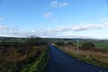
 B6451 towards Farnley - geograph.org.uk - 5985780.jpg 640 × 480; 58 KB
-
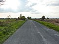
 B6451 towards Norwood Edge - geograph.org.uk - 5985769.jpg 640 × 480; 50 KB
-
 B6451 towards Otley - geograph.org.uk - 5222742.jpg 640 × 480; 53 KB
-
 B6451 towards Otley - geograph.org.uk - 5268906.jpg 640 × 480; 41 KB
-
 B6451 towards Pateley Bridge - geograph.org.uk - 5222771.jpg 640 × 480; 57 KB
-
 B6451, Bland Hill - geograph.org.uk - 3559246.jpg 1,024 × 682; 176 KB
-
 B6451, Norwood Bottom - geograph.org.uk - 5985766.jpg 640 × 480; 88 KB
-
 B6451, Norwood Edge - geograph.org.uk - 3559241.jpg 1,024 × 682; 194 KB
-
 Bales near Brown Bank - geograph.org.uk - 2533276.jpg 640 × 481; 74 KB
-
 Bank End Farm - geograph.org.uk - 3014812.jpg 2,048 × 1,536; 550 KB
-
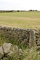
 Bank Slack - geograph.org.uk - 3215125.jpg 3,648 × 2,736; 1.77 MB
-
 Barn along Broad Dubb Road - geograph.org.uk - 4782791.jpg 640 × 427; 79 KB
-
 Barn near Swinsty - geograph.org.uk - 2533421.jpg 640 × 428; 88 KB
-
 Bedlam Lane - geograph.org.uk - 2332637.jpg 4,320 × 3,240; 3.76 MB
-
 Bedlam Lane - geograph.org.uk - 4782818.jpg 640 × 427; 66 KB
-
 Bedlam Lane - geograph.org.uk - 4782819.jpg 640 × 427; 109 KB
-
 Bedlam Lane - geograph.org.uk - 5222737.jpg 640 × 480; 68 KB
-
 Below Swinsty Reservoir - geograph.org.uk - 2533449.jpg 640 × 480; 94 KB
-
 Benchmarked Gateposts off Broad Dubb Lane - geograph.org.uk - 3559546.jpg 682 × 1,024; 226 KB
-
 Bland Hill road junction - geograph.org.uk - 909373.jpg 640 × 426; 101 KB
-
 Bog trotting ahead - geograph.org.uk - 2770015.jpg 3,264 × 2,448; 1.74 MB
-
 Boundary fence of RAF Menwith Hill - geograph.org.uk - 5265745.jpg 6,000 × 4,000; 4.62 MB
-
 Bracken and young woodland - geograph.org.uk - 5985768.jpg 640 × 480; 46 KB
-
 Brame House - geograph.org.uk - 3014593.jpg 2,048 × 1,536; 580 KB
-
 Brame Lane - geograph.org.uk - 4782815.jpg 640 × 427; 74 KB
-
 Brat Lane - geograph.org.uk - 2167373.jpg 640 × 480; 105 KB
-
 Bridge over the Washburn - geograph.org.uk - 2571998.jpg 640 × 480; 111 KB
-
 Bridleway by Renton Wood - geograph.org.uk - 2571895.jpg 640 × 480; 129 KB
-
 Broad Dubb Road - geograph.org.uk - 2167365.jpg 640 × 480; 102 KB
-
 Broad Dubb Road - geograph.org.uk - 5268915.jpg 640 × 480; 61 KB
-
 Broad Dubb Road - geograph.org.uk - 5268919.jpg 640 × 480; 43 KB
-
 Brown Bank - geograph.org.uk - 2571023.jpg 640 × 474; 74 KB
-
 Brown Bank Road - geograph.org.uk - 2046622.jpg 640 × 480; 258 KB
-
 Brown Bank Road - geograph.org.uk - 2167370.jpg 640 × 480; 100 KB
-
 Brown Bank Road - geograph.org.uk - 3559256.jpg 1,024 × 682; 192 KB
-
 Brown Bank Road From Broad Dubb Road - geograph.org.uk - 2149104.jpg 800 × 600; 228 KB
-
 Building southside of Broad Dubb Road - geograph.org.uk - 2167362.jpg 640 × 480; 158 KB
-
 Bungalows on Brame Lane, Bland Hill - geograph.org.uk - 5268930.jpg 640 × 480; 69 KB
-
 By the Washburn - geograph.org.uk - 2571992.jpg 640 × 480; 128 KB
-
 Car park for Swinsty Reservoir, Norwood - geograph.org.uk - 1926600.jpg 1,497 × 2,000; 1.07 MB
-
 Car Park for the Disabled Angler - geograph.org.uk - 4424470.jpg 4,256 × 2,832; 6.71 MB
-
 Chapel at Brown Bank - geograph.org.uk - 16489.jpg 640 × 480; 79 KB
-
 Clay Pit Lane - geograph.org.uk - 4527616.jpg 5,184 × 3,456; 3.87 MB
-
 Clearing in Norwood Edge Plantation - geograph.org.uk - 5985777.jpg 4,866 × 3,408; 4.43 MB
-
 Clearing in Stainburn Forest - geograph.org.uk - 3388933.jpg 640 × 428; 108 KB
-
 Collapsed stile at Sandwith Moor - geograph.org.uk - 3778767.jpg 1,600 × 1,200; 507 KB
-
 Communications mast - geograph.org.uk - 3388866.jpg 428 × 640; 103 KB
-
 Cottage along Bedlam Lane - geograph.org.uk - 4782824.jpg 640 × 427; 104 KB
-
 Covered reservoir, Lindley Moor - geograph.org.uk - 5874330.jpg 1,024 × 768; 184 KB
-
 Cray Pit Lane towards Bank Slack - geograph.org.uk - 3293919.jpg 4,220 × 2,804; 960 KB
-
 Crossing Dyan's Dike - geograph.org.uk - 2571204.jpg 640 × 475; 91 KB
-
 Crossing Swinsty Reservoir - geograph.org.uk - 5268899.jpg 640 × 480; 57 KB
-
 Crossroads at Dangerous Corner - geograph.org.uk - 5265728.jpg 6,000 × 4,000; 3.84 MB
-
 Cut Bench Mark, Gatepost ^1, Broad Dubb Lane - geograph.org.uk - 3559550.jpg 1,024 × 682; 333 KB
-
 Cut Bench Mark, Gatepost ^2, Broad Dubb Lane - geograph.org.uk - 3559551.jpg 1,024 × 682; 290 KB
-
 Dam wall at Swinsty Reservoir through the trees - geograph.org.uk - 2409482.jpg 1,280 × 960; 313 KB
-

-
 Derelict barn near Haverah Park Top - geograph.org.uk - 2570901.jpg 640 × 459; 110 KB
-
 Derelict barn near Haverah Park Top - geograph.org.uk - 2571010.jpg 640 × 410; 90 KB
-
 Derelict machinery at Swinsty Reservoir - geograph.org.uk - 4424884.jpg 4,000 × 2,661; 3.5 MB
-
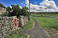
 Disabled anglers' path, Swinsty Reservoir, Norwood - geograph.org.uk - 1926623.jpg 2,000 × 1,500; 768 KB
-
 Disused Gateway - geograph.org.uk - 3215138.jpg 3,648 × 2,736; 1.77 MB
-
 Disused Storage Tank, Swinsty Reservoir - geograph.org.uk - 1924058.jpg 1,024 × 681; 266 KB
-
 Dobpark Bridge - geograph.org.uk - 3778511.jpg 1,600 × 1,200; 867 KB
-
 Dobpark Bridge and Ford - geograph.org.uk - 3778514.jpg 1,600 × 1,200; 813 KB
-
 Dobpark Ford and Bridge - geograph.org.uk - 3778508.jpg 1,600 × 1,200; 844 KB
-
 Edge of Stainburn Forest - geograph.org.uk - 3388937.jpg 640 × 428; 156 KB
-
 Ellers Wood - geograph.org.uk - 2572180.jpg 640 × 480; 141 KB
-
 Entrance to Cooper House Farm and Barns - geograph.org.uk - 2811507.jpg 4,320 × 3,240; 3.78 MB
-
 Entrance to Cooper House Farm and Barns - geograph.org.uk - 3559245.jpg 1,024 × 682; 195 KB
-
 Entrance to Hambleton House Farm - geograph.org.uk - 3215183.jpg 3,648 × 2,736; 1.53 MB
-
 Entrance to The Grange, Fewston - geograph.org.uk - 6254023.jpg 1,024 × 768; 319 KB
-
 Feeding the Birds, Swinsty Reservoir - geograph.org.uk - 1924029.jpg 1,024 × 681; 138 KB
-
 Felled Area, Stainburn Forest - geograph.org.uk - 3559239.jpg 1,024 × 682; 207 KB
-
 Fern Filled Pinfold - geograph.org.uk - 4739574.jpg 4,208 × 2,368; 3.5 MB
-
 Field boundary near Dangerous Corner - geograph.org.uk - 5265750.jpg 6,000 × 4,000; 5.34 MB
-
 Field entrance off Bedlam Lane - geograph.org.uk - 5222531.jpg 640 × 480; 84 KB
-
 Field entrance off Broad Dubb Road - geograph.org.uk - 5268917.jpg 640 × 480; 63 KB
-
 Field entrance off the B6451 - geograph.org.uk - 5268905.jpg 640 × 480; 38 KB
-
 Field entrances off Broad Dubb Road - geograph.org.uk - 5269924.jpg 640 × 480; 91 KB
-
 Field near Reservoir - geograph.org.uk - 3215171.jpg 3,648 × 2,736; 919 KB
-
 Field of Cattle off Broad Dubb Road - geograph.org.uk - 3559251.jpg 1,024 × 682; 162 KB
-
 Field off Penny Pot Lane - geograph.org.uk - 4983328.jpg 1,024 × 682; 185 KB
-
 Fields and wood at Norwood Edge - geograph.org.uk - 106536.jpg 640 × 480; 122 KB
-
 Fields below Cooper House - geograph.org.uk - 5258536.jpg 5,184 × 3,888; 5.03 MB
-
 Fields east of Swinsty Reservoir - geograph.org.uk - 5258548.jpg 1,600 × 1,200; 612 KB
-
 Foggy farmland below Dangerous Corner - geograph.org.uk - 5265756.jpg 6,000 × 4,000; 4.09 MB
-
 Folly Hall - geograph.org.uk - 3778523.jpg 1,600 × 1,200; 758 KB
-
 Folly Hall, Norwood - geograph.org.uk - 2769295.jpg 1,979 × 2,176; 975 KB
-
 Footpath at Sword Point - geograph.org.uk - 2769290.jpg 3,264 × 2,448; 1.94 MB
-
 Footpath by the Wall, Stainburn Forest - geograph.org.uk - 3559237.jpg 682 × 1,024; 279 KB
-
 Footpath junction with Top Lane - geograph.org.uk - 3778533.jpg 1,600 × 1,200; 508 KB
-
 Footpath near Bank End Farm - geograph.org.uk - 2770020.jpg 3,264 × 2,448; 2.52 MB
-
 Footpath near the Sun Inn - geograph.org.uk - 2571873.jpg 640 × 480; 130 KB
-
 Footpath through the forest - geograph.org.uk - 3778776.jpg 1,600 × 1,200; 866 KB
-
 Footpath through the forest at Sandwith Moor - geograph.org.uk - 3778769.jpg 1,600 × 1,200; 803 KB
-
 Ford at Dobpark Bridge - geograph.org.uk - 4249727.jpg 3,872 × 2,592; 4.84 MB
-
 Forest by the A59 - geograph.org.uk - 5265739.jpg 6,000 × 4,000; 5.43 MB
-
 Forest footpath - geograph.org.uk - 2769269.jpg 2,448 × 3,264; 1.98 MB
-
 Forest track, Norwood Edge - geograph.org.uk - 2769281.jpg 3,264 × 2,448; 1.94 MB
-
 Frosted trees near Dangerous Corner - geograph.org.uk - 5265752.jpg 6,000 × 4,000; 5.03 MB
-
 Frosty field near Long Stoop Farm - geograph.org.uk - 5265754.jpg 6,000 × 4,000; 6.28 MB
-
 Frozen footpath at Norwood - geograph.org.uk - 2769287.jpg 2,448 × 3,264; 1.9 MB
-
 Frozen path - geograph.org.uk - 3388922.jpg 428 × 640; 104 KB
-
 Frozen River Washburn - geograph.org.uk - 2332480.jpg 3,072 × 2,304; 1.36 MB
-
 Gate beside Norwood Edge Plantation - geograph.org.uk - 2857326.jpg 4,320 × 3,240; 4.31 MB
-
 Gate near Brame House - geograph.org.uk - 2571832.jpg 640 × 480; 107 KB
-
 Gate on bridleway, Renton Wood - geograph.org.uk - 2571918.jpg 640 × 480; 136 KB
-
 Gatepost in a meadow, Norwood - geograph.org.uk - 1924786.jpg 2,000 × 1,500; 1.03 MB
-
 Gateway to The Grange, Fewston - geograph.org.uk - 5268895.jpg 640 × 480; 90 KB
-
 Geese near the back of The Sun Inn - geograph.org.uk - 644003.jpg 640 × 480; 86 KB
-
 Grazing land near Brame Hall - geograph.org.uk - 2533375.jpg 640 × 449; 90 KB
-
 Grazing near Cooper House Farm - geograph.org.uk - 5268903.jpg 640 × 480; 65 KB
-
 Grazing near Long Slack House - geograph.org.uk - 5222765.jpg 640 × 480; 76 KB
-
 Grazing north of Bedlam Lane - geograph.org.uk - 5222736.jpg 640 × 480; 57 KB
-
 Grazing of the B6451 - geograph.org.uk - 5222739.jpg 640 × 480; 71 KB
-
 Grazing off Broad Dubb Road - geograph.org.uk - 5268914.jpg 640 × 480; 46 KB
-
 Grazing off Smithson's Lane - geograph.org.uk - 5268902.jpg 640 × 480; 46 KB
-
 Grazing, Norwood - geograph.org.uk - 5268912.jpg 640 × 480; 46 KB
-
 Grazing, Norwood Bottom - geograph.org.uk - 5985763.jpg 640 × 480; 76 KB
-
 Grazing, Sandwith Moor - geograph.org.uk - 5268920.jpg 640 × 480; 49 KB
-
 Hillside, Washburn valley - geograph.org.uk - 2572171.jpg 640 × 462; 72 KB
-
 Houses on Brame Lane - geograph.org.uk - 4782813.jpg 640 × 427; 69 KB
-
 Houses, Bland Hill - geograph.org.uk - 5268910.jpg 640 × 480; 54 KB
-
 Hunter's Stones - geograph.org.uk - 2769274.jpg 2,426 × 2,422; 2.09 MB
-
 Hunter's Stones - geograph.org.uk - 3778553.jpg 1,600 × 1,200; 603 KB
-
 In Norwood Edge Plantation - geograph.org.uk - 2548527.jpg 4,320 × 3,240; 4.12 MB
-
 In Norwood Edge Plantation - geograph.org.uk - 5985773.jpg 640 × 480; 124 KB
-
 In the Washburn valley - geograph.org.uk - 2571986.jpg 640 × 480; 131 KB
-
 Junction of Jack Hill Lane with Maud Lane and Brat Lane - geograph.org.uk - 5470527.jpg 3,648 × 2,736; 2.71 MB
-
 Lakeside trees - geograph.org.uk - 1107940.jpg 509 × 640; 148 KB
-
 Lane towards Norwood Bottom Hall - geograph.org.uk - 1058073.jpg 640 × 480; 101 KB
-
 Late Autumn at Lindley - geograph.org.uk - 4117341.jpg 1,728 × 1,152; 965 KB
-
 Lindley Moor Trig Pillar - geograph.org.uk - 5874337.jpg 1,024 × 587; 113 KB
-
 Line of pylons - geograph.org.uk - 3388924.jpg 428 × 640; 107 KB
-
 Livestock pen beside Broad Dubb Road - geograph.org.uk - 5269927.jpg 640 × 480; 84 KB
-
 Long Slack House ^ Farm - geograph.org.uk - 2081680.jpg 4,000 × 3,000; 3.39 MB
-
 Looking along Watson's Lane - geograph.org.uk - 4782806.jpg 640 × 427; 77 KB
-
 Looking east along Penny Pot Lane - geograph.org.uk - 2963849.jpg 800 × 600; 166 KB
-
 Looking south east - geograph.org.uk - 5269926.jpg 640 × 480; 43 KB
-
 Looking South from Norwood Edge - geograph.org.uk - 147861.jpg 640 × 480; 199 KB
-
 Looking towards Norwood - geograph.org.uk - 1058064.jpg 640 × 480; 92 KB
-
 Looking towards Pasture beside Norwood Edge Plantation - geograph.org.uk - 2548539.jpg 4,320 × 3,240; 4.12 MB
-
 Looking west along Broad Dubb Road - geograph.org.uk - 2149088.jpg 800 × 600; 211 KB
-
 Lovely Countryside - geograph.org.uk - 56578.jpg 640 × 480; 146 KB
-
 Mast on Norwood Edge - geograph.org.uk - 186852.jpg 640 × 480; 52 KB
-
 Minor road through woodland, Fewston - geograph.org.uk - 5268894.jpg 640 × 480; 113 KB
-
 Minor road towards Lindley - geograph.org.uk - 5986442.jpg 640 × 480; 88 KB
-
 Moorland above Scargill Reservoir - geograph.org.uk - 3559258.jpg 1,024 × 682; 212 KB
-
 Norwood Bottom Hall - geograph.org.uk - 1166053.jpg 640 × 426; 68 KB
-
 Norwood Bottom Road - geograph.org.uk - 5959544.jpg 1,024 × 683; 352 KB
-
 Norwood Edge - geograph.org.uk - 3215009.jpg 3,648 × 2,736; 1.1 MB
-
 Norwood Edge Plantation - geograph.org.uk - 4355110.jpg 1,024 × 768; 125 KB
-
 Norwood Edge radio mast - geograph.org.uk - 606376.jpg 480 × 640; 38 KB
-
 Norwood Edge trig point - geograph.org.uk - 2769276.jpg 1,937 × 2,177; 758 KB
-
 Norwood Methodist Chapel - geograph.org.uk - 2857332.jpg 4,320 × 3,240; 3.32 MB
-
 Norwood Pumping Station - geograph.org.uk - 2221512.jpg 3,773 × 2,084; 6.28 MB
-
 Norwood Social Hall. Bland Hill - geograph.org.uk - 5268907.jpg 640 × 480; 47 KB
-
 Norwood, North Yorkshire UK parish locator map.svg 1,425 × 1,037; 4.3 MB
-

-
 Old forest road - geograph.org.uk - 3388870.jpg 640 × 428; 108 KB
-

-
 Ordnance Survey Flush Bracket S6448 - geograph.org.uk - 4431552.jpg 2,988 × 5,312; 2.69 MB
-
 Packhorse Bridge over River Washburn (2) - geograph.org.uk - 4450664.jpg 1,024 × 766; 693 KB
-
 Packhorse Bridge over River Washburn - geograph.org.uk - 4450660.jpg 1,024 × 768; 716 KB
-
 Paddock Hill - geograph.org.uk - 285425.jpg 640 × 436; 96 KB
-
 Paddock Hill - geograph.org.uk - 3559243.jpg 1,024 × 682; 223 KB
-
 Pasture near Norwood Hall - geograph.org.uk - 5986441.jpg 5,184 × 3,888; 2.99 MB
-
 Path along the north side of Norwood Edge Plantation - geograph.org.uk - 3778547.jpg 1,600 × 1,200; 597 KB
-
 Path by the Washburn - geograph.org.uk - 2533463.jpg 640 × 480; 141 KB
-
 Path by the Washburn - geograph.org.uk - 2571981.jpg 640 × 480; 138 KB
-
 Path through Norwood Edge Plantation - geograph.org.uk - 3388864.jpg 640 × 428; 113 KB
-
 Penny Pot House (derelict) - geograph.org.uk - 4983333.jpg 1,024 × 682; 272 KB
-
 Penny Pot House - geograph.org.uk - 3293920.jpg 4,608 × 3,072; 918 KB
-
 Penny Pot House - geograph.org.uk - 843975.jpg 640 × 401; 60 KB
-
 Penny Pot Lane - geograph.org.uk - 4983331.jpg 1,024 × 682; 190 KB
-
 Picnic Area, Swinsty Reservoir - geograph.org.uk - 2739768.jpg 1,024 × 681; 253 KB
-
 Picnic Area, Swinsty Reservoir - geograph.org.uk - 3346061.jpg 4,608 × 3,456; 1.75 MB
-
 Pinfold Lane - geograph.org.uk - 2167379.jpg 640 × 480; 178 KB
-
 Portal and twin pipeline, Norwood - geograph.org.uk - 1924736.jpg 2,000 × 1,467; 573 KB
-
 Pump house at Swinsty - geograph.org.uk - 4424917.jpg 4,000 × 2,661; 5.04 MB
-
 RAF Menwith Hill - geograph.org.uk - 5242355.jpg 1,024 × 683; 216 KB
-
 Rear of the Sun Inn, Bramelane - geograph.org.uk - 2571865.jpg 640 × 475; 110 KB
-
 Restricted Byway leading into Haverah Park - geograph.org.uk - 2812006.jpg 4,320 × 3,240; 5.05 MB


_-_geograph.org.uk_-_4450664.jpg)


_-_geograph.org.uk_-_4983333.jpg)


