Category:Nuffield, Oxfordshire
Jump to navigation
Jump to search
village and civil parish in South Oxfordshire, England  | |||||
| Upload media | |||||
| Instance of | |||||
|---|---|---|---|---|---|
| Location | South Oxfordshire, Oxfordshire, South East England, England | ||||
| Population |
| ||||
| Area |
| ||||
| official website | |||||
 | |||||
English: Nuffield is a village and civil parish in the Chiltern Hills in South Oxfordshire, about 4 miles (6 Km) east of Wallingford
Subcategories
This category has the following 6 subcategories, out of 6 total.
Media in category "Nuffield, Oxfordshire"
The following 200 files are in this category, out of 416 total.
(previous page) (next page)-
 'Oak Cottages', Heyden Lane - geograph.org.uk - 5331351.jpg 1,024 × 680; 191 KB
-

-

-

-
 A Rather Thin Hedge - geograph.org.uk - 2943565.jpg 1,600 × 1,211; 563 KB
-
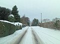
 A4130 by the pub - geograph.org.uk - 2619931.jpg 1,024 × 683; 199 KB
-
 A4130 Gangsdown Hill - geograph.org.uk - 6236454.jpg 1,024 × 684; 352 KB
-
 A4130 towards Wallingford - geograph.org.uk - 6236443.jpg 1,024 × 684; 259 KB
-
 A4130 towards Wallingford - geograph.org.uk - 6236451.jpg 1,024 × 684; 255 KB
-
 A4130 towards Wallingford - geograph.org.uk - 6236455.jpg 1,024 × 684; 258 KB
-
 A4130 towards Wallingford - geograph.org.uk - 6236463.jpg 1,024 × 684; 282 KB
-
 About to get built on^ - geograph.org.uk - 6475257.jpg 4,000 × 3,000; 1.91 MB
-
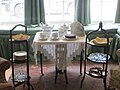 Afternoon Tea - geograph.org.uk - 4811441.jpg 1,024 × 768; 138 KB
-
 Along the hedge on the right - geograph.org.uk - 2189963.jpg 1,024 × 683; 217 KB
-
 An Iron Lung - geograph.org.uk - 4812583.jpg 1,024 × 768; 101 KB
-
 Approaching the crest of Nuffield Hill - geograph.org.uk - 3308285.jpg 3,548 × 2,624; 1.39 MB
-
 Avenue from May's Farm towards the A4130 - geograph.org.uk - 5335034.jpg 683 × 1,024; 314 KB
-
 Back of the club house - geograph.org.uk - 2190671.jpg 1,024 × 683; 156 KB
-
 Bales, Trees and Mud - geograph.org.uk - 2840018.jpg 3,968 × 2,232; 1.22 MB
-
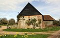 Barn at Howberrywood Farm - geograph.org.uk - 5330672.jpg 1,024 × 657; 175 KB
-
 Beech plantation near Nuffield - geograph.org.uk - 1082184.jpg 640 × 480; 202 KB
-

-

-
 Bench mark in the moss - geograph.org.uk - 2189935.jpg 533 × 800; 186 KB
-
 Bench mark on the school - geograph.org.uk - 2133837.jpg 533 × 800; 141 KB
-
 Benchmark on barn at Howberrywood Farm - geograph.org.uk - 5330664.jpg 683 × 1,024; 289 KB
-

-
 Benchmark on Home Cottage - geograph.org.uk - 5586825.jpg 1,024 × 683; 309 KB
-
 Benchmark on Nuffield Hill Cottage - geograph.org.uk - 5586597.jpg 611 × 1,024; 201 KB
-
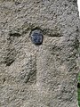
 Benchmark on Nuffield trig pillar - geograph.org.uk - 5586535.jpg 683 × 1,024; 296 KB
-
 Benchmark on outbuilding beside The Crown - geograph.org.uk - 5585661.jpg 648 × 1,024; 260 KB
-
 Benchmark on the Crown - geograph.org.uk - 2619941.jpg 1,024 × 683; 264 KB
-
 Benchmark on The Old School - geograph.org.uk - 5585897.jpg 670 × 1,024; 229 KB
-
 Benchmark on the tower of Holy Trinity Church - geograph.org.uk - 5586585.jpg 683 × 1,024; 315 KB
-
 Benchmark on Timbers Cottage - geograph.org.uk - 5585721.jpg 683 × 1,024; 281 KB
-
 Benchmark on Warren Cottage - geograph.org.uk - 5586603.jpg 674 × 1,024; 154 KB
-
 Bend on Gangsdown Hill - geograph.org.uk - 2620549.jpg 533 × 800; 123 KB
-
 Bend towards Nettlebed - geograph.org.uk - 2686085.jpg 1,024 × 683; 156 KB
-
 Beside Swan Wood (Devils Hill^) - geograph.org.uk - 2901275.jpg 1,600 × 1,153; 681 KB
-
 Bible on the pew - geograph.org.uk - 2108625.jpg 533 × 800; 101 KB
-
 Big Log by the Ridgeway - geograph.org.uk - 6700755.jpg 5,166 × 3,275; 3.85 MB
-
 Bike in the Porch - geograph.org.uk - 4811433.jpg 1,024 × 768; 122 KB
-
 Bixmoor Wood - geograph.org.uk - 54450.jpg 640 × 481; 87 KB
-
 Blacksmith's Cottages - geograph.org.uk - 4070234.jpg 1,280 × 960; 339 KB
-
 Blenheim Cottage - geograph.org.uk - 2130636.jpg 640 × 427; 234 KB
-
 Bluebell wood, Nuffield, Oxfordshire - geograph.org.uk - 4453436.jpg 1,024 × 702; 396 KB
-
 Bluebell wood, Nuffield, Oxfordshire - geograph.org.uk - 4462634.jpg 1,024 × 698; 383 KB
-
-

-

-
 Bluebells in Park Wood - geograph.org.uk - 4194128.jpg 3,072 × 2,304; 1.78 MB
-
 Bluebells, Nuffield, Oxfordshire - geograph.org.uk - 4453473.jpg 1,024 × 752; 417 KB
-
 Bluebells, Nuffield, Oxfordshire - geograph.org.uk - 4497644.jpg 800 × 705; 281 KB
-
 Brass on the aisle - geograph.org.uk - 2107157.jpg 533 × 800; 80 KB
-
 Bridleway heading to Hayden Farm - geograph.org.uk - 6671314.jpg 1,024 × 576; 191 KB
-
 Bridleway heading to Howberrywood - geograph.org.uk - 6671306.jpg 1,024 × 576; 280 KB
-
 Bridleway Near Howberrywood - geograph.org.uk - 3038051.jpg 3,648 × 2,736; 2.48 MB
-
 Brixton Hill - geograph.org.uk - 3308294.jpg 3,579 × 2,659; 2.22 MB
-
 Brixton Hill Cottages - geograph.org.uk - 5586743.jpg 1,024 × 666; 271 KB
-
 Bumps on the Golf Course - geograph.org.uk - 6700774.jpg 5,018 × 3,295; 4.13 MB
-
 Bunker Shadow - geograph.org.uk - 2790541.jpg 1,600 × 1,052; 420 KB
-
 Byway to Whitcall's Farm - geograph.org.uk - 595091.jpg 640 × 477; 140 KB
-

-
 Chairs by the Fireplace - geograph.org.uk - 4812756.jpg 1,024 × 768; 144 KB
-
 Chancel end - geograph.org.uk - 2110211.jpg 533 × 800; 90 KB
-
 Chestnut Avenue in a Bad Way - geograph.org.uk - 2651683.jpg 3,416 × 2,736; 2 MB
-
 Chiltern farmland - geograph.org.uk - 2130601.jpg 640 × 426; 227 KB
-
 Chiltern Way - geograph.org.uk - 1270095.jpg 640 × 480; 84 KB
-
 Chiltern Way at Harcourt Hill - geograph.org.uk - 2130660.jpg 640 × 426; 213 KB
-
 Church of the Holy Trinity - geograph.org.uk - 3308290.jpg 3,511 × 2,598; 2.05 MB
-
 Church of the Holy Trinity, Nuffield - geograph.org.uk - 4070213.jpg 1,280 × 915; 211 KB
-
 Church of the Holy Trinity, Nuffield - geograph.org.uk - 4070219.jpg 881 × 1,280; 192 KB
-
 Church of the Holy Trinity, Nuffield - geograph.org.uk - 4070222.jpg 1,280 × 960; 170 KB
-
 Church of the Holy Trinity, Nuffield - geograph.org.uk - 4070224.jpg 1,280 × 960; 168 KB
-
 Church of the Holy Trinity, Nuffield - geograph.org.uk - 4070226.jpg 1,280 × 960; 145 KB
-
 Clock on the Mantelpiece - geograph.org.uk - 4812760.jpg 600 × 800; 86 KB
-
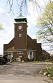 Clock Tower at Turners Court - geograph.org.uk - 5597185.jpg 651 × 1,024; 213 KB
-
 Close up Iron Lung - geograph.org.uk - 4812580.jpg 600 × 800; 80 KB
-
 Close up of the bench mark - geograph.org.uk - 2114112.jpg 600 × 800; 227 KB
-
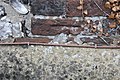
 Close up of the bolt - geograph.org.uk - 2114108.jpg 600 × 800; 216 KB
-
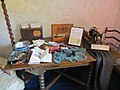
 Coffee on the Dining Table - geograph.org.uk - 4812765.jpg 1,024 × 768; 143 KB
-
 Containers in Mongewell Woods - geograph.org.uk - 1005706.jpg 640 × 426; 204 KB
-
 Couple of Sheds - geograph.org.uk - 4811293.jpg 1,024 × 768; 228 KB
-
 Covered in Moss and Ivy - geograph.org.uk - 2189930.jpg 533 × 800; 204 KB
-
 Cricket pitch at Nuffield Place - geograph.org.uk - 2130535.jpg 640 × 427; 267 KB
-
 Daisies on footpath towards Nuffield Lane - geograph.org.uk - 5597187.jpg 652 × 1,024; 320 KB
-

-

-
 Drinking water this way - geograph.org.uk - 2197327.jpg 640 × 426; 255 KB
-
 Early Horse - geograph.org.uk - 4812761.jpg 1,024 × 768; 119 KB
-
 Edge of the field - geograph.org.uk - 2135062.jpg 1,024 × 683; 136 KB
-
 English Farm - geograph.org.uk - 2840048.jpg 3,665 × 2,225; 1.58 MB
-
 Entering Mongewell Woods - geograph.org.uk - 1005704.jpg 640 × 427; 246 KB
-
 Entrance to Fred's field - geograph.org.uk - 2133806.jpg 533 × 800; 91 KB
-
 Entrance to Heath End Barn from English Lane - geograph.org.uk - 5585879.jpg 1,024 × 683; 260 KB
-
 Entrance to Nuffield Place - geograph.org.uk - 2130573.jpg 640 × 426; 217 KB
-
 Entrance to Park Wood - geograph.org.uk - 2130521.jpg 640 × 427; 252 KB
-
 Entrance to The Crown - geograph.org.uk - 2620568.jpg 533 × 800; 172 KB
-
 Entrance to Turners Court - geograph.org.uk - 2110315.jpg 1,024 × 683; 173 KB
-

-
 Farmland below Nuffield Hill - geograph.org.uk - 3308293.jpg 3,648 × 2,736; 1.61 MB
-
 Farmland near Heath End - geograph.org.uk - 6153447.jpg 1,024 × 768; 251 KB
-
 Farmland north of Grim's Ditch - geograph.org.uk - 6258710.jpg 1,024 × 777; 253 KB
-

-
 Farmland, Nuffield - geograph.org.uk - 1270492.jpg 640 × 480; 142 KB
-
 Farmland, Nuffield - geograph.org.uk - 2818661.jpg 640 × 480; 172 KB
-
 Farmland, Nuffield - geograph.org.uk - 2818730.jpg 640 × 480; 146 KB
-
 Farmland, Nuffield - geograph.org.uk - 6673596.jpg 1,024 × 683; 278 KB
-
 Field by Gangsdown Hill near Ewelme - geograph.org.uk - 4975169.jpg 2,194 × 1,570; 954 KB
-
 Field by Gangsdown Hill, Nuffield - geograph.org.uk - 6315379.jpg 1,920 × 1,280; 1.09 MB
-
 Field by Gangsdown Hill, Nuffield - geograph.org.uk - 6315380.jpg 1,920 × 1,280; 1.02 MB
-
 Field by the Ridgeway - geograph.org.uk - 2135055.jpg 1,024 × 683; 148 KB
-
 Field entrance by Gangsdown Hill - geograph.org.uk - 4982658.jpg 2,048 × 1,536; 1.45 MB
-
 Field entrance by Gangsdown Hill, Nuffield - geograph.org.uk - 6315376.jpg 1,920 × 1,280; 1.65 MB
-
 Field entrance by Gangsdown Hill, Nuffield - geograph.org.uk - 6315378.jpg 1,894 × 1,242; 1.45 MB
-

-
 Field on north side of Nuffield Hill - geograph.org.uk - 5586554.jpg 1,024 × 683; 234 KB
-
 Flowers round the grave - geograph.org.uk - 2110234.jpg 533 × 800; 151 KB
-
 Fog Marker on the Golf Course - geograph.org.uk - 6700074.jpg 5,472 × 3,648; 4.79 MB
-
 Follow the footpath - geograph.org.uk - 2686097.jpg 533 × 800; 77 KB
-
 Footpath Over Warren Hill - geograph.org.uk - 2790548.jpg 1,600 × 1,203; 749 KB
-
 Footpath past the clubhouse - geograph.org.uk - 2190643.jpg 1,024 × 683; 179 KB
-
 Footpath running NE from Old London Road - geograph.org.uk - 5335016.jpg 1,024 × 683; 253 KB
-
 Footpath to A4130 - geograph.org.uk - 2130665.jpg 640 × 427; 206 KB
-
 Footpath to Huntercombe end - geograph.org.uk - 2686093.jpg 1,024 × 683; 156 KB
-
 Footpath to Mongewell - geograph.org.uk - 54400.jpg 640 × 481; 59 KB
-
 Footpath to the church - geograph.org.uk - 2107122.jpg 533 × 800; 151 KB
-
 Footpath towards Nuffield - geograph.org.uk - 5330623.jpg 1,024 × 683; 326 KB
-
 Footpaths at Huntercombe End - geograph.org.uk - 2130507.jpg 640 × 427; 237 KB
-
 Fred's field - geograph.org.uk - 2133816.jpg 1,024 × 683; 110 KB
-
 From the A4130 near Ambrose Farm - geograph.org.uk - 2133642.jpg 640 × 426; 240 KB
-
 Gangsdown Hill to Wallingford - geograph.org.uk - 4182154.jpg 1,500 × 999; 163 KB
-
 Gangsdown Hill, Nuffield - geograph.org.uk - 5067482.jpg 2,048 × 1,536; 1.5 MB
-
 Gangsdown Hill, Nuffield - geograph.org.uk - 6315374.jpg 1,920 × 1,280; 1.12 MB
-
 Garage at Nuffield Place - geograph.org.uk - 4811417.jpg 1,024 × 768; 221 KB
-
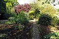 Garden path at Nuffield Place - geograph.org.uk - 4181293.jpg 1,500 × 999; 311 KB
-
 Garden path at Nuffield Place - geograph.org.uk - 4182098.jpg 1,500 × 999; 258 KB
-
 Gates at Ambrose Farm - geograph.org.uk - 3323561.jpg 1,600 × 1,200; 569 KB
-
 Golf at the top of the hill - geograph.org.uk - 3989048.jpg 800 × 515; 126 KB
-
 Golf course, Nuffield Common - geograph.org.uk - 6153818.jpg 1,024 × 778; 324 KB
-
 Gowns of State - geograph.org.uk - 4811596.jpg 600 × 800; 72 KB
-
 Grave slab in the aisle - geograph.org.uk - 2107145.jpg 533 × 800; 106 KB
-
 Grave under the chestnut - geograph.org.uk - 2110282.jpg 533 × 800; 162 KB
-
 Greenhouse at Nuffield Place - geograph.org.uk - 4182102.jpg 1,500 × 999; 212 KB
-
 Greenhouse at Nuffield Place - geograph.org.uk - 4182114.jpg 1,500 × 999; 261 KB
-
 Grim's Ditch near Woodlands - geograph.org.uk - 592068.jpg 640 × 480; 96 KB
-
 Hayden Lane - geograph.org.uk - 2686942.jpg 533 × 800; 85 KB
-
 Hedge Laying - geograph.org.uk - 4811291.jpg 1,024 × 768; 241 KB
-
 HMP Huntercombe near Nuffield - geograph.org.uk - 4182142.jpg 1,500 × 994; 141 KB
-
 Holy Trinity Church - geograph.org.uk - 5586589.jpg 1,024 × 779; 128 KB
-
 Holy Trinity church, Nuffield - geograph.org.uk - 2197336.jpg 640 × 426; 194 KB
-
 Home Cottage, Turners Court - geograph.org.uk - 5586835.jpg 1,024 × 683; 216 KB
-
 House at Ambrose Farm - geograph.org.uk - 3323555.jpg 1,600 × 1,193; 788 KB
-
 House at Huntercombe End - geograph.org.uk - 2130513.jpg 640 × 426; 234 KB
-
 Houses on Port Hill, Nettlebed - geograph.org.uk - 4973148.jpg 2,304 × 1,728; 817 KB
-
 Huntercombe End - geograph.org.uk - 2889578.jpg 640 × 547; 103 KB
-
 Huntercombe End Farm - geograph.org.uk - 2130498.jpg 640 × 426; 213 KB
-
 Huntercombe End Farm - geograph.org.uk - 2130501.jpg 640 × 427; 235 KB
-
 Hymn board on the wall - geograph.org.uk - 2108643.jpg 533 × 800; 71 KB
-
 In Memory of Edward Leaver - geograph.org.uk - 2108717.jpg 533 × 800; 112 KB
-
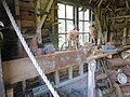 Inside the Shed - geograph.org.uk - 4812574.jpg 1,024 × 768; 151 KB
-
 Inside the Shed - geograph.org.uk - 4812579.jpg 600 × 800; 85 KB
-
 Iron lung in the potting shed - geograph.org.uk - 4182109.jpg 1,500 × 999; 104 KB
-
 Iron lung in the potting shed - geograph.org.uk - 4182112.jpg 999 × 1,500; 122 KB
-
 Ivy on the top - geograph.org.uk - 2189946.jpg 533 × 800; 190 KB
-

-
 Kit Lane becomes Timbers Lane - geograph.org.uk - 3308284.jpg 3,437 × 2,531; 1.33 MB
-
 Lady Nuffield Car - geograph.org.uk - 4811298.jpg 1,024 × 768; 142 KB
-
 Lady Nuffield's Sewing room - geograph.org.uk - 4811605.jpg 1,024 × 768; 120 KB
-
 Layby at Port Hill - geograph.org.uk - 2687209.jpg 1,024 × 683; 166 KB
-
 Leaving Mongewell Woods - geograph.org.uk - 1005709.jpg 640 × 427; 211 KB
-
 Letter box at entrance to ^15 Oakley Court - geograph.org.uk - 5586864.jpg 1,024 × 673; 289 KB
-
 London 41 Henley 6 - geograph.org.uk - 2686986.jpg 533 × 800; 173 KB
-
 Looking North - geograph.org.uk - 38846.jpg 640 × 481; 43 KB
-
 Lord Nuffield's bedroom workshop - geograph.org.uk - 5116110.jpg 453 × 640; 67 KB
-
 Lord Nuffield's Desk - geograph.org.uk - 4811595.jpg 1,024 × 768; 131 KB
-
 Lord Nuffield's Gramophone - geograph.org.uk - 4166820.jpg 2,592 × 3,888; 2.25 MB
-
 Lord Nuffield's Tool Cabinet - geograph.org.uk - 4811601.jpg 1,024 × 768; 142 KB
-
 Lord Nuffield's View - geograph.org.uk - 4166739.jpg 3,888 × 2,592; 3.48 MB
-
 Lord Nuffield's Wolseley - geograph.org.uk - 4182120.jpg 1,500 × 999; 128 KB
-
 Lord ^ Lady Nuffield - geograph.org.uk - 4812758.jpg 600 × 800; 78 KB
-
 Macabre reminder - geograph.org.uk - 2107166.jpg 1,024 × 683; 91 KB
-
 Making the shot - geograph.org.uk - 2190658.jpg 1,024 × 639; 133 KB
-
 Man by the hedge - geograph.org.uk - 2189972.jpg 1,024 × 683; 141 KB
-
 Mast behind the branch - geograph.org.uk - 2190747.jpg 533 × 800; 112 KB
-
 Meadow at Nuffield Place - geograph.org.uk - 5116119.jpg 640 × 480; 69 KB
-
 Memorial by the road - geograph.org.uk - 2107078.jpg 533 × 800; 141 KB
-
 Memorials in the chapel - geograph.org.uk - 2114069.jpg 1,024 × 768; 94 KB
-
 Memorials over the door - geograph.org.uk - 2114059.jpg 600 × 800; 59 KB
-

-
 Milestone at Hayden Lane - geograph.org.uk - 2686952.jpg 533 × 800; 192 KB
-
 Milestone beside A4130 approaching Oak Cottages - geograph.org.uk - 5330892.jpg 1,024 × 683; 295 KB
-
 Milestone on SW side of A4130 - geograph.org.uk - 5330170.jpg 683 × 1,024; 326 KB
-

-
 Mogpits Wood on the Horizon - geograph.org.uk - 2651700.jpg 3,488 × 2,460; 973 KB
-
 Mongewell Woods - geograph.org.uk - 1005707.jpg 640 × 427; 199 KB
-
-
 Morris - geograph.org.uk - 4811424.jpg 1,024 × 768; 231 KB
-
 Mushroom - geograph.org.uk - 336860.jpg 640 × 425; 139 KB
-
 Narrow road off Gangsdown Hill - geograph.org.uk - 4982657.jpg 2,048 × 1,536; 1.44 MB


,_Nuffield_Place,_Nuffield,_Oxfordshire_-_geograph.org.uk_-_2949188.jpg)


_-_geograph.org.uk_-_2901275.jpg)


