Category:Nurgal District
Jump to navigation
Jump to search
English: Nurgal District is situated in the western part of Kunar Province, Afghanistan, 90 km West from Asadabad, and is near Jalalabad city. It borders Nangarhar Province to the west and south, Chapa Dara District to the north and Chawkay and Khas Kunar districts to the east. The population is 28,000 (2006). The district center is the village of Nur Gal, located in central part of the district in the valley of the Kunar river. 70% of the houses were destroyed during the wars. The area is mountainous and the irrigated land is not enough. Many people look for work abroad. The health care and the education need improvement.
district of Afghanistan | |||||
| Upload media | |||||
| Instance of | |||||
|---|---|---|---|---|---|
| Location | Kunar, Afghanistan | ||||
| Elevation above sea level |
| ||||
 | |||||
Media in category "Nurgal District"
The following 7 files are in this category, out of 7 total.
-

-
 Documenting development efforts in Kunar -a.jpg 2,100 × 1,395; 257 KB
-
 Documenting development efforts in Kunar -b.jpg 2,100 × 1,681; 393 KB
-
 Documenting development efforts in Kunar -c.jpg 2,100 × 1,395; 323 KB
-
 Fileds in Nurgal-2010.jpg 2,100 × 1,378; 984 KB
-
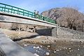 Foot bridge in Kunar Province-2009.jpg 640 × 426; 83 KB
-
 Kunar river Noorgal district in Afghanistan's Konar province.jpg 2,376 × 1,584; 2.38 MB


