Category:Ohori Park
Jump to navigation
Jump to search
| Object location | | View all coordinates using: OpenStreetMap |
|---|
Neighborhood in Chūō-ku, Fukuoka City, Japan and the park "Ōhorikōen" in it .jpg)  | |||||
| Upload media | |||||
| Instance of |
| ||||
|---|---|---|---|---|---|
| Part of |
| ||||
| Location | Chūō-ku, Fukuoka, Fukuoka Prefecture, Japan | ||||
| Located in or next to body of water |
| ||||
| Street address |
| ||||
| Connects with |
| ||||
| Operator |
| ||||
| Has part(s) |
| ||||
| Heritage designation |
| ||||
| Date of official opening |
| ||||
| Population |
| ||||
| Area |
| ||||
| Replaces | |||||
| official website | |||||
 | |||||
Subcategories
This category has the following 3 subcategories, out of 3 total.
Media in category "Ohori Park"
The following 200 files are in this category, out of 224 total.
(previous page) (next page)-
 -i---i- (31150662460).jpg 13,512 × 3,856; 11.13 MB
-
 -i---i- (31406498921).jpg 4,032 × 3,024; 4.29 MB
-
 -i---i- (31505715106).jpg 4,032 × 3,024; 2.75 MB
-
 -i---i- (31522105065).jpg 3,024 × 4,032; 3.21 MB
-
 1 Ōhorikōen, Chūō-ku, Fukuoka-shi, Fukuoka-ken 810-0051, Japan - panoramio (1).jpg 3,264 × 2,448; 2.18 MB
-
 1 Ōhorikōen, Chūō-ku, Fukuoka-shi, Fukuoka-ken 810-0051, Japan - panoramio.jpg 3,264 × 2,448; 1.39 MB
-
 A North Gate of Ohori Park.JPG 3,264 × 2,448; 3.6 MB
-
 Ayameshima Island in Ohori Park.JPG 3,264 × 2,448; 3.63 MB
-
 Ayameshima Island of Ohori Park.JPG 3,264 × 2,448; 2.53 MB
-
 Boathouse Ōhori Park 1-3 Ōhori-kōen Chūō-ku Fukuoka City 20220830.jpg 4,000 × 2,000; 2.17 MB
-
 Chasonhashi Bridge in Ohori Park.JPG 3,264 × 2,448; 3.08 MB
-
 Chūō Police Station Arato Police Box 3-22 Ōhori-kōen Chūō-ku Fukuoka City 20220830.jpg 4,000 × 2,000; 2.86 MB
-
 Chūō Police Station Ōhori Liaison Police Box Ōhori-kōen Chūō-ku Fukuoka City 20221017.jpg 4,000 × 2,000; 2.89 MB
-
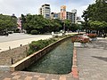
 Circle waterway in Ohori Park 2.jpg 3,960 × 2,970; 4.04 MB
-
 Circle waterway in Ohori Park 20140506.JPG 3,264 × 2,448; 3.21 MB
-
 Circle waterway in Ohori Park 3.jpg 4,032 × 3,024; 4.81 MB
-
 Circle waterway in Ohori Park.jpg 3,984 × 2,988; 3.02 MB
-
 Circulating water channel in Ōhori Park Ōhorikōen Chūō-ku Fukuoka City 20220919.jpg 4,000 × 2,000; 3.29 MB
-
 Combination playground equipment located in Whale Park at Ohori Park.jpg 4,000 × 2,250; 3.33 MB
-
 DEMETER - panoramio.jpg 2,448 × 3,264; 1.24 MB
-
 Duck Island Ōhori-kōen Chūō-ku Fukuoka City 20221017.jpg 4,000 × 2,000; 2.15 MB
-
 East Childrens Playground Whale Park Ōhori-kōen Chūō-ku Fukuoka City 20220825.jpg 4,000 × 2,000; 3.41 MB
-
 Flower of Lilium longiflorum 20180527.jpg 4,032 × 3,024; 3.27 MB
-
 Flowers in Ohori Park 2.jpg 4,032 × 3,024; 4.71 MB
-
 Flowers in Ohori Park 3.jpg 3,966 × 2,974; 3.33 MB
-
 Flowers in Ohori Park at dusk.jpg 3,264 × 2,448; 2.34 MB
-
 Flowers of Helianthus annuus in Ohori Park.jpg 2,448 × 3,264; 2.06 MB
-
 Fukuoka Castle Aerial photograph 2020.jpg 3,600 × 2,600; 4.99 MB
-
 Fukuoka Castle air.jpg 2,702 × 2,286; 3.22 MB
-
 Fukuoka Ohori Post Office from Ohori Park.jpg 3,982 × 2,987; 3.49 MB
-
 Fukuoka Ōhori Post Office 1-1 Ōhori-kōen Chūō-ku Fukuoka City 20220825.jpg 4,000 × 2,000; 2.85 MB
-
 Fukuoka Ōhori Post Office 1-1 Ōhori-kōen Chūō-ku Fukuoka City 20220906.jpg 4,000 × 2,000; 2.33 MB
-
 Fukuoka, Fukuoka (31150650100).jpg 4,032 × 3,024; 3.41 MB
-
 Fukuoka, Fukuoka (31150652920).jpg 4,032 × 3,024; 2.68 MB
-
 Fukuoka, Fukuoka (31483959386).jpg 4,032 × 3,024; 3.79 MB
-
 Gate of Japanese Garden of Ohori Park 2.jpg 4,003 × 3,002; 2.63 MB
-
 Gate of Japanese Garden of Ohori Park.jpg 3,264 × 2,448; 2.19 MB
-
 Goodnight moon - panoramio.jpg 3,264 × 2,448; 1.54 MB
-
 Goodnight moon ^2 - panoramio.jpg 2,448 × 3,264; 1.98 MB
-
 Hoh Theater in Fukuoka sign.jpg 4,912 × 3,264; 6.63 MB
-
 Japanese Swan Lake.jpg 6,000 × 4,000; 7.75 MB
-
 Kangetsubashi Bridge and boathouse of Ohori Park at dusk.JPG 3,264 × 2,448; 1.79 MB
-
 Kangetsubashi Bridge and Ukimido Hall from Maizurubashi Bridge.jpg 4,002 × 3,002; 2.6 MB
-
 Kangetsubashi Bridge and Ukimido Hall in Ohori Park.jpg 3,948 × 2,961; 2.46 MB
-
 Kangetsubashi Bridge in Ohori Park 2.JPG 3,264 × 2,448; 2.03 MB
-
 Kangetsubashi Bridge in Ohori Park 3.jpg 4,032 × 3,024; 2.73 MB
-
 Kangetsubashi Bridge in Ohori Park 4.jpg 4,032 × 3,024; 3.05 MB
-
 Kangetsubashi Bridge in Ohori Park.JPG 3,264 × 2,448; 1.84 MB
-
 Kuromon River Kuromon Bridge Kuromon Ōhori Park 20220728.jpg 4,000 × 2,000; 2.16 MB
-

-
 Kuromongawa River from Maizurubashi Bridge in Ohori Park.jpg 3,927 × 2,945; 3.27 MB
-
 Magnolia kobus in Ohori Park.jpg 2,448 × 3,264; 4.26 MB
-
 Maizurubashi Bridge in Ohori Park.jpg 4,001 × 3,001; 2.04 MB
-
 Matsushima Island in Ohori Park 2.JPG 3,264 × 2,448; 3.85 MB
-
 Matsushima Island in Ohori Park 3.JPG 3,264 × 2,448; 2.86 MB
-
 Matsushima Island in Ohori Park 4.JPG 3,264 × 2,448; 3.53 MB
-
 Matsushima Island in Ohori Park.JPG 3,264 × 2,448; 4 MB
-
 Meiji-dori Street near Ohori Park 2.jpg 3,264 × 2,448; 2.52 MB
-
 Meiji-dori Street near Ohori Park.jpg 3,264 × 2,448; 2.2 MB
-
 Meiji-dori Street near Ohorikoen Station.jpg 3,968 × 2,976; 2.54 MB
-
 No Theater in Ohori Park 2.jpg 3,968 × 2,976; 2.81 MB
-
 No Theater in Ohori Park.JPG 3,157 × 2,368; 1.55 MB
-
Noh Theater in Fukuoka.webm 39 s, 1,920 × 1,080; 53.5 MB
-
 Ohori Kouen - panoramio.jpg 3,968 × 2,976; 2.4 MB
-
 Ohori Park (30681290874).jpg 4,032 × 3,024; 2.37 MB
-
 Ohori Park (30681292984).jpg 4,032 × 3,024; 4.14 MB
-
 Ohori Park (30702939674).jpg 4,032 × 3,024; 3.25 MB
-
 Ohori Park (31171785940).jpg 4,032 × 3,024; 2.13 MB
-
 Ohori Park (31428421291).jpg 4,032 × 3,024; 2.62 MB
-
 Ohori Park (31483955346).jpg 4,032 × 3,024; 2.32 MB
-
 Ohori Park (31483958956).jpg 4,032 × 3,024; 2.32 MB
-
 Ohori Park (31483960496).jpg 4,032 × 3,024; 4.08 MB
-
 Ohori Park (31483961606).jpg 4,032 × 3,024; 4.28 MB
-
 Ohori Park 01.jpg 2,256 × 1,416; 455 KB
-
 Ohori Park 02.jpg 1,876 × 1,246; 355 KB
-
 Ohori Park 2011-11 01.jpg 2,424 × 1,773; 836 KB
-
 Ohori Park 2011-11 02.jpg 2,592 × 1,944; 1.19 MB
-
 Ohori Park 2011-11 03.jpg 2,592 × 1,944; 625 KB
-
 Ohori Park 2011-11 04.jpg 2,484 × 1,827; 928 KB
-
 Ohori Park 2011-11 05.jpg 2,592 × 1,944; 789 KB
-
 Ohori Park 2011-11 06.jpg 2,592 × 1,944; 986 KB
-
 Ohori Park 2011-11 07.jpg 2,592 × 1,461; 921 KB
-
 Ohori Park 20150927-1.JPG 3,264 × 2,448; 3.21 MB
-
 Ohori Park 20150927-2.JPG 3,264 × 2,448; 1.74 MB
-
 Ohori Park 20150927-3.JPG 3,264 × 2,448; 1.93 MB
-
 Ohori Park 20160402.JPG 3,264 × 2,448; 2.57 MB
-
 Ohori Park 20170404.jpg 4,032 × 3,024; 2.26 MB
-
 Ohori Park 20170505-1.jpg 3,993 × 2,995; 4.14 MB
-
 Ohori Park 20170505-2.jpg 4,032 × 3,024; 2.5 MB
-
 Ohori Park 20170505-3.jpg 3,997 × 2,998; 3.22 MB
-
 Ohori Park 20170505-4.jpg 3,982 × 2,987; 3.58 MB
-
 Ohori Park 20170505-5.jpg 4,019 × 3,014; 2.96 MB
-
 Ohori Park 20170505-6.jpg 3,967 × 2,975; 3.08 MB
-
 Ohori Park 20170505-7.jpg 3,987 × 2,990; 2.75 MB
-
 Ohori Park 20170505-8.jpg 4,032 × 3,024; 2.31 MB
-
 Ohori Park 20170623-1.jpg 3,943 × 2,958; 2.38 MB
-
 Ohori Park 20170623-2.jpg 4,032 × 3,024; 2.25 MB
-
 Ohori Park 20180527.jpg 3,993 × 2,995; 2.12 MB
-
 Ohori Park 20180801.jpg 3,977 × 2,983; 2.92 MB
-
 Ohori Park 20191010.JPG 4,032 × 2,268; 3.02 MB
-
 Ohori Park 20200716-1.jpg 4,016 × 3,012; 1.94 MB
-
 Ohori Park 20200716-10.jpg 4,017 × 3,012; 1.99 MB
-
 Ohori Park 20200716-2.jpg 3,971 × 2,978; 2.73 MB
-
 Ohori Park 20200716-3.jpg 3,998 × 2,998; 2.85 MB
-
 Ohori Park 20200716-4.jpg 4,016 × 3,012; 2.04 MB
-
 Ohori Park 20200716-5.jpg 3,966 × 2,974; 2.17 MB
-
 Ohori Park 20200716-6.jpg 3,977 × 2,982; 2.24 MB
-
 Ohori Park 20200716-7.jpg 3,990 × 2,992; 2.72 MB
-
 Ohori Park 20200716-8.jpg 4,007 × 3,006; 1.92 MB
-
 Ohori Park 20200716-9.jpg 3,952 × 2,964; 1.82 MB
-
 Ohori Park at dusk 20170930-1.jpg 4,002 × 3,001; 2.96 MB
-
 Ohori Park at dusk 20170930-2.jpg 3,916 × 2,937; 2.31 MB
-
 Ohori Park at dusk 20170930-3.jpg 4,032 × 3,024; 2.27 MB
-
 Ohori Park at dusk 20170930-4.jpg 3,957 × 2,968; 3.15 MB
-
 Ohori Park at dusk 20170930-5.jpg 4,032 × 3,024; 2.6 MB
-
 Ohori Park at dusk 20170930-6.jpg 4,032 × 3,024; 2.47 MB
-
 Ohori Park at dusk 20170930-7.jpg 4,007 × 3,005; 3.1 MB
-
 Ohori Park at dusk 20170930-8.jpg 4,032 × 3,024; 4.76 MB
-
 Ohori Park at dusk 20170930-9.jpg 4,032 × 3,024; 2.71 MB
-
 Ohori Park before firework display 20140801-1.JPG 3,264 × 2,448; 2.39 MB
-
 Ohori Park before firework display 20140801-2.JPG 3,264 × 2,448; 2.37 MB
-
 Ohori Park before firework display 20140801-3.JPG 3,264 × 2,448; 2.43 MB
-
 Ohori Park before firework display 20140801-4.JPG 3,264 × 2,448; 2.28 MB
-
 Ohori Park before firework display 20140801-5.JPG 3,264 × 2,448; 2.04 MB
-
 Ohori Park before firework display 20150801-1.JPG 3,264 × 2,448; 2.04 MB
-
 Ohori Park before firework display 20150801-2.JPG 3,264 × 2,448; 1.69 MB
-
 Ohori Park before firework display 20150801-3.JPG 3,264 × 2,448; 2.97 MB
-
 Ohori Park before firework display 20150801-4.JPG 3,264 × 2,448; 2.59 MB
-
 Ohori Park from Maizurubashi Bridge.jpg 4,019 × 3,014; 1.98 MB
-
 Ohori Park Maizuru Bridge.jpg 1,280 × 960; 210 KB
-
 Ohori Park near Kangetsubashi Bridge 2.jpg 4,032 × 3,024; 3.64 MB
-
 Ohori Park near Kangetsubashi Bridge.jpg 4,032 × 3,024; 3.25 MB
-
 Ohori Park near No Theater.jpg 4,032 × 3,024; 2.02 MB
-
 Ohori Park, Fukuoka.JPG 1,600 × 1,200; 193 KB
-
 Ohori-park evening landscape 1.jpg 800 × 450; 102 KB
-
 Oohori ferry - Toride "get-together" pier - panoramio.jpg 1,536 × 2,048; 1.3 MB
-
 Oohori ferryboat - Auto park pier - panoramio.jpg 2,048 × 1,536; 1.3 MB
-
 Oohori Park 2011A.jpg 2,000 × 1,125; 952 KB
-
 Rental boat house in Ohori Park.jpg 4,005 × 3,004; 2.3 MB
-
 Satsuki Bridge Ōhori-kōen Chūō-ku Fukuoka City 20221017.jpg 4,000 × 2,000; 2.81 MB
-
 Satsukibashi Bridge in Ohori Park 2.jpg 4,032 × 3,024; 2.22 MB
-
 Satsukibashi Bridge in Ohori Park 3.jpg 4,032 × 3,024; 5.28 MB
-
 Satsukibashi Bridge in Ohori Park.JPG 3,264 × 2,448; 1.96 MB
-
 Shidare sakura flowers.JPG 1,600 × 1,200; 453 KB
-
 Shogetsu Bridge, Ohori Park, Fukuoka - Nov 22, 2018.jpg 6,000 × 4,000; 19.46 MB
-
 Shogetsuhashi Bridge in Ohori Park.JPG 3,264 × 2,448; 3.25 MB
-
 Shōgetsu Bridge Ōhori-kōen Chūō-ku Fukuoka City 20221017.jpg 4,000 × 2,000; 3.09 MB
-
 Sluice on the Kuromon River Ōhori-kōen Chūō-ku Fukuoka City 20220825.jpg 4,000 × 2,000; 2.78 MB
-
 Starbucks Coffee Fukuoka Ohori Koen.jpg 2,725 × 2,119; 1.61 MB
-
 Starbucks Coffee in Ohori Park.jpg 3,985 × 2,988; 3.29 MB
-
 Starbucks, Ohorikoen Park 2016 (25653190421).jpg 4,032 × 3,024; 3.48 MB
-
 Stele on Matsushima Island of Ohori Park.JPG 3,264 × 2,448; 3.43 MB
-
 Swan boat at Ohori park.jpg 3,172 × 2,380; 4.65 MB
-
 Tulip flowers in Ohori Park.JPG 3,264 × 2,448; 4.12 MB
-
 Ukimido Hall of Ohori Park.JPG 3,239 × 2,429; 2.3 MB
-
 View from Ayameshima Island of Ohori Park (east).JPG 3,209 × 2,407; 2.81 MB
-
 View from Ayameshima Island of Ohori Park (north).JPG 3,264 × 2,448; 2.74 MB
-
 View from Chasonhashi Bridge of Ohori Park (east).JPG 3,264 × 2,448; 2.44 MB
-
 View from Chasonhashi Bridge of Ohori Park (north).JPG 3,124 × 2,343; 2.33 MB
-
 View from Chasonhashi Bridge of Ohori Park (southeast).JPG 3,264 × 2,448; 2.46 MB
-
 View from Kangetsubashi Bridge of Ohori Park (northeast).JPG 3,264 × 2,448; 2.57 MB
-
 View from Kangetsubashi Bridge of Ohori Park (southwest).JPG 3,264 × 2,448; 1.68 MB
-
 View from Matsushima Island of Ohori Park (northeast).JPG 3,264 × 2,448; 2.44 MB
-
 View from Matsushima Island of Ohori Park (northwest).JPG 3,264 × 2,448; 2.27 MB
-
 View from Matsushima Island of Ohori Park (southeast).JPG 3,208 × 2,406; 2.71 MB
-
 View from Matsushima Island of Ohori Park (southwest).JPG 3,264 × 2,448; 2.03 MB
-
 View from Satsukibashi Bridge of Ohori Park.JPG 3,264 × 2,448; 2.38 MB
-
 View from Shogetsuhashi Bridge of Ohori Park 2.JPG 3,195 × 2,396; 2.6 MB
-
 View from Shogetsuhashi Bridge of Ohori Park.JPG 3,264 × 2,448; 2.57 MB
-
 View from site of Tenshu of Fukuoka Castle 20140801 (West) 2.JPG 3,264 × 2,448; 2.25 MB
-
 View from site of Tenshu of Fukuoka Castle 20150801-5.JPG 3,264 × 2,448; 1.05 MB
-
 View from south side of Ohori Park.JPG 3,264 × 2,448; 2.5 MB
-
 View from Ukimido Hall of Ohori Park (southeast).JPG 3,264 × 2,448; 2.68 MB
-
 View from Ukimido Hall of Ohori Park (southwest).JPG 3,212 × 2,409; 2.26 MB
-
 View near boathouse in Ohori Park 2.jpg 4,007 × 3,005; 1.8 MB
-
 View near boathouse in Ohori Park 3.jpg 4,032 × 3,024; 2.62 MB
-
 View near boathouse in Ohori Park.jpg 3,979 × 2,985; 1.44 MB
-
 View near north entrance of Ohori Park.jpg 3,976 × 2,982; 5.03 MB
-
 View near Ohori Police Box of Chuo Police Station.jpg 3,963 × 2,973; 2.35 MB
-
 View of Boathouse from Kangetsubashi Bridge of Ohori Park (north).JPG 3,264 × 2,448; 2.51 MB
-
 View of Boathouse from Kangetsubashi Bridge of Ohori Park 2.JPG 3,264 × 2,448; 2.34 MB
-
 View of Boathouse from Kangetsubashi Bridge of Ohori Park.JPG 3,264 × 2,448; 2.37 MB
-
 View of Boathouse of Ohori Park.JPG 3,264 × 2,448; 2.52 MB
-
 View of Consulate of the United States in Fukuoka from Ohori Park.jpg 4,016 × 3,012; 2.51 MB
-
 View of from southwest side of Ohori Park (east) 2.JPG 3,264 × 2,448; 2.52 MB
-
 View of from southwest side of Ohori Park (east).JPG 3,264 × 2,448; 2.6 MB
-
 View of from southwest side of Ohori Park (north).JPG 3,264 × 2,448; 2.47 MB
-
 View of from southwest side of Ohori Park (northeast).JPG 3,264 × 2,448; 2.41 MB
-
 View of islands in Lake Ohori 20140506.JPG 3,264 × 2,448; 1.88 MB
-
 View of Kamoshima Island and Kangetsubashi Bridge from Ayameshima Island of Ohori Park.JPG 3,264 × 2,448; 2.61 MB
-
 View of Kamoshima Island from Ayameshima Island of Ohori Park.JPG 3,264 × 2,448; 2.46 MB
-
 View of Kamoshima Island from Satsukibashi Bridge of Ohori Park 2.jpg 3,993 × 2,995; 3.07 MB
-
 View of Kamoshima Island from Satsukibashi Bridge of Ohori Park.JPG 3,264 × 2,448; 2.33 MB
-
 View of Kangetsubashi Bridge from Ukimido Hall of Ohori Park.JPG 3,264 × 2,448; 2.64 MB
-
 View of Kangetsubashi Bridge in Ohori Park.JPG 3,264 × 2,448; 2.06 MB
-
 View of Kangetsubashi Bridge of Ohori Park.JPG 3,264 × 2,448; 2.01 MB
-
 View of Lake Ohori 20140506 (South).JPG 3,264 × 2,448; 2.11 MB
-
 View of No Theater in Ohori Park.jpg 3,960 × 2,970; 3.31 MB
-
 View of Satsukibashi Bridge of Ohori Park from east side.JPG 3,264 × 2,448; 2.28 MB
-
 View of Satsukibashi Bridge of Ohori Park from west side.JPG 3,264 × 2,448; 2.52 MB
.jpg)
.jpg)
.jpg)
.jpg)


.jpg)
.jpg)
.jpg)


.jpg)
.jpg)
.jpg)
.jpg)
.jpg)
.jpg)
.jpg)
.jpg)
.jpg)


.jpg)


.JPG)
.JPG)
.JPG)
.JPG)
.JPG)


_2.JPG)


.JPG)
.JPG)


.JPG)


_2.JPG)
.JPG)
.JPG)
.JPG)


.JPG)


.jpg)
.JPG)
.JPG)
.JPG)
.JPG)
.JPG)
.JPG)